The best running trails in Hermosa Creek Wilderness
35
runners
14
runs
Jogging routes in Hermosa Creek Wilderness traverse a diverse landscape featuring remote trails, old-growth forests, and a wild backcountry environment. This 37,400-acre designated wilderness within the San Juan National Forest offers varied terrain, from gently descending doubletrack to rugged singletrack with embedded rocks and significant elevation changes. The area is characterized by its namesake Hermosa Creek, which trails often follow, and impressive mixed conifer and ponderosa pine stands.
Best jogging routes in Hermosa Creek Wilderness
- The most popular jogging route is Hermosa Creek Trail, a 9.5 miles (15.3 km) trail that takes 1 hour 44 minutes to complete. This route closely follows Hermosa Creek, transitioning between smooth sections and more rugged, rocky terrain.
- Another top favourite among local runners is Lower Hermosa Creek Trailhead – Jones Creek Trail loop from Lower Hermosa Campground, a difficult 7.2 miles (11.5 km) path. This challenging loop features significant climbs and offers a true backcountry experience.
- Local runners also love the Highline Colorado Trail, a 2.6 miles (4.2 km) trail leading through varied forest, often completed in about 31 minutes.
- Jogging in Hermosa Creek Wilderness is defined by old-growth forests, the winding Hermosa Creek, and rugged mountain terrain. The network offers options for various ability levels, from easy, mostly paved surfaces to challenging trails with significant elevation gain.
- The guide includes highly-rated routes that showcase the best of the region's landscape. More than 35 runners have used komoot to explore Hermosa Creek Wilderness's varied terrain.
Last updated: May 10, 2026
4.20km
00:32
70m
70m
Jog the easy 2.6-mile Highline Colorado Trail to Taylor Lake in San Juan National Forest, gaining 237 feet in about 31 minutes.
3.08km
00:32
180m
180m
Jog the 1.9-mile Cumberland Mountain and Colorado Trail Loop in San Juan National Forest, a moderate route with 605 feet of gain.

Sign up for free
3.58km
00:35
210m
210m
Jog The Notch & Snowstorm Peak, a 2.2-mile moderate trail in San Juan National Forest with 700 feet of gain and stunning peak views.
7
runners
Hard run. Very good fitness required. Mostly accessible paths. Some sure footedness required.
1
runners
15.3km
01:44
230m
230m
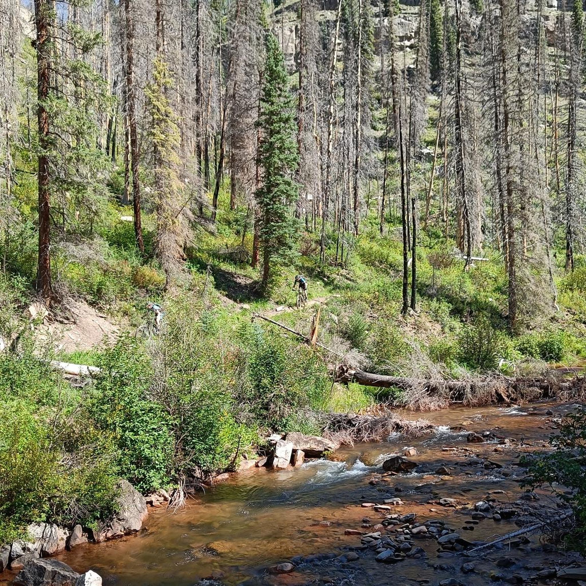
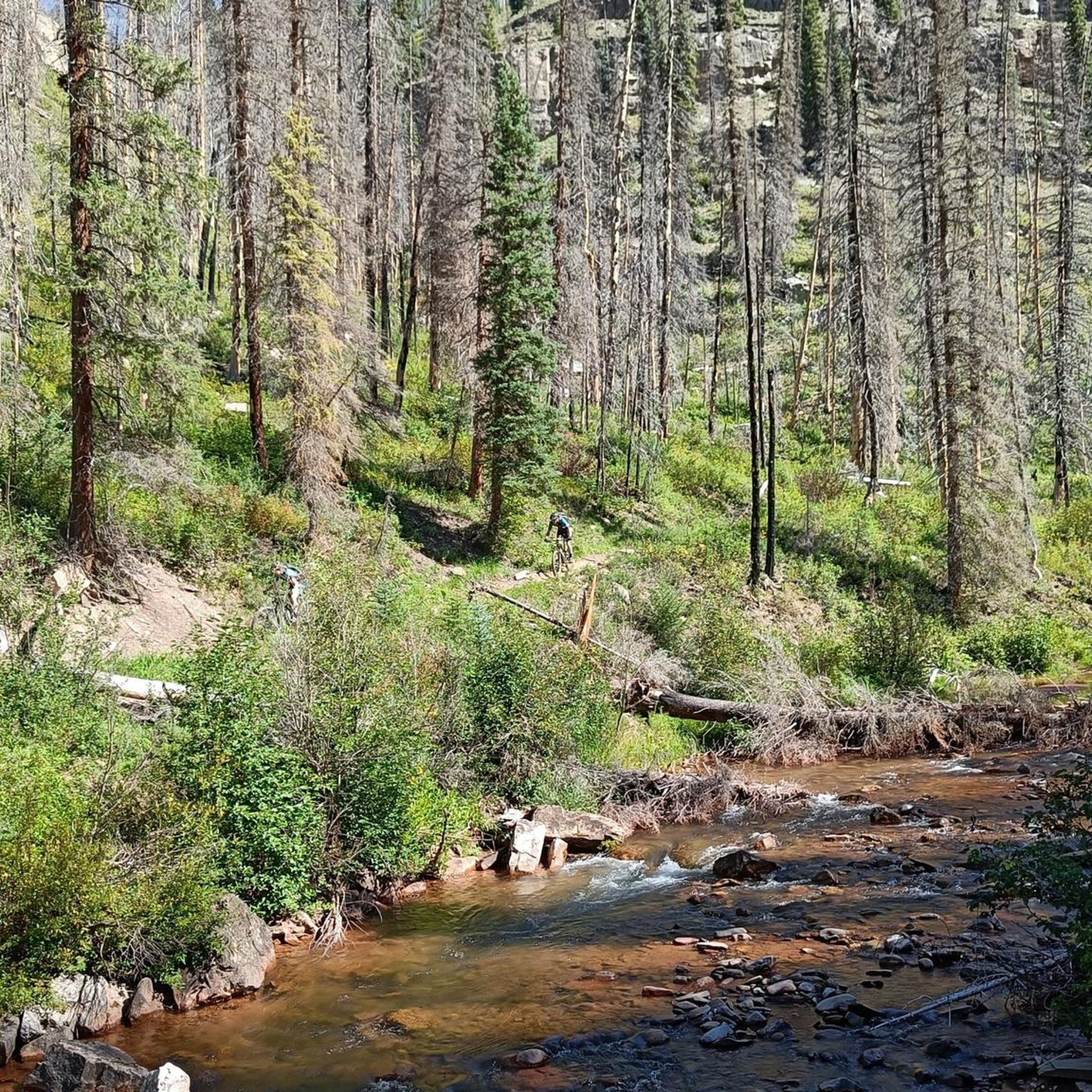
If you're an experienced jogger looking for a challenge, the Hermosa Creek Trail offers a difficult 9.5-mile (15.3 km) route. You'll gain 745 feet (227 metres) in elevation, typically taking about 1 hour and 44 minutes to complete. The trail closely follows Hermosa Creek, winding through an alpine setting with large stands of pine trees. As you descend into the drainage, you'll notice cliffs lining both sides and pass through small meadows. Keep an eye out for sections affected by the 2018 "416 Fire," where regenerating trees create unique open views.
This is a popular multi-use trail, so be ready to share the path with mountain bikers, hikers, and horseback riders. Dogs are welcome on the trail; they can be off-leash in some areas if they respond to voice commands. While generally accessible year-round, you should be aware of potential hazards. Falling trees can be an issue, especially in the burn areas, so always stay alert.
Located in the Hermosa Creek Special Management Area near Durango, Colorado, this trail provides a rewarding experience for those seeking a demanding jog. The route's path through the Hermosa Creek drainage highlights the area's natural beauty and diverse terrain. It's a notable option for exploring the region's unique landscape, offering a blend of dense forest and more open, fire-affected sections.
Get access to more routes and recommendations from other explorers.
Sign up for free
Already have an account?
Our route recommendations are based on thousands of hikes, rides, and runs completed by other people on komoot.
Start today with a free account
Your next adventure awaits.
Login or Signup
Other adventures in Hermosa Creek Wilderness

Tips from the Community

The old silver mine is a great short detour along the Colorado Trail. There are two buildings still standing and also a pretty slanted outhouse. A marmot has moved into the main building and there is a nice flat spot to pitch a tent. Enjoy the view of the mountains and Durango!
2
0

There is a little parking area for the Hermosa Creek Trail system, which is quite extensive. And if you want to stay overnigt: The is a beautiful campground next to the trailhead, the Lower Hermosa Campground. It does not get much more convenient than this!
1
0
Hermosa Creek Trailhead and Jones Creek Trailhead are located just next to each other, with two separate trails that take you into or along the edge of Hermosa Creek Wilderness. At Jones Creek Trailhead, you will find a primitive campground and pit toilets.
0
0

Hermosa Creek Trail runs through the Hermosa Creek Wilderness Area. It includes smooth climbs with beautiful views. The trailhead provides valuable information about the area and the trail itself (though the latter is hard to lose).
0
0

From here you can cross the bridge to follow Hermosa Creek, take the Big Bend trail west to where the Colorado Trail follows the valley ridge, or east via Big Lick Creek up the ridge toward Elbert Creek and Castle Rock.
0
0
A narrow path leads through pine forest, open meadows and all the way along bubbling Hermosa Creek. The water is crystal-clear and once filtered a good option to fill your water bottles.
0
0
Hermosa Creek North Trailhead is your gateway into the Hermosa Creek Wilderness and the Special Management Area. Take a run along Hermosa to the south or follow the West Cross Trail that connects with the long-distance Colorado Trail. Whatever you decide the landscape is spectacular.
0
0

Snowstorm Peak is a 12,511-foot peak near the northern end of the La Plata Mountains. The summit is along a rocky ridge that requires some class 2 travel. Views of the basin from the peak are pretty remarkable.
0
0
Frequently Asked Questions
How many running trails are available in Hermosa Creek Wilderness?
Hermosa Creek Wilderness offers a network of 14 running trails. These routes vary significantly in difficulty and length, providing options for different fitness levels and preferences.
What kind of terrain should I expect when running in Hermosa Creek Wilderness?
You'll encounter a diverse range of terrain, from gently descending doubletrack to more rugged singletrack with loose, rocky, and rooted sections. The landscape features impressive old-growth forests, scenic views, and a wild backcountry environment, often following the winding Hermosa Creek.
Are there easy jogging routes suitable for beginners or a relaxed run?
Yes, there are routes with minimal elevation gain and mostly paved or smoother surfaces. For example, the Highline Colorado Trail is an easy 2.6-mile (4.2 km) path that takes about 31 minutes to complete, leading through varied forest.
Are there any loop running trails in the Hermosa Creek Wilderness?
Yes, for those who prefer circular routes, the Lower Hermosa Creek Trailhead – Jones Creek Trail loop from Lower Hermosa Campground is a popular choice. This challenging 7.2-mile (11.5 km) loop offers a true backcountry experience with significant climbs.
What are some notable natural features or attractions I might see while jogging?
The Hermosa Creek Wilderness is known for its 'Outstanding Waters' and some of Colorado's largest conifers. You'll frequently jog alongside the Hermosa Creek, pass through impressive old-growth forests, and enjoy breathtaking scenic views of the creek below and expansive mountain vistas. Some trails also traverse areas affected by a 2018 fire, offering a unique perspective on forest regeneration.
Are there any running routes with good viewpoints?
Many trails in the Hermosa Creek Wilderness offer stunning scenic views, including glimpses of the creek below and expansive mountain vistas. The rugged mountain terrain naturally provides numerous opportunities for breathtaking outlooks as you traverse the landscape.
What do other runners enjoy most about jogging in Hermosa Creek Wilderness?
Runners frequently praise the area for its diverse landscape, from remote trails and old-growth forests to its wild backcountry environment. The winding Hermosa Creek and the variety of terrain, suitable for different ability levels, are often highlighted as key attractions. Over 35 runners have used komoot to explore these varied routes.
Is Hermosa Creek Wilderness suitable for dog-friendly runs?
The Hermosa Creek Wilderness is generally welcoming for dogs, but it's crucial to check specific trail regulations and always keep your dog on a leash to protect wildlife and ensure a pleasant experience for all users. Be prepared for rugged terrain and potential river crossings.
Where can I find parking or trailheads for these running routes?
Key access points include areas near the Lower Hermosa Creek Campground, which serves as a trailhead for routes like the Lower Hermosa Creek Trailhead – Jones Creek Trail loop. Additionally, some routes, such as the Hermosa Creek Trail, offer an iconic shuttle ride experience, allowing runners to be dropped off near Purgatory Ski Resort and run back down.
What is the best time of year to go running in Hermosa Creek Wilderness?
The best time for running is typically from late spring through early fall when trails are clear of snow and weather conditions are mild. Summer offers lush greenery, while fall brings vibrant foliage. Always check local conditions before heading out, especially for higher elevations.
Are there any less crowded running routes for a more solitary experience?
While popular routes like the Hermosa Creek Trail can see more traffic, the vastness of the 37,400-acre wilderness area means you can often find more remote sections or less-trafficked trails, especially on weekdays or by exploring some of the more challenging options like The Notch & Snowstorm Peak.
Can I spot wildlife while jogging in Hermosa Creek Wilderness?
Yes, the Hermosa Creek Wilderness is an incredible wild backcountry and provides valuable big game habitat. Keep an eye out for deer, elk, and various bird species. Remember to maintain a respectful distance and never approach wildlife.

Get inspired with the komoot mobile app


Explore more
Browse the best Running Trails & Routes in other regions.
