The best road cycling routes in Blood Mountain Wilderness
5.0
(1)
459
riders
7
rides
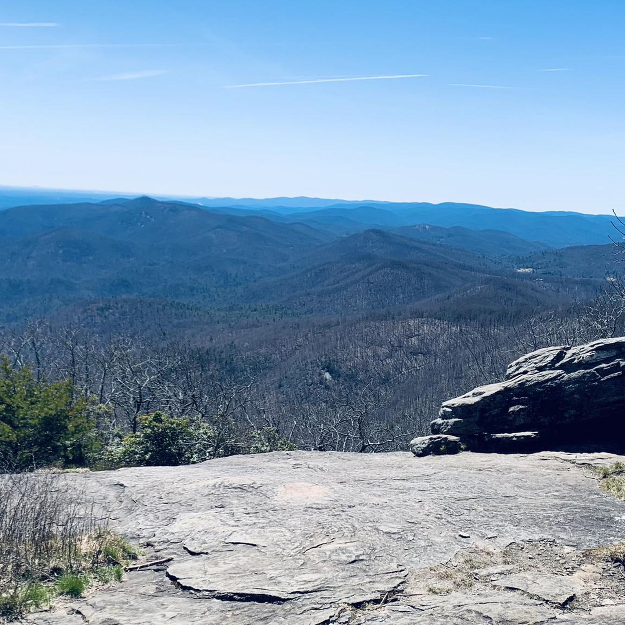
Road cycling routes in Blood Mountain Wilderness traverse a landscape characterized by rugged mountain peaks, winding roads, and dense hardwood forests within Georgia's Chattahoochee National Forest. The region features significant elevation gains and challenging climbs, making it a destination for experienced road cyclists. Roads like those around Neels Gap and Woody Gap are known for their steep ascents and descents, offering panoramic views of the Appalachian Mountains.
Best road cycling routes in Blood Mountain Wilderness
- The most popular road cycling…
Last updated: May 27, 2026
77
riders
126km
06:58
2,650m
2,660m
Get ready for a demanding road cycling adventure on the Woody Gap to Chattahoochee Wildlife Management Area loop. This difficult route stretches for 78.4 miles (126.2 km) and challenges you…
130km
06:27
1,860m
1,860m
A difficult 80.7-mile road cycling loop in Chattahoochee–Oconee National Forest with 6096 feet of elevation gain and mountain views.

Sign up for free
38
riders
102km
05:25
1,730m
1,730m
Hard road ride. Very good fitness required. Mostly well-paved surfaces and easy to ride.
22
riders
84.8km
04:32
1,550m
1,550m
Hard road ride. Very good fitness required. Mostly well-paved surfaces and easy to ride.
9
riders
30.4km
02:18
620m
620m
Moderate road ride. Good fitness required. Some segments of this route may be unpaved and difficult to ride.
Get access to more routes and recommendations from other explorers.
Sign up for free
Already have an account?
Our route recommendations are based on thousands of hikes, rides, and runs completed by other people on komoot.
Start today with a free account
Your next adventure awaits.
Login or Signup
Popular around Blood Mountain Wilderness
Tips from the Community

Roughly 30 miles from Springer Mountain, Neels Gap is a key milestone for northbound hikers. The trail literally passes through the breezeway of Mountain Crossings, a historic stone building that houses an outfitter, hostel, and resupply stop. It’s the first real chance to replace gear, send items home, or get advice from seasoned staff, many of whom are former thru-hikers.
1
0

Last summit on the official "Six Gaps" route, with a 6-mile beautiful, easy-flowing descent from here. Just don't start too close to any motor vehicle in front of you, if you want to enjoy the descent without braking much.
0
0

Fun hike to a very cool lookout! was cloudy when we went but when its clear the views are amazing
0
0

Woody Lake in Suches captivates with its serene beauty, nestled amidst picturesque forests.
0
0
Stunning views from Steedly Mountain into the Blue Ridge Mountains of Georgia!
0
0
Chattahoochee Wildlife Management Area, sprawling across Georgia's landscape, spans over 25,000 acres, offering a refuge for diverse wildlife species and nature seekers.
0
0

Smithgall Woods State Park acts as a mountain retreat for mountain lovers. Reservations have to be made to stay overnight, and all visitors need to register at the visitor center when entering the park. The trails in the park offer views of Yonah Mountain, river and creek access, and hunting access.
0
0

A picturesque viewpoint offering stunning vistas of the surrounding mountains. It's the perfect spot to pause and dismount your bike before continuing onwards.
0
0
Frequently Asked Questions
How many road cycling routes are available in Blood Mountain Wilderness?
There are 11 dedicated road cycling routes in Blood Mountain Wilderness, ranging from moderate to difficult. These routes are designed to showcase the rugged mountain peaks and dense hardwood forests of the region.
What is the best time of year for road cycling in Blood Mountain Wilderness?
The North Georgia mountains offer excellent road cycling, but conditions can vary. Spring and fall generally provide the most pleasant temperatures and vibrant scenery, with fall foliage being particularly stunning. Summers can be warm, and winters may bring colder temperatures and potential for icy conditions at higher elevations, so always check weather forecasts before heading out.
How challenging are the road cycling routes in this region?
Road cycling in Blood Mountain Wilderness is known for its challenging climbs and significant elevation gains, making it a destination for experienced cyclists. The region features demanding ascents and descents, often along winding roads, with 8 out of 11 routes rated as difficult. Be prepared for a strenuous workout amidst beautiful mountain scenery.
What scenic viewpoints can I expect along the road cycling routes?
The routes often pass by or offer access to stunning overlooks. Notable viewpoints include Preachers Rock, which provides picturesque views over Woody Gap, and the Blood Mountain Summit itself, offering expansive panoramic views of the Appalachian Mountains. Roads like the Richard B. Russell Scenic Highway also provide numerous scenic vistas.
Are there any notable landmarks or points of interest near the cycling routes?
Yes, several points of interest are accessible. Neels Gap and Mountain Crossings is a historic landmark and resupply point on the Appalachian Trail. The Blood Mountain Summit & Shelter, a stone structure built in the 1930s, is also a significant site. Additionally, the DeSoto Falls Scenic Area is on the eastern boundary of the wilderness, featuring beautiful waterfalls.
Are there any circular road cycling routes in Blood Mountain Wilderness?
Yes, many routes are designed as loops. For example, the Woody Gap to Chattahoochee Wildlife Management Area loop is a popular 78.4-mile option, and the Newport Road from Woody Gap loop offers extensive elevation changes over 80.7 miles.
Can I find routes that include famous climbs like Neels Gap or Woody Gap?
Absolutely. The region is renowned for its challenging climbs, and many routes incorporate these iconic gaps. Both Neels Gap and Woody Gap are integral parts of well-known cycling routes, including sections of the famous 'Six Gap Century' ride, offering steep ascents and rewarding views.
Are there any family-friendly road cycling options in the North Georgia mountains?
The immediate Blood Mountain Wilderness area is primarily characterized by challenging mountain roads with significant elevation changes, which are generally more suited for experienced road cyclists. While the region is beautiful, truly 'family-friendly' paved routes with minimal elevation gain are limited directly within this rugged terrain. Consider exploring nearby areas for flatter, less demanding options if cycling with young children or those new to road biking.
What kind of amenities or services are available near the road cycling routes?
Key areas like Neels Gap offer facilities such as Mountain Crossings, which provides a store and services for hikers and visitors. Woody Gap Trailhead is a pleasant stopping point with an overlook and facilities. Additionally, the nearby Lake Winfield Scott Recreation Area offers camping, picnicking, and restrooms.
Where can I find parking for road cycling routes in Blood Mountain Wilderness?
Parking is typically available at popular trailheads and scenic areas. Woody Gap is a common starting point with parking facilities. Other areas like Neels Gap also offer parking options, often near amenities or access points to the Appalachian Trail and surrounding roads.
What should I bring for road biking in this area?
Given the challenging terrain and potential for varying weather, it's essential to be well-prepared. Bring plenty of water, nutrition, a repair kit, and appropriate layers of clothing. A helmet is crucial, and a GPS device or a downloaded komoot tour is highly recommended for navigation, as cell service can be spotty in some remote sections.
Are there routes that offer extensive elevation changes and scenic views?
Yes, this is a defining characteristic of road cycling in Blood Mountain Wilderness. Routes like the Newport Road from Woody Gap loop and the Lake Winfield Scott – Woody Gap loop from Dahlonega are prime examples, featuring significant climbs and descents that reward cyclists with breathtaking views of the Appalachian Mountains and surrounding forests.
What are some of the longer, more demanding road cycling routes?
For those seeking longer and more demanding rides, the Newport Road from Woody Gap loop spans 80.7 miles with extensive elevation changes. Another challenging option is the Woody Gap to Chattahoochee Wildlife Management Area loop, covering 78.4 miles and featuring demanding climbs and descents through mountainous terrain.
Most popular routes in Blood Mountain Wilderness
Most popular attractions in Blood Mountain Wilderness

Get inspired with the komoot mobile app


Explore more
Browse the best Road cycling routes in other regions.
