The best road cycling routes around River Falls
27
riders
1
ride
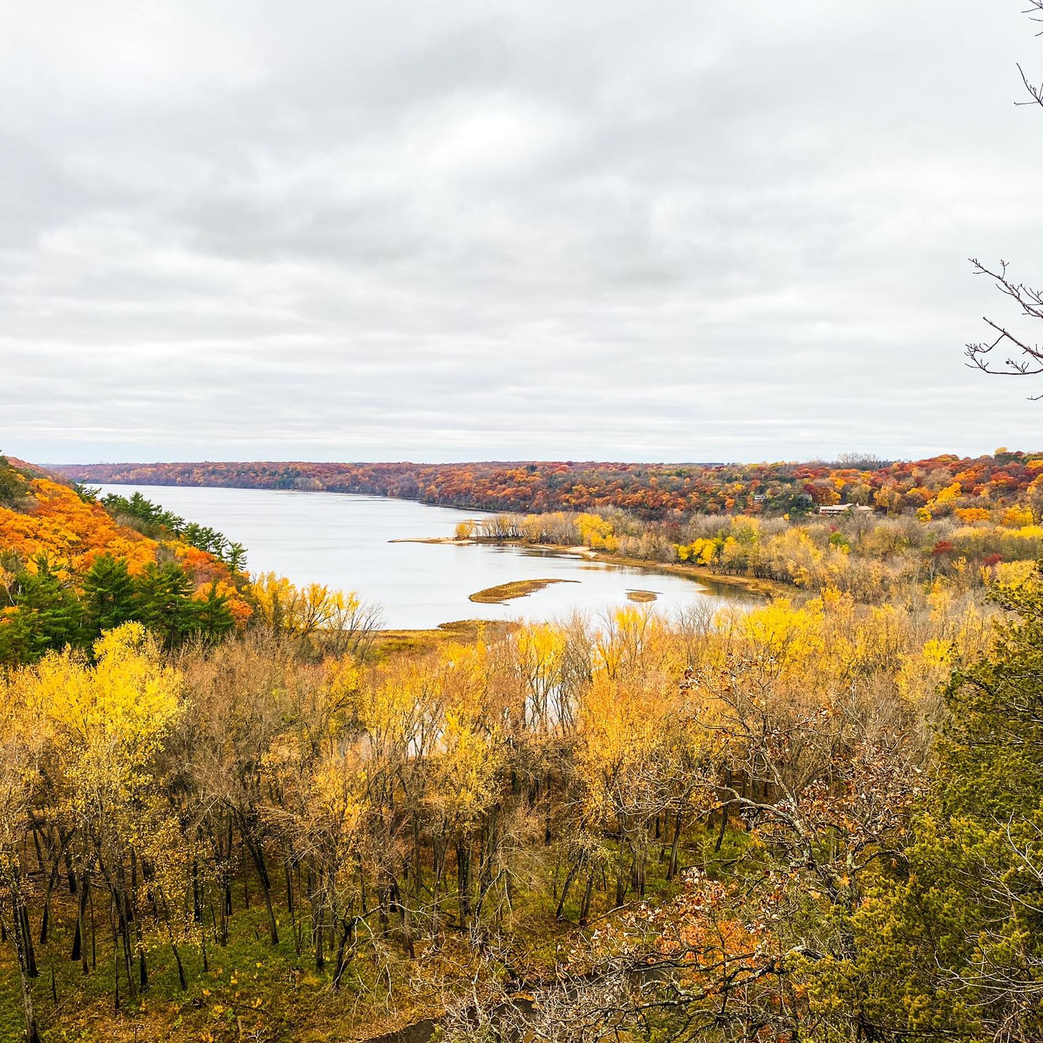
Road cycling around River Falls offers diverse landscapes and interconnected trail systems. The region is characterized by rolling Wisconsin hills and the scenic St. Croix River Valley, providing varied terrain for cyclists. Key features include the Kinnickinnic River, flowing through the city, and the iconic St. Croix Crossing Bridge and Stillwater Lift Bridge, which offer dedicated cycling paths and panoramic river views.
Best road cycling routes around River Falls
- The most popular road cycling route is Stillwater Lift Bridge – Stillwater Lift Bridge loop from I-94 & Carmichael Rd (St. Croix Co), a 24.1 miles (38.8 km) trail that takes 1 hour 41 minutes to complete. This route features scenic views of the St. Croix River and includes crossings over the St. Croix Crossing Bridge and Stillwater Lift Bridge.
- Another top favourite among local road cyclists is Coons Hill – Hop and Barrel Brewery loop from I-94 & Carmichael Rd (St. Croix Co), a moderate 36.7 miles (59.0 km) path. This route traverses rolling countryside with varied elevation gains.
- Local road cyclists also love the Twin Lakes loop from I-94 & Carmichael Rd (St. Croix Co), a 38.5 miles (61.9 km) trail leading through the scenic St. Croix River Valley, often completed in about 2 hours 35 minutes.
- Road cycling around River Falls is defined by rolling Wisconsin hills, the St. Croix River Valley, and iconic bridges connecting Wisconsin and Minnesota. The network offers options for various ability levels, from easy loops to more challenging routes with significant elevation gain.
- The guide includes highly-rated routes that showcase the best of the region's landscape. More than 20 road cyclists have used komoot to explore River Falls's varied terrain.
Last updated: May 31, 2026
4
riders
Moderate road ride. Good fitness required. Some segments of this route may be unpaved and difficult to ride.
3
riders
Moderate road ride. Good fitness required. Mostly well-paved surfaces and easy to ride.

4
riders
Moderate road ride. Good fitness required. Mostly well-paved surfaces and easy to ride.
4
riders
Moderate road ride. Good fitness required. Mostly well-paved surfaces and easy to ride.
5
riders
77.3km
03:26
540m
540m
Moderate road ride. Good fitness required. Mostly well-paved surfaces and easy to ride.
Our route recommendations are based on thousands of hikes, rides, and runs completed by other people on komoot.
Start today with a free account
Your next adventure awaits.
Popular around River Falls

Tips from the Community

I was planning my big farm road loop around stopping here when almost back to the car. Made it with under 30 minutes to spare, but the Fest Beer was worth it! Still so neat to have a brewery and bike shop all together!
1
0
Neat park, I'm not sure how many parks Troy has, but this has to be one of their gems!
1
0
Quite the YMCA camp with tons of cabins, huge mess hall and other buildings. Looks like a neat place to go to sleep away camp.
2
0
Nice to be able to go under the highway. Went to check out the YMCA camp.
2
0
My route took me here and I was going to pedal the loop of path around the school. I did most of it, then stopped to read the signs and it said no bikes, rollerblades, etc. Oh well, but you could get to this picnic shelter and stop for a break. Interesting paintings on all the posts of the shelter, I'm guessing done by the kids of the elementary school.
2
0
Nice place for a beer after a ride, fun to be able to wander the bike shop while enjoying a beverage.
1
0
Great place, big bike store, bike mechanic, and a brewery plus music stage and lots of outdoor seating. Wasn't open on Tuesday, FYI.
2
0
Glover Park, pickleball, baseball, playground, picnic shelter, nice bathrooms, bike station, and hiking trails!
2
0
Frequently Asked Questions
What kind of terrain can I expect on road cycling routes around River Falls?
The River Falls area offers diverse terrain for road cyclists. You'll encounter rolling Wisconsin hills and scenic countryside, particularly in the St. Croix River Valley. Routes can vary from long vistas and gentle rolls in the south to more rugged environments with rocks, cliffs, and woods further north along the St. Croix Scenic Byway.
Are there easy road cycling routes suitable for beginners in River Falls?
Yes, River Falls has options for less experienced riders. An easy route is the Stillwater Lift Bridge – Stillwater Lift Bridge loop, which is about 24.1 miles (38.8 km) and features scenic views of the St. Croix River, including crossings over the iconic St. Croix Crossing Bridge and Stillwater Lift Bridge. Another easy option is the Roadbike loop from I-94 & Carmichael Rd (St. Croix Co), covering approximately 26.4 miles (42.4 km).
What are some of the longer or more challenging road cycling routes in the region?
For those seeking longer or more challenging rides, the Lone Mound loop from River Falls is a moderate route spanning about 44.4 miles (71.4 km) with over 500 meters of elevation gain, requiring good fitness. Other moderate options include the Coons Hill – Hop and Barrel Brewery loop (36.7 miles / 59.0 km) and the Twin Lakes loop (38.5 miles / 61.9 km), both traversing rolling countryside with varied elevation.
What natural features or landmarks can I see along the road cycling routes?
Many routes offer scenic views of the St. Croix River and the Kinnickinnic River. You'll cross engineering marvels like the St. Croix Crossing Bridge and the historic Stillwater Lift Bridge, which provide panoramic river views. Notable natural areas include Kinnickinnic State Park, and you can find various viewpoints such as the Saint Croix River Viewpoint and a River overlook.
Are there any circular road cycling routes around River Falls?
Yes, many of the road cycling routes around River Falls are designed as loops, allowing you to start and end in the same location. Examples include the Stillwater Lift Bridge – Stillwater Lift Bridge loop, the Coons Hill – Hop and Barrel Brewery loop, and the Twin Lakes loop.
When is the best time of year for road cycling in River Falls?
The best time for road cycling in River Falls is typically from spring through fall. Spring offers fresh greenery, while summer provides warm weather. Fall is particularly scenic with vibrant foliage, especially along the St. Croix River Valley. Winter cycling is possible but requires appropriate gear and caution due to colder temperatures and potential snow or ice.
Where can I find parking for road cycling routes in River Falls?
Many routes, such as those starting from I-94 & Carmichael Rd (St. Croix Co), offer convenient parking access. Specific parking information for individual trailheads or starting points can often be found on the detailed route pages on komoot or local park websites.
Are there any cafes or pubs along the road cycling routes in River Falls?
Yes, the region has establishments that cater to cyclists. The Coons Hill – Hop and Barrel Brewery loop, for instance, passes by Hop and Barrel Brewery. Additionally, the Rush River Brewing is another local option. Charming towns like Stillwater, Prescott, and Hudson, often connected by cycling routes, also offer various cafes and pubs.
Do I need any permits for road biking in River Falls, WI?
Generally, road cycling on public roads and designated bike paths in River Falls does not require specific permits. However, if you plan to venture into state parks or specific trail systems, it's always advisable to check their individual regulations for any required passes or fees.
Are there family-friendly road cycling options in River Falls?
While many road cycling routes involve shared roads, the paved loop trail connecting the St. Croix Crossing Bridge and the Stillwater Lift Bridge is 4.7 miles long and open year-round for pedestrians and bicycles, making it a great option for families. For longer rides, easier loops with less traffic might be suitable, but always prioritize safety with children.
What do other road cyclists enjoy most about road cycling in River Falls?
Road cyclists frequently praise the diverse landscapes, from rolling hills to scenic river valleys. The iconic St. Croix Crossing Bridge and Stillwater Lift Bridge are often highlighted for their breathtaking views and unique cycling experience. The variety of routes catering to different fitness levels and the well-maintained surfaces also contribute to a positive experience.
Most popular routes around River Falls
Most popular attractions around River Falls

Get inspired with the komoot mobile app


Explore more
Browse the best Road cycling routes in other regions.
