The best running trails around Five Corners
3.5
(4)
574
runners
49
runs
Jogging around Five Corners offers a network of routes primarily featuring greenways, creek-side paths, and park trails. The terrain generally includes gentle elevation changes, with some routes reaching nearly 200 meters of ascent. This region provides accessible jogging routes suitable for various fitness levels, often following established paths through suburban and natural areas.
Best jogging routes around Five Corners
- The most popular jogging route is Burnt Bridge Creek Greenway loop from Fort Vancouver High School, a 10.7 miles (17.2…
Last updated: October 12, 2026
32
runners
Moderate run. Good fitness required. Mostly paved surfaces. Suitable for all skill levels.
6
runners
Hard run. Very good fitness required. Mostly paved surfaces. Suitable for all skill levels.

4
runners
7.50km
00:47
40m
40m
Moderate run. Good fitness required. Mostly paved surfaces. Suitable for all skill levels.
5
runners
5.83km
00:36
30m
30m
Moderate run. Good fitness required. Mostly paved surfaces. Suitable for all skill levels.
5
runners
12.2km
01:17
110m
110m
Moderate run. Good fitness required. Mostly paved surfaces. Suitable for all skill levels.
Get access to more routes and recommendations from other explorers.
Already have an account?
Our route recommendations are based on thousands of hikes, rides, and runs completed by other people on komoot.
Start today with a free account
Your next adventure awaits.
Popular around Five Corners

Tips from the Community

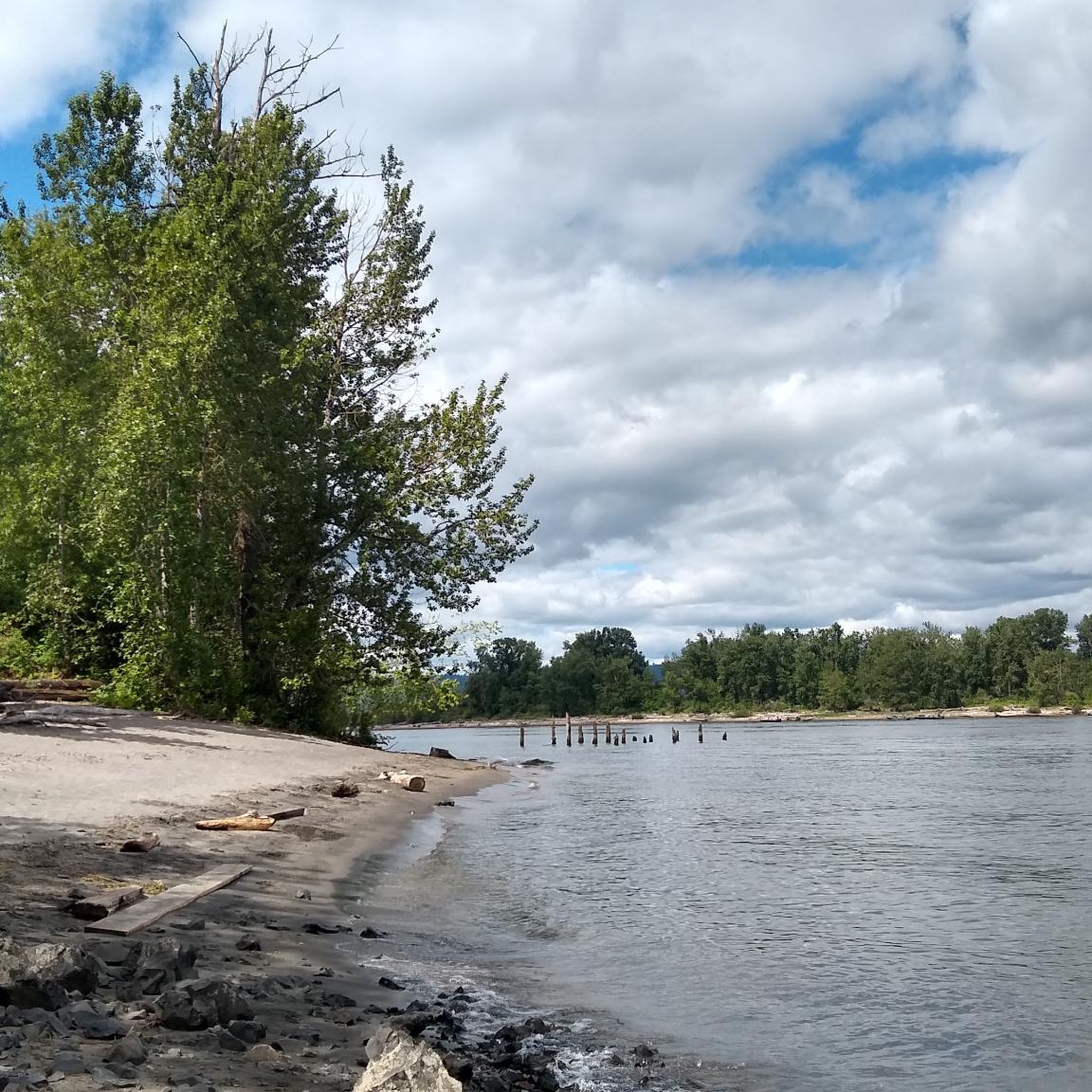
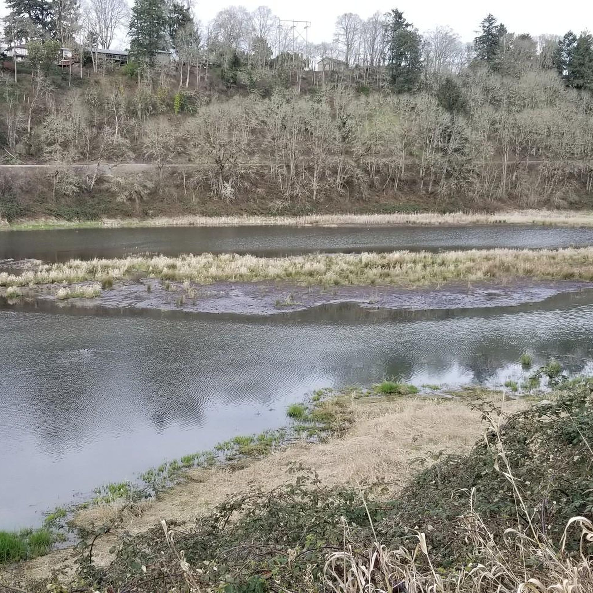
Here you can view Burnt Bridge Creek as it flows west to Vancouver Lake, which drains into Lake River and eventually feeds into the Columbia River.
0
0

The Burnt Bridge Creek Trail is a completely paved bike way that leads from Vancouver Lake through the northern part of the city towards the Columbia River. The trail passes through numerous parks and can be accessed from a few different trailheads and parking lots.
1
0

Burnt Bridge Creek is a 13-mile stream starting near Orchards and ending in Vancouver Lake. For the first 8 miles, the creek travels through natural and artificial waterways before joining a small canyon. The creek's lower section is home to coho salmon, rainbow trout, and steelhead. The 8-mile Burnt Bridge Creek Greenway Trail, a popular path for walking, biking, and jogging, runs along the creek as well.
0
0
Salmon Creek Regional Park and Pond lie at the east end of the paved Salmon Creek Greenway. Though located in an urban setting, the park has 35 acres of developed parkland and 368 acres of undeveloped green space, providing habitat for rabbits, deer, turtles, and beavers.
0
0
The 3.9-mile Salmon Creek Greenway has an asphalt surface and is open to biking, wheelchair access, horseback riding, walking, and running. The trail extends from Salmon Creek Park to the Felida Bridge at NW 36th Avenue. As the trail reaches the park, it winds around the softball fields and to Klineline Pond. The route offers a mix of tree-lined sections and scenic open areas, giving visitors a sense of being far from the city.
0
0

Needed to run an errand cross town, and decided to test Komoot integration with an Apple Watch. Great route! More important (to me) the Komoot -Apple Watch integration was flawless. I've been hoping this would be the case and justify the Watch purchase. Interesting comment about bike computers: They serve two different audiences - Training and Touring. Frankly, the dedicated GPS Computers are great if you want to track statistics for training, or compete with others over training rides, but for Touring they are way too complicated, expensive, and built around features I don't need. The Apple Watch combined with the Komoot App is perfect for finding your way on a Tour. My only complaint is the Watch-Komoot App didn't want to close or give up control of my phone (The Watches 'App Switcher' did work to close Komoot. Here's hoping Komoot keeps building on the Apple Watch integration!
0
1

This greenway follows Burnt Bridge Creek through a variety of landscapes. Open grasslands, wetlands, and forests make this 8-mile greenway popular with active people and nature lovers alike, as you can watch waterfowl and listen to songbirds. The trail gets its name from a bridge dating back to 1889 that burnt down.
0
0

Enjoy both nature and city views while walking along Salmon Creek's lush forest trails in Salmon Creek Park.
0
0
Frequently Asked Questions
How many running routes are available in Five Corners?
There are over 50 dedicated running routes around Five Corners, offering a wide variety of distances and terrains for joggers of all levels.
What types of terrain can I expect on jogging trails in Five Corners?
Jogging routes in Five Corners primarily feature greenways, creek-side paths, and park trails. The terrain generally includes gentle elevation changes, making most routes accessible and enjoyable.
Are there any easy or beginner-friendly running routes in Five Corners?
Yes, Five Corners offers several easy jogging routes. There are at least 4 routes specifically categorized as easy, perfect for beginners or those looking for a relaxed run. Many moderate routes also have gentle gradients.
Can I find circular jogging routes in Five Corners?
Absolutely. Many of the running paths in Five Corners are designed as loops, allowing you to start and finish at the same point. A popular example is the Burnt Bridge Creek Greenway loop from Fort Vancouver High School, which offers a substantial circular experience.
Are there any running routes suitable for families with children?
Yes, the region's greenways and park trails are generally well-suited for families. Routes with gentle gradients and paved or well-maintained paths, such as sections of the Burnt Bridge Creek Greenway, are ideal for a family run or walk.
What are some points of interest or landmarks I might see while running in Five Corners?
While jogging, you might encounter natural areas like the Burnt Bridge Creek Trail itself, which is a highlight. The broader area also features historical sites like Fort Vancouver and scenic spots along the Columbia Riverfront Renaissance Trail, though these might require a short detour from some specific running paths.
Are the jogging trails in Five Corners dog-friendly?
Many of the park trails and greenways in Five Corners are dog-friendly, provided dogs are kept on a leash. Always check local signage for specific regulations on individual trails to ensure a pleasant experience for everyone.
What do other runners say about the jogging experience in Five Corners?
The running routes in Five Corners are highly rated by the komoot community, with an average score of 4.0 stars. Runners often praise the well-maintained paths, the natural beauty of the greenways, and the accessibility of the trails.
Are there any longer, more challenging running routes in the area?
For those seeking a longer challenge, the Burnt Bridge Creek Greenway – Burnt Bridge Creek Trail loop from Minnehaha offers a significant distance of over 30 kilometers with nearly 200 meters of ascent, providing a more demanding run.
Are there any running routes that explore Salmon Creek Regional Park?
Yes, a popular route that takes you through this beautiful area is the Salmon Creek Regional Park – Turtle Ponds loop from Salmon Creek. This moderate 7.5-mile path allows you to explore the park's natural setting and ponds.
What is the typical duration for jogging routes in Five Corners?
The duration of jogging routes varies widely. Shorter routes, like the Running loop from Hazel Dell, can be completed in under an hour, while longer trails, such as the extensive Burnt Bridge Creek Greenway loops, can take several hours.
Most popular routes around Five Corners
Most popular attractions around Five Corners

Get inspired with the komoot mobile app


Explore more
Browse the best Running Trails & Routes in other regions.
