The best walks and hikes around Woodstock Village
4.6
(31)
472
hikers
17
hikes
Hiking around Woodstock Village offers routes through the rolling Green Mountains of Vermont. The area is characterized by forested hills, historic carriage roads, and paths along the Ottauquechee River. The trail network provides a mix of gentle riverside walks and more moderate ascents to viewpoints overlooking the village.
Best hiking trails around Woodstock Village
- The most popular hiking route is Mount Tom and The Pogue loop — Marsh-Billings-Rockefeller National Historical Park, a 4.4 mile (7.1 km) trail that takes about 2 hours to complete. This moderate hike combines an ascent of Mount Tom with a circuit around a 14-acre pond.
- Another top favourite among local hiking enthusiasts is Mount Tom loop via the Faulkner Trail — Woodstock, Vermont, an easy 4.0 mile (6.4 km) path. The route follows a series of switchbacks up the hill through woodland.
- Local hiking enthusiasts also love the Mount Peg — Woodstock, Vermont, a 1.2 mile (2.0 km) trail leading through open meadows, often completed in about 35 minutes.
- Hiking around Woodstock Village is defined by its well-maintained trail systems within the Marsh-Billings-Rockefeller National Historical Park and ascents of local hills like Mount Tom and Mount Peg. The network of paths and carriage roads offers options for different ability levels.
- The routes in Woodstock Village are highly rated by the komoot community with an average score of 4.7 stars from more than 30 reviews. More than 400 hikers have used komoot to explore Woodstock Village's varied terrain.
Last updated: October 10, 2026
1
hikers
4.14km
01:11
100m
100m
The Mount Peg Foot and Bridle Trails offer a delightful journey through shaded hardwoods, leading to a grassy overlook at the Mount Peg summit. You'll traverse packed earth and dirt paths, with some short, steep sections adding a bit of challenge before the reward of panoramic views. From the top, you can gaze upon the Ottauquechee River Valley and the picturesque Woodstock village, making this an easy and scenic escape.
Accessing the trails is simple, as they are easily reached from downtown Woodstock. The route is suitable for year-round enjoyment, whether you're hiking in the vibrant fall foliage or snowshoeing in winter. Just be prepared for potentially muddy sections, especially during spring, and remember that the trails are not groomed for skiing.
These trails are part of the larger Woodstock Trail Network, offering over 30 miles of interconnected paths. Mount Peg itself has a rich history, becoming a public park in 1908 through a land donation. It's particularly family-friendly, with a bell to ring and picnic tables at the summit, making it an ideal spot for a leisurely outing.
4.7
(9)
70
hikers
7.09km
02:03
170m
170m
Hike the moderate 4.4-mile Mount Tom and The Pogue loop for scenic views, diverse forests, and a tranquil pond in Woodstock, VT.

4.5
(8)
59
hikers
7.03km
02:03
180m
180m
Hike the moderate 4.4-mile Mount Tom and The Pogue loop in Vermont, featuring a scenic pond and village views from Mount Tom.
5.0
(1)
25
hikers
6.44km
01:54
180m
180m
The Mount Tom loop via the Faulkner Trail offers an easy hiking experience through varied terrain. You will ascend gradually on well-maintained switchbacks, enjoying the atmosphere of Marsh-Billings-Rockefeller National Historical Park. This 4.0-mile (6.4 km) route involves a 575-foot (175 metres) elevation gain, taking approximately 1 hour and 54 minutes to complete. As you hike, you'll discover incredible panoramic views of Woodstock and the surrounding area, especially from viewpoints along the way. The scenery transforms with vibrant fall colors in autumn, making it a particularly picturesque time to visit.
This trail is easily accessible, connecting directly from downtown Woodstock to the Marsh-Billings-Rockefeller National Historical Park. You can typically find parking available near the trailhead in Woodstock, making it convenient to start your hike. While the route is generally easy, be aware that the final 100 yards to the summit of Mount Tom are strenuous, featuring uneven footing. A handrail is provided to assist you on this steeper section. Consider visiting in autumn to experience the most vibrant scenery.
From the summit of Mount Tom, you can enjoy views extending northwest over Route 4 towards Killington. During the winter months, keep an eye out for the illuminated star on Mount Tom, a cherished village icon that adds a unique charm to the landscape. This popular trail provides a rewarding experience for various fitness levels, connecting you with both nature and local tradition.
5.0
(3)
27
hikers
6.31km
01:49
150m
150m
Embark on an easy hike along The Pogue loop via The Carriage Road, a pleasant 3.9-mile (6.3 km) route that takes about 1 hour and 48 minutes to complete. You'll experience a gentle ascent of 499 feet (152 metres) as you wander through managed forest stands, featuring Norway spruce and eastern hemlock. The trail follows wide, smooth carriage roads, winding through mixed hardwood forests filled with ferns and wildflowers. A key highlight is the 14-acre Pogue pond, where you can enjoy beautiful views and spot wildlife like fish, turtles, and ducks, especially vibrant during autumn.
When planning your visit, you will find parking generally available at the Carriage Barn Visitor Center. The trail is suitable for leisurely walks, though be aware that some sections can be mildly steep. If you bring your dog, remember they are permitted on the trails but must be kept on a leash; however, dogs are not allowed in The Pogue pond itself. This route offers a great outdoor experience for most hikers.
This trail is located within the Marsh-Billings-Rockefeller National Historical Park, offering a unique blend of natural beauty and historical significance. The diverse scenery, from managed forest stands to mixed hardwood forests, provides a rich habitat for local wildlife. The Pogue pond serves as a central feature, contributing to the area's ecological value and offering a peaceful setting for your hike.
Get access to more routes and recommendations from other explorers.
Already have an account?
Our route recommendations are based on thousands of hikes, rides, and runs completed by other people on komoot.
Start today with a free account
Your next adventure awaits.


Tips from the Community


A very idyllic small town post office. Very cute.
0
0
There really is EVERYTHING to walk here. Very pretty little town in Vermont, a postcard idyll.
0
0
Very pretty small town in Vermont, postcard idyll.
0
0

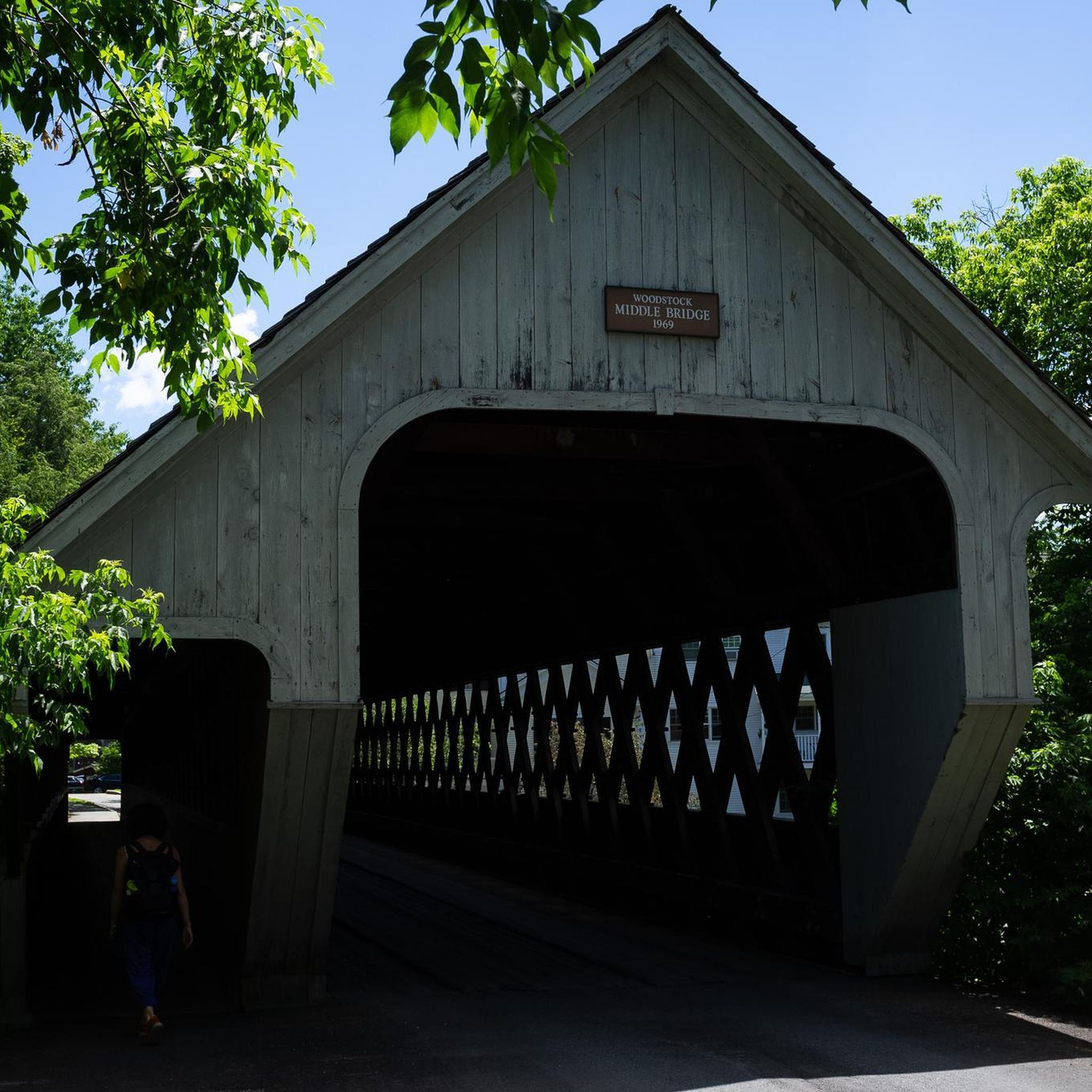
Woodstock Middle Covered Bridge has spanned the Ottauquechee River since 1969 and was supposedly constructed without the use of any nails.
0
0

Mount Peg is a short summit just a few minutes from the main street of Woodstock, Vermont. Standing at just 1,080 feet, Mount Peg is a popular spot with hikers and mountain bikers in the summer and snowshoers and skiers in the winter. The trails on the east side of the mountain are actually groomed in the winter for nordic skiing. At the summit there is a picnic table and some benches, and great views over the town of Woodstock, Mount Tom, and the Ottauquechee River Valley.
0
0
This spot is a wonderful viewpoint on the Faulkner trail on the southeast side of Mount Tom. From this clearing in the forest you get fantastic views over the town of Woodstock and the surrounding area. While this is a lovely spot all year round, it is exceptionally beautiful in the falls when the leaves are changing; this is a great place to enjoy some classic New England peak foliage!
0
0
The Carriage Barn Visitor Center is open from 10am-5pm, Memorial Day weekend until October 31. The building was constructed on the foundation of a stable that the Billings Family originally erected in 1895 to house their horses and carriages. The main floor of this Visitor Center houses an exhibit Conservation Stewardship, a bookstore and a reading area, and restrooms. Park Rangers are there daily to answer any questions you might have. The Carriage Barn Visitor Center is a great place to stop by before exploring the Marsh-Billings-Rockefeller National Historical Park.
0
0
Frequently Asked Questions
Where can I find parking for the main hiking trails in Woodstock?
Parking for trails in the Marsh-Billings-Rockefeller National Historical Park, including those for Mount Tom, is available at the Billings Farm & Museum parking lot. For trails on Mount Peg, there is a dedicated trailhead parking area off of High Street. The Ottauquechee River Trail has parking available near the Woodstock village green.
Are dogs allowed on the hiking trails around Woodstock?
Yes, many trails in the Woodstock area are dog-friendly, but policies vary. In the Marsh-Billings-Rockefeller National Historical Park, dogs must be on a leash at all times. Trails on Mount Peg also require dogs to be leashed. Always check local signage at the trailhead for the most current regulations and be prepared to clean up after your pet.
What are some good family-friendly or easy hikes in the area?
For a gentle and scenic walk, The Pogue loop via The Carriage Road is an excellent choice. This 4-mile (6.3 km) trail follows historic carriage roads to a beautiful mountaintop pond and is suitable for most fitness levels. The flat, 3-mile Ottauquechee River Trail is another great option for a relaxed family stroll.
Are there any circular walks available?
Yes, many of the most popular hikes in Woodstock are loops. The trails within the Marsh-Billings-Rockefeller National Historical Park are designed as a network of interconnecting carriage roads, making it easy to create circular routes of various lengths. The trails on both Mount Tom and Mount Peg are also typically hiked as loops, returning you to your starting point.
What do other hikers enjoy most about the trails in Woodstock Village?
The area is highly regarded by the komoot community, with an average score of 4.7 stars. Reviewers often praise the well-maintained historic carriage roads in the National Park, the beautiful forest scenery, and the rewarding views of the village and surrounding Green Mountains from the summits of Mount Tom and Mount Peg.
Which trails offer the best viewpoints?
For classic views overlooking Woodstock Village and the Ottauquechee River Valley, the summits of both Mount Tom and Mount Peg are the primary destinations. The Faulkner Trail on Mount Tom provides several scenic overlooks on its way to the top. Within the Marsh-Billings-Rockefeller National Historical Park, the area around The Pogue offers serene woodland and water views.
Are there any hikes that take longer than 3 hours?
While many of the main trails are shorter, you can easily combine paths to create a longer hike. Within the Marsh-Billings-Rockefeller National Historical Park, you can link several carriage road loops together to extend your time on the trail well beyond three hours while exploring the extensive forest network.
What is the best time of year to hike in Woodstock?
Hiking in Woodstock is enjoyable from late spring through fall. Summer offers lush green forests, while autumn provides spectacular fall foliage, typically peaking in early October. Winter is also popular for snowshoeing and cross-country skiing on the same trails. Spring can be muddy, so waterproof footwear is recommended.
How many hiking trails are there around Woodstock Village?
There are over 15 designated hiking routes in and around Woodstock Village. These range from easy riverside paths to moderate ascents up local hills, with the majority of trails concentrated within the Marsh-Billings-Rockefeller National Historical Park and on Mount Peg.
What should I pack for a day hike in the Green Mountains?
For a day hike, you should bring water, snacks, a map of the area, and a fully charged phone. Weather can change quickly, so packing layers and a rain jacket is always a good idea. Sturdy, comfortable footwear is essential, especially for the hillier terrain on Mount Tom.
Are there any trails that follow the river?
Yes, the Ottauquechee River Trail is a flat, accessible path that runs along the river, offering a peaceful walk close to the village. It's an ideal choice for those looking for a less strenuous hike with pleasant water views.
Most popular routes around Woodstock Village
Most popular attractions around Woodstock Village

Get inspired with the komoot mobile app


Explore more
Browse the best Hikes in other regions.
