The best road cycling routes around Santa Clara
4.3
(12)
1,347
riders
58
rides
If you've ever tried to plan road cycling around Santa Clara, you know how many options there are, and how hard it can be to figure out which routes are genuinely worth your time. It's easy to get lost in a sea of possibilities, wondering which paths offer the best views, the most satisfying climbs, or simply a great ride. That's where komoot comes in. Our community has ridden, mapped, and reviewed countless routes, and we've distilled that collective wisdom…
Last updated: May 28, 2026
4.8
(8)
273
riders
73.2km
03:24
840m
840m
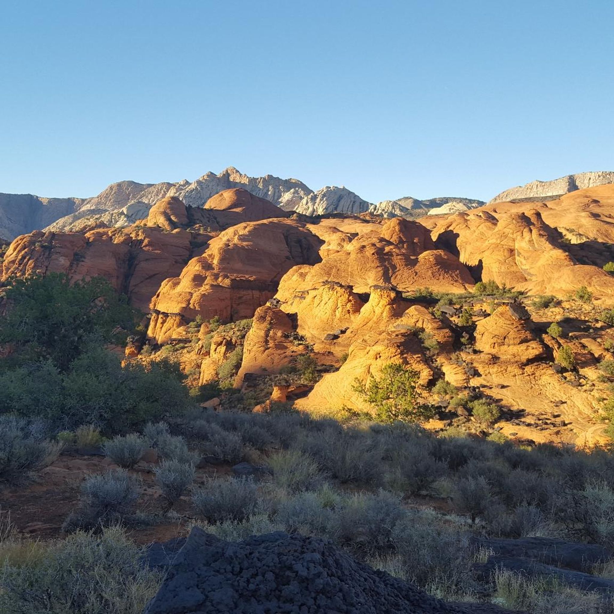
This road cycling loop takes you through the stunning red and white sandstone formations of Snow Canyon State Park, past the Veyo Volcano, and down to Gunlock Reservoir State Park.…
28
riders
101km
04:32
990m
990m
Hard road ride. Very good fitness required. Some segments of this route may be unpaved and difficult to ride.

13
riders
50.9km
02:11
300m
300m
Moderate road ride. Good fitness required. Mostly well-paved surfaces and easy to ride.
10
riders
53.3km
02:15
360m
360m
Moderate road ride. Good fitness required. Mostly well-paved surfaces and easy to ride.
2
riders
17.2km
00:48
130m
130m
Easy road ride. Mostly well-paved surfaces and easy to ride.
Get access to more routes and recommendations from other explorers.
Already have an account?
Our route recommendations are based on thousands of hikes, rides, and runs completed by other people on komoot.
Start today with a free account
Your next adventure awaits.
Tips from the Community

Scrambling up to the top of this massive rock is pretty much a rite of passage in St. George. So is watching for traffic on the busy Red Hills Parkway — ride carefully!
0
0

Endless expanse very beautiful
4
1

Bloomington Park, along the Virgin River Trail South, has sports fields and a playground for kids. The park has views of the Virgin River and public restrooms.
0
0

Veyo Volcano is an extinct cinder cone volcano. While Veyo & its sister to the south, Santa Clara, are both extinct there is potential for further volcanic activity in the area. That being said it's highly unlikely to happen while you're riding by. If you have the time and energy you can hike to the summit of the volcano but there is no official trail as it's essentially just a giant pile of ash and scree.
0
0
As Frank mentioned in a previous trip the conditions for cycling are top notch. In addition to the low speed limit there is also a paved bike path that parallels the road for added safety, which allows you to take in the incredible scenery at your own pace. In winter you may encounter ice and snow and during summer the temperature can be oppressive. As long as you prepare for seasonal conditions you will have a great ride.
3
0
This bike path is the way to go if you're cycling this stretch of Hwy 18. The views all around are incredible so you can safely look around without the worry of distracted drivers doing the same.
2
0
This trail stretches along the Virgin River for 12 miles and is popular with runners, walkers, and cyclists. As such you'll need to keep an eye out for other trail users when you're not soaking up the views.
0
0
Frequently Asked Questions
What kind of terrain can I expect on road cycling routes around Santa Clara?
Santa Clara offers a diverse range of terrain for road cyclists. You'll find routes traversing the flat Santa Clara Valley floor, challenging climbs into the surrounding Santa Cruz Mountains and Diablo Range, and scenic paths through baylands like the San Francisco Bay Trail. This variety allows for everything from leisurely rides to significant elevation gains.
Are there many easy road cycling routes suitable for beginners in Santa Clara?
Yes, Santa Clara has a good selection of routes suitable for beginners. Out of the 56 available road cycling routes, 21 are classified as easy. These often follow multi-use paths along waterways such as the Guadalupe River Trail and the San Tomas Aquino/Saratoga Creek Trail, providing comfortable and scenic rides.
What are some challenging road cycling routes for experienced riders?
For experienced riders seeking a challenge, Santa Clara offers several routes with significant elevation gains. While specific routes are not detailed as 'difficult' in the top list, the region is known for climbs to areas like Mount Hamilton, which can involve over 6,000 feet of elevation. There are 5 routes classified as difficult in the area, such as the Chuckwalla Bike Path – Virgin River Trail loop from Santa Clara, which covers over 60 miles with substantial climbing.
What are the most popular road cycling routes in Santa Clara?
Among the local favorites, the Snow Canyon & Gunlock Reservoir State Parks loop is highly popular, offering varied terrain over 45.5 miles. Other top choices include the Snow Canyon State Park loop, a moderate 16.7-mile path, and the Snow Canyon Scenic Road loop from Entrada Wellnes Center, which is 13 miles long.
What kind of scenic views can I expect on road cycling routes in Santa Clara?
Road cycling in Santa Clara offers a variety of scenic views. You can enjoy vistas of the Santa Clara Valley, the surrounding mountain ranges, and the San Francisco Bay. Routes along the Guadalupe River and San Tomas Aquino/Saratoga Creek provide lush green scenery, while the San Francisco Bay Trail offers views of wetlands and the bay itself. Higher elevation routes can provide panoramic views of Silicon Valley.
Are there any family-friendly road cycling routes in Santa Clara?
Many of Santa Clara's multi-use paths are ideal for family cycling. Routes that avoid high-traffic streets and pass through city parks, such as those incorporating sections of the Guadalupe River Trail or the San Tomas Aquino/Saratoga Creek Trail, are generally suitable for families. These paths often feature dedicated bike lanes or are entirely separate from vehicle traffic.
What is the best season for road biking in Santa Clara?
Santa Clara benefits from an almost perfect climate, making it ideal for year-round outdoor activities, including road cycling. The mild temperatures and generally sunny weather mean you can enjoy the routes comfortably in most seasons. However, spring and fall offer particularly pleasant conditions with moderate temperatures.
Are there loop road cycling trails available in Santa Clara?
Yes, many road cycling routes in Santa Clara are designed as loops, offering a convenient way to explore the area without retracing your path. Examples include the popular Snow Canyon & Gunlock Reservoir State Parks loop and the Snow Canyon State Park loop.
What do other road cyclists enjoy most about road cycling in Santa Clara?
The road cycling experience in Santa Clara is highly rated by the komoot community, with an average score of 4.4 stars from over 13 reviews. Cyclists often praise the diverse terrain, ranging from flat valley paths to challenging mountain climbs, and the extensive network of multi-use trails that provide scenic and safe riding opportunities.
What attractions or points of interest can I find along the road cycling routes?
Many routes pass by or near interesting attractions. For instance, some routes might take you through or near Petrified Dunes, Snow Canyon State Park, or along the Snow Canyon Scenic Road. You might also encounter natural features like Scout's Cave or historical sites like the Santa Clara River Petroglyphs, depending on your chosen route.
Are there dedicated bike paths or lanes in Santa Clara?
Yes, Santa Clara is actively working on improving its cycling infrastructure. Many routes feature multi-use paths where a significant portion is on dedicated trails, and other sections are on roads with comfortable bike lanes. This commitment ensures a continually improving environment for cyclists, making it safer and more enjoyable to explore the region.
What is the typical length of road cycling routes in Santa Clara?
The routes in Santa Clara vary significantly in length to accommodate different preferences and fitness levels. You can find shorter rides, such as the Snow Canyon Scenic Road loop from Entrada Wellnes Center at 13 miles, to much longer excursions like the Snow Canyon & Gunlock Reservoir State Parks loop at 45.5 miles, and even routes exceeding 60 miles.
Most popular routes around Santa Clara
Most popular attractions around Santa Clara

Get inspired with the komoot mobile app


Explore more
Browse the best Road cycling routes in other regions.
