The best road cycling routes around Barton Creek
4.7
(32)
2,244
riders
73
rides
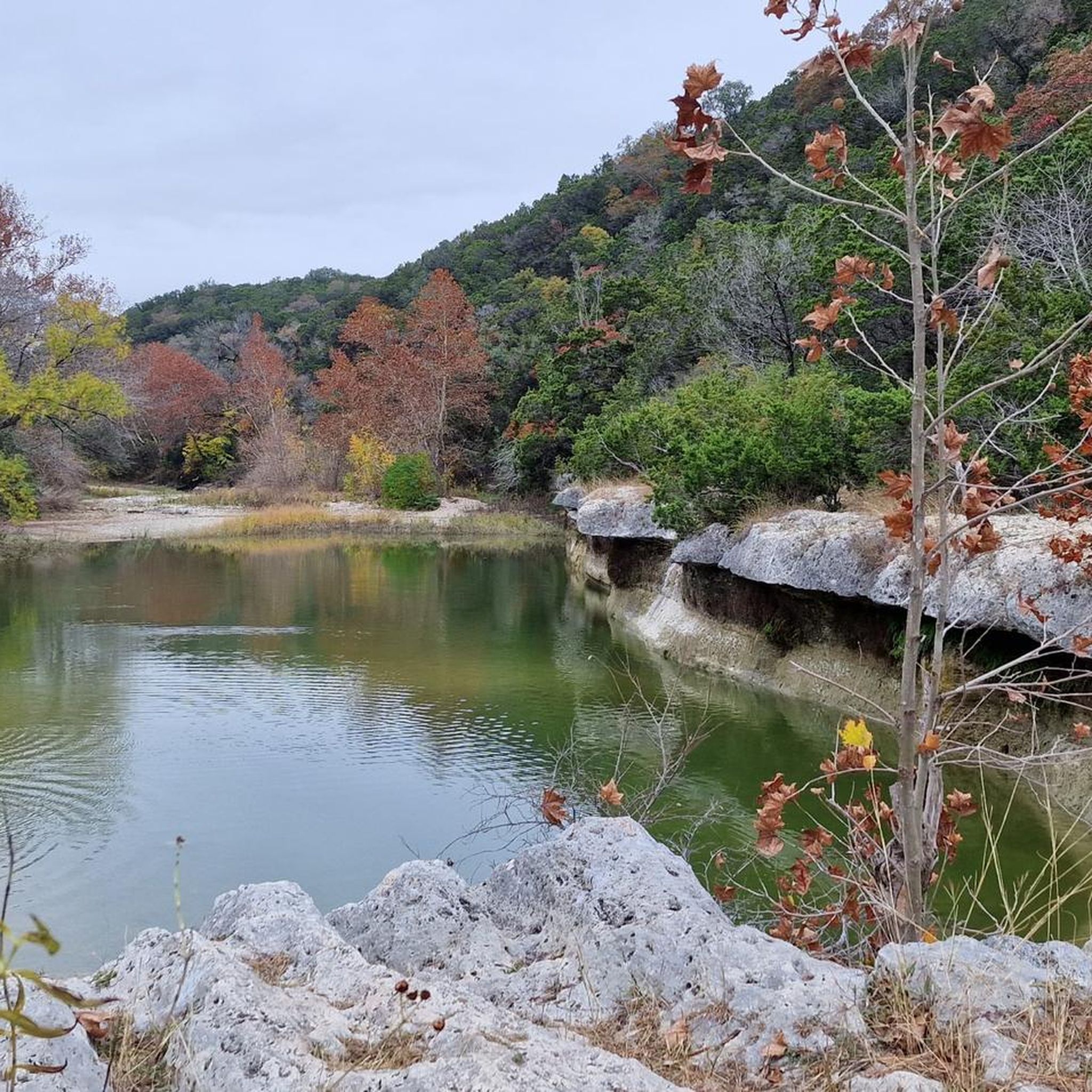
Road cycling routes around Barton Creek traverse the diverse landscape of the Texas Hill Country, characterized by rolling hills, lush oak-juniper forests, and limestone formations. The area offers mostly well-paved surfaces suitable for road bikes, providing varied terrain from moderate climbs to challenging ascents. Cyclists can experience scenic vistas and natural features that define the region.
Best road cycling routes around Barton Creek
- The most popular road cycling route is Pace Bend National Park loop from Barton Creek, a 53.8 miles (86.6 km) difficult trail that takes 4 hours 28 minutes to complete. This route features significant climbs and offers views of Lake Travis.
- Another top favourite among local road cyclists is Suburban SoCo Hills – Pfluger Pedestrian Bridge loop from West Ridge Middle School Tennis Courts, a moderate 39.7 miles (64.0 km) path. This route winds through the suburban hills, offering a mix of ascents and descents.
- Local road cyclists also love the Barton Creek Country Club loop from Barton Creek, a 12.7 miles (20.4 km) trail leading through the scenic Barton Creek area, often completed in about 1 hour 2 minutes.
- Road cycling around Barton Creek is defined by rolling hills, lush landscapes, and oak-juniper forests. The network offers options for different ability levels, from easy rides to challenging loops with significant elevation gain.
- The routes in Barton Creek are highly rated by the komoot community with an average score of 4.8 stars from more than 20 reviews. More than 2000 road cyclists have used komoot to explore Barton Creek's varied terrain.
Last updated: May 30, 2026
9
riders
86.6km
04:28
950m
950m
Hard road ride. Very good fitness required. Mostly well-paved surfaces and easy to ride.
10
riders
Moderate road ride. Great for any fitness level. Some segments of this route may be unpaved and difficult to ride.

Sign up for free
8
riders
20.4km
01:02
340m
340m
Moderate road ride. Good fitness required. Mostly well-paved surfaces and easy to ride.
8
riders
17.1km
00:54
290m
290m
Easy road ride. Great for any fitness level. Mostly well-paved surfaces and easy to ride.
6
riders
Moderate road ride. Good fitness required. Some segments of this route may be unpaved and difficult to ride.
Get access to more routes and recommendations from other explorers.
Sign up for free
Already have an account?
Our route recommendations are based on thousands of hikes, rides, and runs completed by other people on komoot.
Start today with a free account
Your next adventure awaits.
Login or Signup



Tips from the Community

The Pfluger Pedestrian Bridge, also known as the James D. Pfluger Pedestrian and Bicycle Bridge, spans 700 feet over Lady Bird Lake in downtown Austin, Texas. Opened in 2001, this shared-use bridge connects the north and south sides of the Ann and Roy Butler Hike-and-Bike Trail. It features a distinctive "double curve" design supported by curved concrete piers and a concrete deck on top of weathering steel plate girders. The bridge is named after James D. Pfluger, a local architect who designed the trails surrounding Lady Bird Lake.
0
0

Zilker Metropolitan Park, located in South Austin, Texas, is a haven for urban exploration. Spanning over 350 acres at the confluence of Barton Creek and the Colorado River, this historic park was originally donated by Andrew Jackson Zilker in 1917 and developed into a park during the 1930s. The park is now a central hub for recreation, with the popular hike-and-bike trail around Lady Bird Lake. Whether you're cruising through the park or heading out to explore Austin’s vibrant streets, Zilker Park is a great starting point for any urban adventure. The park also hosts major events like the Austin City Limits Music Festival and the Zilker Park Kite Festival.
0
0

Beckett Road passes alongside Dick Nichols District Park. It is a firm favourite with families, with plenty of trails to discover. With bike paths on either side of the road, it's a nice green route into or out of Austin.
0
0

Don't forget small change for the musicians
0
0
Beckett Road passes alongside Dick Nichols District Park. It is a firm favourite with families, with plenty of trails to discover. With bike paths on either side of the road, it's a nice green route into or out of Austin.
0
0
The Escarpment Boulevard cuts through the park, giving lovely open views of nature in both directions. It's a popular place to be outdoors, with a network of hiking and dirt cycling trails within its borders.
1
0
The Village at Western Oaks Karst Preserve and Watershed Management Area is designated City of Austin (CoA) land, serving as an important part of the Balcones Canyonlands Preserve (BCP). The goal is to preserve and protect this unique ecosystem. Visitors can find fireflies here during the summer months or use the trail systems all year round.
0
0
The Village at Western Oaks Karst Preserve and Watershed Management Area is designated City of Austin (CoA) land, serving as an important part of the Balcones Canyonlands Preserve (BCP). The goal is to the preserve and protect this unique ecosystem. Visitors can find fireflies here during the summer months or use the trail systems all year round.
0
0
Frequently Asked Questions
What kind of terrain can I expect on road cycling routes around Barton Creek?
Road cycling routes in the Barton Creek area primarily feature well-paved surfaces, traversing the diverse landscape of the Texas Hill Country. You'll encounter rolling hills, lush oak-juniper forests, and limestone formations, offering varied terrain from moderate climbs to challenging ascents.
Are there any easy or beginner-friendly road cycling routes in Barton Creek?
Yes, the Barton Creek area offers options for different ability levels. For an easier ride, consider the Barton Creek Country Club loop from TXDOT Dumping Area, which is 10.6 miles (17.1 km) long and has an easy difficulty grade.
What are some challenging road cycling routes for experienced cyclists?
For experienced cyclists seeking a challenge, the Pace Bend National Park loop from Barton Creek is a difficult 53.8-mile (86.6 km) route featuring significant climbs and stunning views of Lake Travis.
Can I find scenic views or natural features along the road cycling routes?
Absolutely. The routes offer scenic vistas of the Texas Hill Country, including rolling hills, lush landscapes, and unique rock formations. While the Greenbelt itself is rugged, the wider area provides views of oak-juniper forests and the presence of Barton Creek and nearby Lake Travis adds to the natural beauty.
What is the best time of year to go road cycling in Barton Creek?
The best time to road cycle in Barton Creek generally avoids the peak summer heat. Spring and fall offer more moderate temperatures, making for more comfortable rides. Always check local weather conditions, especially for rain, which can impact road surfaces.
Are there any family-friendly road cycling options in the Barton Creek area?
While the Greenbelt trails are not suitable for road bikes, the wider Barton Creek area does offer some paved routes that can be enjoyed by families. Look for routes with lower elevation gain and shorter distances for a more relaxed experience.
What kind of attractions or landmarks can I see near the road cycling routes?
While cycling, you might pass by areas with natural attractions. Notable spots nearby include Sculpture Falls and Twin Falls, known for their natural beauty. You could also visit Barton Springs Pool for a refreshing stop.
How many road cycling routes are available in the Barton Creek area?
There are over 60 road cycling routes available around Barton Creek, catering to various skill levels. This includes 8 easy routes, over 50 moderate routes, and 7 difficult routes.
What do other road cyclists think about the routes in Barton Creek?
The road cycling routes in Barton Creek are highly rated by the komoot community, with an average score of 4.8 stars from more than 20 reviews. Cyclists often praise the varied terrain, scenic vistas, and well-paved surfaces.
Are there any loop routes for road cycling in Barton Creek?
Yes, many road cycling routes in the area are designed as loops. For example, the Suburban SoCo Hills – Pfluger Pedestrian Bridge loop from West Ridge Middle School Tennis Courts is a popular moderate loop, and the Barton Creek Country Club loop from Barton Creek offers a shorter, scenic option.
Is public transportation an option for accessing road cycling routes in Barton Creek?
CapMetro bus routes serve the Austin area, and some may have bike racks, offering a way to get closer to certain cycling routes. It's advisable to check specific CapMetro routes and their bike policies for the most convenient access points.
Are there any permits required for road cycling in the Barton Creek area?
Generally, no specific permits are required for road cycling on public roads in the Barton Creek area. However, if you plan to access specific parks or protected areas, it's always best to check their individual regulations. For information regarding the Barton Creek Greenbelt, you can visit austintexas.gov.
Most popular attractions around Barton Creek

Get inspired with the komoot mobile app


Explore more
Browse the best Road cycling routes in other regions.
