The best walks and hikes around Ardmore
4.8
(66)
1,176
hikers
78
hikes
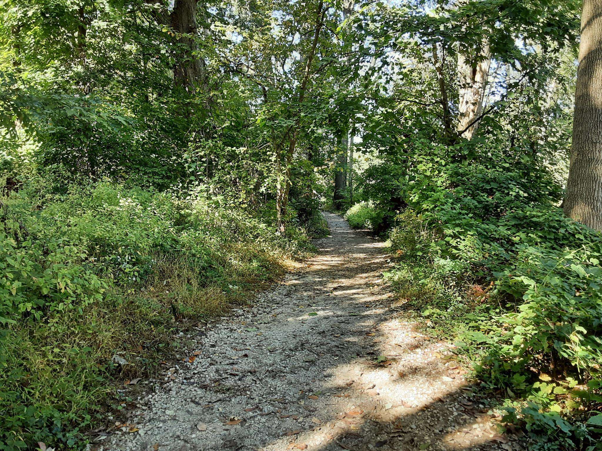
Hiking around Ardmore offers a network of trails primarily through local parks, woodlands, and along heritage paths. The region features varied terrain, including gentle valleys and wooded preserves, providing accessible outdoor experiences. These trails often follow natural waterways and connect green spaces within the area. The landscape is characterized by established parkland and suburban natural areas.
Best hiking trails around Ardmore
- The most popular hiking route is Ithan Valley Park Loop, a 1.3 miles (2.1 km) trail that takes about 34 minutes to complete. This easy route winds through a scenic park setting.
- Another top favourite among local hikers is Delco Woods Loop, an easy 2.1 miles (3.4 km) path. This trail offers a pleasant walk through wooded areas.
- Local hikers also love the Northbrook and Meadow Trail Loop, a 1.2 miles (2.0 km) trail leading through meadows and woodlands, often completed in about 31 minutes.
- Hiking around Ardmore is defined by park trails, wooded areas, and valley paths. The network offers options for easy to difficult routes, catering to various skill levels.
- The routes in Ardmore are highly rated by the komoot community with an average score of 4.8 stars from over 50 reviews. More than 1000 hikers have used komoot to explore Ardmore's varied terrain.
Last updated: July 29, 2026
2
hikers
2.11km
00:34
20m
30m
The Ithan Valley Park Loop offers a tranquil escape into a surprisingly rich natural setting, perfect for a short, easy hike. This 1.3-mile (2.1 km) loop takes you through a lush landscape dotted with stately exotic trees, remnants of an 18th-century arboretum, and along the gentle flow of Ithan Creek. You'll encounter charming features like an old mill site waterfall and historical stone walls, all within an easy 33 minutes of walking, with only 67 feet (20 metres) of elevation gain.
For the most pleasant experience, aim to visit in spring or summer when the foliage is dense, creating a vibrant green canopy and dampening ambient road noise. While the trail is generally easy and accessible for all skill levels, be prepared for potentially muddy sections after rain and slippery leaves during the winter months. The park is also dog-friendly, making it a great spot for a walk with your canine companion.
What truly sets this trail apart is its deep botanical and historical roots. Once part of an old estate, the park boasts a diverse collection of exotic trees that made it one of the most significant botanical sites in the United States in the mid-1800s. The presence of Ithan Creek, where fishing is permitted, and the historical waterfall from its mill site past, add layers of interest to this accessible and engaging loop.
1
hikers
1.68km
00:26
10m
0m
The Darby Creek Trail offers a delightful, varied experience, winding through wooded areas right alongside the tranquil creek. You'll encounter a mix of surfaces, from natural dirt and grass to smooth, wide paved sections, making it one of the most accessible trails in the region. The scenery is consistently pleasant, providing a refreshing connection to nature even close to urban areas, with the sounds of the creek often taking precedence over distant traffic.
Planning your visit to the Darby Creek Trail is straightforward, as it's designed for ease of access. This easy 1.0-mile (1.7 km) hike, with a minimal 27 feet (8 metres) of elevation gain, can be completed in about 25 minutes, making it ideal for a spontaneous outing. Its family-friendly nature, including sections perfect for strollers and mobility devices, means you can bring everyone along for a gentle walk.
What makes the Darby Creek Trail truly notable is its role as a key component of "The Circuit," a vast network of interconnected trails in the Philadelphia region. This trail's inclusive design and creek-side beauty within Darby Creek Valley Park highlight its importance, offering a welcoming outdoor experience for all. It's a great example of how natural spaces are being integrated into developed surroundings.

Sign up for free
1.96km
00:31
10m
20m
Step onto the Northbrook and Meadow Trail Loop for a refreshing, easy hike that feels miles away from the everyday. This gentle 1.2-mile (2.0 km) path, with only 40 feet (12 metres) of elevation gain, guides you through the serene landscapes of Meadowhill Park. Expect a peaceful 30-minute walk through lush greenery and open spaces, perfect for unwinding and enjoying nature's calm.
Accessing the loop is convenient, with parking typically available at Meadowhill Park, a well-known community hub. This trail is ideal for a spontaneous outing, whether you're looking for a quick morning stroll or an afternoon break. It's a beginner-friendly route that doesn't require extensive planning, making it a great choice for a casual walk.
The Northbrook and Meadow Trail Loop is part of a larger network managed by the Northbrook Park District, emphasizing accessibility and community integration. The area features diverse scenery, including prairie landscapes and wooded corridors, providing a unique blend of natural beauty within a suburban setting. It's a fantastic example of how green spaces are woven into daily life, offering a convenient escape for local residents and visitors alike.
1.13km
00:19
20m
20m
The Saunders Woods Preserve Loop offers a delightful blend of wooded areas and open meadows, making it a peaceful natural oasis in Gladwyne, Pennsylvania. As you hike, you'll traverse unpaved paths and dirt woodland trails, with a picturesque tributary of the Schuylkill River enhancing the scenery. Look out for the historic 19th-century barn and springhouse, which add a unique charm to this tranquil setting.
This easy 0.7-mile (1.1 km) hiking route involves a gentle 68 feet (21 metres) of elevation gain and typically takes about 18 minutes to complete. It's an ideal choice for beginners and families, offering a manageable and enjoyable experience. The trail is dog-friendly, provided your canine companion remains on a leash, and spring and fall are particularly beautiful times to visit for wildflowers or autumn colors.
Beyond its natural beauty, the preserve is owned by the Natural Lands Trust, a significant conservation organization. The trail also connects to the broader Bridlewild Trail network, providing options for longer excursions if you wish to extend your adventure beyond this charming loop.
1.91km
00:33
40m
50m
The Bridlewild Trail in Gladwyne, Pennsylvania, offers a delightful and easy singletrack hiking experience, perfect for a quick outdoor escape. This well-defined path covers 1.2 miles (1.9 km) with a minimal 145 feet (44 metres) of elevation gain, making it accessible for nearly everyone. You can expect to complete this pleasant walk in about 32 minutes, enjoying a serene natural environment close to home.
Planning your visit to the Bridlewild Trail is straightforward, as it's located conveniently near Gladwyne, Pennsylvania. The trail is very popular, suggesting easy access, though specific parking information isn't detailed. It's a fantastic option for dog owners, as leashed dogs are permitted, making it a great spot for a family outing with your furry friend.
What sets this trail apart is the dedicated effort of the Bridlewild Trails Association, which actively maintains and preserves many miles of walking and horse riding trails in Lower Merion. They work to clear downed trees, repair water runoff damage, and cut back vegetation, ensuring the trail remains in excellent condition for all users. This commitment to upkeep makes the Bridlewild Trail a reliable and enjoyable choice for a short, easy hike.
Get access to more routes and recommendations from other explorers.
Sign up for free
Already have an account?
Our route recommendations are based on thousands of hikes, rides, and runs completed by other people on komoot.
Start today with a free account
Your next adventure awaits.
Login or Signup




Frequently Asked Questions
How many hiking trails are available around Ardmore?
Ardmore offers a wide selection of hiking opportunities, with over 70 routes available. These trails range from easy strolls through local parks to more challenging paths, catering to various skill levels.
Are there any family-friendly hiking options in Ardmore?
Yes, Ardmore has many family-friendly trails, particularly those found in local parks and woodlands. Routes like the Northbrook and Meadow Trail Loop are easy and suitable for families looking for a pleasant outdoor experience.
What kind of natural features can I expect to see while hiking in Ardmore?
The hiking trails around Ardmore primarily wind through established parkland, wooded areas, and along valley paths. You'll encounter green spaces and natural waterways, offering a peaceful escape within a suburban natural setting.
Are there any circular walks or loop trails in Ardmore?
Many of Ardmore's trails are designed as loops, providing convenient circular walks. For example, the Ithan Valley Park Loop and the Delco Woods Loop are popular choices that allow you to start and end at the same point.
What do other hikers say about the trails in Ardmore?
The hiking routes in Ardmore are highly regarded by the komoot community, boasting an average score of 4.8 stars from over 50 reviews. Hikers often praise the well-maintained paths and the serene, accessible natural environments.
Are there any challenging hikes for experienced trekkers?
While many trails are easy to moderate, Ardmore does offer a few more challenging options for those seeking a greater workout. Out of the 72 available routes, 3 are rated as difficult, providing varied terrain for experienced hikers.
Can I find trails that offer scenic views?
Yes, many trails in Ardmore provide pleasant views as they traverse through woodlands and open meadows. The Cynwyd Heritage Trail Loop, for instance, offers a scenic journey along a heritage path.
Are there any specific attractions or landmarks near the hiking trails?
While hiking in Ardmore, you're close to several notable attractions. You could visit the Philadelphia Museum of Art Steps, see the Rocky Statue, or explore parts of the Schuylkill River Trail, which offers additional walking opportunities.
What is the best time of year to go hiking in Ardmore?
Ardmore's trails are enjoyable throughout much of the year. Spring and fall offer pleasant temperatures and beautiful foliage, while summer provides lush green scenery. Winter hiking is also possible, though conditions may vary.
Are there any hidden gem trails or less-known paths in Ardmore?
Beyond the more popular routes, Ardmore has numerous local park trails that offer a quieter experience. Exploring areas like the Saunders Woods Preserve Loop can lead you to serene wooded paths that are less frequented.
Is public transport available to access hiking trails in Ardmore?
Ardmore is well-connected by public transport, making many of its local parks and trailheads accessible without a car. It's advisable to check local transit schedules for the most convenient routes to your chosen starting point.
Are there options for shorter, easy walks?
Absolutely. Ardmore is rich in easy, shorter walks perfect for a quick outing or a leisurely stroll. Many park loops, such as the Saunders Woods Preserve Loop, are under 2 miles and can be completed in under an hour.
Most popular attractions around Ardmore

Get inspired with the komoot mobile app


Explore more
Browse the best Hikes in other regions.
