The best road cycling routes around New Rochelle
4.3
(137)
2,735
riders
209
rides
Road cycling around New Rochelle offers diverse terrain, characterized by its Long Island Sound waterfront, numerous parks, and interconnected trail systems. The city's geographical position provides varied landscapes for exploration, from scenic coastal views to routes accessing larger multi-use trail networks. Cyclists can find both relatively flat paths and routes with significant elevation gains, catering to different preferences. Access to major trailways like the South County Trailway and East Coast Greenway further expands cycling opportunities.
Best road cycling routes around New Rochelle
- The most popular road cycling route is S-Curve Hill beneath the George Washington Bridge – The High Bridge loop from New Rochelle, an 84.2 miles (135.5 km) trail that takes about 6 hours to complete. This difficult route features significant elevation changes and connects to broader regional networks.
- Another top favourite among local road cyclists is Pinebrook Road North – Kensico Reservoir loop from New Rochelle, a moderate 43.2 miles (69.6 km) path. This route offers a substantial ride through varied landscapes, including views of the Kensico Reservoir.
- Local road cyclists also love the Shore Road Bridge – City Island Road bike path loop from New Rochelle, a 14.9 miles (24.0 km) trail leading through coastal areas, often completed in about 1 hour 7 minutes.
- Road cycling around New Rochelle is defined by its Long Island Sound waterfront, extensive parklands, and connectivity to major trail systems like the South County Trailway. The network offers options for different ability levels, from easy loops to challenging long-distance rides.
- The routes in New Rochelle are highly rated by the komoot community with an average score of 4.0 stars from over 70 reviews. More than 1900 road cyclists have used komoot to explore New Rochelle's varied terrain.
Last updated: October 4, 2026
10
riders
70.0km
03:24
600m
600m
Moderate road ride. Good fitness required. Mostly well-paved surfaces and easy to ride.
5.0
(3)
116
riders
33.8km
01:35
210m
210m
Moderate road ride. Great for any fitness level. Some segments of this route may be unpaved and difficult to ride.

4.9
(25)
178
riders
54.6km
02:23
360m
360m
Moderate road ride. Good fitness required. Mostly well-paved surfaces and easy to ride.
3.0
(1)
36
riders
30.0km
01:16
160m
160m
Easy road ride. Great for any fitness level. Mostly well-paved surfaces and easy to ride.
9
riders
75.3km
03:28
720m
720m
Moderate road ride. Good fitness required. Mostly well-paved surfaces and easy to ride.
Get access to more routes and recommendations from other explorers.
Already have an account?
Our route recommendations are based on thousands of hikes, rides, and runs completed by other people on komoot.
Start today with a free account
Your next adventure awaits.
Tips from the Community

Martine’s Fine Bake Shoppe is a European style bakery that is a great stop for breakfast, lunch or a mid-ride pastry. It has outdoor seating, so you can keep an eye on your bike while you eat.
2
0

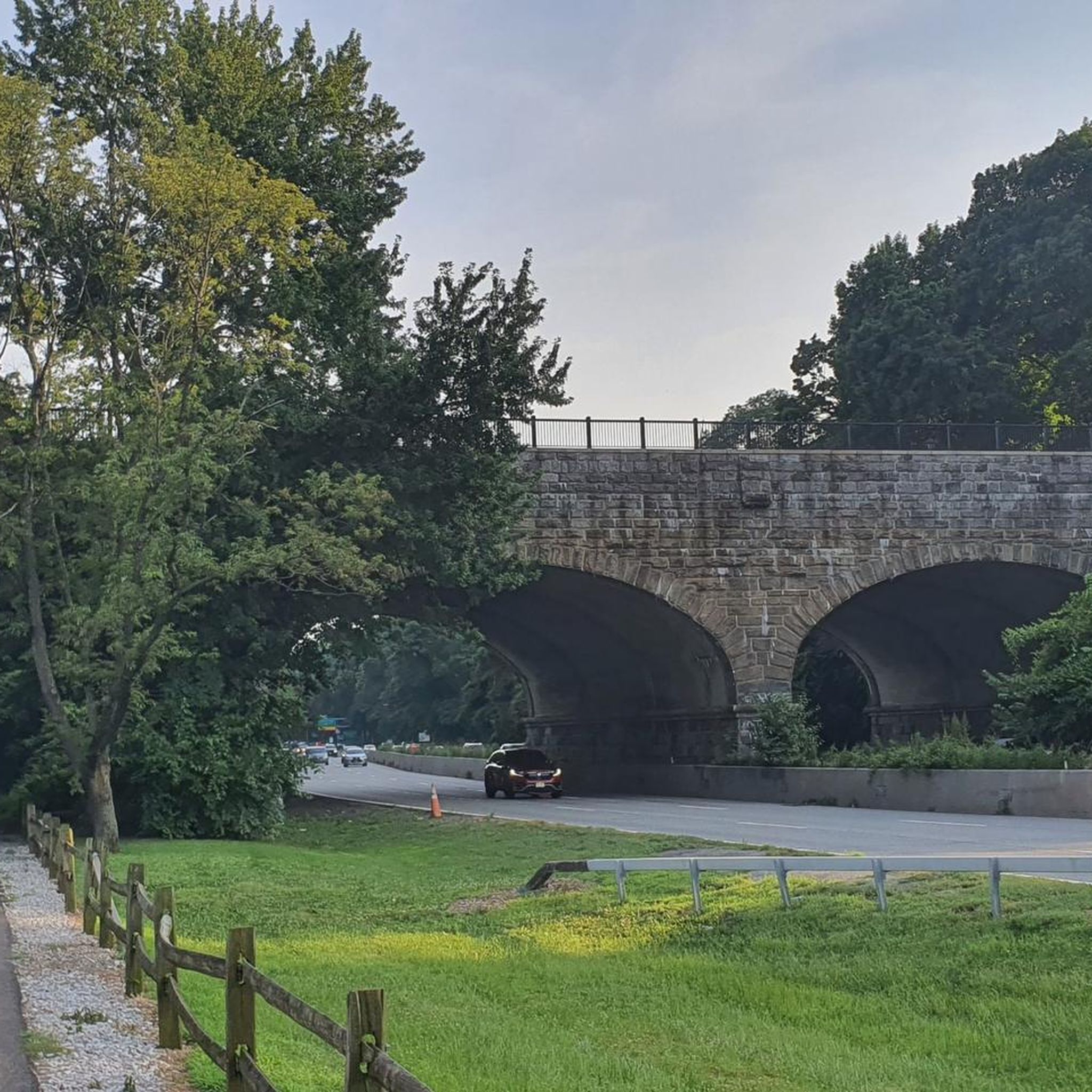
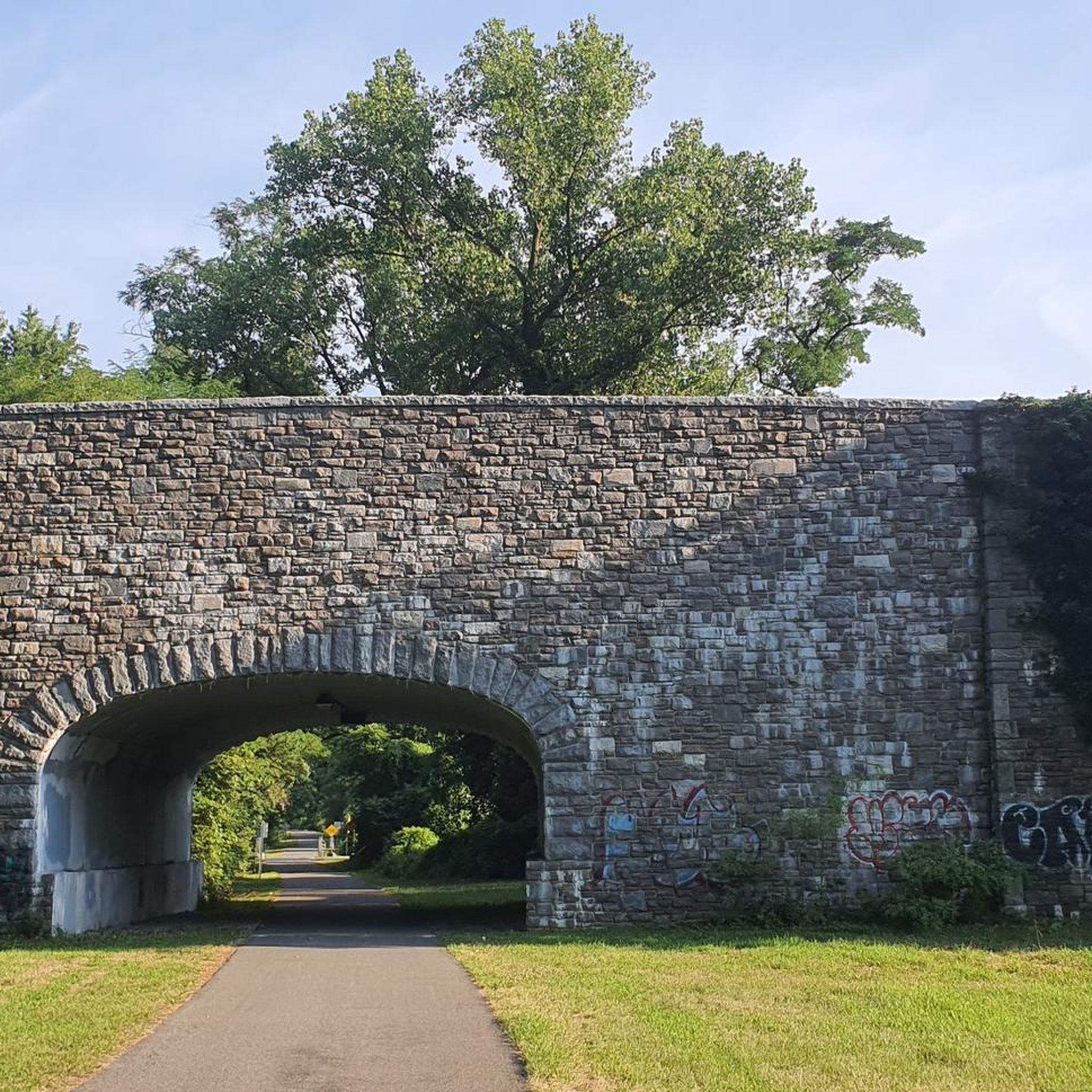
This path is super beautiful and away from the cars. It is probably the best bike path in the Bronx. It will take you to the Empire State Trail and you can go all the way to Canada.
1
0


Newly renovated bridge over Mamaroneck river (on the Boston Post Road).
0
0
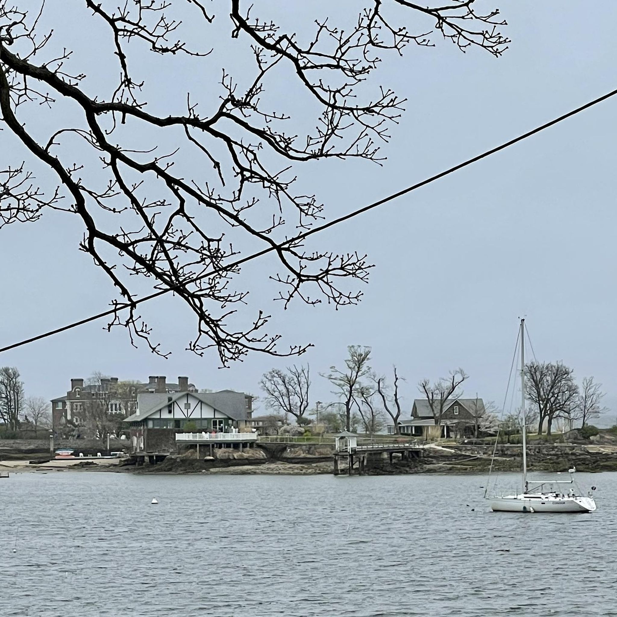
Nice view of Long Island sound on Forest Ave (small inlet between houses).
0
0
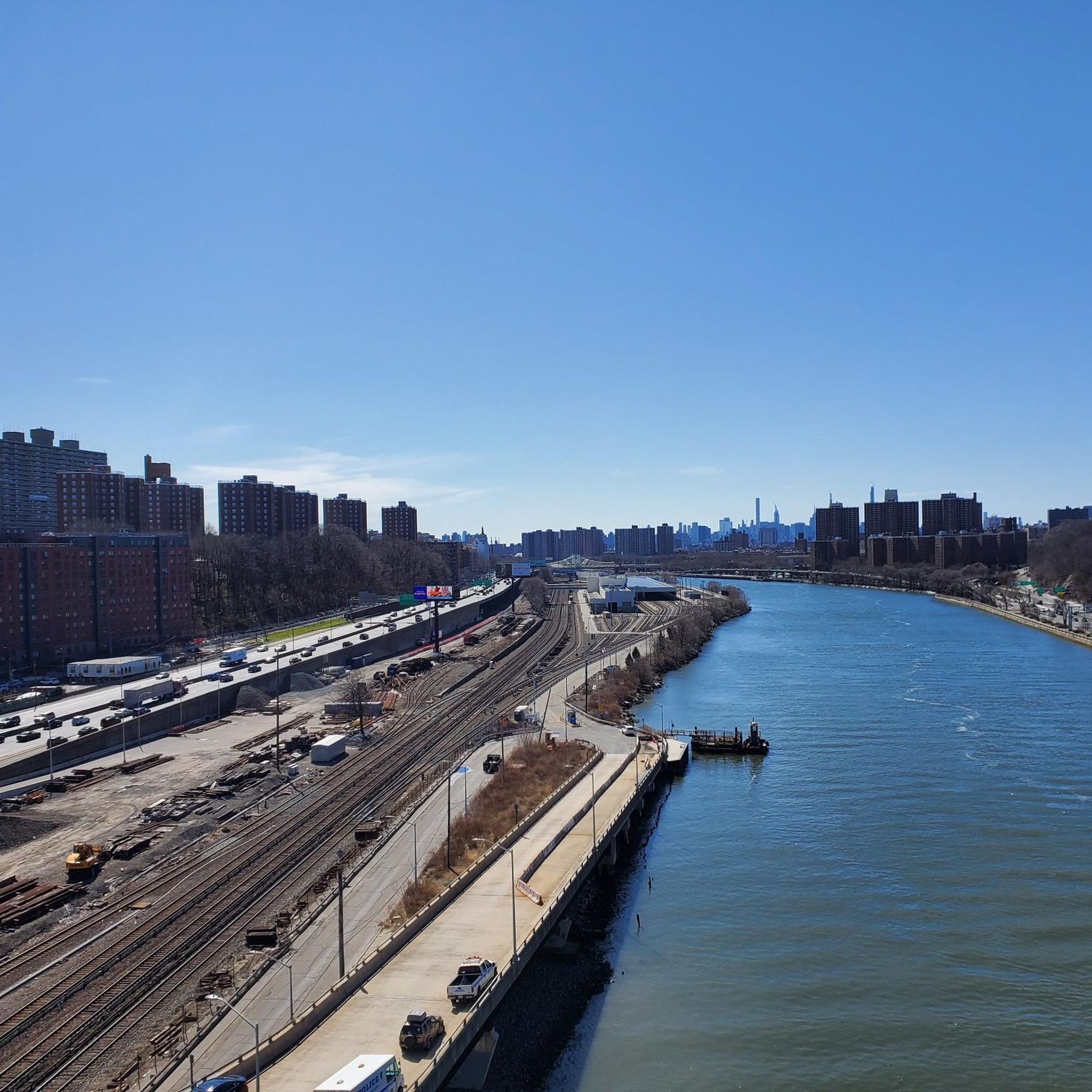
Lovely section of the Bronx River Pathway. A good portion of this section runs through parkland and gives you good views of the river.
0
0

A nice path, winding its way along the Bronx River.
1
0
Frequently Asked Questions
What kind of terrain can I expect on road cycling routes in New Rochelle?
New Rochelle offers a diverse range of terrain for road cyclists. You'll find routes along the picturesque Long Island Sound waterfront, through extensive parklands, and connecting to larger multi-use trail systems like the South County Trailway. While some routes are relatively flat, others feature significant elevation changes, providing options for different preferences and fitness levels.
Are there road cycling routes suitable for beginners or families in New Rochelle?
Yes, New Rochelle has several easy road cycling routes perfect for beginners or families. For instance, the Shore Road Bridge – City Island Road bike path loop from New Rochelle is an easy 14.9-mile (24.0 km) trail that takes about 1 hour 7 minutes to complete, offering coastal views. Another easy option is the Playland Lake – Red Mill at Kirby Tidal Pond loop from New Rochelle, which is 21.3 miles (34.2 km) long.
What are some scenic highlights or landmarks I can see while road cycling in New Rochelle?
Road cycling in New Rochelle offers numerous scenic views and landmarks. You can enjoy the Long Island Sound waterfront, explore various parks like Five Islands Park and Glen Island Park, and pass by tranquil spots such as Twin Lakes Park and Beechmont Lake. The Shore Road Bridge is another notable feature, offering views of tidal marshes. Routes like the Pinebrook Road North – Kensico Reservoir loop from New Rochelle also provide views of the Kensico Reservoir.
Are there any long-distance road cycling routes available from New Rochelle?
Absolutely. For those seeking a longer challenge, the S-Curve Hill beneath the George Washington Bridge – The High Bridge loop from New Rochelle is a difficult 84.2-mile (135.5 km) route that typically takes around 6 hours to complete. This route features significant elevation changes and connects to broader regional networks, offering an extensive ride.
What is the best time of year to go road cycling in New Rochelle?
The best time for road cycling in New Rochelle is generally during the spring, summer, and fall months. These seasons offer pleasant temperatures and vibrant scenery, from blooming parks to colorful autumn foliage. While winter cycling is possible, be mindful of colder temperatures and potential icy conditions, especially near the waterfront.
Are there loop trails for road cycling in New Rochelle?
Yes, many of the road cycling routes in New Rochelle are designed as loops, allowing you to start and end at the same point. Examples include the Pinebrook Road North – Carpenter Pond loop from New Rochelle, a moderate 32.7-mile (52.6 km) route, and the Shore Road Bridge – City Island Road bike path loop from New Rochelle, an easy 14.9-mile (24.0 km) option.
What do other road cyclists enjoy most about cycling in New Rochelle?
The road cycling routes in New Rochelle are highly rated by the komoot community, with an average score of 4.0 stars from over 70 reviews. Cyclists often praise the diverse landscapes, from coastal views along the Long Island Sound to the peaceful parklands, and the excellent connectivity to major trail systems like the South County Trailway.
Is public transport available to access road cycling routes in New Rochelle?
New Rochelle is well-connected by public transport, including Metro-North Railroad, which can provide access to the city. From the New Rochelle station, you can often cycle to various starting points for routes or connect to major trailways like the South County Trailway. It's advisable to check specific train line policies regarding bicycles during peak hours.
Are there any road cycling routes that offer views of lakes or reservoirs?
Yes, several routes provide scenic views of local water bodies. The Pinebrook Road North – Kensico Reservoir loop from New Rochelle is a moderate 43.2-mile (69.6 km) path that offers beautiful vistas of the Kensico Reservoir. Additionally, routes passing through parks like Twin Lakes Park and Beechmont Lake will provide tranquil lake views.
Where can I find parking for road cycling routes in New Rochelle?
Parking is generally available at various parks and public access points throughout New Rochelle, especially near popular trailheads or waterfront areas. Many parks, such as Glen Island Park or those providing access to the South County Trailway, offer designated parking facilities. It's recommended to check specific park regulations and parking availability before your ride.
Are there any particularly challenging road cycling routes in New Rochelle for experienced riders?
For experienced riders seeking a challenge, the S-Curve Hill beneath the George Washington Bridge – The High Bridge loop from New Rochelle is classified as a difficult route. This 84.2-mile (135.5 km) ride features significant elevation gains, making it suitable for those looking for a demanding and extensive road cycling experience.
Can I connect to larger regional trail networks from New Rochelle?
Yes, a significant advantage for road cyclists in New Rochelle is its excellent connectivity to larger multi-use trail systems. The South County Trailway is easily accessible and offers a long, mostly uninterrupted paved path stretching northward. The East Coast Greenway also passes through the area, providing extensive cycling opportunities beyond the immediate vicinity of New Rochelle.
Most popular routes around New Rochelle
Most popular attractions around New Rochelle

Get inspired with the komoot mobile app


Explore more
Browse the best Road cycling routes in other regions.
