The best road cycling routes around Lincoln
4.5
(3)
284
riders
12
rides
Road cycling routes around Lincoln traverse a landscape characterized by significant elevation changes, dense forests, and scenic mountain passes. The region offers challenging climbs and long descents, making it suitable for experienced road cyclists. Routes often follow river valleys and ascend towards prominent peaks and notches, providing varied terrain for exploration.
Best road cycling routes around Lincoln
- The most popular road cycling route is Franconia Notch Bike Trail – Franconia Notch Bike Path loop from Clark's Bears Station, a…
Last updated: October 11, 2026
5.0
(2)
76
riders
127km
06:00
1,610m
1,610m
Hard road ride. Very good fitness required. Mostly well-paved surfaces and easy to ride.
33
riders
65.7km
03:10
850m
850m
Moderate road ride. Good fitness required. Mostly well-paved surfaces and easy to ride.

26
riders
143km
06:50
1,880m
1,880m
Hard road ride. Very good fitness required. Some segments of this route may be unpaved and difficult to ride.
4.0
(1)
23
riders
96.5km
06:23
1,670m
1,670m
Hard road ride. Very good fitness required. Some segments of this route may be unpaved and difficult to ride.
12
riders
92.5km
04:28
1,310m
1,310m
Hard road ride. Very good fitness required. Mostly well-paved surfaces and easy to ride.
Get access to more routes and recommendations from other explorers.
Already have an account?
Our route recommendations are based on thousands of hikes, rides, and runs completed by other people on komoot.
Tips from the Community

The highway is easy to ride on a bike because of the wide shoulder. And there are always great views.
0
0
Here you'll find a beautiful landscape, varied and challenging for cycling.
0
0

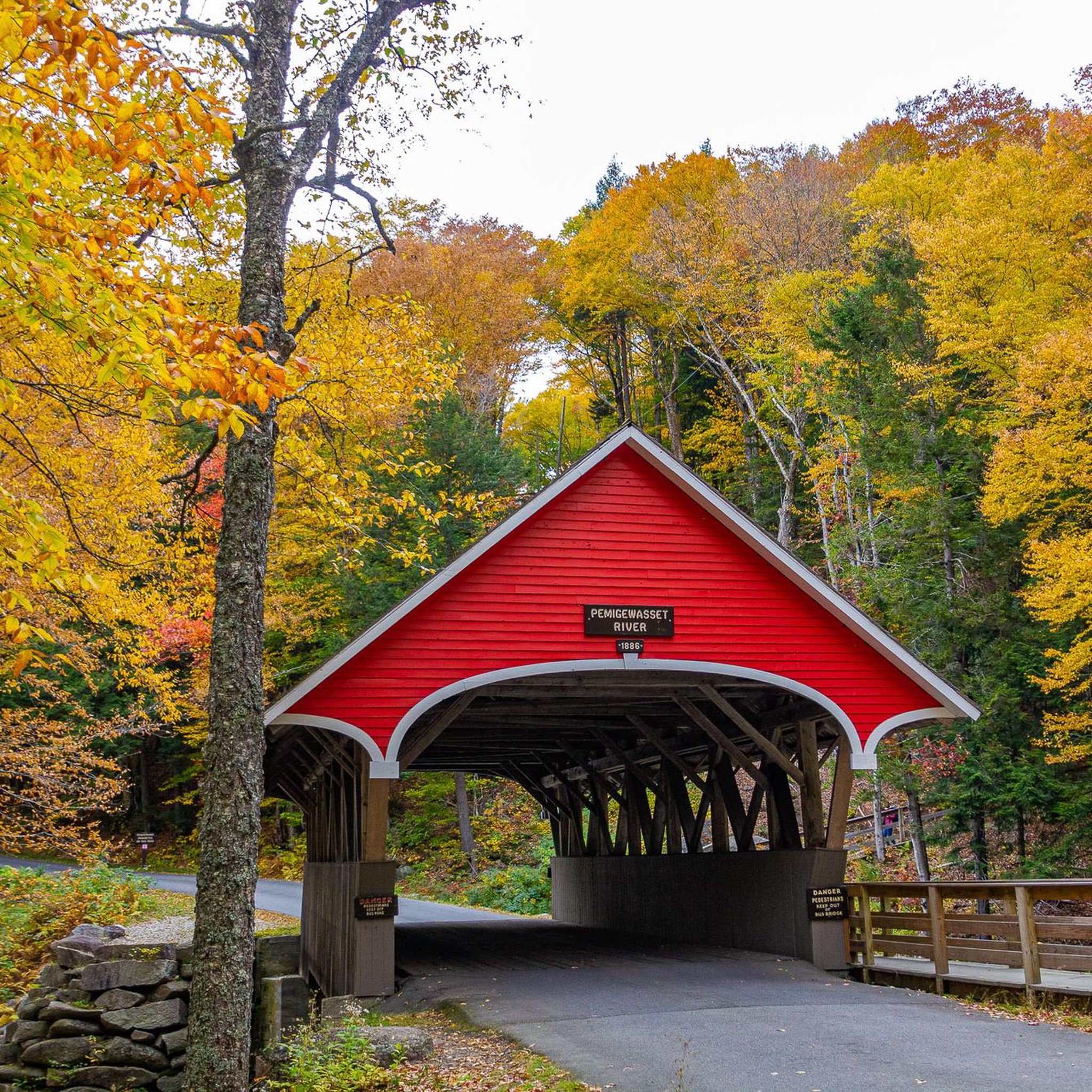
Bartlett, New Hampshire, is a picturesque mountain town nestled in the heart of the White Mountains. Known for its outdoor recreation, Bartlett offers access to scenic hiking trails, including those leading to Mount Langdon and Crawford Notch. In winter, it transforms into a hub for skiing and snowboarding at nearby resorts. With its charming village vibe, covered bridges, and proximity to natural wonders, Bartlett is a favorite destination for those looking to explore the beauty of New England.
0
0

Mount Moosilauke Highway offers a picturesque route perfect for cycling enthusiasts. The paved roads meander through the breathtaking landscapes of the White Mountain National Forest, providing cyclists with stunning views along the way.
0
0
Glencliff is a snug community tucked away in the stunning White Mountain National Forest. With fewer than 100 residents and a handful of dining spots, its main attraction lies in its breathtaking views.
0
0

The Lost River Reservation is set high in Kinsman Notch, one of the most famous passes in the area. This beautiful wooded area gets its name from the brook draining from the southeast of the notch that disappears below the surface in a narrow, steep-walled glacial gorge. The gorge is partially filled with massive granite blocks, through which the brook cascades along its course until it eventually emerges and joins the Pemigewasset River. Lost River protects 157 acres around the gorge, including a mile-long boardwalk, waterfalls, and caves, among the many attractions here to explore.
0
0
Kinsman Notch is a stunning area in the White Mountains, situated between Mount Moosilaukie and the Kinsman Range. The landscape is truly breathtaking, with its soft forests and trees standing tall and straight, nestled among the hills. The area is home to the Lost River Reservation, Beaver Brook Cascades, and Beaver Pond, all must-visit destinations when exploring this beautiful area.
0
0
Frequently Asked Questions
How many road cycling routes are available around Lincoln?
There are 17 road cycling routes around Lincoln documented on komoot. These routes offer a variety of challenges, from easy rides to very difficult ascents through mountainous terrain.
Are there any easy road cycling routes for beginners in Lincoln?
Yes, while many routes in Lincoln are challenging, there are 2 easy road cycling routes available. One notable option is the Fay State Forest loop from Lincoln, which is 33.3 km long with a moderate elevation gain of 281 meters, making it suitable for less experienced riders.
What kind of terrain can I expect on road cycling routes near Lincoln?
Road cycling routes around Lincoln are characterized by significant elevation changes, dense forests, and scenic mountain passes. You can expect challenging climbs and long descents, often following river valleys and ascending towards prominent peaks and notches. The region is primarily suited for experienced road cyclists seeking demanding routes.
What are some of the most challenging road cycling routes in the Lincoln area?
Lincoln offers several challenging routes for experienced cyclists. The Sabbaday Falls – Kancamagus Pass loop from Lincoln is a difficult 140.6 km path with extensive climbing through a well-known scenic byway. Another demanding option is the Franconia Notch Bike Trail – Franconia Notch Bike Path loop from Clark's Bears Station, a 127.2 km trail featuring substantial elevation gain through a notable mountain pass.
Are there any circular road cycling routes around Lincoln?
Yes, many of the road cycling routes around Lincoln are designed as loops, allowing you to start and finish in the same location. Examples include the Glencliff – Mount Moosilauke Highway loop from Lincoln and the Franconia Notch Bike Trail – Franconia Notch Bike Path loop from Lincoln.
What can I see along the road cycling routes around Lincoln?
The routes often pass through scenic areas with opportunities to see natural attractions. You might encounter highlights such as the Flume Gorge, Falling Waters Trail, and The Basin (Pemigewasset River). For panoramic views, look out for spots like View of Cannon Mountain.
What do other road cyclists enjoy most about road cycling in Lincoln?
The area is highly rated by the komoot community, with an average score of 5.0 stars from over 6 reviews. Cyclists often praise the challenging mountain passes, extensive forest roads, and the significant elevation changes that provide a demanding and rewarding experience.
What is the best time of year for road cycling in Lincoln?
The best time for road cycling in Lincoln is generally from late spring through early autumn, when the weather is most favorable and mountain passes are clear of snow. This period offers the most comfortable temperatures and optimal road conditions for tackling the region's challenging terrain.
Are there any specific scenic byways or passes featured in Lincoln's road cycling routes?
Yes, several routes incorporate well-known scenic byways and mountain passes. For instance, the Sabbaday Falls – Kancamagus Pass loop from Lincoln takes you through the famous Kancamagus Pass, known for its extensive climbing and stunning views. The Franconia Notch area also features prominently in routes like the Franconia Notch Bike Trail – Franconia Notch Bike Path loop from Clark's Bears Station.
What are the typical distances and durations for road cycling routes around Lincoln?
The road cycling routes around Lincoln vary significantly in length and duration. You can find shorter routes like the Fay State Forest loop from Lincoln at 33.3 km (approx. 1 hour 24 minutes), up to much longer and more demanding rides such as the Sabbaday Falls – Kancamagus Pass loop from Lincoln, which is 140.6 km and typically takes around 6 hours 43 minutes to complete.
Are there any routes that pass by notable peaks or summits?
Many routes in the Lincoln area offer views of or pass near prominent peaks. While the routes themselves are for road cycling, you might catch glimpses of summits like Mount Pemigewasset/Indian Head Summit or Whaleback Mountain from the road. The mountainous terrain is a defining feature of the region's cycling experience.
Most popular routes around Lincoln
Most popular attractions around Lincoln

Get inspired with the komoot mobile app


Explore more
Browse the best Road cycling routes in other regions.
