The best walks and hikes around Skyland
4.6
(65)
811
hikers
81
hikes
Hiking around Skyland offers a variety of trails, often featuring views of Lake Tahoe and its surrounding natural landscape. The area includes paths through forested sections and open terrain, providing diverse hiking experiences. Trails range from gentle loops to more challenging ascents, catering to different fitness levels.
Best hiking trails around Skyland
- The most popular hiking route is Zephyr Cove loop, a 4.7 miles (7.6 km) trail that takes 2 hours 18 minutes to complete. This moderate route offers varied terrain near the lake.
- Another top favourite among local hikers is Nevada Beach and Round Mound Trail, a moderate 1.0 mile (1.6 km) path. This trail features natural scenery.
- Local hikers also love the Castle Rock Loop Trail, a 2.9 miles (4.7 km) trail leading through forested areas, often completed in about 1 hour 23 minutes.
- Hiking around Skyland is defined by its lake views, forested paths, and varied elevation changes. The network offers options for different ability levels, from easy strolls to more demanding ascents.
- The routes in Skyland are highly rated by the komoot community with an average score of 4.6 stars from more than 80 reviews. More than 900 hikers have used komoot to explore Skyland's varied terrain.
Last updated: July 22, 2026
4.8
(5)
60
hikers
4.69km
01:24
150m
150m
The Castle Rock Loop Trail near Stateline, Nevada, offers a delightful hiking experience with stunning views of Lake Tahoe and the surrounding Humboldt-Toiyabe National Forest. You'll follow a dirt path with gradual undulations, encountering both granite and volcanic rock formations along the way. The route culminates at Castle Rock, where you can enjoy easy rock scrambling to a lower ledge for expansive vistas of the peaks and the iconic lake.
This easy 2.9-mile (4.7 km) loop, with 479 feet (146 metres) of elevation gain, typically takes about 1 hour and 23 minutes to complete. It's a fantastic option for families or anyone looking for a rewarding hike without a strenuous climb. The trail is generally less crowded than other Tahoe area routes, providing a more serene outing.
Beyond hiking, the area is popular for birding and mountain biking, and it also provides access to the larger Tahoe Rim Trail. While Castle Rock is a notable climbing spot, be aware that access to the rock may be temporarily restricted during certain seasons due to peregrine falcon nesting, so it's wise to check local advisories before your visit.
5.0
(1)
4
hikers
12.0km
03:34
370m
410m
The Tahoe Rim Trail (TRT) from Kingsbury North to Kingsbury South offers a fantastic moderate hiking experience, guiding you through a varied landscape of dense fir and ancient aspen forests, open ridges, and impressive granite boulders. You'll be treated to consistent, sweeping panoramic views of Lake Tahoe and the Carson Valley, with specific stunning vistas from viewpoints like the Lake Tahoe view. The trail involves a steady climb, particularly on the eastern side, but the changing scenery and rewarding views make every step worthwhile.
Planning your visit requires attention to a few key details. Water sources are notably limited along this 7.4-mile (12.0 km) route, especially in mid-summer, so you must carry sufficient supplies. You'll also need to exercise caution when crossing Highway 207 (Kingsbury Grade) due to traffic. The trail is best hiked during the warmer months, from spring through fall, to avoid snow and enjoy the full beauty of the area.
This segment is historically significant for the Tahoe Rim Trail, as the Daggett Connector trail, developed in 2012, filled a crucial gap, allowing hikers to bypass steep residential streets. Beyond the stunning natural features like old-growth junipers and granite passes, you might catch glimpses of South Tahoe casinos and the distant Desolation Wilderness. It's a great way to experience a core section of the TRT, offering a challenging yet accessible adventure for about 3 hours and 34 minutes, with 1202 feet (366 metres) of elevation gain.

Sign up for free
638m
00:13
20m
20m
Embark on the Cave Rock Overlook hike, a challenging 0.4 miles (0.6 km) route that climbs 81 feet (25 metres) in just 12 minutes. From the moment you step onto the trail, you are greeted with stunning views of Lake Tahoe's vibrant blue waters. As you ascend, you'll catch glimpses of the iconic volcanic Cave Rock formation itself, leading you towards a saddle that opens up to expansive vistas of the shoreline stretching both north and south, with the majestic Sierra Nevada Mountains in the distance. The final push involves a short scramble over granite outcroppings to reach the summit, rewarding you with sweeping panoramic views of the entire lake. This short but difficult hike offers a truly memorable experience for its length.
When planning your visit, be aware that parking at the trailhead is very limited, typically accommodating only about four to six vehicles. To ensure you find a spot and avoid crowds, consider visiting during off-peak hours. There are no restrooms, trash cans, or water sources available along the route, so come prepared with everything you need. It is highly recommended to wear stable shoes, especially if you intend to tackle the final scramble to the summit, as the terrain can be uneven.
This trail is notable for its unique geological features, particularly the volcanic Cave Rock formation, which adds a dramatic element to the landscape. The hike provides an excellent opportunity to experience the natural beauty of Lake Tahoe Nevada State Park, offering some of the most comprehensive views of the lake and surrounding mountains. Its short duration makes it an accessible option for those looking for a quick, impactful outdoor adventure with a significant reward at the top.
1.62km
00:30
110m
0m
The Nevada Beach and Round Mound Trail offers a delightful blend of sandy lakeside paths and forested climbs, leading to expansive views over Lake Tahoe. You'll start with picturesque strolls along Nevada Beach, then wind through peaceful woods before reaching the impressive rock formations of Round Mound. It's an easy 1.0-mile (1.6 km) hike with 347 feet (106 metres) of elevation gain, typically taking just 30 minutes, making it a perfect high-payoff option for a quick outdoor escape.
Accessing the trailhead is simple from Nevada Beach, a well-known spot with amenities. This trail is a local favorite, so consider an early start to enjoy the tranquility, especially during peak seasons. Remember that dogs are not allowed on this route, so plan accordingly if you're traveling with pets.
What makes this trail special is its unique combination of accessible beach access and rewarding summit views without significant effort. From the top of Round Mound, you can spot landmarks like East Peak, Monument Peak, and even Freel Peak. Historically, Nevada Beach even featured in the opening of the TV show *Bonanza*, adding a touch of classic Americana to your Lake Tahoe adventure.
4.0
(4)
16
hikers
7.63km
02:18
250m
250m
The Zephyr Cove loop offers a truly diverse hiking experience, winding through lush pine and aspen forests, across open meadows, and along picturesque lakeside paths. You'll encounter rugged granite outcrops and cross charming footbridges, all while enjoying continuous, expansive viewpoints of Lake Tahoe and the majestic Sierra Nevada mountains. This moderate route provides a rich tapestry of natural features, making it a rewarding journey for those who appreciate varied scenery.
Planning your visit to the Zephyr Cove loop is straightforward, with easy access from Zephyr Cove Park. The park provides convenient amenities like a store, restaurant, and restrooms right near the trailhead, and parking at Zephyr Cove loop trailhead is generally available. This is a dog-friendly trail, so your leashed furry friends are welcome to join you on this 4.7-mile (7.6 km) adventure.
What makes the Zephyr Cove loop truly notable is its blend of natural beauty and accessibility. With an elevation gain of 811 feet (247 metres) and an estimated duration of 2 hours and 18 minutes, it's a perfect moderate hike for experiencing Lake Tahoe's diverse ecosystems. The area is also known for the seasonal "Washoe Zephyr" wind and offers access to sandy beaches and various water sports, making it a great base for exploring the wider Zephyr Cove area.
Get access to more routes and recommendations from other explorers.
Sign up for free
Already have an account?
Our route recommendations are based on thousands of hikes, rides, and runs completed by other people on komoot.
Start today with a free account
Your next adventure awaits.
Login or Signup

Other adventures around Skyland

Tips from the Community

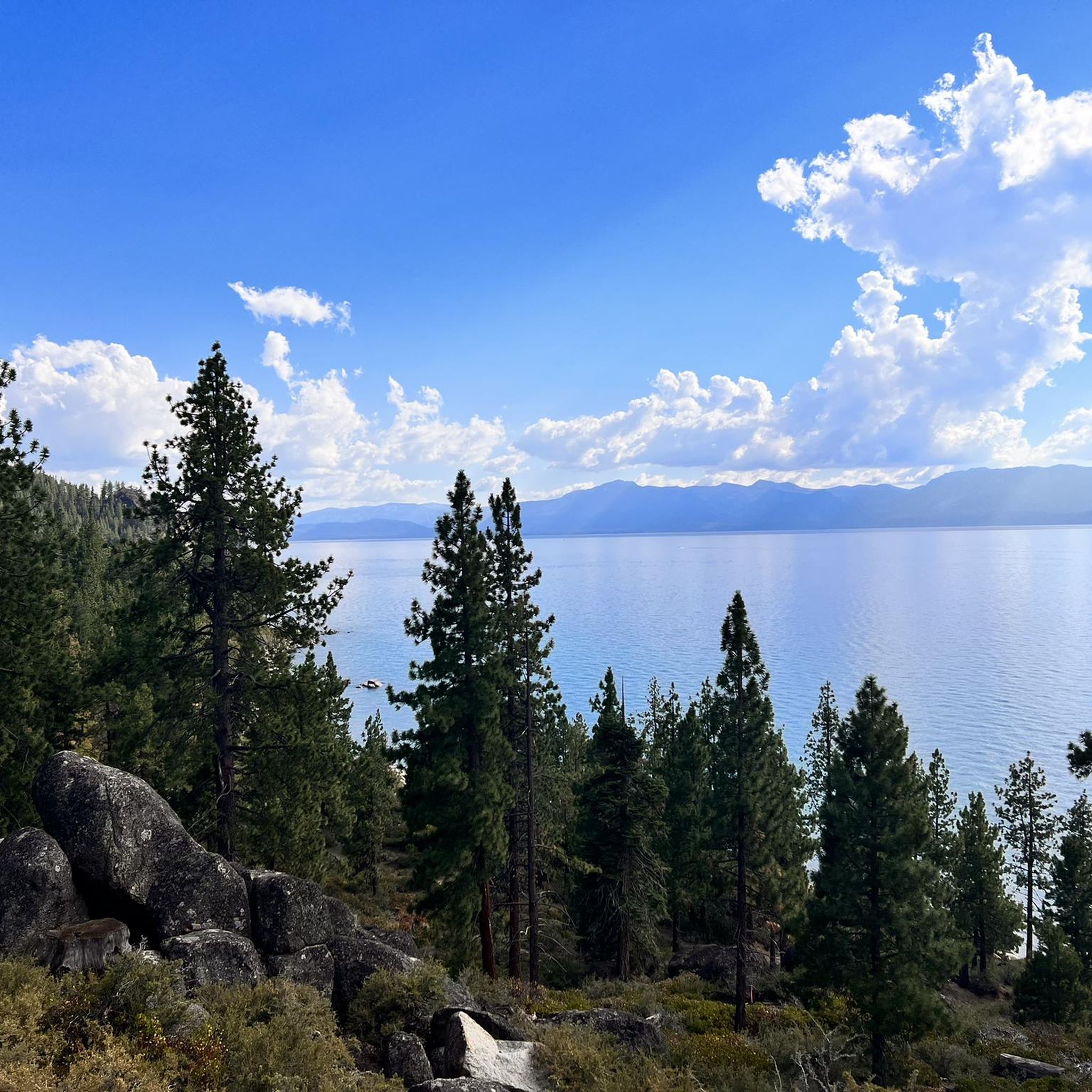
Great view of Lake Tahoe and the surrounding mountains from the Tahoe Rim Trail. There are great views across the entire trail, but this section is particularly impressive.
0
0
Great view of the mountains in the Lake Tahoe Basin Management Unit. The hike up to the viewpoint is strenuous but it's worth the effort for the great views.
0
0


At this junction, you'll find the entrance to the Van Sickle Trail. You can either continue on the Tahoe Rim Trail or head towards Van Sickle State Park from here. It's an enjoyable downhill ride, but be aware that the trail is heavily frequented by hikers. Exercise caution as you descend.
0
0
Choose to continue on the Tahoe Rim Trail or head back to Van Sickle State Park from this junction. Continuing on the Tahoe Rim Trail, you'll encounter ski resorts and lifts along the way.
0
0

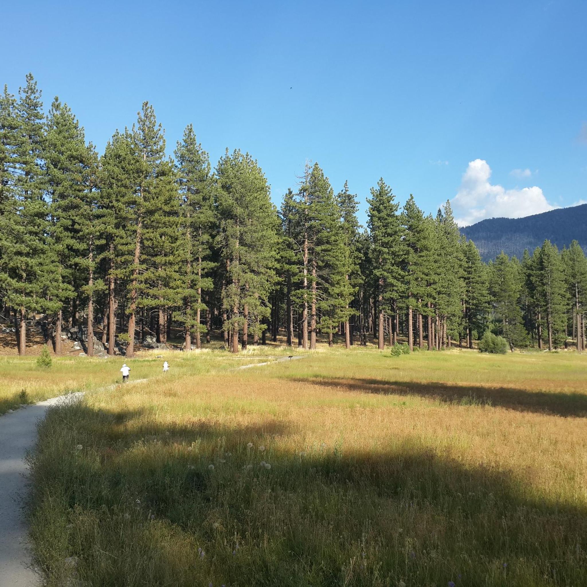
Classic Tahoe granite and towering Ponderosa pine dominate this section of trail.
0
0

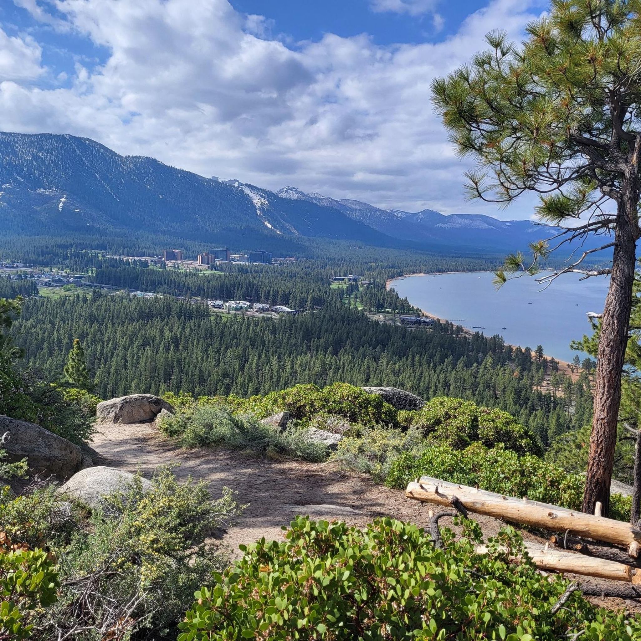
Castle Rock Viewpoint offers stunning views all over Lake Tahoe and the surrounding mountains. Perfect for a rest on a longer hike.
0
0

Zephyr Cove Park is an awesome place to go for a walk or just enjoy a picnic with incredible views over Tahoe Lake.
0
0
Frequently Asked Questions
How many hiking trails are available around Skyland?
There are over 60 hiking routes around Skyland, offering a diverse range of experiences. These include 37 easy trails, 21 moderate options, and 11 more challenging routes, ensuring there's something for every fitness level.
What kind of terrain can I expect on Skyland hikes?
Hiking around Skyland features varied terrain, including forested sections and open areas, often with stunning views of Lake Tahoe. You'll find paths ranging from gentle loops to more demanding ascents, providing a rich and diverse hiking experience.
Are there any easy, family-friendly hikes in Skyland?
Yes, Skyland offers several easy, family-friendly options. A great choice is the Castle Rock Trail – Castle Rock loop from Castle Rock, an easy 4.5 km trail that takes about 1 hour 20 minutes to complete, leading through pleasant forested areas.
What are some popular routes with lake views?
Many routes in Skyland offer beautiful lake views. The Zephyr Cove loop — South Lake Tahoe is a popular moderate trail featuring varied terrain near the lake. Another excellent option is the Castle Rock – Lake Tahoe view loop from Castle Rock, which provides expansive vistas of Lake Tahoe.
Are there any historical points of interest along the trails?
Yes, for those interested in history, the Round Mound and Lam Watah Historic Trail is a moderate 8.3 km path that features both natural scenery and historical points, offering a blend of outdoor activity and cultural insight.
What do other hikers say about the trails in Skyland?
The trails in Skyland are highly regarded by the komoot community, with an average rating of 4.4 stars from over 80 reviews. Hikers often praise the stunning lake views, the variety of forested and open paths, and the options available for different ability levels.
Are there any circular walks available in Skyland?
Yes, many of the trails around Skyland are circular, allowing you to start and end at the same point. Examples include the Zephyr Cove loop — South Lake Tahoe and the Castle Rock Trail – Castle Rock loop from Castle Rock, both offering convenient loop experiences.
What natural attractions can I find near the hiking trails?
Near the hiking trails, you can explore various natural attractions. These include beautiful beaches like South Lake Tahoe Beach and Nevada Beach, as well as the impressive natural monument of Cave Rock. There's also Bridge & Waterfall for scenic views.
Are there any places to explore beyond hiking trails?
Beyond the hiking trails, you can visit the vibrant area of South Lake Tahoe, which offers various amenities and sights. For those who enjoy cycling, the Upper Truckee River Bike Path is also nearby.
What is the most challenging hike in the Skyland area?
While the guide focuses on a range of difficulties, there are 11 difficult routes available for experienced hikers seeking a greater challenge. These trails typically feature more significant elevation changes and longer distances.
Can I find trails that are less crowded?
To find less crowded trails, consider exploring some of the routes that are not highlighted as the most popular. Often, trails slightly off the main tourist paths or those with moderate difficulty can offer a more peaceful experience while still providing beautiful scenery.
What is the best time of year to hike in Skyland?
The best time to hike in Skyland generally depends on the specific trail and your preferences. Spring and fall offer pleasant temperatures and beautiful scenery, while summer is ideal for enjoying the lake and longer daylight hours. Winter hiking is possible on some trails, but requires appropriate gear and caution due to snow and ice.
Most popular attractions around Skyland

Get inspired with the komoot mobile app


Explore more
Browse the best Hikes in other regions.
