The best road cycling routes around Bonner-West Riverside
5.0
(5)
249
riders
21
rides
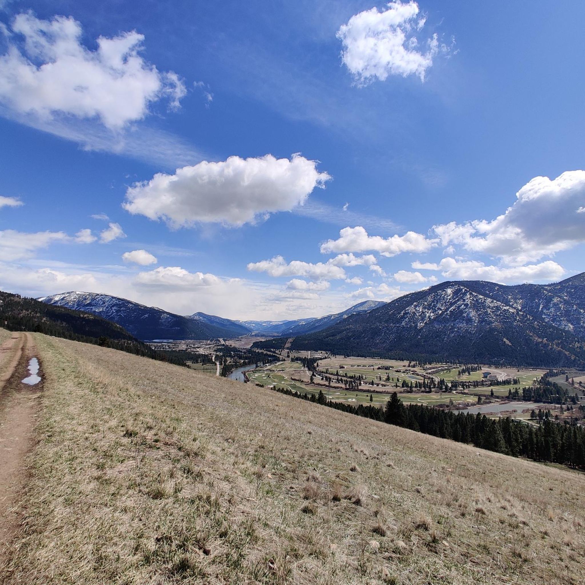
Road cycling routes around Bonner-West Riverside are set within Missoula County, characterized by a blend of forested mountains, river valleys, and prominent hills. The area is defined by the confluence of the Blackfoot River and the Clark Fork River, offering diverse terrain for cyclists. Routes range from paved paths along rivers to more challenging rides with varied elevation gains. This geography provides options for different fitness levels, from gentle riverside paths to more demanding ascents.
Best road cycling routes around…
Last updated: May 13, 2026
15
riders
50.9km
02:08
190m
190m
Moderate road ride. Good fitness required. Mostly well-paved surfaces and easy to ride.
5.0
(1)
9
riders
155km
07:48
370m
370m
Hard road ride. Very good fitness required. Mostly well-paved surfaces and easy to ride.

Sign up for free
19
riders
51.0km
02:11
170m
170m
Moderate road ride. Good fitness required. Mostly well-paved surfaces and easy to ride.
16
riders
30.8km
01:41
290m
290m
Moderate road ride. Great for any fitness level. Some segments of this route may be unpaved and difficult to ride.
12
riders
33.2km
01:41
330m
330m
Moderate road ride. Good fitness required. Some segments of this route may be unpaved and difficult to ride.
Get access to more routes and recommendations from other explorers.
Sign up for free
Already have an account?
Our route recommendations are based on thousands of hikes, rides, and runs completed by other people on komoot.
Start today with a free account
Your next adventure awaits.
Login or Signup



Tips from the Community

The Beartracks Bridge is a four-lane bridge over the Clark Fork River in downtown Missoula. It was constructed in 1962 and recently renovated to improve pedestrian safety. The bridge now has dedicated bike lanes and widened sidewalks.
0
0

Jacob's Island is a dog park on the banks of Clark Fork River. The park is 6-acres and the river works as a beautiful natural barrier for the dogs. It also offers a series of paved and unpaved trails, benches, picnic tables and dog-waste bags.
0
0
Jacob's Island is a dog park on the banks of Clark Fork River. The park is 6 acres and the river works as a beautiful natural barrier for the dogs. It also offers a series of paved and unpaved trails, benches, picnic tables and dog-waste bags.
0
0
The Clark Fork River is one of the longest stretches of water in Montana. Along with its tributaries, they are some of the most popular fly fishing destinations in the United States.
1
0

Nestled in the northern Rockies, the city is known as the "Garden City" for its lush surroundings as well as trout fishing. The city is home to the University of Montana, founded in 1893.
0
0

McCormic Park marks the western terminus of the Kim Williams Trail and the eastern terminus of the Milwaukee Trail. The park has some playing fields, open space, picnic areas, and is nestled up right next to the river.
0
0

The Bitterroot River is 84 miles long and it flows through the Bitterroot Valley. It's a very popular destination for fly fishing.
1
0
A park with sports fields, trails, a fishing pond & pool. Lots of water fountains, benches and grassy areas.
1
0
Frequently Asked Questions
How many road cycling routes are available in Bonner-West Riverside?
Bonner-West Riverside offers a diverse network of nearly 20 road cycling routes. These routes cater to various skill levels, with options ranging from easy paved paths to more challenging rides with significant elevation gains.
What is the best time of year for road cycling in Bonner-West Riverside?
The spring and fall seasons are generally ideal for road cycling in Bonner-West Riverside, offering pleasant temperatures and beautiful scenery. While summer is also popular, be prepared for warmer weather. Winter cycling options may be limited due to conditions.
What are the typical terrain and difficulty levels for road cycling in the area?
The terrain around Bonner-West Riverside is quite varied, characterized by forested mountains, river valleys, and prominent hills. You'll find a mix of easy, paved paths, moderate routes with manageable elevation changes, and difficult trails featuring significant ascents. For example, the Missoula/Clark Fork River loop is a moderate ride, while the Bitterroot Trail offers a more difficult, extensive experience.
Are there easy, family-friendly road cycling routes in Bonner-West Riverside?
Yes, there are several easy and family-friendly options. The Bonner Streetcar Trail offers a paved pathway, and routes like the Jacob's Island loop from Missoula are rated as easy, providing a comfortable ride for beginners or families. Many routes along the river valleys also provide gentle gradients.
Are there challenging routes for experienced road cyclists?
Absolutely. For experienced road cyclists seeking a challenge, the Bitterroot Trail is a difficult 96.5-mile route with notable elevation changes, offering extensive scenic rides alongside the Bitterroot Mountains. The region's geography includes more demanding mountain ascents for those looking for a rigorous workout.
What natural features or landmarks can I see along the road cycling routes?
Road cycling routes in Bonner-West Riverside offer stunning views of the Blackfoot River and Clark Fork River, which define the landscape. You can also explore areas near the Bitterroot River. Notable landmarks and parks include McCormick Park, and the Kim Williams Trail, which offers scenic river views. Bonner's Two Rivers Memorial Park also provides historical context along the Bonner Streetcar Trail.
Are there any loop road cycling trails in the area?
Yes, several popular loop routes are available. The Missoula/Clark Fork River loop and the Bitterroot Trail – Bitterroot River loop from Missoula are excellent options for circular rides, allowing you to experience diverse scenery without retracing your path.
Where can I park my car when accessing road cycling trails?
Parking is generally available at various access points for popular trails. For instance, you can find parking near the Bitterroot Trail and the Kim Williams Trail in Missoula, which are easily accessible from Bonner-West Riverside. Specific parking details often depend on the starting point of your chosen route.
Are there cafes or pubs near the road cycling routes for a break?
While specific cafes and pubs directly on every route may vary, the proximity to Missoula and Bonner-West Riverside means you'll find amenities nearby. Areas around the Bitterroot Trail and Bonner Streetcar Trail often have options for refreshments, especially in the towns they pass through.
Is public transport available to access road cycling trails, and can I bring my bike?
Missoula's Mountain Line bus service can provide access to areas near some cycling routes, and they typically have bike racks. It's advisable to check Mountain Line's specific bike rack policy and route schedules for the most current information to plan your trip to trailheads from Bonner-West Riverside.
What do other road cyclists enjoy most about road cycling in Bonner-West Riverside?
The area is highly rated by the komoot community, with an average score of 5.0 stars from 4 reviews. Cyclists often praise the stunning natural landscapes, the variety of terrain from gentle riverside paths to challenging mountain ascents, and the scenic beauty of the Blackfoot and Clark Fork Rivers.
Most popular attractions around Bonner-West Riverside

Get inspired with the komoot mobile app


Explore more
Browse the best Road cycling routes in other regions.
