The best road cycling routes around Lanesboro
5.0
(1)
118
riders
5
rides
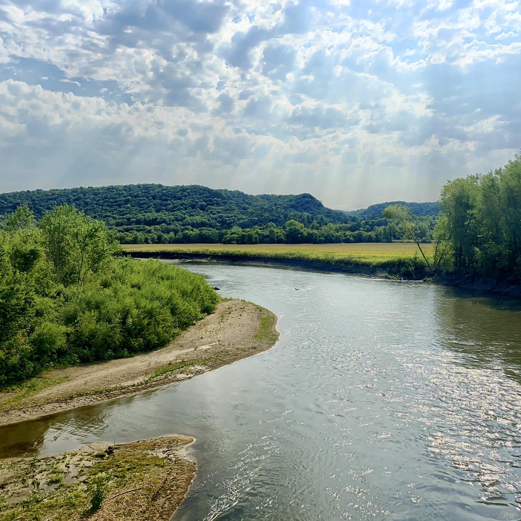
Road cycling routes around Lanesboro are situated in Minnesota's Driftless Area, a region characterized by dramatic limestone bluffs, deep river valleys, and fertile farmland. The landscape, untouched by glaciers, offers a varied topography with both generally level paved trails and sections with steeper inclines. The Root River meanders through the area, providing a scenic backdrop for many cycling paths.
Best road cycling routes around Lanesboro
- The most popular road cycling route is Root River State Trail loop from Lanesboro,…
Last updated: July 22, 2026
39
riders
86.9km
03:47
270m
270m
Moderate road ride. Good fitness required. Mostly well-paved surfaces and easy to ride.
18
riders
63.3km
03:19
280m
280m
The Root River State Trail – Preston Overlook loop from Lanesboro offers a delightful road cycling adventure through southeastern Minnesota's stunning "Bluff Country." You'll pedal past towering limestone bluffs, winding…

Sign up for free
12
riders
18.2km
01:03
100m
90m
Moderate road ride. Great for any fitness level. Some segments of this route may be unpaved and difficult to ride.
10
riders
15.9km
00:52
90m
100m
Easy road ride. Great for any fitness level. Mostly well-paved surfaces and easy to ride.
8
riders
35.3km
01:58
160m
160m
Moderate road ride. Great for any fitness level. Some segments of this route may be unpaved and difficult to ride.
Our route recommendations are based on thousands of hikes, rides, and runs completed by other people on komoot.
Start today with a free account
Your next adventure awaits.
Login or Signup
Popular around Lanesboro
Tips from the Community

Preston is an ideal location for exploring the western end of the Harmony-Preston Valley and Root River State Trail system, as it is nearly equidistant from Fountain (12 miles), Harmony (12.3 miles), and Lanesboro (10.2 miles). There are parking, picnic, and toilet facilities at the trailhead.
0
0

The paved Root River State Trail spans 42 miles from Fountain to Houston, following the scenic Root River. Built on an abandoned railroad, the trail is mostly level and wheelchair accessible, with the exception of a steep half-mile stretch between Vinegar Ridge and Houston. Walking/hiking biking, in-line skating, skiing, and wheelchairs are all allowed on this trail. As part of the Blufflands Trail System, the trail offers stunning views of the limestone bluffs of the Root River Valley, and passes through historic towns nestled in the hills, rolling farmlands, old milling areas, and remnants of the railroad era. There are also wildlife viewing opportunities; you might see deer, hawks, wild turkeys, and the occasional rattlesnake. There are also historical sites, campgrounds, bed-and-breakfasts, restaurants, museums, and unique shops along the way.
0
0

This overlook was constructed by the Minnesota Department of Highways back in 1937-38. It is an observation point situated on the outskirts of Preston. It overlooks the Root River from a bluff, 90 feet (27.4 meters) above the river. Arthur R. Nichols, a landscape architect designed the point in a rustic style. The site was added to the National Register of Historic Places in 2003.
0
0
The Harmony-Preston Valley State Trail is a beautiful paved 18-mile multiple use trail that connects the towns of Harmony and Preston in southern Minnesota. It is a good quality, rural biking trail.
0
0

The RJD Memorial Hardwood Forest offers many possibilities in its boundaries, with recreation areas, campgrounds, and day-use areas. The State Forest has a variety of species of plants, mushrooms, and animals (especially birds), that you can observe along the trails. The preserved area offers some riverside trails, such as the Root River State Trail, which is also a bike path and has access to some peaceful spots along it. For more information about the road closure and forest alerts, see: https://www.dnr.state.mn.us/state_forests/forest.html?id=sft00033#alerts
0
0
Frequently Asked Questions
How many road cycling routes are available around Lanesboro?
Lanesboro offers over 8 dedicated road cycling routes. These routes cater to various skill levels, from easy loops to more challenging rides with significant elevation gain, all set within the scenic Driftless Area.
What makes road cycling in Lanesboro unique?
Road cycling in Lanesboro is unique due to its location in the 'Bluff Country' of the Driftless Area, a region untouched by glaciers. This results in a distinctive landscape of towering limestone bluffs, deep river valleys carved by the Root River, and extensive paved trails like the Root River State Trail. You'll experience a varied topography that contrasts with flatter plains, offering stunning views and a diverse riding experience.
Are there road cycling routes suitable for families or beginners in Lanesboro?
Yes, Lanesboro has several easy road cycling routes perfect for families and beginners. For instance, the Root River State Trail loop from Lanesboro is an easy 22.2-mile (35.7 km) trail that follows a well-known paved path through the scenic river valley, offering a generally level ride suitable for all ages.
Are there any challenging road cycling routes in the Lanesboro area?
While many trails are generally level, some sections present steeper inclines for those seeking a challenge. Routes like the Cushings Peak loop from Lanesboro, a 54.0-mile (86.9 km) trail, lead through bluffs and river valleys with notable elevation changes, providing a more demanding experience for experienced cyclists.
What are some notable natural features or viewpoints I might see while cycling?
As you cycle, you'll encounter dramatic limestone bluffs, some reaching 300 feet, and the meandering Root River. The region's karst topography also means you might spot fascinating features like sinkholes. The Root River State Trail – Preston Overlook loop from Lanesboro, for example, offers varied terrain along the river, including a notable overlook with expansive views of the valley.
What is the best time of year to go road cycling in Lanesboro?
The spring, summer, and fall months generally offer the best conditions for road cycling in Lanesboro. The region boasts consistently cool, spring-fed rivers and streams, contributing to a pleasant environment. Autumn is particularly scenic with vibrant fall foliage, making it a popular time for visitors.
Where can I park my car when starting a road cycling route in Lanesboro?
Lanesboro is well-equipped for cyclists, and parking is generally available in and around the town, especially near trailheads for the Root River State Trail. Many local businesses and accommodations also offer parking options for their guests.
Are there any specific permit requirements for cycling the trails?
The Root River State Trail and Harmony-Preston Valley State Trail are part of Minnesota's state trail system. While some state trails require a Great Minnesota Get-Together (GMG) pass, the Root River State Trail generally does not require a permit for cycling. However, it's always a good idea to check the latest regulations from the Minnesota Department of Natural Resources before your trip.
Where can I rent a bike or find bike services in Lanesboro?
Lanesboro is known as a cycling hub, and bike rentals are readily available in town. Several local outfitters and bike shops cater to cyclists, offering rentals, repairs, and gear to ensure you have everything you need for your ride.
What other attractions can I explore near the road cycling routes?
Beyond cycling, Lanesboro and the surrounding Driftless Area offer a wealth of attractions. You can explore the unique karst landscape at Mystery Cave, Minnesota's longest cave system, located in Forestville/Mystery Cave State Park. The park also offers hiking trails and the historic townsite of Forestville. Additionally, Lanesboro is a gateway to Amish Country, where you can take tours and experience a unique cultural heritage.
Are there options for food and drink along the cycling routes?
Yes, the extensive network of trails, particularly the Root River State Trail, connects charming trail towns. These towns, including Lanesboro itself, provide amenities like restaurants, cafes, and pubs where cyclists can stop for refreshments, meals, or a coffee break during their ride.
Are there any circular road cycling routes available from Lanesboro?
Yes, many of the routes around Lanesboro are designed as loops, allowing you to start and end in the same location. Examples include the Root River State Trail loop from Lanesboro and the Roadbike loop from Lanesboro, which offer convenient circular journeys through the scenic landscape.
How do other cyclists rate the road cycling experience in Lanesboro?
The road cycling experience in Lanesboro is highly rated by the komoot community, with an average score of 5.0 stars. Cyclists often praise the well-maintained paved trails, the stunning natural beauty of the bluffs and river valleys, and the charming small-town atmosphere.
Most popular routes around Lanesboro

Get inspired with the komoot mobile app


Explore more
Browse the best Road cycling routes in other regions.
