The best road cycling routes around Red Wing
5.0
(8)
398
riders
6
rides
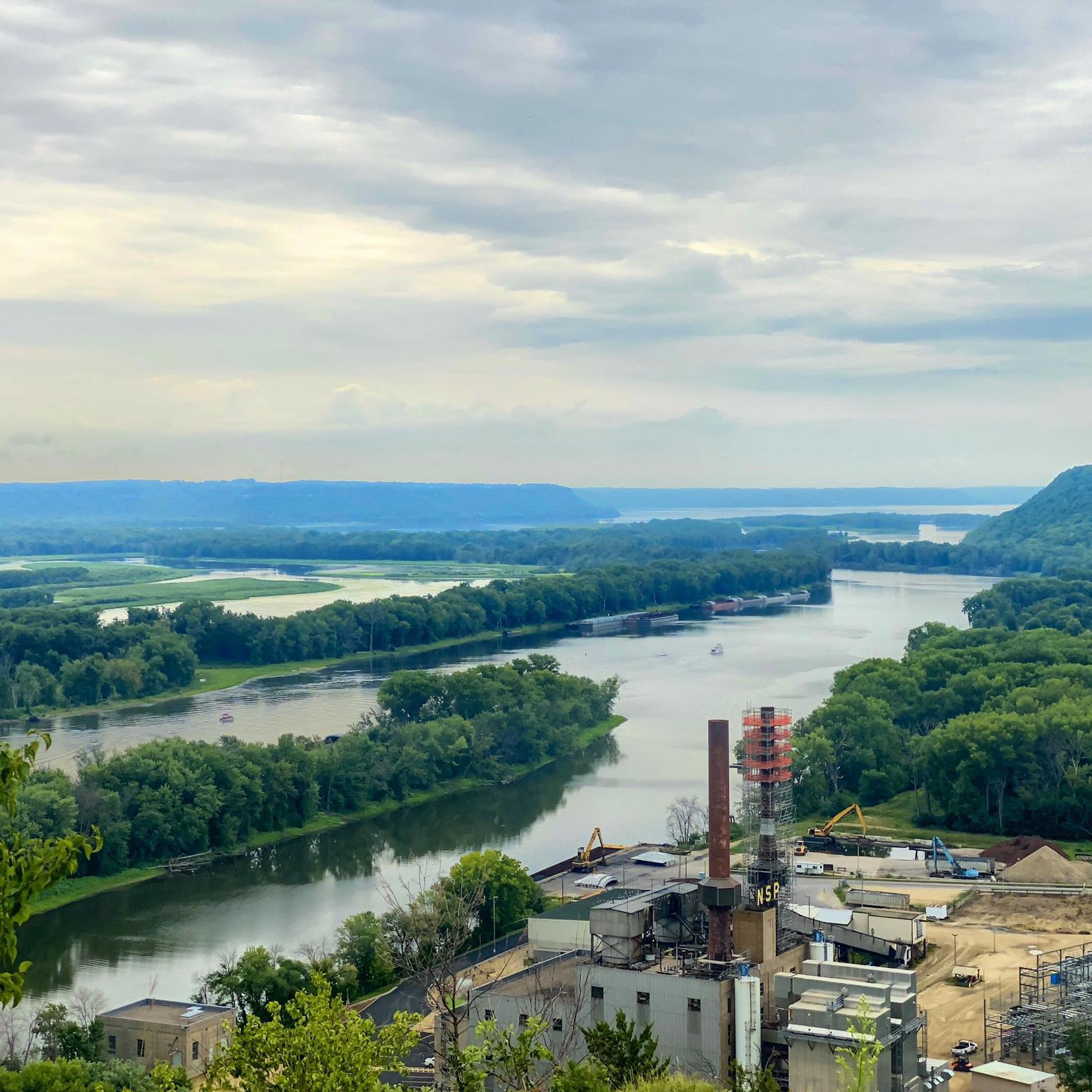
Road cycling around Red Wing, Minnesota, is characterized by its location along the Mississippi River, offering varied terrain with bluffs and riverfront views. The region is part of the unique "Driftless Area," featuring dramatic bluffs and valleys that provide both scenic beauty and elevation changes. Cyclists can expect routes that traverse diverse landscapes, from river valleys to elevated bluffs, with well-maintained surfaces.
Best road cycling routes around Red Wing
- The most popular road cycling route is Cannon Valley Trail – Belle Creek Rest Area loop from Red Wing, a 43.7 miles (70.3 km) trail that takes 3 hours 11 minutes to complete. This moderate route offers extensive views along the Cannon Valley Trail.
- Another top favourite among local road cyclists is Belle Creek Rest Area – Cannon Valley Trail loop from Welch, a moderate 33.8 miles (54.4 km) path. This route provides a scenic journey through the river valley, featuring diverse landscapes.
- Local road cyclists also love the Cannon Valley - Welch Access – Cannon Valley Trail loop from Welch, a 18.6 miles (30.0 km) trail leading through the Cannon Valley, often completed in about 1 hour 16 minutes.
- Road cycling around Red Wing is defined by bluffs, the Mississippi River, and the Cannon River, offering a mix of flat riverfront paths and routes with elevation gains. The network offers options for different ability levels, from easy rides to more challenging climbs.
- The routes in Red Wing are highly rated by the komoot community with an average score of 5.0 stars from over 7 reviews. More than 370 road cyclists have used komoot to explore Red Wing's varied terrain.
Last updated: November 8, 2026
5.0
(1)
156
riders
56.8km
02:37
370m
370m
Moderate road ride. Good fitness required. Mostly well-paved surfaces and easy to ride.
5.0
(3)
26
riders
42.2km
02:03
240m
240m
Moderate road ride. Good fitness required. Some segments of this route may be unpaved and difficult to ride.

5.0
(3)
28
riders
47.9km
02:15
270m
270m
Moderate road ride. Good fitness required. Mostly well-paved surfaces and easy to ride.
5.0
(1)
147
riders
78.3km
03:52
460m
460m
Moderate road ride. Good fitness required. Some segments of this route may be unpaved and difficult to ride.
4
riders
74.6km
03:30
570m
570m
Moderate road ride. Good fitness required. Some segments of this route may be unpaved and difficult to ride.
Our route recommendations are based on thousands of hikes, rides, and runs completed by other people on komoot.
Start today with a free account
Your next adventure awaits.
Popular around Red Wing
Tips from the Community

I was planning my big farm road loop around stopping here when almost back to the car. Made it with under 30 minutes to spare, but the Fest Beer was worth it! Still so neat to have a brewery and bike shop all together!
1
0
The dam that creates Lake George on the Kinnickinnic River is called Junction Falls. It's a neat concrete stair design. I think this is the first time I pedaled over to take a look. Worth a quick stop!
1
0
Nice to look at the ski hill in the summer, it's so quiet when it's not ski season. Although it used to be loud when they were running the lifts for mountain biking.
0
0
They are currently working on a big section of the trail, this is where they have it closed off. But it's open from here to the Old West Main Trailhead.
2
0
The river is pretty fast here, which can make launching in a group a bit tricky, but you'll catch up again as you go down the river.
0
0
Nice place for a beer after a ride, fun to be able to wander the bike shop while enjoying a beverage.
1
0
Frequently Asked Questions
What types of road cycling routes can I find around Red Wing?
Red Wing offers a diverse range of road cycling routes, characterized by its location along the Mississippi River and within the unique "Driftless Area." You'll find routes that combine flat riverfront paths with more challenging climbs up dramatic bluffs and through scenic valleys. The area features well-maintained surfaces suitable for various fitness levels.
Are there any easy road cycling routes suitable for beginners or families?
Yes, Red Wing has several easy road cycling routes. For instance, the Cannon Valley - Welch Access – Cannon Valley Trail loop from Welch is an easy 18.6-mile (30.0 km) trail through the Cannon Valley. Another option is the Welch Village – Belle Creek Rest Area loop from A. P. Anderson Park, which is 16.4 miles (26.4 km) and also rated easy.
What are the longer road cycling routes available in the Red Wing area?
For longer rides, consider the Cannon Valley Trail – Belle Creek Rest Area loop from Red Wing, which spans 43.7 miles (70.3 km) and offers extensive views along the Cannon Valley Trail. Another substantial option is the Belle Creek Rest Area – Cannon Valley Trail loop from Welch, a 33.8-mile (54.4 km) path providing a scenic journey through the river valley.
Are there any challenging road cycling routes with significant climbs?
While Red Wing offers a mix of terrain, the region's bluffs, part of the "Driftless Area," provide opportunities for elevation gains. Routes like the Cannon Valley Trail – Belle Creek Rest Area loop from Red Wing include over 1,300 feet (400 meters) of elevation gain, offering a more challenging experience for road cyclists seeking climbs.
What scenic viewpoints or natural attractions can I see along the road cycling routes?
Many routes offer stunning views of the Mississippi River and the surrounding bluffs. You can explore highlights like He Mni Can / Barn Bluff, which provides panoramic vistas. The Mississippi River View from Rattlesnake Bluff is another notable viewpoint. The Cannon Valley Trail itself offers picturesque views of the Cannon River and diverse landscapes.
Is the Cannon Valley Trail suitable for road cycling, and what should I know about it?
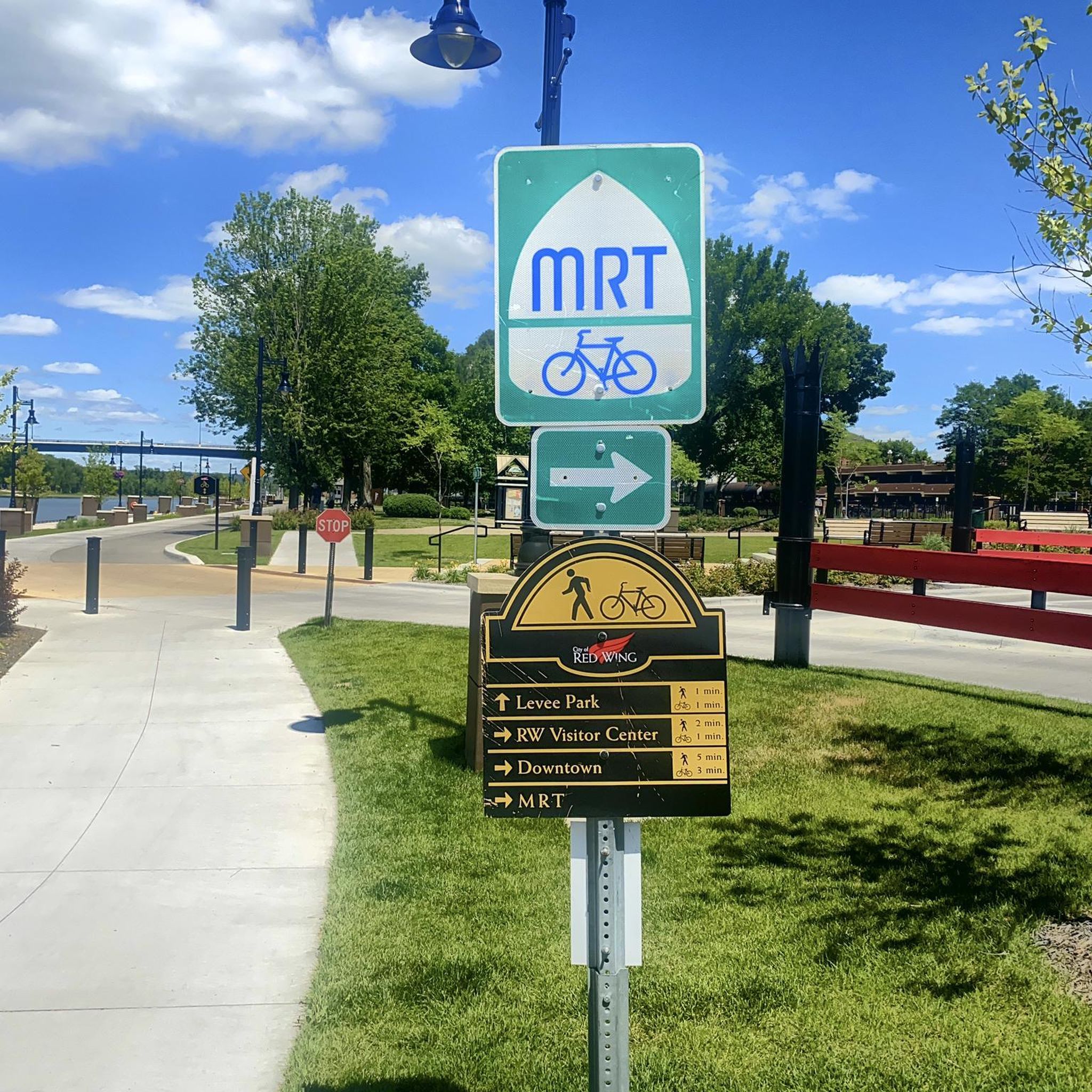
The Cannon Valley Trail is an excellent choice for road cycling, offering a 19.7-mile paved path connecting Red Wing to Cannon Falls. It's well-maintained and provides picturesque views of the Cannon River. A wheel pass is required for use from April 1 to November 1. Trailheads are conveniently located in Red Wing, Cannon Falls, and Welch.
What do other road cyclists say about the routes in Red Wing?
The road cycling routes around Red Wing are highly regarded by the komoot community, with an average rating of 5.0 stars from over 7 reviews. Cyclists often praise the varied terrain, from river valleys to elevated bluffs, and the well-maintained surfaces that make for an enjoyable ride.
Are there any loop trails for road cycling in Red Wing?
Yes, many of the popular road cycling routes in Red Wing are designed as loops. Examples include the Cannon Valley Trail – Belle Creek Rest Area loop from Red Wing and the Welch Village – Belle Creek Rest Area loop from Welch, allowing you to start and end your ride in the same location.
What is the best time of year to go road cycling in Red Wing?
The spring and fall seasons are particularly popular for road cycling in Red Wing, offering pleasant temperatures and beautiful scenery, especially with the changing leaves in autumn. The Mississippi River is also a significant flyway for migrating birds, including bald eagles, which can be observed during these times. Summer is also suitable, but be prepared for warmer weather.
Are there any facilities or rest stops along the road cycling routes?
Yes, you'll find facilities along some routes. For example, the Belle Creek Rest Area and the Rest Stop on the Cannon Valley Trail at Welch Village are available for cyclists. The city of Red Wing and nearby towns also offer various amenities.
Where can I find parking for road cycling routes in Red Wing?
Trailheads for popular routes like the Cannon Valley Trail typically offer parking. For example, the Cannon Valley Trail has trailheads in Red Wing, Cannon Falls, and Welch, which usually include parking facilities. Many city parks and bluffs also provide parking options; you can find more information on local park facilities at redwingmn.gov.
Can I rent a bike in Red Wing?
Yes, Red Wing offers bike rental services, making it convenient for visitors who wish to explore the area's road cycling routes without bringing their own equipment. It's advisable to check with local rental shops for availability and types of bikes offered.
Most popular routes around Red Wing
Most popular attractions around Red Wing

Get inspired with the komoot mobile app


Explore more
Browse the best Road cycling routes in other regions.
