The best cycling routes around North Bethesda
4.5
(351)
3,090
riders
111
rides
Touring cycling routes around North Bethesda feature an extensive network of multi-use trails, many utilizing abandoned railway lines, which provide relatively flat and scenic paths. The region is characterized by diverse landscapes, including extensive park systems like Rock Creek Park, shaded woodland trails, and riverside towpaths. The terrain generally features gentle gradients, making it accessible for various fitness levels.
Best touring cycling routes around North Bethesda
- The most popular touring cycling route is Rock Creek Park – Beach Drive, Rock…
Last updated: July 27, 2026
4.8
(60)
260
riders
Moderate bike ride. Good fitness required. Mostly paved surfaces. Suitable for all skill levels.
4.8
(4)
41
riders
18.0km
01:20
100m
100m
Easy bike ride. Great for any fitness level. Mostly paved surfaces. Suitable for all skill levels.

Sign up for free
4.6
(28)
45
riders
17.0km
00:59
50m
50m
Easy bike ride. Great for any fitness level. Mostly paved surfaces. Suitable for all skill levels.
3.5
(2)
25
riders
37.3km
02:26
320m
320m
Moderate bike ride. Good fitness required. Mostly paved surfaces. Suitable for all skill levels.
4.8
(10)
224
riders
Moderate bike ride. Good fitness required. Mostly paved surfaces. Suitable for all skill levels.
Get access to more routes and recommendations from other explorers.
Sign up for free
Already have an account?
Our route recommendations are based on thousands of hikes, rides, and runs completed by other people on komoot.
Start today with a free account
Your next adventure awaits.
Login or Signup

Tips from the Community

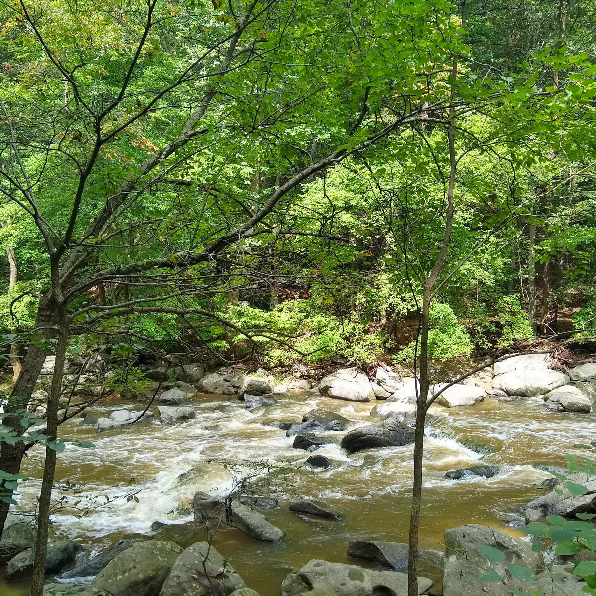
Rock Creek winds through the forest, even passing near downtown Bethesda. A paved multi-use path follows alongside, weaving through the woods and connecting several parks—a nice, shaded stretch for an easy ride.
0
0


Peirce Mill, built in 1829 by Isaac Peirce on Rock Creek, once used water to power this mill that processed corn, wheat, and rye until its turbine shaft broke in 1897. Situated on a 960-acre plantation operated with slave labor, the mill became part of Rock Creek Park in 1890 through an Act of Congress. By the early 1900s, park managers enhanced the site with roads, bridges, and a dam. The New Deal legislation gave Rock Creek Park to the National Park Service in 1933, and the mill was restored. Today, visitors can explore the site, which includes parking, a visitor center, bathrooms, and a picnic area, as part of Rock Creek Park’s year-round attractions.
1
0
Rock Creek Park, spanning 1,754 acres, is a natural escape from city life, offering trails, wildlife, and historic landmarks. Founded by Congress in 1890, this national park features not only natural beauty but also family-friendly activities. Visitors can explore its flat paved trails, visit the Smithsonian National Zoo, or learn about history at the 19th-century Peirce Mill. Families can enjoy the Nature Center, and Discovery Room. The park also hosts stargazing at its planetarium, guided ranger walks, picnic spots, and opportunities to visit historic sites like Fort Stevens, where Lincoln stood during the Civil War.
0
0
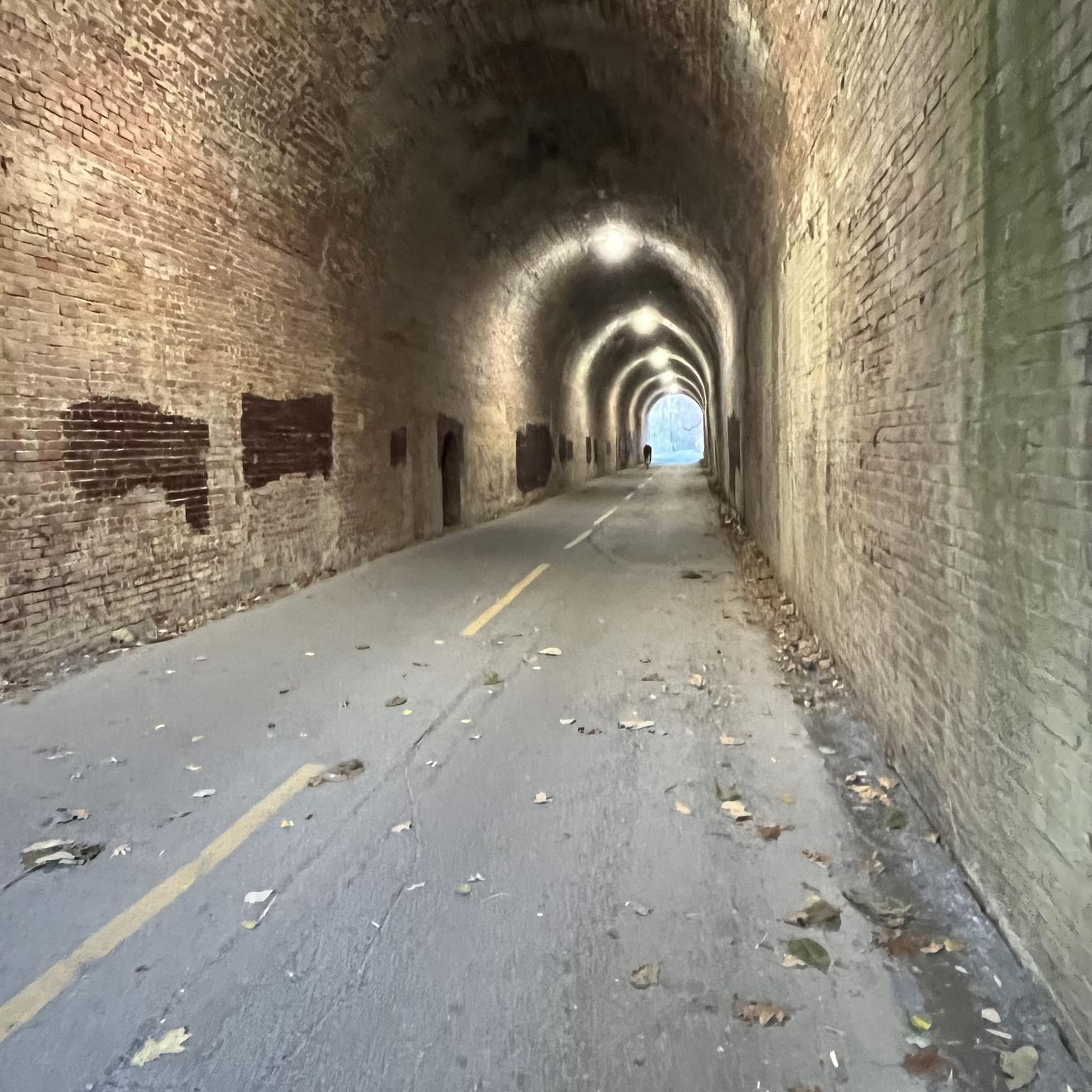
The final (or beginning) mile of the C&O Canal stands here, next to the Tide Lock on the Potomac, the true birthplace of the canal. The spot is marked with a stone pillar. Stretching from Cumberland to Washington, DC, this route ends at Mile Post 0, where hikers and bikers can definitively mark the start or finish of their journey along the historic canal. The towpath follows the canal’s full 184.5 miles to its Cumberland, MD, terminus, often extending to 333 miles for those who begin in Pittsburgh on the Great Allegheny Passage (GAP) trail.
0
1
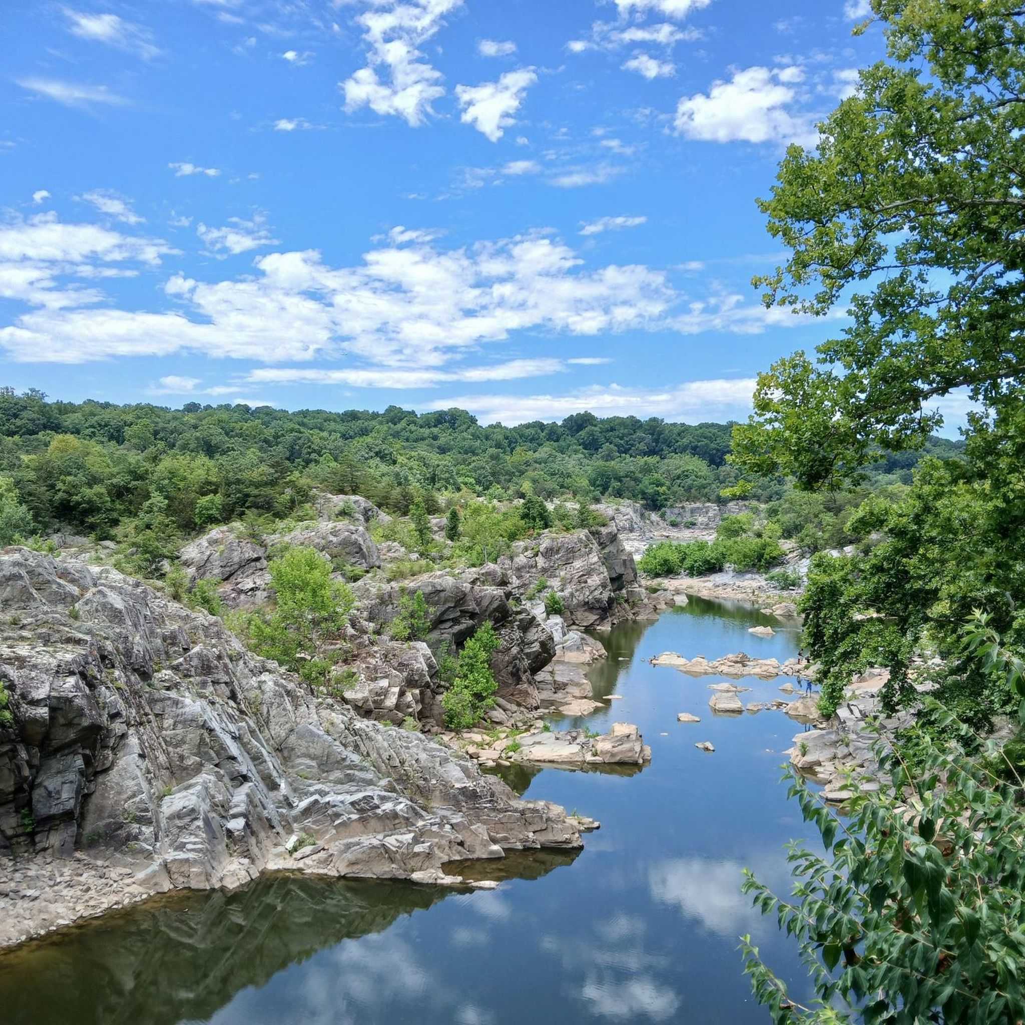
The Potomac River, stretching 405 miles from the Potomac Highlands in West Virginia to Maryland's Chesapeake Bay, ranks as the fourth-largest river on the East Coast. Swimming is prohibited in the District of Columbia's portion of the river. George Washington envisioned the Potomac as "the great avenue into the Western Country," and it played a central role in his life, serving as a vital hub during his era. For scenic views of the Potomac River on a bike, follow the Capital Crescent Trail, the Chesapeake and Ohio Canal Trail, or the Potomac Heritage National Scenic Trail.
0
0

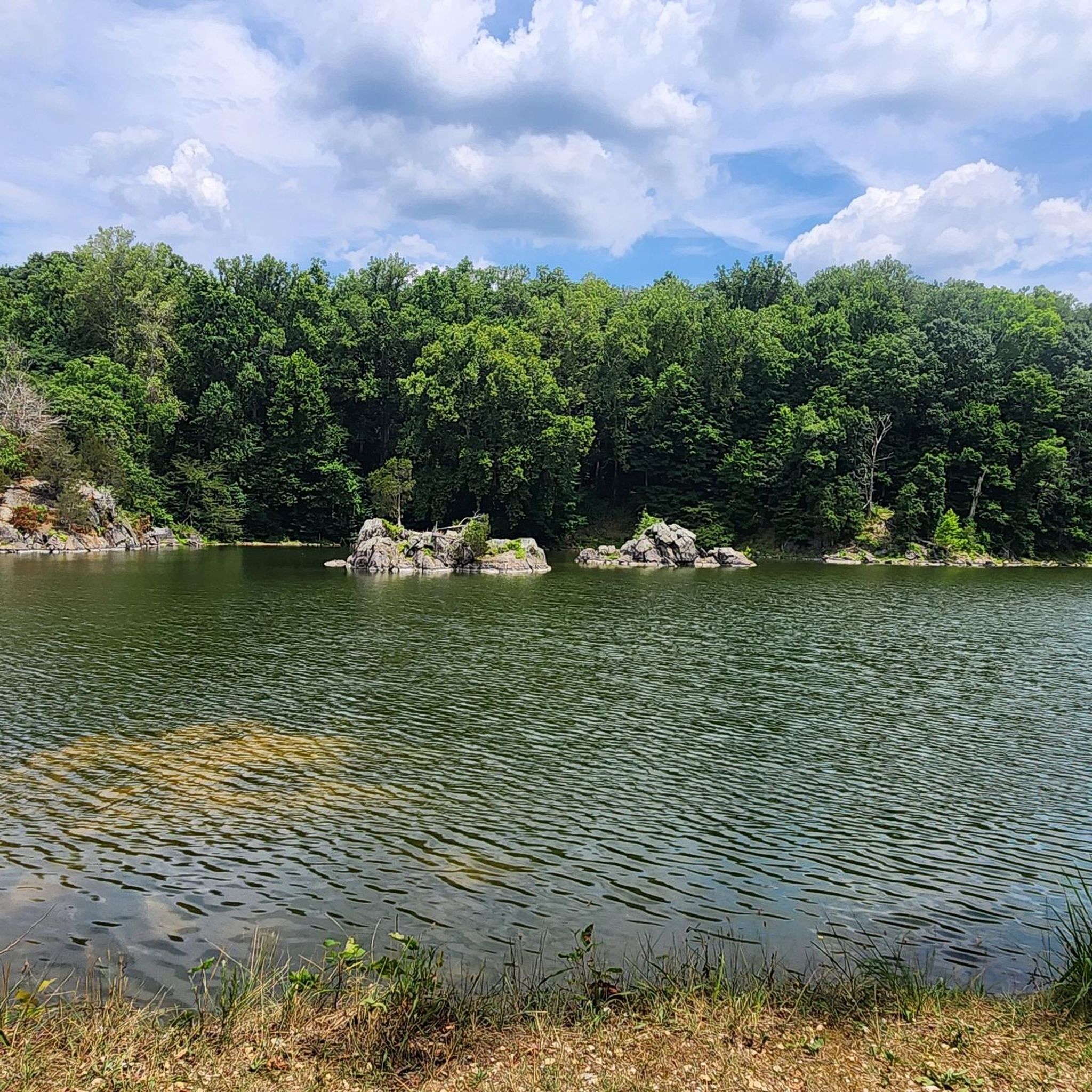
Lake Needwood is a beautiful 75-acre lake at the start of the Rock Creek Trail. The lake is popular with boaters, swimmers and fishermen. It is a great place for a break on your ride to take a dip to cool down.
1
0

A beautiful stone bridge with an arch. The construction is completely different from the pedestrian bridges around it.
4
0
Frequently Asked Questions
How many touring cycling routes are available around North Bethesda?
North Bethesda offers an extensive network of touring cycling routes, with over 100 options available on komoot. These routes cater to various skill levels, including 43 easy, 52 moderate, and 5 difficult trails.
What kind of terrain can I expect on touring cycling routes in North Bethesda?
The touring cycling routes around North Bethesda are characterized by extensive park systems, riverside towpaths, and shaded woodland trails. Many routes utilize abandoned railway lines, providing relatively flat and scenic paths with gentle gradients, making them accessible for a wide range of fitness levels.
Are there family-friendly touring cycling options in North Bethesda?
Yes, North Bethesda has several family-friendly options, particularly on its multi-use trails. The Rock Creek Trail – Lake Needwood Southeast Shore loop from Twinbrook is an easy 11.1-mile path that provides a scenic ride alongside Rock Creek and Lake Needwood, suitable for families. The Capital Crescent Trail and Bethesda Trolley Trail are also popular car-free options with gentle grades.
Can I find circular touring cycling routes in the area?
Absolutely. Many routes in North Bethesda are designed as loops, offering convenient circular rides. For example, the Rock Creek Park – Beach Drive, Rock Creek Park loop from Grosvenor–Strathmore is a popular 22.8-mile loop that utilizes Beach Drive, often closed to vehicular traffic. Another option is the Rock Creek Trail – Lake Needwood Southeast Shore loop from Garrett Park, a 23.2-mile trail through wooded areas.
What are some notable landmarks or attractions I can explore along the cycling routes?
While cycling, you can explore various natural and historical attractions. The Rock Creek Trail system offers access to Lake Needwood Southeast Shore and Lake Needwood. For those interested in history, the Josiah Henson Museum & Park is nearby. Additionally, the extensive Rock Creek Park itself is a major landmark, offering lush greenery and scenic views.
Are there any waterfalls accessible from the touring cycling routes?
Yes, the broader North Bethesda area provides access to several beautiful waterfalls. You can find highlights like Scott's Run Falls, Dead Run Waterfalls, and the impressive Great Falls Park on the C&O Trail, which are popular spots for visitors.
What do other touring cyclists say about the routes in North Bethesda?
The touring cycling routes in North Bethesda are highly rated by the komoot community, with an average score of 4.4 stars from over 500 reviews. Reviewers often praise the extensive network of well-maintained trails, the scenic beauty of Rock Creek Park, and the accessibility of routes with gentle gradients.
Are there options for longer touring cycling routes in North Bethesda?
Yes, for cyclists looking for longer rides, North Bethesda offers several options. The Rock Creek Park – Klingle Road Wooden Bridge loop from North Bethesda is a moderate 38.4-mile (61.7 km) route, and the Meadowbrook Stables – Rock Creek Park loop from North Bethesda extends to 40.4 miles (65 km), both providing extensive exploration of the park system.
Is public transport available to access the cycling trails?
North Bethesda has good public transport infrastructure. Many trails, such as the Bethesda Trolley Trail and Capital Crescent Trail, are designed to connect neighborhoods and are often accessible via local bus routes or Metro stations, making it convenient to reach starting points without a car.
What is the best time of year for touring cycling in North Bethesda?
The spring and fall seasons generally offer the most pleasant conditions for touring cycling in North Bethesda, with mild temperatures and beautiful foliage. Summer can be warm and humid, while winter can bring colder temperatures and potential for snow or ice, though many paved trails remain accessible.
Are there cafes or restaurants near the cycling routes?
Yes, North Bethesda is well-developed, and many cycling routes pass through or near areas with amenities. The Capital Crescent Trail, for instance, connects to Bethesda and Georgetown, offering numerous cafes, restaurants, and shops. Areas like Pike & Rose also provide dining options and pedestrian-friendly spaces close to some trail access points.
What is the Bethesda Trolley Trail and what does it offer cyclists?
The Bethesda Trolley Trail, also known as the North Bethesda Trail, is a paved path spanning 3.5 to 5.9 miles. It utilizes the abandoned right-of-way of a former streetcar line, offering a relatively flat and scenic route. It includes pedestrian and bicycle-only bridges, connecting neighborhoods and providing a low-impact recreational path. You can find more historical context about its origins on Wikipedia.
Most popular routes around North Bethesda
Most popular attractions around North Bethesda

Get inspired with the komoot mobile app


Explore more
Browse the best Cycling routes in other regions.
