The best cycling routes around Brownsville
4.6
(17)
265
riders
10
rides
Touring cycling around Brownsville, Texas, features a landscape shaped by the Rio Grande, characterized by ancient river channels known as resacas and subtropical ecosystems. The terrain is generally flat, with minimal elevation changes, making it suitable for touring cyclists. The region includes native Sabal palm stands, mesquite, and thornscrub habitats, offering diverse natural scenery.
Best touring cycling routes around Brownsville
- The most popular touring cycling route is Chesapeake and Ohio Canal Towpath, a 11.3 miles (18.2 km) trail that…
Last updated: October 1, 2026
4.8
(4)
64
riders
18.2km
01:26
30m
30m
Embark on an easy touring bicycle ride along the Chesapeake and Ohio Canal Towpath, a route that guides you through a heavily wooded environment, providing ample shade. This 11.3 miles…
5.0
(5)
77
riders
Moderate bike ride. Good fitness required. Mostly paved surfaces. Suitable for all skill levels.

5.0
(5)
42
riders
114km
08:49
730m
730m
Hard bike ride. Very good fitness required. Mostly paved surfaces. Suitable for all skill levels.
7
riders
10.6km
00:42
100m
100m
Easy bike ride. Great for any fitness level. Mostly paved surfaces. Suitable for all skill levels.
5.0
(1)
14
riders
6.32km
00:35
80m
80m
Easy bike ride. Great for any fitness level. Mostly paved surfaces. Suitable for all skill levels.
Get access to more routes and recommendations from other explorers.
Already have an account?
Our route recommendations are based on thousands of hikes, rides, and runs completed by other people on komoot.
Start today with a free account
Your next adventure awaits.


Tips from the Community

One of my favorite rides! The trail is well maintained and smooth. So many spots to rest and take breathtaking pics
1
0

28 Sept 2025: staircase closed as they rebuild it
0
0

A paved elevated boardwalk stretches out along the water, giving you a fantastic view of the Potomac River. This spot can get pretty popular on summer weekends.
0
0
The Antietam Aqueduct was built in 1834 to carry canal boats over Antietam Creek. It is over 140 feet long and is one of many such aqueducts along the C&O Canal.
0
0

The Antietam Aqueduct, located at mile 69.4 of the C&O Canal Towpath, is a three-arch stone aqueduct that once carried the canal over Antietam Creek. Built in 1834, it is constructed from limestone quarried nearby and remains one of the best-preserved aqueducts along the canal. During the Civil War, it was near the site of Confederate troop movements before and after the Battle of Antietam in 1862. Though it suffered some damage over the years, it has been fully restored and now serves as a scenic and historic stop along the towpath, offering great river views and picnic spots.
0
0

to get from trail to Harper's Ferry, you have to go up these stairs. There are bike racks at the base, or you carry your bike up with you
0
0

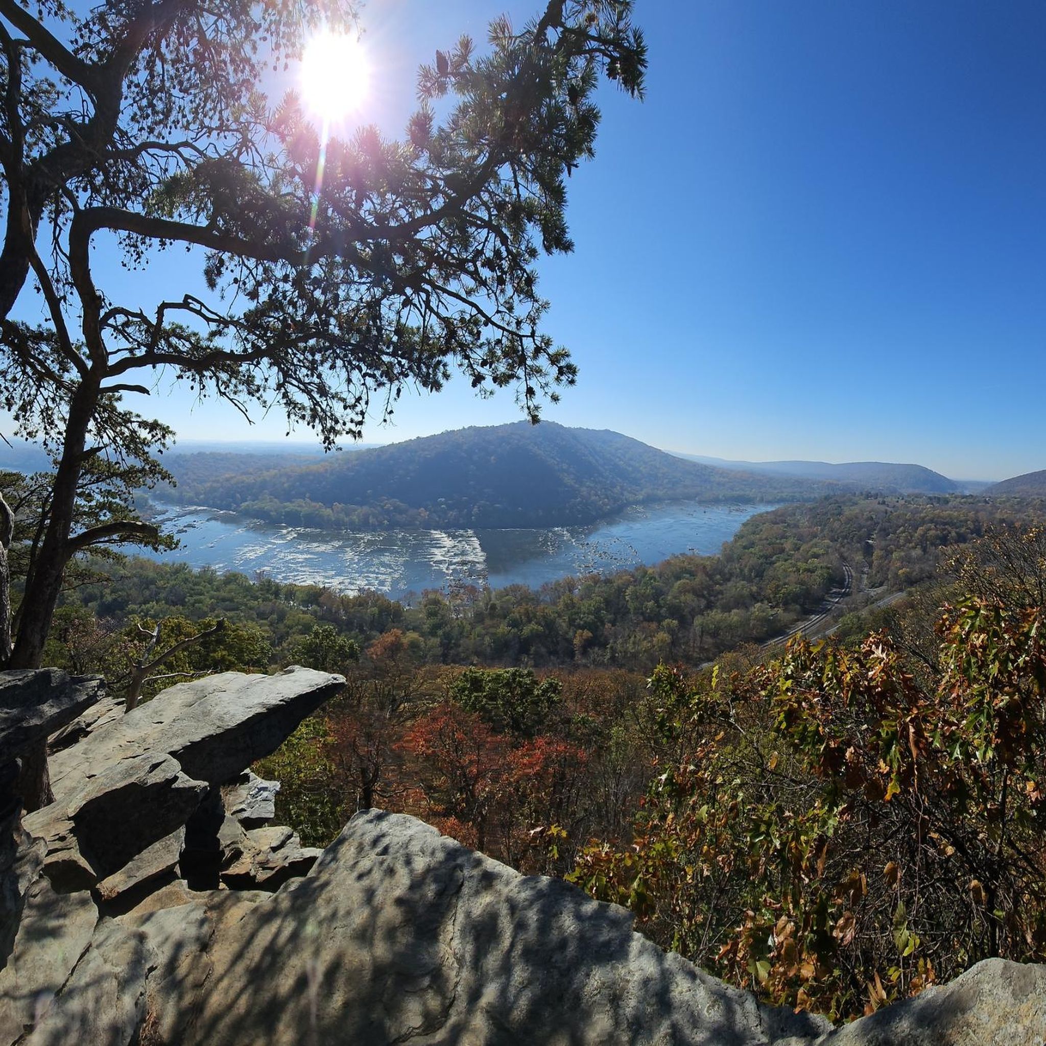
The Potomac River has a mix of flatwater and whitewater, visible as you pedal along the C&O Canal bike trail; this is a great spot to stop and watch some of those rapids.
0
0
From this spot near McMahon’s Mill, you get great views of Big Slackwater. McMahon’s Mill used a steel wheel in the early 20th century to generate electricity. The mill closed in 1922 after a flood but was later restored by the National Park Service. Downstream from McMahon’s Mill, Big Slackwater marks where canal boats entered the Potomac River, avoiding the rocky cliffs by using pools behind Dam 4 and Dam 5. In 1996, flooding damaged the towpath, making this section impassable for over 15 years. Reconstruction began in 2010, and by 2012, the missing towpath section was restored, allowing visitors to travel the entire 184.5 miles of the C&O Canal once again.
0
0
Frequently Asked Questions
What is the general terrain like for touring cycling in Brownsville?
Brownsville's landscape is generally flat, shaped by the Rio Grande and its ancient river channels, known as resacas. You'll encounter subtropical ecosystems with native Sabal palms, mesquite, and thornscrub habitats. The minimal elevation changes make it suitable for touring cyclists, offering a gentle ride through diverse natural scenery.
Are there any easy touring cycling routes for beginners or families?
Yes, Brownsville offers several easy options. The city has a growing network of multi-use trails, including paved paths suitable for leisurely rides. For example, the Historic Battlefield Trail is a 9-mile path that is generally flat and connects to Linear Park. The Paseo de la Resaca Trail System also provides 7 miles of paved trails through residential areas and parks, ideal for families.
What kind of natural features or wildlife can I expect to see while cycling?
Brownsville is rich in unique natural features. You'll often cycle alongside serene resacas, which are ancient river channels providing picturesque views and vital habitats for diverse bird species. The region's subtropical ecosystems feature native Sabal palms, mesquite, and various thornscrub. Areas like Resaca de la Palma State Park are prime for wildlife viewing, including various birds from observation decks, and Monte Bella Trails Park offers opportunities to spot birds, lizards, and rabbits.
Are there any notable landmarks or historical sites accessible by bike?
Yes, the Historic Battlefield Trail is a prime example, running directly through Brownsville and connecting to the Palo Alto Battlefield National Historical Park. While cycling, you can explore significant historical and cultural sites. Although outside Brownsville, the region also has historical sites like Maryland Heights Stone Fort and Philip Frankel & Co. (NPS Lower Town Information Center).
What is the best time of year to go touring cycling in Brownsville?
Brownsville's subtropical climate allows for year-round outdoor activities. However, cyclists should be mindful of warm weather, especially during summer. Spring and fall generally offer more comfortable temperatures for longer rides. The city sometimes hosts CycloBia events at night to mitigate high summer temperatures, suggesting cooler evenings are preferred during hotter months.
Where can I park my car when accessing Brownsville's bike trails?
Many of Brownsville's trails offer convenient parking. For instance, the Historic Battlefield Trail connects to Linear Park, which features amenities including a public repair station. The Monte Bella Trails Park also provides access for cyclists. It's advisable to check specific trailheads or park websites for designated parking areas.
Is public transport available to reach cycling routes in Brownsville?
Brownsville is actively developing its cycling infrastructure and connectivity. While specific public transport links directly to trailheads might vary, the city's Bicycle and Trails Master Plan aims to increase city connectivity and provide accessible facilities. The Paseo de la Resaca Trail System connects to various parks and public facilities, enhancing accessibility within residential neighborhoods.
Are there any circular touring cycling routes in the Brownsville area?
Yes, there are several loop options for touring cyclists. For example, the Antietam Aqueduct – Huckleberry Hill Campsite loop from Chestnut Grove Park is a moderate 30.8-mile path. Another option is the Shepherdstown – Antietam Aqueduct loop from Brunswick, a 38.4-mile trail. These routes offer varied terrain and scenic views.
What do other touring cyclists enjoy most about cycling in Brownsville?
The touring cycling routes in Brownsville are highly rated by the komoot community, with an average score of 5.0 stars from over 19 reviews. Cyclists often praise the unique landscape shaped by resacas and subtropical ecosystems, as well as the growing network of multi-use trails that cater to different ability levels.
Are there any bike rental options or repair stations available in Brownsville?
Yes, Brownsville is committed to supporting cyclists. Public repair stations are available at locations such as Linear Park (along the Historic Battlefield Trail) and the Belden Trail. Additionally, local bike shops in Brownsville rent quality bikes, making it accessible for visitors who don't have their own equipment.
Can I bring my dog on the cycling trails in Brownsville?
While many multi-use trails are generally pet-friendly, it's always best to check specific park or trail regulations. For instance, Resaca de la Palma State Park allows bikes on its trails, but specific rules regarding pets should be confirmed directly with the park to ensure a pleasant experience for everyone.
Are there cafes or places to eat near the cycling routes?
Brownsville supports a 'Bicycle Friendly Business' program, where participating businesses offer amenities like free water and restrooms to riders. While specific cafes along every route are not detailed, the city installs bike racks and promotes these businesses on bike routes and maps, suggesting you'll find options, especially near urban trail sections like the Belden Trail which connects to commercial areas.
What is the longest touring cycling route available in the Brownsville area?
One of the longer touring cycling routes in the area is the Big Slackwater – Big Slackwater View loop from Dargan, which spans approximately 71.5 miles (115.1 km). This route offers an extensive ride with varied elevation.
Most popular attractions around Brownsville

Get inspired with the komoot mobile app


Explore more
Browse the best Cycling routes in other regions.
