The best road cycling routes around Berwyn Heights
4.5
(41)
1,245
riders
70
rides
Road cycling routes around Berwyn Heights traverse a landscape characterized by natural reserves and multi-use trails, offering a mix of environments for cyclists. The region features generally gentle terrain, with routes often following waterways and through green spaces. Elevation changes are typically modest, making the area suitable for various fitness levels.
Best road cycling routes around Berwyn Heights
- The most popular road cycling route is Patuxent Research Refuge loop, a 24.3 miles (39.1 km) trail that takes 1 hour…
Last updated: May 21, 2026
3.6
(5)
39
riders
39.1km
01:37
260m
260m
Easy road ride. Great for any fitness level. Mostly well-paved surfaces and easy to ride.
60
riders
Easy road ride. Great for any fitness level. Mostly well-paved surfaces and easy to ride.

Sign up for free
54
riders
74.4km
03:10
500m
500m
Moderate road ride. Good fitness required. Mostly well-paved surfaces and easy to ride.
5.0
(4)
207
riders
65.1km
02:50
150m
150m
Moderate road ride. Good fitness required. Mostly well-paved surfaces and easy to ride.
5.0
(2)
48
riders
Easy road ride. Great for any fitness level. Mostly well-paved surfaces and easy to ride.
Get access to more routes and recommendations from other explorers.
Sign up for free
Already have an account?
Our route recommendations are based on thousands of hikes, rides, and runs completed by other people on komoot.
Start today with a free account
Your next adventure awaits.
Login or Signup
Popular around Berwyn Heights
Tips from the Community

Hello
0
0

This site is famous for a very important and unfortunate event in American history: the Battle of Bladensburg during the War of 1812. You can learn about the battle, see historical markers, and understand how this event shaped the nation.
0
0

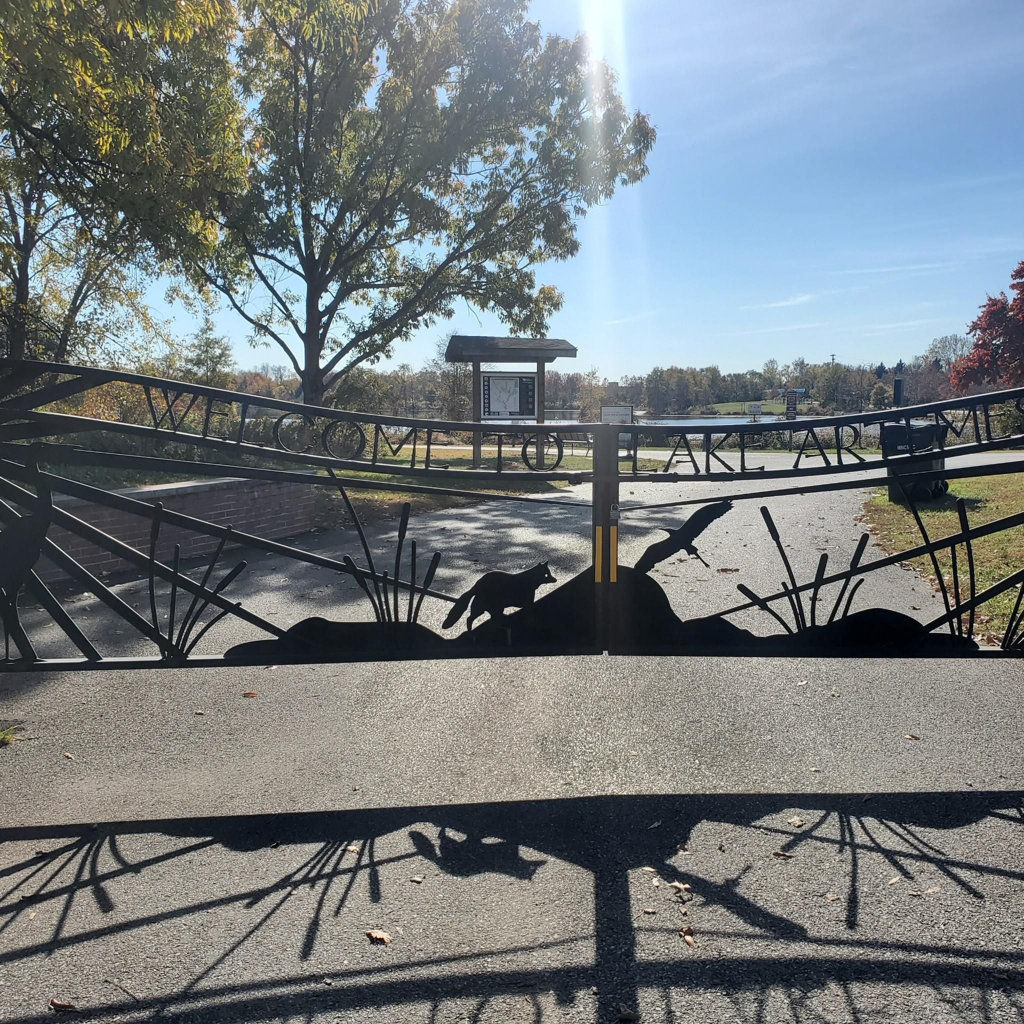
Artemesia Lake, a 38-acre man-made lake, is named after Artemesia N. Drefs, who donated the area in 1972. The lake features a fishing dock, and it's common to see people enjoying various water activities.
0
0

It’s really a skateboard track, but I was really tempted to test it with my bike
1
0

The Anacostia Riverwalk Trail follows along the Anacostia River from Bladensburg to the Navy Yard, covering 21.5 miles through forests, fields, marshes, and river ecosystems. Ideal for walking, jogging, biking, or dog walking, the paved trail offers scenic views of the Anacostia River and its wildlife. It passes through Anacostia Park and Kenilworth Aquatic Gardens and connects to five bridges and several city bike routes. The trail features asphalt, boardwalk, brick, and concrete surfaces, with access points at Hyattsville, MD, and The Wharf in D.C.
0
0

I don't "recommend" the bridge itself - it has not improved since the previous comments were made in 2019 and 2021 - but it is a necessary part of an excellent ride along the Anacostia bicycle path. The Bladensburg riverfront park just south of the bridge has good facilities, with restrooms large enough to bring your bike inside for security while you take care of things. But the bridge itself - it's still as bumpy as a rutted trail in the woods, and often with families crossing it, so be careful. The downhill is tempting, but take it slow.
2
0
Lake Artemesia is a man-made lake, spanning 38 acres and surrounded by Lake Artemesia Park. The lake and the park are named after Artemesia N. Drefs, who in 1972 donated ten lots to the county for preservation as a public green space.
0
0

Nestled along the picturesque Anacostia River, this hidden gem offers a delightful blend of natural beauty, recreational activities, and fascinating history. There is a lovely riverside walking path, bike and boat rentals, a fishing pier, a historic B&O caboose, and interpretive signs from the War of 1812 and the Battle of Bladensburg. It's a beautiful spot to spend an afternoon or a nice place to take a break before continuing your journey along the beautiful Anacostia River Trail system.
0
0
Frequently Asked Questions
How many road cycling routes are available around Berwyn Heights?
There are over 60 road cycling routes around Berwyn Heights, offering a variety of options for different skill levels and preferences.
What kind of terrain can I expect on road cycling routes in Berwyn Heights?
The road cycling routes in Berwyn Heights generally feature gentle terrain with modest elevation changes. You'll often find yourself traversing natural reserves and multi-use trails, following waterways and passing through green spaces.
Are there easy road cycling routes suitable for beginners in Berwyn Heights?
Yes, Berwyn Heights offers many easy routes perfect for beginners. For instance, the Patuxent Research Refuge loop is an easy 24.3-mile (39.1 km) trail that provides a scenic ride through a natural area.
Are there more challenging road cycling routes for experienced riders?
While the region is known for its gentle terrain, there are moderate options for those seeking a longer ride. The Patuxent Research Refuge – Patuxent Research Refuge loop from Greenbelt is a moderate 46.4-mile (74.6 km) trail that takes about 3 hours 12 minutes to complete, offering an extended exploration of the natural reserves.
What are some popular loop road cycling routes in the area?
Many routes in Berwyn Heights are loops, allowing you to start and end in the same location. Popular options include the Patuxent Research Refuge loop from College Park–University of Maryland, an easy 27.9-mile (44.9 km) path, and the Northeast Branch Trail – College Park Airport loop from Greenbelt, which is 16.8 miles (27.1 km) long.
What can I see along the road cycling routes in Berwyn Heights?
Many routes offer scenic views and pass by interesting attractions. You can cycle past Lake Artemesia, explore the natural beauty of Patuxent Research Refuge, or even cycle near the historic College Park Airport.
Are there family-friendly road cycling routes in Berwyn Heights?
Given the generally gentle terrain and modest elevation changes, many of the easy and multi-use trails are suitable for families. Routes that stick to dedicated trails, like sections of the Northeast Branch Trail, are often good choices for a family outing.
What do other road cyclists enjoy most about cycling in Berwyn Heights?
The area is highly rated by the komoot community, with an average score of 4.6 stars from over 40 reviews. Cyclists often praise the peaceful natural reserves, the well-maintained multi-use trails, and the accessibility of routes for various fitness levels.
Are there any routes that connect to other trail systems?
Yes, some routes in the Berwyn Heights area connect to or utilize parts of larger trail systems. For example, the Melrose Park Pump Track – Sligo Creek Trail loop from College Park–University of Maryland incorporates sections of the Sligo Creek Trail, offering a diverse riding experience.
What is the best time of year for road cycling in Berwyn Heights?
The region is enjoyable for road cycling through much of the year. Spring and fall offer pleasant temperatures and beautiful scenery. Summer can be warm, but routes often pass through shaded areas. Winter cycling is possible, though conditions may vary.
Where can I find parking for road cycling routes in Berwyn Heights?
Many trailheads and parks in and around Berwyn Heights offer parking facilities. For routes starting from specific locations like College Park–University of Maryland or Greenbelt, you can often find public parking nearby, though it's always good to check local regulations.
Most popular attractions around Berwyn Heights

Get inspired with the komoot mobile app


Explore more
Browse the best Road cycling routes in other regions.
