The best running trails around Fryeburg
40
runners
7
runs
Jogging around Fryeburg offers a diverse landscape for runners, characterized by a mix of rolling hills, forested paths, and trails with varying elevation changes. The region features routes that traverse ridges and lead to local summits, providing both challenging ascents and more level sections. This varied terrain allows for different types of running experiences, from short, moderate efforts to longer, more demanding routes.
Best jogging routes around Fryeburg
- The most popular jogging route is Southwest Ridge Trail, a 5.5 miles (8.8 km) trail that takes 1 hour 24 minutes to complete. This difficult route features significant elevation gain and ridge views.
- Another top favourite among local runners is Mountain Division Trail, a moderate 7.8 miles (12.6 km) path. This route offers a longer, flatter path through the landscape.
- Local runners also love the Black Cap Trail, a 2.3 miles (3.6 km) trail leading to a local hill summit, often completed in about 31 minutes.
- Jogging around Fryeburg is defined by varied terrain, including ridges, mountain trails, and forested paths. The network offers options for different ability levels, from moderate runs to more difficult challenges.
- The guide includes highly-rated routes that showcase the best of the region's landscape. More than 10 runners have used komoot to explore Fryeburg's varied terrain.
Last updated: July 21, 2026
2
runners
3.64km
00:32
190m
190m
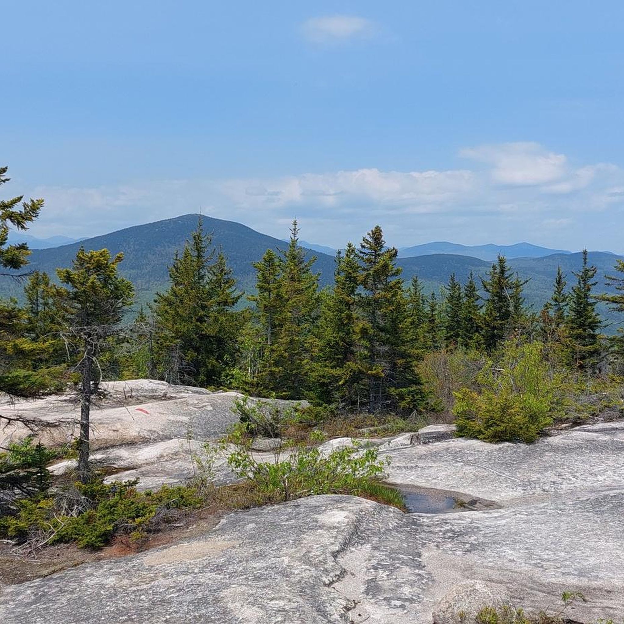
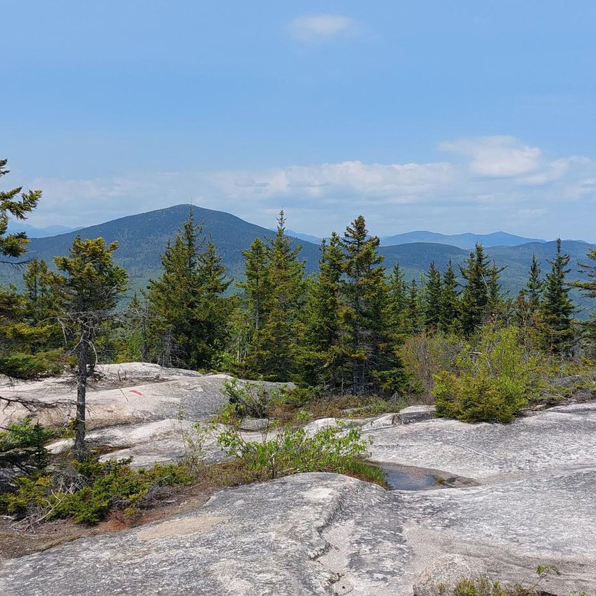
Embark on a moderate jogging route along the Black Cap Trail, a rewarding 2.3 miles (3.6 km) journey that climbs 610 feet (186 metres) in about 31 minutes. You'll start by winding through quiet, dense woods, feeling the cool shade of the trees. As you ascend, the path opens up to expansive ledges near the summit. From these vantage points, you can take in sweeping panoramic views of the Conway valley, with the distinctive Moat Mountain ridge standing out. Keep an eye out for the impressive White Horse and Cathedral Ledges in the distance. On clear days, you might even spot Mount Washington and other distant peaks of the White Mountains. This trail offers a great blend of forest immersion and open vistas.
Before you head out, be aware that access to the Black Cap Trail can change with the seasons. While generally accessible, Hurricane Mountain Road, which leads to the trailhead, closes during the winter months. If you plan to jog the trail in winter, be prepared for a significantly longer round-trip distance and more elevation gain. You will need appropriate gear, such as snowshoes, to tackle the extended trek. Always check local conditions before your visit to ensure a smooth experience.
The Black Cap Trail is nestled within the beautiful Green Hills Preserve, offering more than just a good workout. It's a popular spot for birding, so listen for local species as you jog. The trail is also particularly stunning in autumn, when the foliage transforms into a vibrant display of fall colors. This route provides a fantastic opportunity to experience the natural beauty of the region, combining physical activity with scenic rewards.
2
runners
12.6km
01:18
50m
50m
Embark on a moderate jogging experience along the Mountain Division Trail, covering 7.8 miles (12.6 km) with a gentle elevation gain of 152 feet (46 metres). You can expect to complete this route in about 1 hour and 18 minutes. As you jog, you'll pass through a varied landscape of woods, farmlands, and open fields. Keep an eye out for scenic railroad bridge crossings, such as the one over the Presumpscot River, which adds a unique visual element to your run. While mostly paved, be prepared for a 1-mile section of gravel when you reach Standish. This trail offers a pleasant mix of natural beauty and accessible terrain for your workout.
Planning your visit to the Mountain Division Trail is straightforward, as parking is generally available at various access points along its length. This multi-use trail is designed to be fully ADA accessible, making it suitable for a wide range of users. You can start your jogging adventure from several points, depending on which section you wish to explore. Consider an early morning or late afternoon start to enjoy cooler temperatures and potentially fewer people on the path.
The Mountain Division Trail stands out for its diverse scenery, offering glimpses of mountain views through breaks in the trees, particularly in the Fryeburg section. This route follows a historic railroad corridor, providing a unique perspective on the region's past as you jog. It's a great option if you are looking for a consistent jogging path that combines natural beauty with a touch of local history.

Sign up for free
2
runners
8.78km
01:24
490m
490m
Prepare for a challenging jogging experience on the Southwest Ridge Trail, a difficult route that covers 5.5 miles (8.8 km) with a significant elevation gain of 1601 feet (488 metres). You can expect to complete this climb in about 1 hour and 23 minutes. The trail begins with a steady incline through wooded areas, especially for the first two miles, before opening up to expansive views. As you ascend, you'll be treated to rewarding vistas of surrounding lakes and mountains, culminating in panoramic scenes from Pleasant Mountain Summit. From the summit, you can enjoy extensive views of Fryeburg, Conway, Brownfield, and the White Mountains. You might even hear the distinct calls of loons from Moose Pond during the summer months.
The Southwest Ridge Trail is open all year, making it a flexible option for your jogging plans. This route is quite popular and sees heavy foot traffic, so be prepared to share the path with other outdoor enthusiasts. It is well-maintained, ensuring a clear and accessible journey for all visitors. If you plan to bring your canine companion, dogs are welcome on the trail but must be kept on a leash at all times.
This trail is located within the Pleasant Mountain Preserve, an area known for its natural beauty and conservation efforts. The Loon Echo Land Trust actively maintains the route, contributing to its excellent condition and accessibility. The preserve offers a chance to connect with nature, providing a habitat for various wildlife and plant species. The trail's challenging nature makes it a notable option for those seeking a demanding uphill workout in the region.
2
runners
5.94km
00:49
210m
210m
The Surf's Up Trail offers a dynamic jogging experience, covering 3.7 miles (5.9 km) with a moderate difficulty. You will gain 683 feet (208 metres) in elevation, making it a good workout that takes about 48 minutes to complete. Expect to jog through wooded areas, where the terrain includes some steep sections typical of mountain trails, providing a refreshing natural setting.
Planning your visit is straightforward, as the trail is easily accessible for joggers. Parking is generally available near the trailhead, so you should not have trouble finding a spot to start your adventure. There are no specific warnings about road closures or permits needed for this route, making it a hassle-free option for your next jog.
This route is located within the Green Hills Preserve, offering a chance to connect with nature. As you climb, you can anticipate views towards Mount Cranmore, which stands out as a key highlight along the way. The Surf's Up Trail is perfect if you are looking for a quick, challenging jog that provides both exercise and scenic rewards.
4.21km
00:34
120m
120m
Jog the Peary Mountain Trail, a moderate 2.6-mile route in Brownfield, Maine, offering panoramic views of the White Mountains.
Get access to more routes and recommendations from other explorers.
Sign up for free
Already have an account?
Our route recommendations are based on thousands of hikes, rides, and runs completed by other people on komoot.
Start today with a free account
Your next adventure awaits.
Login or Signup


Tips from the Community

Black Cap, a 2,369-foot mountain in Conway, New Hampshire, sits between Kearsarge North Mountain and Peaked Mountain. Its rocky summit offers sweeping views of Maine and New Hampshire's White Mountains. Known as the "little mountain with big views," Black Cap is a favorite for its stunning scenery despite its modest climb to the peak.
0
0

Pleasant Mountain is an isolated, lengthy mountain mass that stretches about 4 miles on the north-south line of Bridgton and Denmark. The main summit is open and filled with ledges, which are typical in a very granite heavy state.
0
0

The southwest ridge trail is one of the most popular routes up Pleasant Mountain. The trail pushes up the rocky forest and offers a bunch of views of the surrounding lakes and mountains along the way.
0
0
The Fryeburg section of the Mountain Division Rail Trail consists of a 4-mile paved path that passes through the countryside while following an old rail bed. There are trailheads on both ends of the path on Main Street and Portland Street.
0
0
At 958 feet, Peary Mountain is an uprising in a wide open area in southern Maine. You can see over to the Presidentials, back towards Pleasant Mountain, and out over Lovewell Pond. The trail to the top is steep and technical, giving this peak a real mountain-running feel.
0
0

Cranmore Mountain is a very popular spot year round. In winter, it is a ski resort and the rest of the year, it is full of hikers, runners and cyclist. There are great views from the peak of the other mountains and valleys in North Conway.
1
0
The peak of Black Cap is located at a bare summit, so it gives you great views of the surrounding mountains and valleys. The trail up is moderately challenging and takes you through spruce and beech forest.
1
0

Cranmore Mountain in North Conway is a four-season recreational destination. While in the winter it is a popular skiing destination, it is a great spot for hiking from spring to autumn. At the top of the chairlift, you get a great overview over the area.
0
0
Frequently Asked Questions
How many running routes are available in Fryeburg?
There are over 7 dedicated running routes around Fryeburg featured in this guide. These routes offer a variety of experiences, from moderate paths to more challenging trails with significant elevation changes.
Are there any beginner-friendly or moderate running routes in Fryeburg?
Yes, Fryeburg offers several moderate running routes suitable for beginners or those looking for a less strenuous run. The Mountain Division Trail is a great option, offering a longer, flatter path through the landscape. Another moderate choice is the Black Cap Trail, which leads to a local hill summit.
What are the typical lengths of jogging trails in Fryeburg?
The jogging trails in Fryeburg vary in length to suit different preferences. You can find shorter routes like the Black Cap Trail at approximately 2.3 miles (3.6 km), or longer options such as the Mountain Division Trail, which spans about 7.8 miles (12.6 km).
Are there any scenic running routes with viewpoints in Fryeburg?
Absolutely! Many routes in Fryeburg offer beautiful scenery and rewarding viewpoints. The Southwest Ridge Trail is known for its significant elevation gain and stunning ridge views. For a local summit experience, the Black Cap Trail leads to the Black Cap Summit, offering panoramic vistas.
What is the best time of year for jogging in Fryeburg?
Fryeburg offers distinct running experiences throughout the year. Spring and fall provide pleasant temperatures and vibrant foliage, making them ideal for exploring the trails. Summer is also popular, though you might prefer early morning or late afternoon runs to avoid the warmest part of the day. Winter running is possible but requires appropriate gear for snow and ice.
Are the jogging routes in Fryeburg suitable for dogs?
Many trails in the Fryeburg area are dog-friendly, but it's always best to check specific trail regulations before heading out. Generally, dogs should be kept on a leash and owners are expected to clean up after their pets to ensure a pleasant experience for everyone.
Are there any circular jogging routes in Fryeburg?
Most of the running routes listed in this guide are designed as loops or out-and-back trails, allowing for a circular experience. For example, the Surf's Up Trail and Peary Mountain Trail offer engaging circular paths through varied terrain.
What kind of terrain can I expect on Fryeburg's running trails?
Fryeburg's running terrain is quite varied, characterized by a mix of rolling hills, forested paths, and trails with varying elevation changes. You'll find routes that traverse ridges, lead to local summits, and offer flatter sections through the landscape, providing options for different types of running experiences.
Are there any interesting landmarks or attractions near the running routes?
Yes, the Fryeburg area is rich with natural landmarks. While running, you might encounter points of interest like the Black Cap Summit, which is accessible via the Black Cap Trail. Other nearby attractions include Peaked Mountain and the scenic Hurricane Mountain Road.
What should I wear for jogging on Fryeburg trails?
Given the varied terrain and New England weather, layering is key. Opt for moisture-wicking athletic wear, and consider trail running shoes for better grip on uneven surfaces. Depending on the season, you might need a light jacket, hat, and gloves, especially for higher elevations or cooler mornings.
Are there any challenging running routes for experienced runners in Fryeburg?
Experienced runners looking for a challenge will find it in Fryeburg. The Southwest Ridge Trail is rated as difficult, featuring significant elevation gain and demanding sections that will test your endurance.
Most popular routes around Fryeburg
Most popular attractions around Fryeburg

Get inspired with the komoot mobile app


Explore more
Browse the best Running Trails & Routes in other regions.
