The best road cycling routes around Cary
4.0
(3)
258
riders
33
rides
Road cycling around Cary, North Carolina, is characterized by an extensive network of greenways and diverse landscapes. The region features over 100 miles of paved greenway trails, integrating into a larger regional network that includes segments of the East Coast Greenway. Terrain varies from woodlands and fields to scenic lake views, offering a comprehensive network for cyclists. This infrastructure provides a range of routes suitable for various skill levels.
Best road cycling routes around Cary
- The most popular road cycling…
Last updated: October 29, 2026
3.0
(1)
84
riders
47.3km
02:09
280m
280m
Moderate road ride. Good fitness required. Mostly well-paved surfaces and easy to ride.
27
riders
68.4km
03:50
250m
250m
Moderate road ride. Good fitness required. Some segments of this route may be unpaved and difficult to ride.

5.0
(1)
22
riders
Easy road ride. Mostly well-paved surfaces and easy to ride.
5.0
(1)
19
riders
14.7km
00:48
30m
30m
Easy road ride. Mostly well-paved surfaces and easy to ride.
10
riders
34.8km
01:36
250m
250m
Easy road ride. Mostly well-paved surfaces and easy to ride.
Get access to more routes and recommendations from other explorers.
Already have an account?
Our route recommendations are based on thousands of hikes, rides, and runs completed by other people on komoot.
Start today with a free account
Your next adventure awaits.



Tips from the Community

Who said the Illinois is flat, well it is flat, however the section of McHenry / Illinois Prairie Rail Trail ad add a bit of variety to the rest of the trail which usually has long drawn out grades of max 2%, here there are 4 short but steep climbs hitting 16% in a very dense Forrest spending a bit of shade on very hot Midwest summers. The trail twists and turns through the forest which does not give one a notice that the climbs are going to be steep.
0
0
The section of trail between McHenry and Edgewood Road is a part of the trail that needs to be resurfaces. It is rideable but there are places where the roots of trees and shrubs have pushed up the surface creating a bit of a rough ride.
0
0
The section of McHenry / Illinois Prairie Rail Trail from Ringwood to McHenry is all asphalted, sometimes smooth, sometimes rough but all in all a decent trail. Suitable for all bicycles but recommend with tyres => 28mm. The trail rolls up and down the countryside, passing McCollum Lake, giving one the opportunity for a quick swim in hot weather. McHenry itself offers many opportunities to eat and drink. The village is very nice clean and many outdoor possibilities to eat and keep an eye on your bike.
0
0
The stretch of the McHenry / Illinois Prairie Trail Bergseen Richmond and Ringwood is a ver smooth cycling path on hard packed limestone. It is very suitable for road bikes, as well as gravel and MTB. I would highly recommend tyres with widths of =>28mm. The path is well kept, with the exception of within the city limits of Richmond. The trail is paved south of Ringwood all the way down to Oswego, IL with the exception of one or two small sections of hard packed roadbike suitable gravel. In Ringwood itself is a bar located directly on the trail with an outdoor terrace which makes it easy to for one to dine and drink, while being able to keep an eye on your bike.
0
0
This beautiful well packed and smooth cycle path on hard packed gravel is a joy, until one gets into the Richmond City Limits. It seems the city does not take very well care of their trail under their jurisdiction. The crossings are rough with some short cement edges and some metal objects sticking out. Look before you cross, as they can be rough. Richmond it self is a beautiful village with a very European touch to it. Filled with great restaurants and well preserved brick buildings.
0
0
A nicely hard packed gravel trail with a smooth surface for the most part, easily accessible and a lot of cyclists underway on this. This trail cuts through the Glacier Nature Park which one can see a lot of Eagles, Deer and many different species of birds.
0
0
This stretch of Harts Road in the Wildlife Zone is in much better shape than the rest of the road. The pavement is asphalt with a few blemishes here and there but easily rode with tyres => 28mm.
0
0

The Dundee Visitor Center, also known as "The Depot, is a popular stop along the Fox River Trail. It has restrooms, water, and information on local tourist attractions.
0
0
Frequently Asked Questions
How many road cycling routes are available in Cary?
Cary offers a comprehensive network of over 200 miles for cyclists, including more than 100 miles of paved greenway trails. Our guide features over 25 road cycling routes, catering to various skill levels.
What types of terrain can I expect on road cycling routes in Cary?
The terrain in Cary is diverse, ranging from woodlands and fields to scenic lake views. While many routes are paved greenways, some more challenging rides or sections within natural areas might include unpaved or gravel surfaces, especially in areas like William B. Umstead State Park.
Are there any easy or beginner-friendly road cycling routes in Cary?
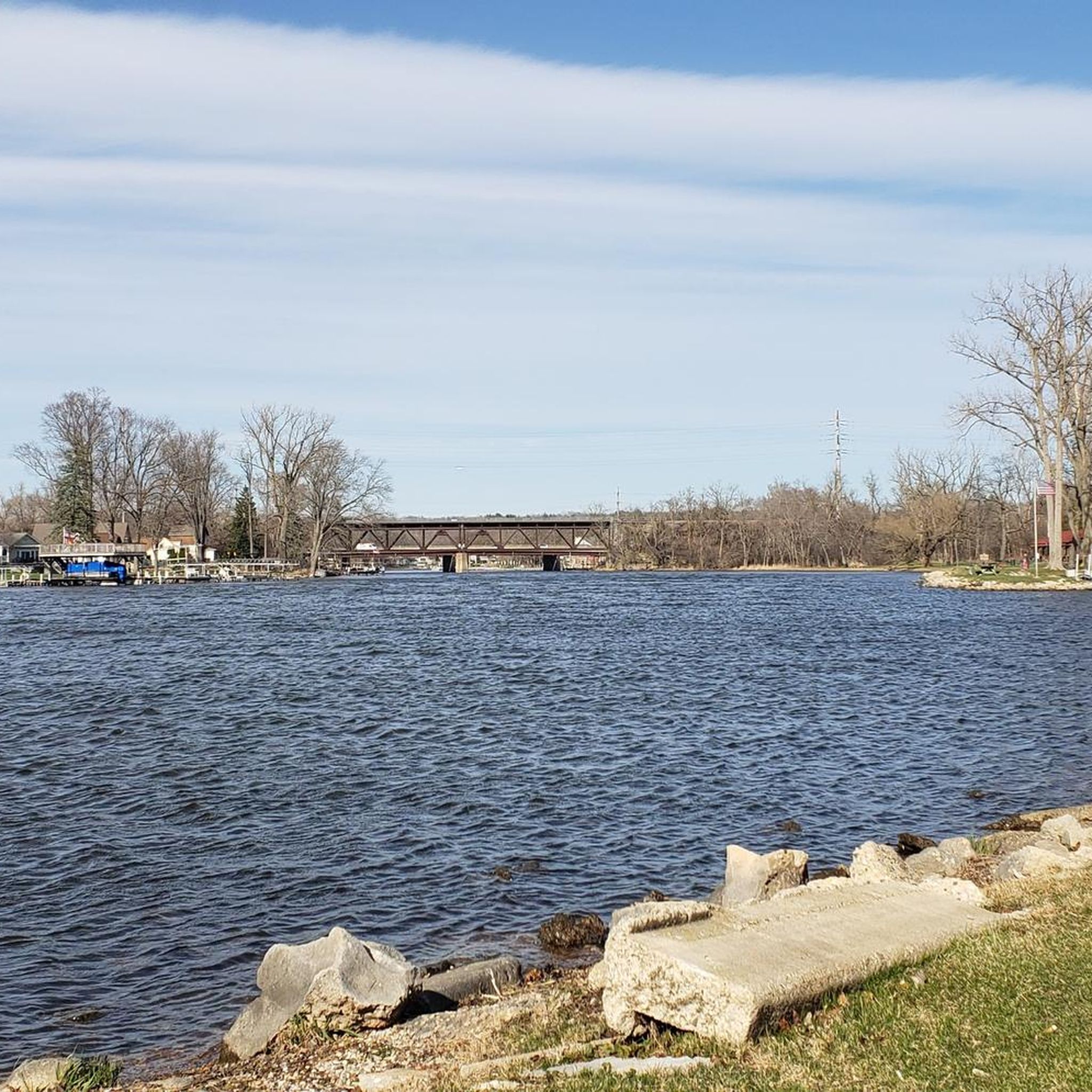
Yes, Cary has many easy routes, particularly along its extensive greenway system. For example, the Fox River view – Wooden Bridge Over Fox River loop from Algonquin is an easy 11.0-mile path with scenic views. The Black Creek Greenway and White Oak Creek Greenway also offer accessible, mostly flat sections suitable for beginners.
Where can I find longer or more challenging road cycling routes in Cary?
For longer and more challenging rides, consider routes that incorporate segments of the East Coast Greenway or extend into William B. Umstead State Park. These can offer significant elevation gain and cover distances like the 53.4-mile East Coast Greenway (NC) route mentioned in regional research. The Fox River view – Fox River loop from Crystal Lake is a moderate 32.2-mile route that provides a good challenge.
What scenic landmarks or natural features can I see along Cary's road cycling routes?
Cary's routes offer views of various natural features and parks. You can cycle past areas like Bond Park, Lake Crabtree, and Jordan Lake. The American Tobacco Trail provides pleasant paths through natural settings. For specific points of interest, consider visiting Lone Tree at Moraine Hills State Park or exploring Sterne's Fen Nature Preserve, which are accessible from routes in the wider region.
Are there any circular road cycling routes in Cary?
Yes, many of Cary's greenways and interconnected trails form excellent circular routes. For instance, the Crabtree Creek – Reedy Creek Multiuse Trail loop is a popular option. The Veteran Acres Park – Petersen Park Beach loop from Crystal Lake is another well-regarded circular route, covering 23.6 miles.
What do other road cyclists enjoy most about road cycling in Cary?
The area is highly rated by the komoot community, with an average score of 4.5 stars. Reviewers often praise the extensive network of paved greenways, the diverse landscapes from woodlands to lake views, and the variety of routes suitable for different skill levels.
Are Cary's road cycling routes suitable for families?
Absolutely. Cary's extensive network of paved greenways, such as the Black Creek Greenway and White Oak Creek Greenway, are ideal for family rides. Bond Park also features trails suitable for families, offering a safe and enjoyable environment for all ages.
What is the best time of year to go road cycling in Cary?
Cary offers pleasant cycling conditions for much of the year. Spring and fall generally provide the most comfortable temperatures and beautiful scenery. Summers can be warm and humid, so early morning or late afternoon rides are often preferred during those months.
Are there places to explore or attractions near the road cycling routes?
Many routes pass by or connect to Cary's numerous parks and natural areas. You can explore Raceway Woods Trails, visit the Stevens Nature Center at Hemlock Bluffs Nature Preserve, or enjoy the botanical gardens at Downtown Cary Park. Lake Crabtree and Jordan Lake also offer scenic views and recreational opportunities.
Where can I find parking for road cycling trails in Cary?
Many of Cary's parks and greenway access points offer dedicated parking. For example, Bond Park, Lake Crabtree County Park, and William B. Umstead State Park all provide parking facilities. Specific trailhead access points for major greenways also typically have parking available.
Are there any routes that offer views of lakes or water bodies?
Yes, several routes in and around Cary feature scenic lake views. The White Oak Creek Greenway connects to Lake Crabtree County Park, and other loops incorporate views of Jordan Lake. The Fox River view – Wooden Bridge Over Fox River loop from Algonquin also offers beautiful river scenery.
Most popular attractions around Cary

Get inspired with the komoot mobile app


Explore more
Browse the best Road cycling routes in other regions.
