The best road cycling routes around Wolfzahnau
4.6
(2776)
35,087
riders
825
rides
Road cycling routes around Wolfzahnau are characterized by the confluence of the Wertach and Lech rivers, flowing through a 76-hectare landscape protection area. The terrain primarily features floodplain forests, open meadows, and well-maintained river cycle paths. Elevations are generally low, making the area suitable for accessible road cycling. This region offers a mix of natural beauty and dedicated cycling infrastructure.
Best road cycling routes around Wolfzahnau
- The most popular road cycling route is View of Scherneck Castle – Lech Bridge…
Last updated: August 11, 2026
4.1
(7)
143
riders
Moderate road ride. Great for any fitness level. Some segments of this route may be unpaved and difficult to ride.
3.8
(5)
38
riders
27.3km
01:05
130m
130m
Easy road ride. Great for any fitness level. Mostly well-paved surfaces and easy to ride.

Sign up for free
39
riders
39.1km
01:32
110m
110m
Easy road ride. Great for any fitness level. Mostly well-paved surfaces and easy to ride.
4.5
(77)
680
riders
Moderate road ride. Good fitness required. Mostly well-paved surfaces and easy to ride.
4.4
(115)
749
riders
Easy road ride. Great for any fitness level. Mostly well-paved surfaces and easy to ride.
Get access to more routes and recommendations from other explorers.
Sign up for free
Already have an account?
Our route recommendations are based on thousands of hikes, rides, and runs completed by other people on komoot.
Start today with a free account
Your next adventure awaits.
Login or Signup
Tips from the Community

The Bismarck Tower Steppach was erected in honor of the first German Reich Chancellor Otto von Bismarck to commemorate his immortal work and the unification of Germany. The monument was initiated from 1901 by various student fraternities and a committee chaired by the Augsburg mayor Franz Gentner, who wanted to create a memorial for the "Iron Chancellor" dismissed in 1890. The tower was designed as a massive "fire column" made of Urach tuff stone, which originally served to ignite a fire on Bismarck's birthday (April 1st), and today offers a wide view over the city of Augsburg.
0
0


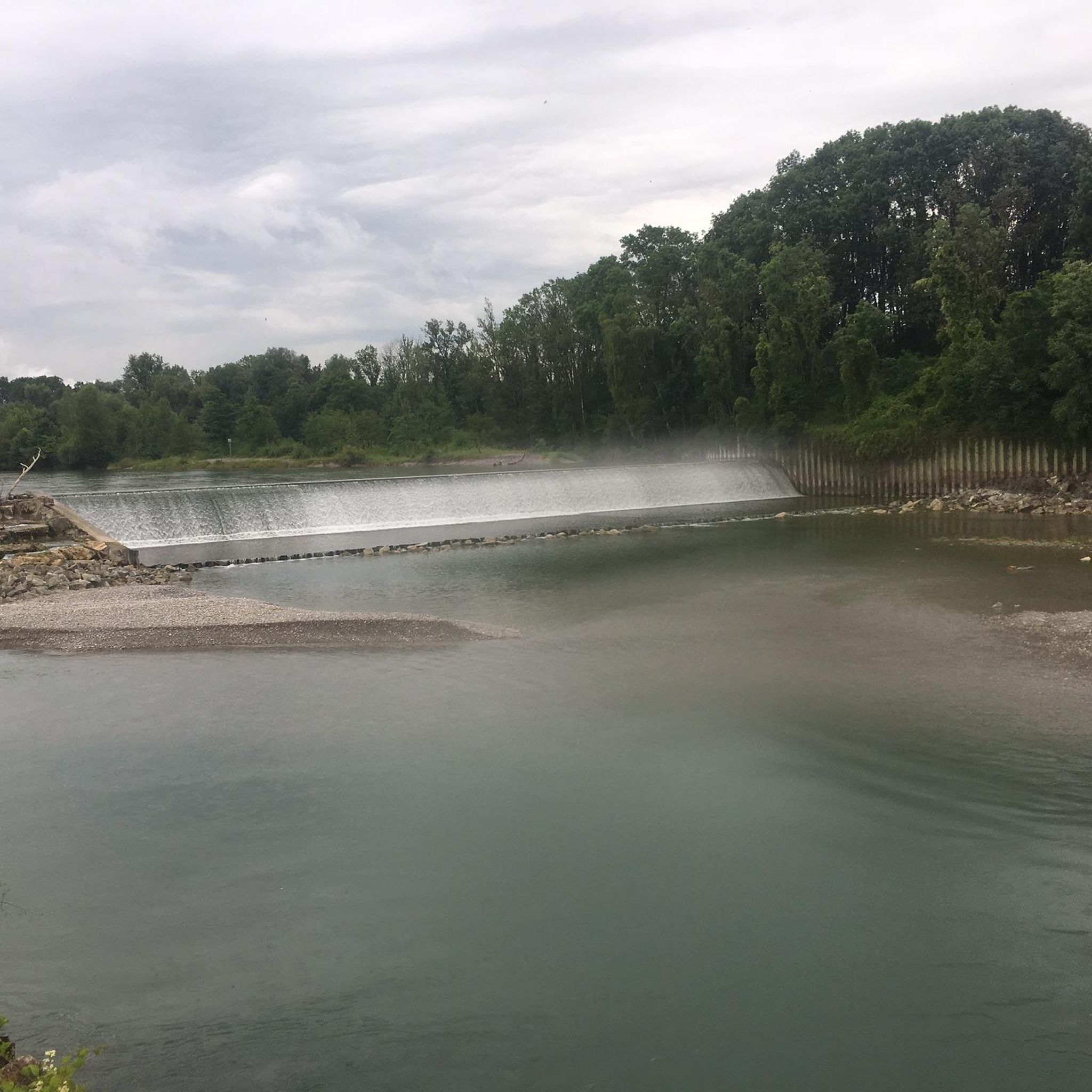
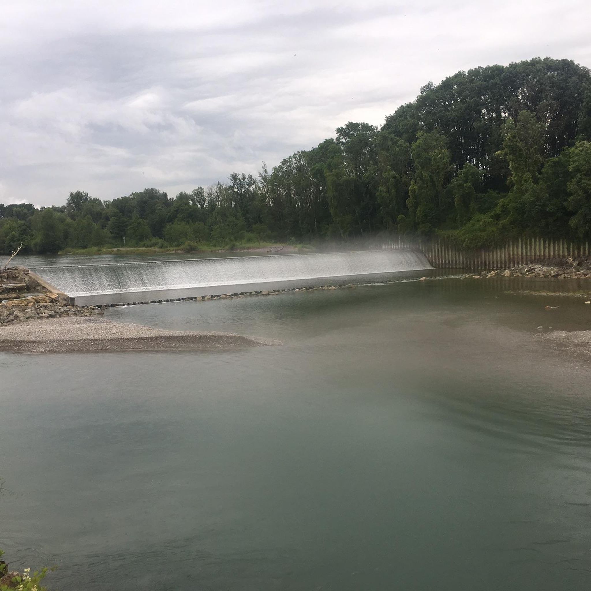
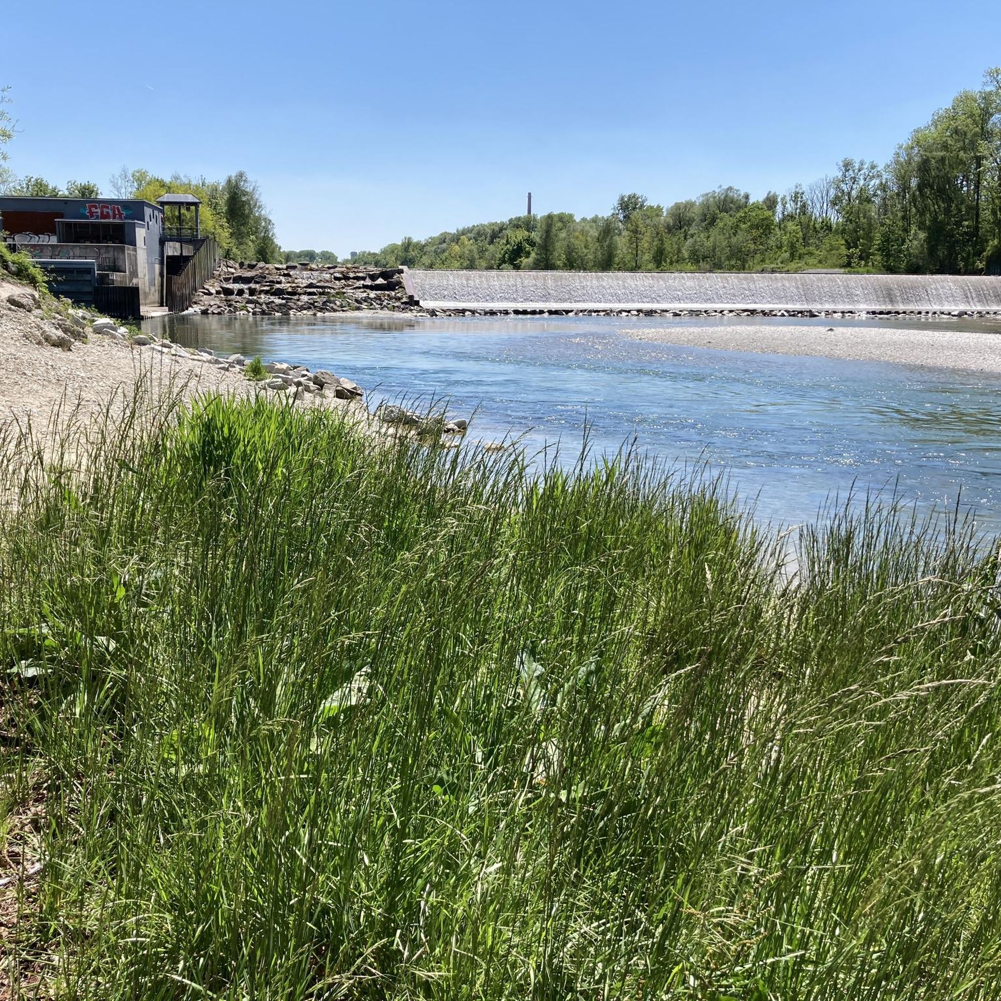
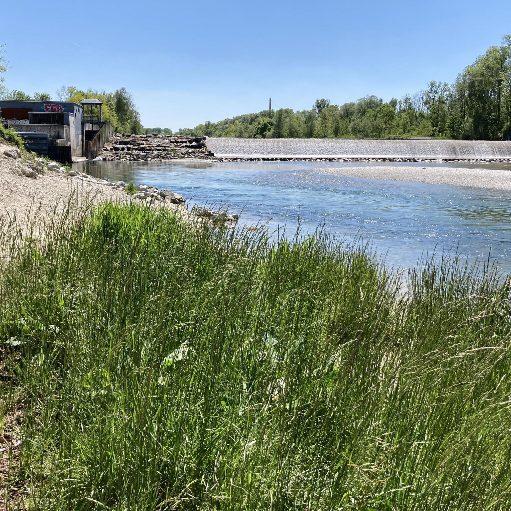
Depending on the water flow in the Lech, north of the weir in Gersthofen, the "river" is only fed by the water flowing through the fish ladder, with the water being primarily diverted into the Lech canal.😒
0
0

A beautiful 2.5km long path leads completely around the motorway lake. Numerous benches and sunbathing lawns invite you to linger. A children's playground, barbecue areas, toilets and a beer garden are also on site. Swimming in the lake is possible in summer.
2
0

The bike path is too short and narrow for a group ride.
0
0

A hall church with a recessed choir, the core of which is late Gothic. The southern tower has an onion dome.
0
0
Well-paved cycle path along the road between Achsheim and Langweid am Lech
0
0

The Lech is a right tributary of the Danube. The 256 km long river originates in Vorarlberg in the Hochtannberg region at the confluence of the Spullerbach and Formarinbach streams in the Tannläger valley. It flows through Tyrol and southern Bavaria, where it empties into the Danube. Shortly before the Austrian-German border, it joins the Vils river, forms the artificial Lechfall near Füssen, and crosses Swabia and Upper Bavaria on its way. The largest cities on the Lech are Landsberg and Augsburg; in this city, it receives its largest tributary, the Wertach. The river empties into the Danube near Marxheim. Source: Wikipedia
2
1
Frequently Asked Questions
How many road cycling routes are available in Wolfzahnau?
There are over 800 road cycling routes around Wolfzahnau listed on komoot, offering a wide variety of options for cyclists of all levels. This includes 212 easy routes, 562 moderate routes, and 30 more challenging options.
What is the typical terrain like for road cycling in Wolfzahnau?
The terrain in Wolfzahnau is generally flat to gently rolling, characterized by well-maintained river cycle paths along the Wertach and Lech rivers. You'll primarily cycle through floodplain forests and open meadows, making it suitable for accessible road cycling. The broader Augsburg Land offers a mix of terrain, but Wolfzahnau itself is largely low elevation.
Are there routes suitable for beginners or those looking for an easy ride?
Yes, Wolfzahnau offers numerous easy road cycling routes. For instance, the Lech Bridge – Church in Achsheim loop from Oberhausen is an easy 24.3-mile (39.1 km) path that navigates along the Lech river and through local villages, perfect for a relaxed ride.
What kind of natural features can I expect to see while cycling in Wolfzahnau?
Wolfzahnau is rich in natural beauty. You can witness the striking confluence of the Wertach and Lech rivers, where their distinct colors meet. The area is also home to the Wolfzahnau Nature Reserve, featuring diverse floodplain forests and open pastures where you might spot Scottish Highland cattle, introduced to maintain the varied plant structure.
Are there any historical landmarks along the cycling routes?
Yes, an impressive historical landmark is the Wolfzahnau Hydroelectric Power Plant. Built in 1902, it was Augsburg's first station to generate electricity for industrial use and continues to operate today. While privately owned, it's a notable sight along many cycling routes.
What do other cyclists say about road cycling in Wolfzahnau?
The road cycling routes in Wolfzahnau are highly rated by the komoot community, with an average score of 4.6 stars from over 2,100 reviews. Cyclists often praise the well-maintained river paths, the scenic views of the river confluence, and the peaceful atmosphere of the floodplain forests.
Are there any circular road cycling routes in Wolfzahnau?
Yes, many routes in Wolfzahnau are designed as loops, offering convenient circular rides. An example is the popular View of Scherneck Castle – Lech Bridge loop from Oberhausen, a 19.7-mile (31.7 km) route that provides scenic views and follows the Lech river.
What is the best time of year to go road cycling in Wolfzahnau?
Wolfzahnau is enjoyable for road cycling throughout much of the year. Spring and autumn offer pleasant temperatures and beautiful foliage, while summer provides longer daylight hours. Winter conditions can vary, so it's advisable to check local weather forecasts for ice or snow before heading out.
Is Wolfzahnau suitable for family-friendly road cycling?
Yes, the generally flat terrain and extensive network of well-maintained paths along the rivers make Wolfzahnau very suitable for family-friendly road cycling. The absence of significant elevation changes ensures a comfortable experience for all ages and fitness levels.
How can I get to the road cycling routes in Wolfzahnau using public transport?
Wolfzahnau is located in the northern part of Augsburg, which has good public transport connections. You can typically reach the area by bus or tram from Augsburg city center, with stops conveniently located near access points to the cycling paths. It's recommended to check local public transport schedules for the most current information.
Where can I park my car when visiting Wolfzahnau for road cycling?
There are usually designated parking areas available at various entry points to the Wolfzahnau landscape protection area. These are often found near major access roads or trailheads, providing convenient starting points for your road cycling adventure.
Are there any longer, more challenging routes for experienced road cyclists?
While Wolfzahnau itself is largely flat, the broader Augsburg Land offers more challenging options. Within the immediate area, routes like the Weldenbahn Cycle Path – Weldenbahn Cycle Path Section loop from Augsburg-Oberhausen, at 30 miles (48.3 km) with over 300 meters of elevation gain, provide a moderate challenge for experienced riders.
Can I find places to eat or drink along the road cycling routes?
While Wolfzahnau is a nature protection area, its proximity to Augsburg means you can find cafes and restaurants in nearby districts or villages. Many cyclists plan their routes to pass through these areas for refreshment stops. It's always a good idea to carry water and snacks, especially on longer rides.
Most popular routes around Wolfzahnau
Most popular attractions around Wolfzahnau

Get inspired with the komoot mobile app


Explore more
Browse the best Road cycling routes in other regions.
