The best MTB trails around Aubinger Lohe
4.5
(1975)
8,250
riders
643
rides
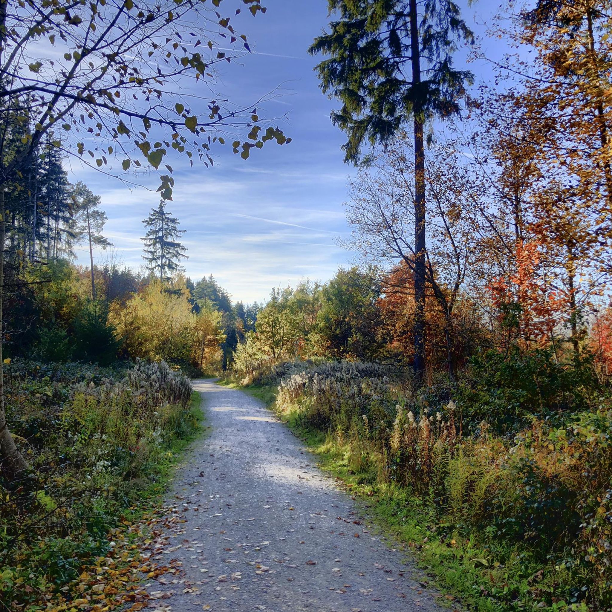
Mountain biking around Aubinger Lohe offers a network of trails through a forested area on the western edge of Munich. The region is characterized by its flat to gently rolling terrain, featuring dense woodlands, open fields, and several lakes and rivers. Aubinger Lohe mountain bike trails difficulty ranges from easy to moderate, making it accessible for various skill levels. The landscape provides a mix of natural paths and well-maintained cycle routes.
Best mountain bike trails around Aubinger Lohe
- The most…
Last updated: October 9, 2026
4.8
(13)
40
riders
46.3km
03:17
310m
310m
Hard mountain bike ride. Good fitness required. Advanced riding skills necessary. Some portions of the route may require you to push your bike.
4.7
(6)
14
riders
35.7km
01:58
80m
80m
Easy mountain bike ride. Great for any fitness level. Suitable for all skill levels.

5.0
(3)
10
riders
20.9km
01:19
50m
50m
Easy mountain bike ride. Great for any fitness level. Suitable for all skill levels.
5.0
(1)
8
riders
26.5km
01:44
80m
80m
Easy mountain bike ride. Great for any fitness level. Suitable for all skill levels.
3.2
(5)
10
riders
53.0km
02:55
120m
120m
Moderate mountain bike ride. Good fitness required. Suitable for all skill levels.
Get access to more routes and recommendations from other explorers.
Already have an account?
Our route recommendations are based on thousands of hikes, rides, and runs completed by other people on komoot.
Start today with a free account
Your next adventure awaits.
Tips from the Community

Schloss Blutenburg is located quietly in today's Munich district of Pasing and, with its towers, bridges, and moat, looks almost like a fairytale castle. But behind the old walls lies a history that goes back many centuries. As early as the 13th century, a small moated castle stood on this site. Later, Duke Albrecht III of Bavaria had the complex expanded into a hunting and country residence. However, Blutenburg became particularly famous for the tragic love story between Albrecht and the barber's daughter Agnes Bernauer. According to legend, Agnes lived at Blutenburg for a time. Her relationship with the Duke was considered a scandal at the time, and her fate remains one of Bavaria's best-known stories to this day. In the 15th century, under Duke Sigismund of Bavaria, Blutenburg acquired its present appearance. He had the castle rebuilt into a magnificent palace with high walls, a courtyard, and a late Gothic castle chapel. The chapel, in particular, with its ornate altar, is still considered one of the most beautiful late Gothic structures in Munich. For many centuries, Blutenburg served as a hunting lodge and retreat for the Wittelsbachs. Today, it is a peaceful place full of history, surrounded by water, old trees, and small paths — a piece of medieval Bavaria in the middle of the big city.
0
0

In former times, the castle chaplain pastorally looked after the small village of Kemnaten (that was the name of Nymphenburg before the castle was built). As the city grew more and more into this area, the court curacy was elevated to a parish in 1922. Since the castle chapel also became too small, the Munich architect August Blössner was commissioned to build a new church. In 1930 it was completed, with an external appearance strongly oriented towards Baroque building traditions. Destroyed in the Second World War, the church was rebuilt in a much simpler way from 1947 to 1950.
14
0
The view of the castle canal from the Ludwig Ferdinand Bridge on the city side clearly shows the dimensions of the monumental three-winged complex of Nymphenburg Palace. From 1715 to 1918, it was the summer residence of the Electors, then of the Kings of Bavaria from the House of Wittelsbach. Nymphenburg is one of the largest palaces in Germany.
12
0
The iron and reinforced concrete arch bridge over the Nymphenburg Palace Canal connects Notburgastraße with Menzinger Straße. To its right and left, the Northern and Southern Drive Avenues lead to the palace. From the apex of the bridge, there is a direct view of Nymphenburg Palace. In 1892, the Ludwig-Ferdinand Bridge was built according to the plans of architect Friedrich von Thiersch as a single-arch road bridge with a span of 17.30 meters. It was Munich's first reinforced concrete arch. In 1914, the bridge was widened by 8.80 meters to accommodate tram tracks. In 1956, the bridge was significantly altered and widened again to a total of 33 meters, and in 1992 it was renovated. Today, four traffic lanes, a double tram track in between, turning lanes, as well as bicycle and pedestrian paths on both sides cross the Nymphenburg Palace Canal here. The bridge is named after Prince Ludwig Ferdinand of Bavaria (1859 to 1949), a doctor and artist from the House of Wittelsbach.
13
0

Beautiful park to linger, great cycling route, nice for chilling
1
0

Beautifully landscaped castle park :)
1
0

Christkönig is a Catholic parish church in the Munich district of Neuhausen-Nymphenburg. The town parish church Christkönig is located in Nymphenburg at Notburgastraße, corner of Prinzenstraße, a few meters from the castle canal. The postal address of the parish office directly on the church square is: Notburgastraße 15, 80639 Munich. The old village church of Kemnaten, as Nymphenburg was originally called, had to make way for the expansion of Nymphenburg Palace, begun by Elector Max Emanuel in 1701. The people living in and around the palace were initially cared for pastorally by Capuchins, and in the 19th century by curates (Hofkuratie Nymphenburg). The palace chapel also served as a place of worship for the local population. It was only when the city of Munich expanded around the turn of the 20th century and the population of Nymphenburg grew significantly – Nymphenburg was incorporated into Munich in 1899 – that a church building association was founded. After delays due to war and inflation, the town parish of St. Magdalena was founded in 1922, and the church was finally built between 1928 and 1930. As had been planned for a long time, the name of the parish was changed to Christkönig in 1936. On February 25, 1945, the church was destroyed by a bombing raid. Between 1947 and 1950, it was rebuilt under the direction of Sep Ruf and renovated in 1977. Pastors of Christkönig Wilhelm Lurz (1902–1990), pastor at Christkönig from 1942 Josef Maß (1936–2006), pastor at Christkönig (1973–2006) .... Source: https://de.wikipedia.org/wiki/Christk%C3%B6nig_(M%C3%BCnchen)
3
1
Christkönig is a Catholic parish church in the Munich district of Neuhausen-Nymphenburg. The city parish church Christkönig is located in Nymphenburg at the corner of Notburgastraße and Prinzenstraße, a few meters from the Nymphenburg Palace Canal. The postal address of the parish office directly on the church square is: Notburgastraße 15, 80639 Munich. The old village church of Kemnaten, as Nymphenburg was originally called, had to make way for the expansion buildings of Nymphenburg Palace, begun by Elector Max Emanuel in 1701. The people living in and around the palace were initially cared for pastorally by Capuchins, and in the 19th century by curates (Hofkuratie Nymphenburg). The palace chapel also served the local population as a place of worship. Only when the city of Munich expanded around the turn of the 20th century and the Nymphenburg population grew sharply – Nymphenburg was incorporated into Munich in 1899 – was a church building association founded. After delays due to war and inflation, the city parish of St. Magdalena was founded in 1922, and the church was finally built between 1928 and 1930. As had been planned for some time, the name of the parish was changed to Christkönig in 1936. On February 25, 1945, the church was destroyed by a bombing raid. In the years 1947 to 1950, it was rebuilt under the direction of Sep Ruf and renovated in 1977. Pastors of Christkönig Wilhelm Lurz (1902–1990), pastor in Christkönig from 1942 Josef Maß (1936–2006), pastor in Christkönig (1973–2006) ..... Source: https://de.wikipedia.org/wiki/Christk%C3%B6nig_(M%C3%BCnchen)
0
0
Frequently Asked Questions
What is the general difficulty level of mountain bike trails in Aubinger Lohe?
The mountain bike trails in Aubinger Lohe primarily range from easy to moderate. Out of over 650 available routes, approximately 257 are rated as easy, and 372 are moderate. There are also about 21 more challenging routes for experienced riders.
Are there family-friendly mountain bike trails in Aubinger Lohe?
Yes, Aubinger Lohe offers several family-friendly mountain bike trails. The terrain is generally flat to gently rolling, making it suitable for riders of various ages and skill levels. Many routes feature well-maintained paths through woodlands and open fields, ideal for a relaxed family outing.
What are the typical lengths of mountain bike trails in Aubinger Lohe?
Trail lengths in Aubinger Lohe vary, but many popular routes are between 10 to 25 miles (16 to 40 km). For example, the Langwieder Lake – Lußsee loop from Lochhausen is about 10 miles (16.3 km), while the Olchinger See – View of the Amper loop from Lochhausen extends to about 23.3 miles (37.6 km).
Is there parking available for mountain bikers in Aubinger Lohe?
Yes, there are designated parking areas. For instance, the Aubinger Lohe South Car Park is a convenient option for accessing the trails.
Can I reach the mountain bike trails in Aubinger Lohe by public transport?
Aubinger Lohe is located on the western edge of Munich and is generally accessible by public transport. You can typically reach the area via S-Bahn lines (e.g., S3 or S4 to Lochhausen) or local bus services, followed by a short ride to the trailheads. It's advisable to check specific connections depending on your starting point.
When is the best time of year to go mountain biking in Aubinger Lohe?
The best time for mountain biking in Aubinger Lohe is generally from spring to autumn (April to October). During these months, the weather is usually pleasant, and the trails are dry and well-maintained. While possible, winter riding can be challenging due to snow and ice, especially on unpaved sections.
Are there many circular mountain bike routes in Aubinger Lohe?
Yes, the majority of mountain bike routes in Aubinger Lohe are circular, offering convenient loops that bring you back to your starting point. This allows for varied exploration without needing to retrace your steps. An example is the Forest trail at Teufelsberg – Cycle Path Along Gröbenbach loop from Lochhausen.
What interesting sights or landmarks can I see along the mountain bike trails in Aubinger Lohe?
Beyond the natural beauty of the woodlands and fields, you can encounter several points of interest. These include the Aubinger Lohe forest itself, the historic Aubinger Burgstall (Teufelsburg), and the tranquil Ziegelweiher lake. There's also a sledding hill near Gröbenzell which offers views.
What do other mountain bikers appreciate about Aubinger Lohe?
The komoot community highly rates Aubinger Lohe, with an average score of 4.5 stars from over 1600 reviews. Riders often praise the diverse landscape, which includes dense woodlands, open fields, and scenic lake and river paths. The accessibility for various skill levels and the well-maintained network of trails are also frequently highlighted.
How many mountain bike trails are available in Aubinger Lohe?
There are over 650 mountain bike trails available for exploration in Aubinger Lohe, offering a wide variety of options for different preferences and skill levels.
Are there cafes or places to eat near the Aubinger Lohe mountain bike trails?
While the immediate trail areas are primarily natural, the Aubinger Lohe is situated close to the residential areas of Munich's western districts. You'll find various cafes, restaurants, and beer gardens in nearby towns and neighborhoods like Lochhausen or Aubing, typically a short ride away from the main trailheads.
What kind of wildlife might I encounter on the Aubinger Lohe trails?
As a forested area on the outskirts of Munich, Aubinger Lohe is home to typical Central European forest wildlife. You might spot various bird species, squirrels, rabbits, and occasionally deer. Maintaining a respectful distance and keeping noise levels down increases your chances of observing local fauna.
Most popular routes around Aubinger Lohe
Most popular attractions around Aubinger Lohe

Get inspired with the komoot mobile app


Explore more
Browse the best MTB trails in other regions.
