The best mountain hikes around Ljótipollur
5.0
(7)
88
hikers
6
hikes
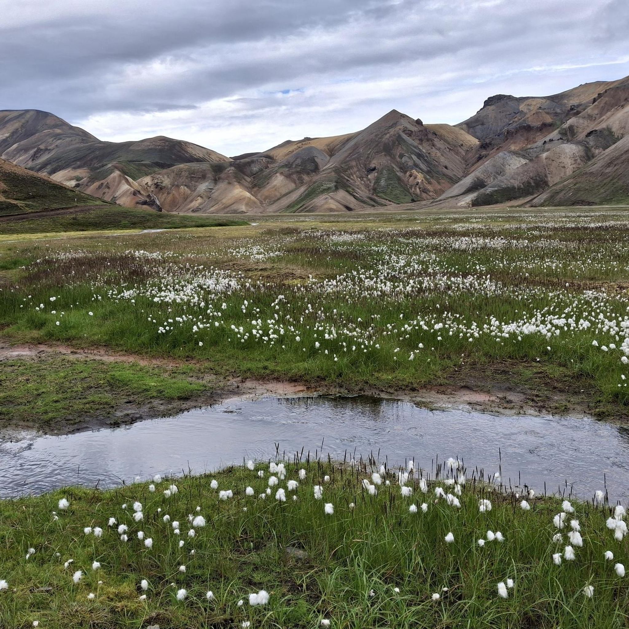
Mountaineering routes around Ljótipollur explore a unique volcanic landscape in the Icelandic Highlands. The region is characterized by a vibrant crater lake, Ljótipollur, enclosed by steep walls of red and black volcanic rock. Surrounding this are rugged volcanic terrain, ancient lava fields, and colorful rhyolite mountains, all part of the Torfajökull volcanic system. This area presents challenging and rewarding terrain for mountaineers, offering panoramic views of the vast Highlands and distant glaciers.
Best mountaineering routes around Ljótipollur
- The most popular…
Last updated: November 12, 2026
17
hikers
6.94km
02:20
180m
180m
Hard mountaineering route. Good fitness required. Sure-footedness, sturdy shoes and alpine experience required.
5.0
(2)
24
hikers
9.90km
04:12
460m
470m
Hard mountaineering route. Good fitness required. Sure-footedness, sturdy shoes and alpine experience required.

5.0
(3)
18
hikers
Hard mountaineering route. Good fitness required. Sure-footedness, sturdy shoes and alpine experience required.
5.0
(1)
16
hikers
6.35km
02:44
280m
280m
Hard mountaineering route. Good fitness required. Sure-footedness, sturdy shoes and alpine experience required.
5
hikers
Hard mountaineering route. Good fitness required. Sure-footedness, sturdy shoes and alpine experience required.
Our route recommendations are based on thousands of hikes, rides, and runs completed by other people on komoot.
Start today with a free account
Your next adventure awaits.
Popular around Ljótipollur
Tips from the Community

The best-stocked shop on the route
0
0

great view
0
0

Both tributaries are very hot, but the water cools down considerably after a few meters. Very crowded! No changing rooms: you have to make do with the towel you brought with you.
0
0
In a large tent you can warm yourself up a bit and enjoy the snacks you brought with you.
1
2
Here you can find warm drinks and simple food.
0
0

Campsite with showers, beautiful hot pot to soak in, plenty of popular hiking trails, a bus selling all the essentials and hot dogs / coffee!
1
0

Landmannalaugar is always worth a visit and from the top you have a great view of the entire valley.
0
0
Great glacier foothills and a great place to relax for a while (as long as the weather plays along).
0
0
Frequently Asked Questions
How many mountaineering routes are available around Ljótipollur?
There are over 5 mountaineering routes detailed around Ljótipollur, all offering challenging experiences through the unique volcanic landscape of the Icelandic Highlands.
What kind of terrain can I expect on mountaineering routes near Ljótipollur?
The terrain around Ljótipollur is characterized by a rugged mix of volcanic rock, ancient lava fields, and colorful rhyolite mountains. You'll encounter steep, rugged walls of red and black volcanic rock, especially around the crater lake itself, and experience the powerful geological forces of the Torfajökull volcanic system.
Are there any easy mountaineering routes suitable for beginners in the Ljótipollur area?
The mountaineering routes listed for the Ljótipollur area are generally considered difficult, catering to experienced mountaineers. While there might be easier walking paths to the crater's edge, the featured routes involve challenging climbs and significant elevation changes.
What are some notable landmarks or viewpoints I can expect to see on these routes?
From the crater's rim, you'll be treated to awe-inspiring panoramic views of the vast Icelandic Highlands. On clear days, distant glaciers like Vatnajökull and Langjökull are visible, along with sights such as Lake Frostastaðavatn and the winding Tungnaá river. Many routes also feature the vibrant Ljótipollur Crater Lake itself, with its striking deep blue or turquoise hue.
Are there any circular mountaineering routes available?
Yes, several routes are circular. For example, you can explore the area's geothermal features on the Reykjadalur Hot Springs loop from Landmannalaugar, or take the Bláhnúkur Summit – Landmannalaugar Hiking Area loop from Kirkjubæjarklaustur for expansive views.
What is the best time of year for mountaineering around Ljótipollur?
The best time for mountaineering is typically during the summer months when the trails are clear of snow and the weather is more stable. However, the region's dramatic geological contrasts make it highly photogenic, especially during sunrise and sunset, and the red and black hues can even peek through winter snow, offering a unique experience for winter mountaineering or cross-country skiing.
Is the Ljótipollur area suitable for family-friendly mountaineering or hiking?
While the featured mountaineering routes are rated as difficult, the Ljótipollur area does offer a range of hiking opportunities with varying difficulty levels. For families, it's advisable to seek out shorter, less strenuous trails to the crater's edge rather than the challenging mountaineering routes listed here, which require more experience and fitness.
What about public transport and parking for accessing these routes?
Access to Ljótipollur often requires a 4x4 vehicle for certain sections. While specific public transport options directly to the trailheads are limited, Ljótipollur can be reached via guided tours or as part of a multi-day trek from the nearby Landmannalaugar mountain hut. Parking availability varies by trailhead, and it's recommended to research specific access points for your chosen route.
What makes the mountaineering experience around Ljótipollur unique?
The Ljótipollur area offers an immersive geological journey. You'll traverse explosion craters, ancient lava fields, and vibrant rhyolite mountains, all part of a powerful volcanic system. The striking contrast of the deep blue crater lake against the red and black volcanic rock, combined with geothermal activity and panoramic views of the vast Highlands, creates a truly unique and challenging mountaineering experience.
Are there any routes that specifically highlight the geothermal activity in the region?
Yes, routes like the View of Landmannalaugar – Reykjadalur Hot Springs loop from Landmannalaugar and the Reykjadalur Hot Springs – View of Landmannalaugar loop from Landmannalaugar will lead you through areas known for their geothermal features, allowing you to experience the powerful geological forces firsthand.
What do other mountaineers enjoy most about the Ljótipollur routes?
The area is highly rated by the komoot community, with an average score of 5.0 stars. Mountaineers often praise the dramatic geological contrasts, the stunning views of the Icelandic Highlands, and the challenging yet rewarding terrain that offers a more tranquil and intimate experience compared to some of the more frequented trails in the region.
Most popular routes around Ljótipollur

Get inspired with the komoot mobile app


Explore more
Browse the best Mountain Hikes & Routes in other regions.
