The best running trails around Cow Green Reservoir
4.0
(1)
67
runners
6
runs
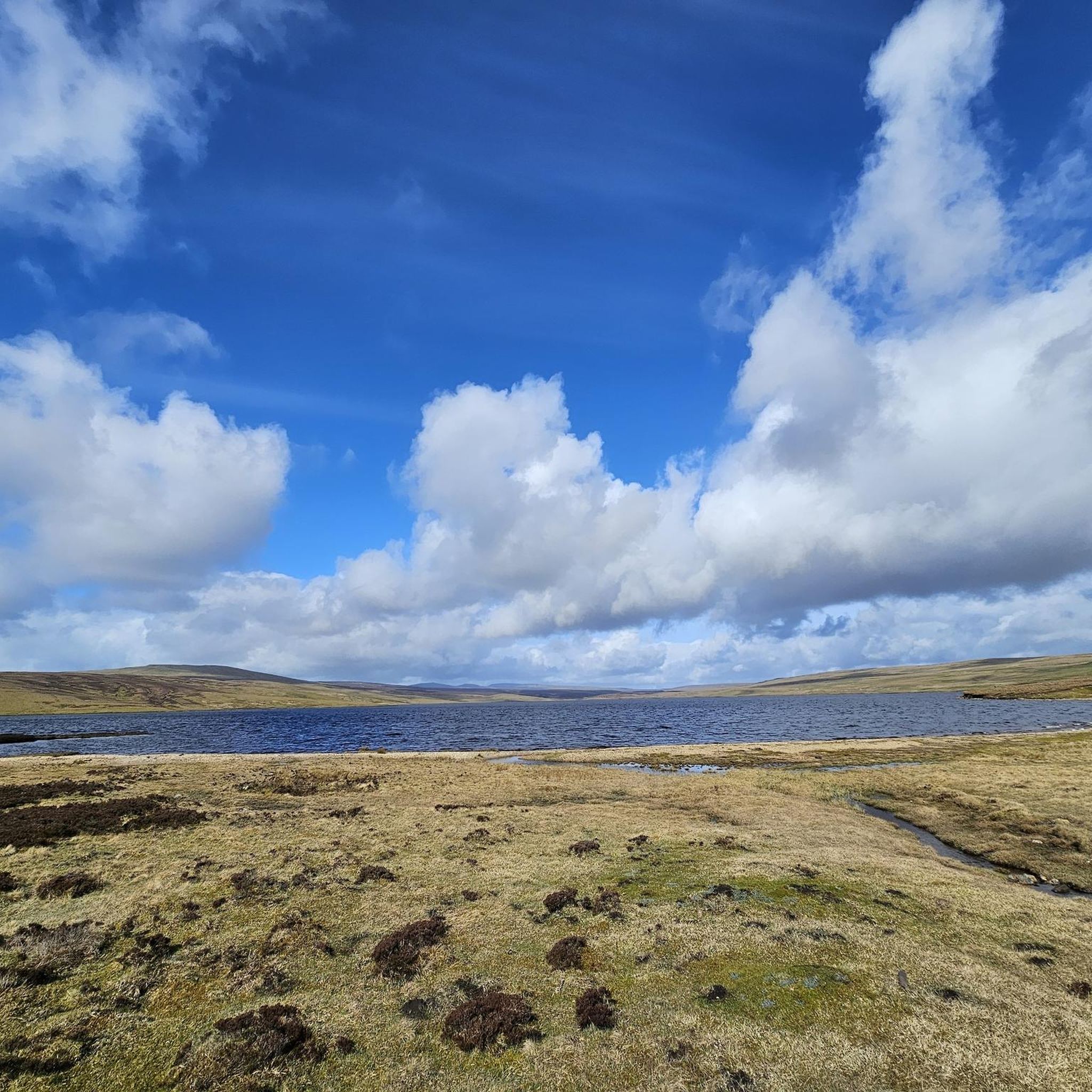
Jogging around Cow Green Reservoir offers diverse landscapes, from wild moorland and the desolate Widdybank Fell to the dramatic Cauldron Snout waterfall. The area features a mix of hard stony tracks and tarred roads around the reservoir shores, providing varied terrain for runners. The nascent River Tees meanders through the valley, offering pleasant riverside sections and impressive views. This region, part of the Moor House-Upper Teesdale National Nature Reserve, is characterized by its high-altitude environment and unique geological formations.
Best…
Last updated: October 2, 2026
4.0
(1)
13
runners
14.7km
01:36
160m
160m
Hard run. Good fitness required. Sure-footedness, sturdy shoes and alpine experience required.
26
runners
21.7km
02:32
320m
320m
Hard run. Very good fitness required. Mostly paved surfaces. Suitable for all skill levels.

3
runners
17.8km
02:14
490m
490m
Hard run. Very good fitness required. Mostly paved surfaces. Suitable for all skill levels.
2
runners
Moderate run. Good fitness required. Mostly paved surfaces. Suitable for all skill levels.
9
runners
12.3km
01:25
200m
200m
Moderate run. Good fitness required. Mostly paved surfaces. Suitable for all skill levels.
Our route recommendations are based on thousands of hikes, rides, and runs completed by other people on komoot.
Start today with a free account
Your next adventure awaits.
Popular around Cow Green Reservoir
Tips from the Community

Best views from the north side of the river i.e. before crossing Wynch bridge
0
0

This is among the more interesting of the bridges that cross the river Tees. This suspension footbridge owes its existence to the Holwick lead miners who used it to get to the lead mine at Little Eggleshope in the fells to the north.
0
0
Low Force is a beautiful spot. With a series of low cascades, it is not as dramatic as nearby High Force, but it is an area still worth visiting. You can park nearby at Bowlees Visitor Centre, which has a decent car park with a donations payment box.
0
0

Housed in a former Methodist chapel, it serves as a central hub for hikers and families visiting the Upper Teesdale area.
0
0
The waterfall is fed by the Cow Green Reservoir, with water running over a dam wall and then plunging into the river.
0
0

Nice cafe in a converted church serving coffees, soup, sandwiches and a range of cakes. Good refuelling point.
0
0

it more of a long cataract than a waterfall and at 200 yards long ,reckoned to be the longest waterfall in England . keep away from the edges cos can be very slippery when wet .
1
0

Frequently Asked Questions
How many running routes are available around Cow Green Reservoir?
There are over 7 dedicated running routes around Cow Green Reservoir listed on komoot, offering a variety of experiences for different fitness levels.
What kind of terrain can I expect on the jogging routes around Cow Green Reservoir?
You can expect a diverse mix of terrain, including hard stony tracks, tarred roads around the reservoir shores, and sections of wild moorland. Some paths, particularly near Cauldron Snout, may involve scrambling, adding an adventurous element to your run.
Are there any challenging running trails for experienced joggers?
Yes, the area features 4 difficult routes for experienced runners. For example, the Cow Green Reservoir and Dam – High Cup Nick loop from Cow Green Reservoir is a challenging 13.5-mile (21.7 km) path offering extensive views.
What natural landmarks or features can I see while jogging around Cow Green Reservoir?
Joggers can encounter spectacular natural features such as the Cauldron Snout waterfall, where the River Tees plunges over 60 meters. You'll also experience the dramatic heather hillscapes of Widdybank Fell, unique geological formations like the Great Whin Sill, and pleasant riverside sections along the nascent River Tees.
Are there any circular running routes available?
Yes, several circular routes are available. A notable one is the Cow Green & Cauldron Snout — North Pennines route, which is a 9.2-mile (14.7 km) loop passing the dam and the spectacular Cauldron Snout.
Is Cow Green Reservoir suitable for dog-friendly runs?
The area is generally dog-friendly, but as it's part of the Moor House-Upper Teesdale National Nature Reserve, it's crucial to keep dogs on a lead to protect the rare Arctic and Alpine plants and local wildlife, especially ground-nesting birds and grazing Swaledale sheep.
What makes the Cow Green Reservoir area unique for nature lovers?
The reservoir is within an internationally important National Nature Reserve, renowned for its rare Arctic and Alpine plants that survived since the last Ice Age. The unique Teesdale violet is also found here. The area's geology, including outcropping sugar limestone, adds to its distinct natural character.
Where can I park when visiting Cow Green Reservoir for a run?
There is a car park available at Cow Green Reservoir. Informational panels at the car park describe the reserve's geology, vegetation, animal life, and climate.
What do other runners say about the trails at Cow Green Reservoir?
The komoot community highly rates the running trails around Cow Green Reservoir, with an average score of 4.0 stars. Over 70 runners have explored the varied terrain, often praising the wild moorland scenery and the dramatic Cauldron Snout waterfall.
What is the best time of year to go jogging in this region?
The high-altitude environment means a cool climate, similar to Reykjavik, Iceland, making it pleasant for jogging during warmer months. The area is also recognized as a 'dark sky friendly site,' offering excellent opportunities for stargazing after an evening run.
Are there any routes that offer extensive views of the reservoir?
Yes, the Cow Green Reservoir and Dam – High Cup Nick loop from Cow Green Reservoir is a popular option that provides extensive views of the reservoir and its dam.
How can I protect the unique environment while jogging in the nature reserve?
To protect the fragile Arctic and Alpine plants and local wildlife, visitors are asked to keep to the paths. This helps maintain the delicate botanical balance of the Moor House-Upper Teesdale National Nature Reserve.
Are there any moderate running routes available?
Yes, there are 3 moderate routes. For example, the High Force Waterfall – Footbridge over the River Tees loop from Youth Hostel is a moderate 10.9-mile (17.6 km) route that takes you past the impressive High Force Waterfall.
Most popular routes around Cow Green Reservoir

Get inspired with the komoot mobile app


Explore more
Browse the best Running Trails & Routes in other regions.
