The best walks and hikes around Silent Valley Reservoir
4.5
(1241)
9,640
hikers
135
hikes
Hiking around Silent Valley Reservoir offers routes through the Mourne Mountains, characterized by the large reservoir itself, surrounding hills, and open moorland. The area features varied terrain, from gentle paths along the water's edge to more challenging ascents into the higher elevations of the Mournes. This landscape provides a mix of sheltered valleys and exposed mountain trails.
Best hiking trails around Silent Valley Reservoir
- The most popular hiking route is Slieve Binnian & Wee Binnian loop from Silent Valley Reservoir…
Last updated: August 5, 2026
4.0
(3)
6
hikers
15.8km
05:19
740m
750m
Hard hike. Very good fitness required. Easily-accessible paths. Suitable for all skill levels.
4.5
(2)
30
hikers
34.7km
12:53
2,220m
2,230m
Hard hike. Very good fitness required. Easily-accessible paths. Suitable for all skill levels.

Sign up for free
4.4
(14)
200
hikers
10.4km
02:45
100m
100m
Moderate hike. Good fitness required. Easily-accessible paths. Suitable for all skill levels.
4.1
(12)
72
hikers
14.0km
04:46
650m
640m
Moderate hike. Good fitness required. Easily-accessible paths. Suitable for all skill levels.
26
hikers
6.86km
01:56
140m
140m
Easy hike. Great for any fitness level. Easily-accessible paths. Suitable for all skill levels.
Get access to more routes and recommendations from other explorers.
Sign up for free
Already have an account?
Our route recommendations are based on thousands of hikes, rides, and runs completed by other people on komoot.
Start today with a free account
Your next adventure awaits.
Login or Signup
Tips from the Community

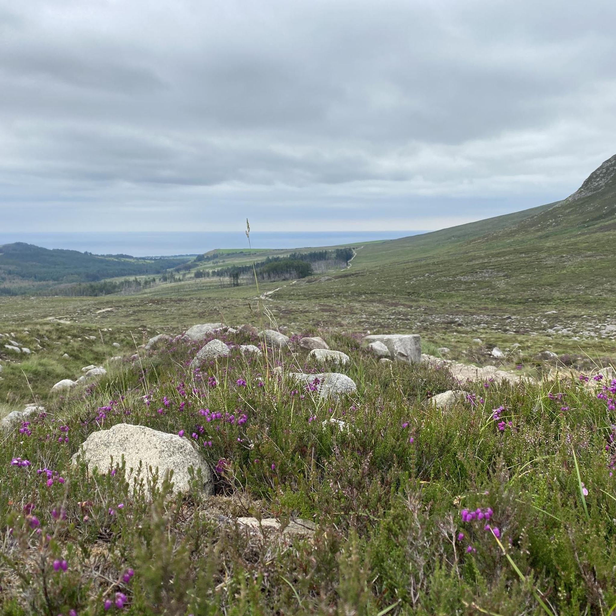
Near the Silent Valley reservoir you can hike wonderfully through beautiful, extensive heathland, with views of the 35 km long Mourne Wall through the Mourne Mountains and the sea in the distance.🐑☘️🍺🏰😀
0
0
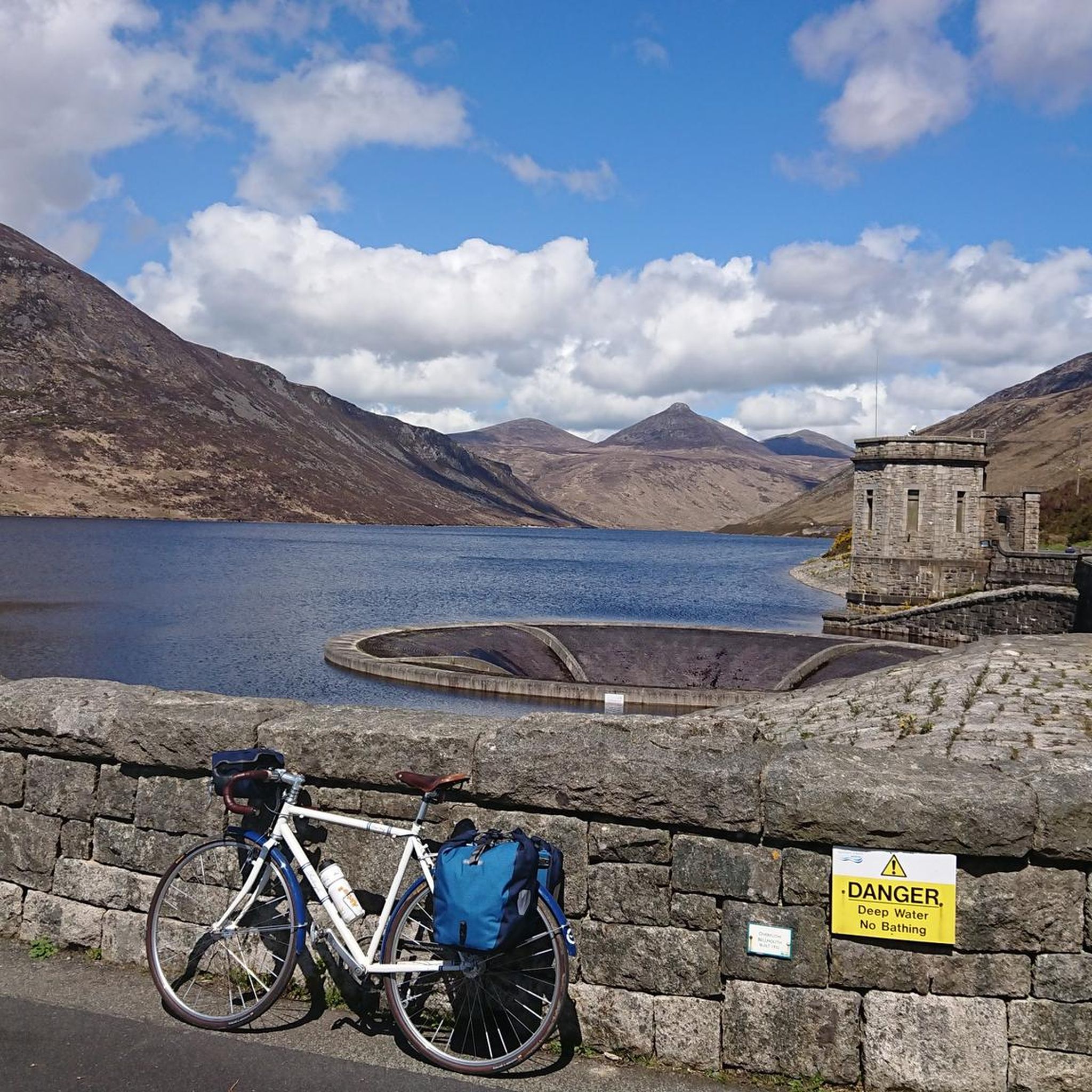
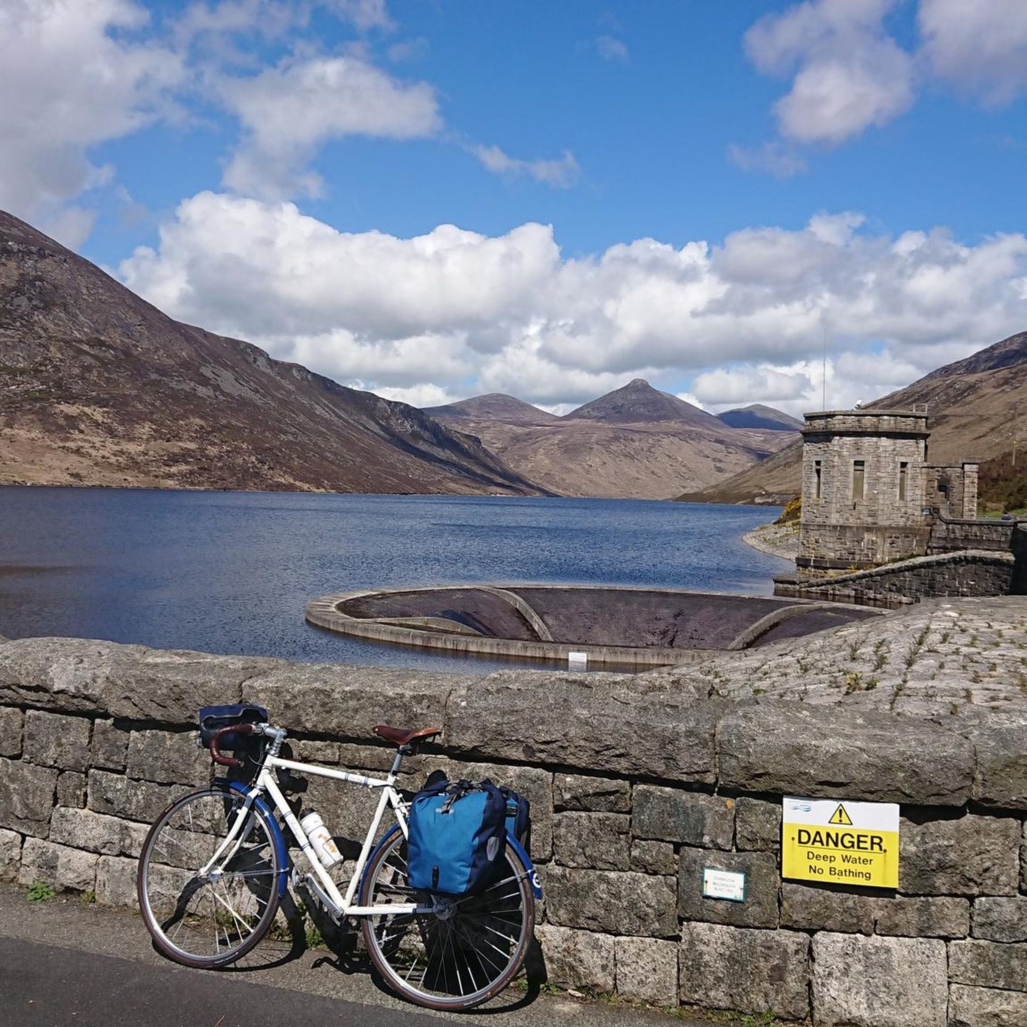
The Mourne Wall, built from 1904-22, was originally intended to protect the catchment area (36 km²) for Belfast's water supply around the water reservoir. With modern treatment facilities, this is no longer so crucial today. The 35 km long wall, made of unworked granite stone, crosses 15 summits of the Mourne Mountains, including Northern Ireland's highest, Slieve Donard, and offers beautiful hikes. Some take on the challenge of hiking it in one day.
0
0
The small exhibition provides insights into the hard work of the construction of the dam. Next to it, you can still see houses built for the workers.
0
0

Slieve Binnian is absolute magic. Standing as the third-highest peak in Northern Ireland (747 meters), it easily claims the title for the most dramatic silhouette in the Mournes, thanks to the massive, weathered granite towers—called tors—that guard its summit. https://www.expresstollpass.com
0
0

The Binnian Tunnel (2.5 miles long) was constructed between 1947 and 1950/51 and is located under the Mourne Mountains in County Down, Northern Ireland. The main purpose of the tunnel is to divert water from the Annalong Valley to the Silent Valley Reservoir underneath Slieve Binnian, after which the tunnel was named.
0
0
The tunnel diverts the waters of the Annalong Valley catchment area into this reservoir and was opened on 28th August 1952
0
0

Hare's Gap is a dramatic mountain pass nestled in the heart of the Mourne Mountains. This striking pass, situated between Slieve Bearnagh and Slievenaglogh, offers hikers a blend of natural beauty and historical intrigue. From this vantage point, hikers are treated to panoramic views of the surrounding peaks and valleys. The pass itself is historically significant, having once served as a route for smuggling goods across the mountains, adding a layer of intrigue to the hike. Hare's Gap is a popular starting point for various hikes, including ascents of Slieve Bearnagh and Slieve Meelmore.
2
0
Starting from Carrick Little Car Park, the hiking path to Slieve Binnian offers a rewarding journey through the heart of the Mourne Mountains. This moderate to challenging loop, approximately 11.2 km in length, follows the Mourne Wall, a historic dry-stone structure built in the early 1900s, guiding hikers toward the summit of Slieve Binnian (747 m). The ascent is steady, with a mix of rocky terrain and scenic views. As you approach the summit, the path becomes more rugged, leading to the iconic South and North Tors. From the summit, panoramic vistas unfold, offering breathtaking views of the Silent Valley and the surrounding peaks.
1
0
Frequently Asked Questions
How many hiking trails are available around Silent Valley Reservoir?
There are over 130 hiking routes documented around Silent Valley Reservoir on komoot, offering a wide range of options from gentle strolls to challenging mountain ascents.
Are there easy hiking trails suitable for beginners or families?
Yes, Silent Valley Reservoir offers several easy trails. For a gentle introduction, consider the Silent Valley Duck Pond – Silent Valley Reservoir loop from Kilkeel River, which is 4.3 miles (6.9 km) and leads through more accessible areas of the park, ideal for families.
What are the options for more challenging or longer hikes?
For experienced hikers seeking a challenge, the Slieve Binnian & Wee Binnian loop from Silent Valley Reservoir is a difficult 9.8-mile (15.8 km) trail with significant elevation gain, offering panoramic views. Another demanding option is the Mourne Wall Challenge, which is a much longer and more strenuous route.
Are there any circular walking routes around the reservoir?
Yes, many routes are circular. A popular moderate circular path is the Silent Valley Reservoir – Silent Valley Reservoir Road loop from Kilkeel River, which follows the reservoir's perimeter for 6.5 miles (10.4 km), providing consistent views of the water and dam infrastructure.
What is the best time of year to go hiking in Silent Valley Reservoir?
The best time to hike is generally from spring to autumn (April to October) when the weather is milder and daylight hours are longer. However, the area can be beautiful in winter, though conditions can be more challenging with colder temperatures and potentially icy paths, especially at higher elevations.
Are dogs allowed on the hiking trails?
Dogs are generally welcome in the Silent Valley Mountain Park, but they must be kept on a lead at all times to protect local wildlife and livestock. Always check specific trail regulations before you go, as some areas might have restrictions.
Where can I find parking for the hiking trails?
There is a large car park available at the entrance to Silent Valley Mountain Park. This serves as a convenient starting point for most of the trails within the reservoir area.
Is Silent Valley Reservoir accessible by public transport?
Public transport options to Silent Valley Reservoir are limited. It is generally recommended to travel by car. Some local bus services might operate to nearby towns like Kilkeel, from where you would need to arrange further transport or a taxi to reach the reservoir entrance.
What kind of views can I expect on the hikes?
Hikes around Silent Valley Reservoir offer diverse views. You can expect stunning vistas of the reservoir itself, the impressive Mourne Mountains, and open moorland. Higher trails, such as the Slieve Binnian North Tor – Slieve Binnian summit loop, provide expansive panoramic views of the surrounding peaks and coastline.
What do other hikers say about the trails in Silent Valley Reservoir?
Hikers rate the trails highly, with an average score of 4.5 stars from over 1,200 reviews on komoot. Reviewers often praise the varied terrain, the stunning views of the reservoir and surrounding mountains, and the sense of tranquility found within the park.
Are there any facilities like cafes or restrooms near the trails?
Silent Valley Mountain Park has visitor facilities, including restrooms and a cafe, located near the main entrance and car park. These are typically open during park operating hours, providing a convenient stop before or after your hike.
Most popular routes around Silent Valley Reservoir

Get inspired with the komoot mobile app


Explore more
Browse the best Hikes in other regions.
