The best cycling routes around Shaw Heights
4.6
(178)
1,359
riders
80
rides
Touring cycling routes around Shaw Heights offer a diverse landscape for cyclists. The region features a mix of open spaces, creek-side paths, and routes that traverse through various local parks and natural areas. Terrain includes gentle gradients along waterways and some moderate climbs towards overlooks and mesa areas. The network of routes provides options for different skill levels, from flat, easy rides to more challenging paths with elevation changes.
Best touring cycling routes around Shaw Heights
- The most popular touring…
Last updated: August 11, 2026
4.7
(13)
75
riders
51.3km
03:06
460m
460m
Cycle the difficult 31.9-mile US 36 Bikeway, gaining 1515 feet with mountain views and the Davidson Mesa Overlook.
5.0
(6)
55
riders
Moderate bike ride. Good fitness required. Mostly paved surfaces. Suitable for all skill levels.

Sign up for free
4.8
(4)
21
riders
28.9km
01:43
130m
130m
Easy bike ride. Great for any fitness level. Mostly paved surfaces. Suitable for all skill levels.
5.0
(2)
18
riders
Easy bike ride. Great for any fitness level. Mostly paved surfaces. Suitable for all skill levels.
4.5
(2)
10
riders
43.9km
02:34
220m
220m
Moderate bike ride. Good fitness required. Mostly paved surfaces. Suitable for all skill levels.
Get access to more routes and recommendations from other explorers.
Sign up for free
Already have an account?
Our route recommendations are based on thousands of hikes, rides, and runs completed by other people on komoot.
Start today with a free account
Your next adventure awaits.
Login or Signup



Tips from the Community

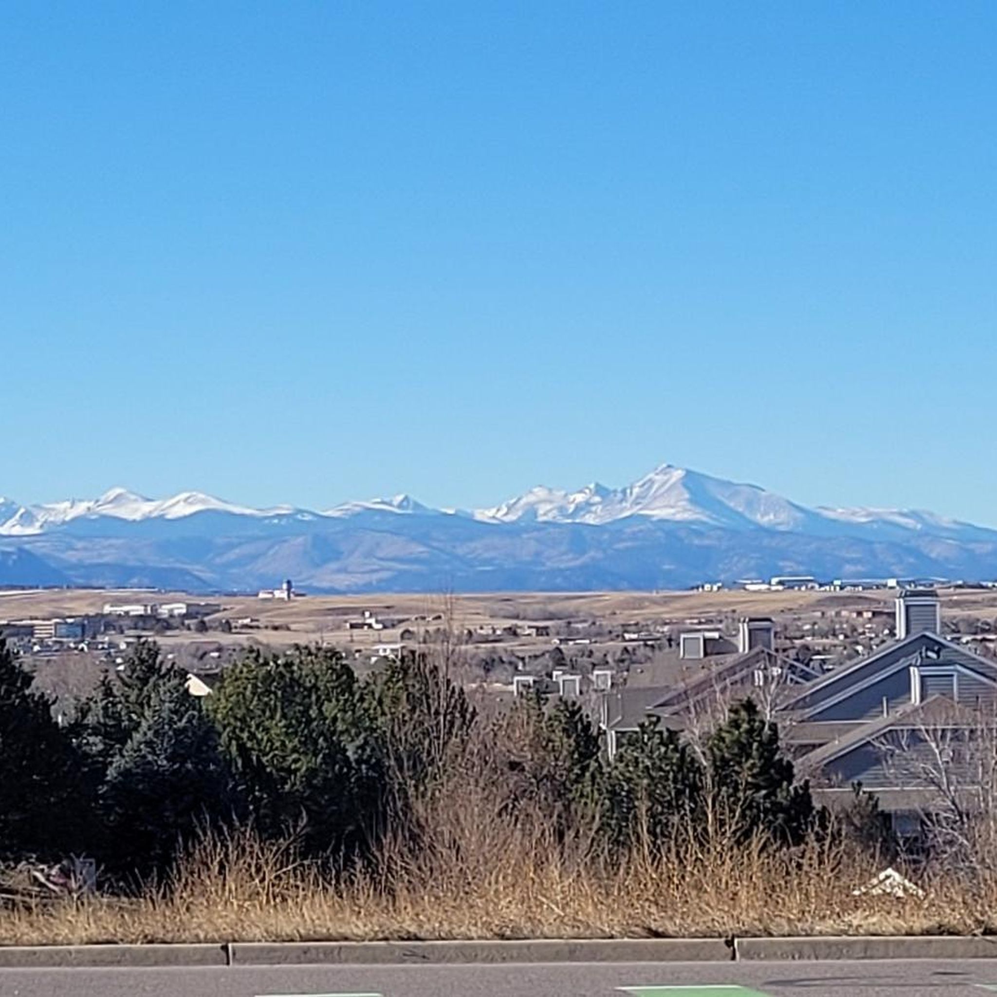
The Big Dry Creek Trail is located in Westminster and spans 12 miles from Interstate 25 to Standley Lake. The multi-use trail features a mostly flat terrain with occasional moderate uphill, passing through open spaces, parks, and neighborhoods. It includes a short on-road section near 99th Street and connects to the US 36 Bikeway, which links Denver and Boulder. Due to the Big Dry Creek stream bank restoration project, there will be periodic closures through fall 2024, and a section will remain closed through summer 2025, with detours available.
0
0
The Big Dry Creek Trail is located in Westminster and spans 12 miles from Interstate 25 to Standley Lake. The multi-use trail features a mostly flat terrain with occasional moderate uphill, passing through open spaces, parks, and neighborhoods. It includes a short on-road section near 99th Street and connects to the US 36 Bikeway, which links Denver and Boulder. Due to the Big Dry Creek stream bank restoration project, there will be periodic closures through fall 2024, and a section will remain closed through summer 2025, with detours available.
1
0

The US 36 Bikeway, spanning 16 miles across Adams, Boulder, Broomfield, and Jefferson counties, provides a safe and convenient non-motorized route between Denver and Boulder. The trail, separated from traffic by barriers and grassy medians, connects to other regional trails, with scenic views and multiple access points to open spaces and parks.
0
0

This trail follows the path of Little Dry Creek, which holds the distinction of being the site of the first significant gold discovery in Colorado, way back in 1858! You'll encounter vibrant wildflower meadows in spring, peaceful open spaces, and even some sections with rock formations.
0
0
The South Platte River Trail in Colorado is a scenic pathway that winds its way for over 34 miles through the heart of the state. The trail's path follows a historic route used by pioneers in the 19th century as they ventured westward.
0
0
Clear Creek, a vibrant waterway roughly 66 miles long, originates in the Rocky Mountains west of Denver, finally meeting with the South Platte River. The contrast in the water's color and flow is often noticeable, with Clear Creek's clear, fast-moving water meeting the South Platte's slower, sometimes more opaque flow.
0
0
Take a moment to appreciate the park's namesake—the two sparkling lakes. They provide a picturesque backdrop for any activity, whether you're relaxing on a bench or actively exploring the park. You can find a few wood carving sculptures that showcase the beauty of nature.
0
0

The Westminster Station Pond is just off the side of the Little Dry Creek Trail. The paved path passes the pond at the southern end of Westminster Station Park, which is the quieter portion of the park. As you make your way north, you pass restrooms, water fountains, benches, and picnic areas, but you'll also encounter a lot more people.
0
0
Frequently Asked Questions
How many touring cycling routes are available in Shaw Heights?
Shaw Heights offers a wide selection of touring cycling routes, with over 80 different options to explore. These routes cater to various skill levels, from easy rides to more challenging paths.
Are there easy touring cycling routes suitable for beginners or families?
Yes, Shaw Heights has numerous easy routes perfect for beginners or family outings. An excellent option is the Big Dry Creek Trail – College Pond loop from Big Dry Creek Open Space, which is 17.8 miles (28.7 km) long and features gentle gradients through open spaces and alongside water features.
What are some challenging touring cycling routes in Shaw Heights?
For experienced touring cyclists seeking a challenge, the region offers routes with significant elevation changes. The US 36 Bikeway is a difficult 31.9 miles (51.3 km) trail that provides a long-distance experience with varied urban and natural scenery and notable climbs.
Are there any long-distance touring cycling routes in the area?
Absolutely. For those looking for longer rides, the US 36 Bikeway covers 31.9 miles (51.3 km). Another substantial option is the Adler-Fingru Open Space – Aquarius Open Space loop from Shaw Heights, which is 30.3 miles (48.7 km) long and offers a moderate challenge.
Can I find circular touring cycling routes in Shaw Heights?
Yes, many routes in Shaw Heights are designed as loops, allowing you to start and end at the same point. The Big Dry Creek – Davidson Mesa Overlook loop from Front Range Community College is a popular moderate 25.3 miles (40.8 km) circular route offering scenic views.
What kind of scenic viewpoints or attractions can I expect along the routes?
Touring cycling routes in Shaw Heights often pass by natural attractions and open spaces. You can enjoy views from the Davidson Mesa Overlook on routes like the Big Dry Creek loop. Other notable natural features in the wider area include Standley Lake and the Lowell Ponds Wildlife Area, which are great for spotting local wildlife.
Is it possible to spot wildlife while cycling in Shaw Heights?
Yes, the region's numerous open spaces, creek-side paths, and natural areas provide opportunities for wildlife spotting. Routes that follow the Big Dry Creek or pass near areas like the Lowell Ponds Wildlife Area are particularly good for observing local fauna.
Where can I park my car when accessing touring cycling trails?
Many touring cycling routes in Shaw Heights start from open spaces or community colleges, which typically offer parking facilities. For example, the Big Dry Creek – Davidson Mesa Overlook loop starts from Front Range Community College, which has parking available. Always check specific trailhead information for designated parking areas.
Are the touring cycling routes accessible by public transport?
Shaw Heights and its surrounding areas have public transport options that can provide access to various trailheads. Routes that start near urban centers or community hubs, such as the Big Dry Creek – Westminster Station Pond loop from Westminster, often have better public transport connections. It's advisable to check local transit schedules and routes for specific access points.
What is the best time of year for touring cycling in Shaw Heights?
The spring and fall months generally offer the most pleasant conditions for touring cycling in Shaw Heights, with mild temperatures and vibrant scenery. Summer can also be enjoyable, especially during morning or late afternoon rides to avoid the midday heat. Winter cycling is possible, but some paths may be affected by snow or ice, requiring appropriate gear.
Are there any cafes or places to stop for refreshments along the touring cycling routes?
Many routes in Shaw Heights traverse through or near urban areas and local parks, providing opportunities to find cafes, restaurants, or convenience stores for refreshments. Routes like the Big Dry Creek – Westminster Station Pond loop pass through developed areas where amenities are more readily available. Planning your route with komoot can help identify potential stops.
What do other touring cyclists enjoy most about cycling in Shaw Heights?
The komoot community highly rates touring cycling in Shaw Heights, with an average score of 4.5 stars from over 400 reviews. Cyclists often praise the region's diverse landscape, which includes open spaces, scenic creek-side paths, and routes with rewarding overlooks. The variety of routes catering to different skill levels is also frequently highlighted.
Most popular attractions around Shaw Heights

Get inspired with the komoot mobile app


Explore more
Browse the best Cycling routes in other regions.
