The best walks and hikes around Rollinsville
4.7
(31)
972
hikers
45
hikes
Hiking around Rollinsville offers diverse landscapes within the Rocky Mountains, primarily encompassing Roosevelt National Forest and Arapaho National Forest. The terrain features lush forests, high-altitude environments with alpine lakes, and expansive views of the Indian Peaks and Continental Divide. South Boulder Creek carves through the area, providing creekside scenery, while nearby Barker Reservoir offers peaceful lakeside walks. The region presents a mix of open meadows, dense forested sections, and challenging rocky paths.
Best hiking trails around Rollinsville
- The most popular hiking route is Super Vü - Clear Cut - Handshake - Aspen Alley Loop Trail, a 2.4 miles (3.9 km) trail that takes 1 hour 9 minutes to complete. This route offers passage through aspen tunnels and wildflower meadows with views of the Indian Peaks.
- Another top favourite among local hikers is Barker Reservoir Trail, an easy 3.7 miles (5.9 km) path. This trail provides a peaceful lakeside walk with scenic views of the reservoir.
- Local hikers also love the Boy Scout Spur via Star Wars Trail, an 11.3 miles (18.3 km) trail leading through varied forest terrain, often completed in about 5 hours 35 minutes.
- Hiking around Rollinsville is defined by national forests, high-altitude alpine environments, and scenic creek valleys. The network offers options for different ability levels, from easy lakeside strolls to challenging mountain ascents.
- The routes in Rollinsville are highly rated by the komoot community with an average score of 4.7 stars from over 30 reviews. More than 900 hikers have used komoot to explore Rollinsville's varied terrain.
Last updated: July 22, 2026
5.0
(2)
25
hikers
15.5km
04:17
250m
190m
Moderate hike. Good fitness required. Mostly accessible paths. Sure-footedness required.
803m
00:12
0m
0m
Easy hike. Great for any fitness level. Easily-accessible paths. Suitable for all skill levels.

Sign up for free
125km
35:11
2,500m
2,820m
Hard hike. Very good fitness required. Mostly accessible paths. Sure-footedness required.
22
hikers
3.87km
01:09
80m
80m
Moderate hike. Great for any fitness level. Mostly accessible paths. Sure-footedness required.
4.0
(1)
4
hikers
18.3km
05:36
400m
400m
Hard hike. Very good fitness required. Mostly accessible paths. Sure-footedness required.
Get access to more routes and recommendations from other explorers.
Sign up for free
Already have an account?
Our route recommendations are based on thousands of hikes, rides, and runs completed by other people on komoot.
Start today with a free account
Your next adventure awaits.
Login or Signup
Tips from the Community

This is a good place to stop and just breathe after arriving on a bike from any of 3 great road climbs. www.cyclepass.com/t_p_Peak_m15.3_u.html , Just south of the intersection is a good distant view of Mt. Evans. But the light is completely flat in the late afternoon. The included photo is a telephoto shot (objects may seem closer than they actually are)
0
0

Lily Lake is just south of Estes Park, Colorado and is located within the boundaries of Rocky Mountain National Park. You get great views of the high mountains of the park, like Longs Peak and Mount Meeker, reflected in the water, making it a popular spot to stop for photographs. This is a great spot to pause on your ride, eat a snack and enjoy the views.
0
0

Just south of Estes Park, on the edge of South Saint Vrain Avenue, you find this small lake and this very easy to do loop, all at the foot of Lily Mountain.
0
0

There is a dirt parking lot here with room for around a dozen vehicles. From here you can run, hike or bike on the dense trail system east or west of the highway
0
0

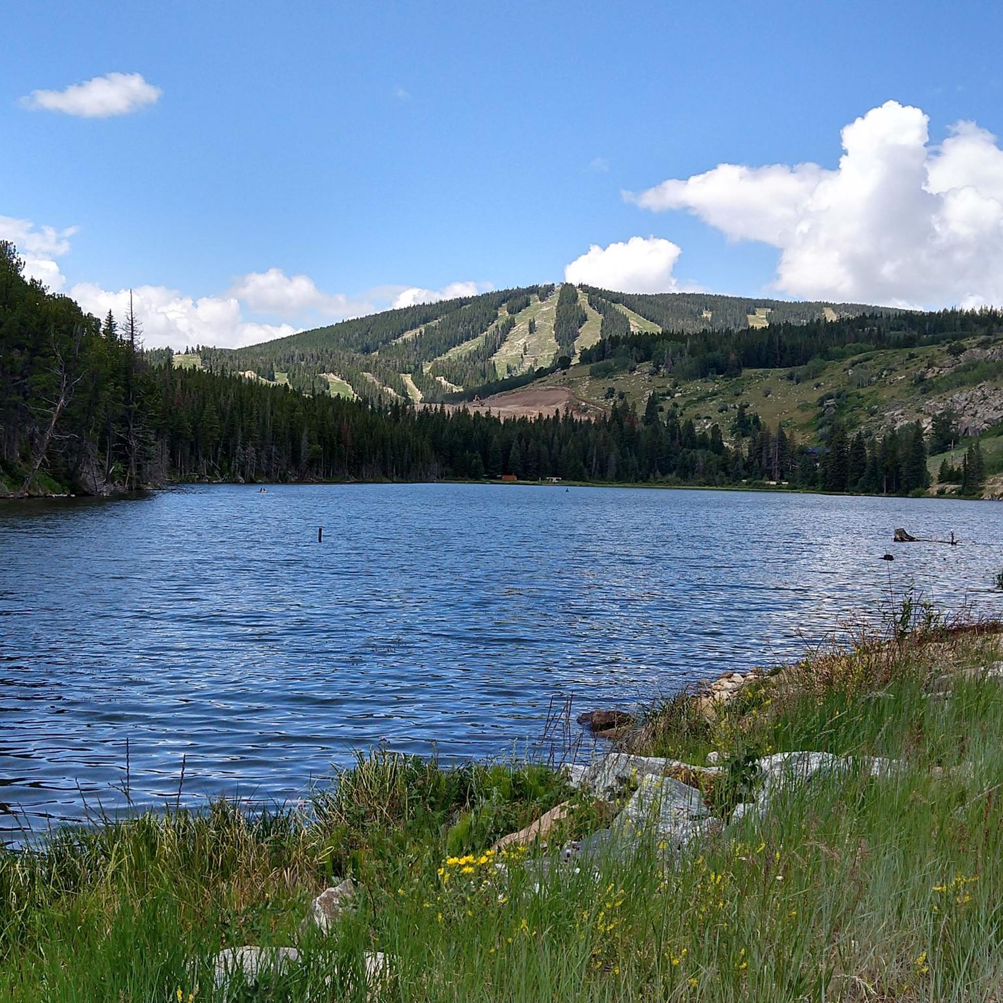
Barker Meadow Reservoir was purchased by Boulder in 2010 from a Mrs. Barker (who was forced to sell, but didn't want to). The reservoir provides hydro-electricity and features a plethora of activities including trail running, hiking and fishing. There are several nice areas to picnic with great views of the reservoir.
0
0
There is an excellent network of running and mountain biking trails from the trailhead, which has a sign map and a decently sized dirt parking lot.
0
0

Nederland is an old mining town that is now known as a gateway to outdoor recreation, due to its proximity to Indian Peaks Wilderness, Rocky Mountain National Park and Roosevelt National Forest.
0
0
Barker Meadow Reservoir was purchased by Boulder in 2010 from a Mrs. Barker (who was forced to sell, but didn't want to). The reservoir provides hydro-electricity and features a plethora of activities including hiking and fishing. There are several nice areas to picnic with great views of the reservoir.
0
0
Frequently Asked Questions
How many hiking trails are available around Rollinsville?
Rollinsville offers a diverse network of over 30 hiking trails, catering to various skill levels. You'll find everything from easy lakeside strolls to challenging high-altitude ascents within the Roosevelt and Arapaho National Forests.
Are there easy hikes suitable for beginners or families in Rollinsville?
Yes, Rollinsville has several easy trails perfect for beginners or families. The Barker Reservoir Trail — Nederland is an easy 3.7-mile path offering a peaceful lakeside walk. Another great option is the Mud Lake loop — Mud Lake Open Space, which is also considered easy and provides scenic views.
What kind of terrain and elevation can I expect on Rollinsville hikes?
The terrain around Rollinsville is highly varied. You'll encounter lush forests, tranquil creekside paths along South Boulder Creek, and high-altitude alpine environments with significant elevation gains, especially as you approach areas like Rollins Pass and the James Peak Wilderness. Views of the Indian Peaks and the Continental Divide are common.
What natural features or landmarks can I see while hiking in Rollinsville?
Rollinsville's trails offer stunning natural features and historical landmarks. You can experience golden aspen tunnels and wildflower meadows, especially on trails like the Aspen Alley Trail. Other notable sights include alpine lakes in the James Peak Wilderness, the historic Moffat Tunnel East Portal, and remnants of old railroad infrastructure on Rollins Pass. You might also spot Lost Lake or Mud Lake.
Are there any loop trails in the Rollinsville area?
Yes, Rollinsville offers several loop trails. The Aspen Alley Trail via Whoop-Di-Doos and Super Vu loop is a moderate 2.4-mile option. Another easy choice is the Mud Lake loop — Mud Lake Open Space. For a more challenging experience, consider the School Bus Trail loop — Roosevelt National Forest.
What do other hikers enjoy most about hiking in Rollinsville?
The hiking routes in Rollinsville are highly rated by the komoot community, with an average score of 4.8 stars from over 20 reviews. Hikers often praise the diverse landscapes, from serene forests to breathtaking alpine views, and the variety of trails suitable for different fitness levels. The peaceful atmosphere and opportunities to see wildlife are also frequently mentioned.
What is the best time of year to go hiking in Rollinsville?
The best time for hiking in Rollinsville is generally from late spring through early fall (May to October). During this period, trails are typically clear of snow, and the weather is pleasant. Fall is particularly stunning, with vibrant golden aspen tunnels creating picturesque scenery. High-altitude trails may remain snow-covered into early summer.
Are there any historical sites to explore near Rollinsville's hiking trails?
Absolutely. Rollinsville is rich in history. You can visit the Moffat Tunnel East Portal, a significant historical and recreational hub. Further up Rollins Pass, you might find remnants of the Corona Ghost Town and historic railroad trestles. Other historical sites include John Frazer's Cabin and the DeLonde Homestead.
Are dogs allowed on hiking trails in Rollinsville?
Many trails in the Roosevelt and Arapaho National Forests, which surround Rollinsville, are dog-friendly. However, regulations can vary, especially in designated wilderness areas like James Peak Wilderness. It's always best to check specific trail rules and ensure your dog is on a leash and you practice Leave No Trace principles.
Where can I find parking for Rollinsville hiking trails?
Parking is generally available at popular trailheads such as the Moffat Tunnel East Portal. Many trails within the Roosevelt National Forest also have designated parking areas. It's advisable to arrive early, especially on weekends, as parking can fill up quickly at popular spots.
Are there any challenging or difficult hikes in Rollinsville?
Yes, Rollinsville offers several challenging hikes for experienced adventurers. The James Peak Wilderness, accessible from Rollinsville, features routes with significant elevation gains and stunning alpine lakes, such as the Crater Lakes Trail. The Boy Scout Spur via Star Wars Trail — Roosevelt National Forest is an 11.3-mile difficult trail, and the School Bus Trail loop is another difficult option.
Can I access Rollinsville trails using public transport?
Public transport options directly to Rollinsville's trailheads are limited. Most visitors rely on personal vehicles to reach the various starting points within the national forests. Some regional bus services might connect to nearby towns like Nederland, but onward travel to specific trailheads would likely require a car.
Most popular attractions around Rollinsville

Get inspired with the komoot mobile app


Explore more
Browse the best Hikes in other regions.
