The best running trails around Eldorado Springs
4.7
(4)
456
runners
12
runs
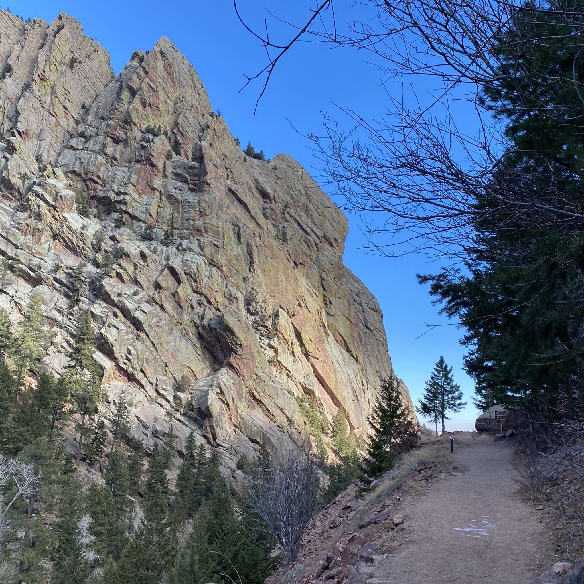
Jogging routes around Eldorado Springs offer a diverse range of terrain set against a backdrop of striking natural features. The region is characterized by dramatic sandstone cliffs, the winding South Boulder Creek, and a varied ecosystem that includes pine forests and open meadows. Elevation changes are common, providing both challenging climbs and more gradual paths for runners. This landscape provides a unique outdoor experience for those seeking running trails with significant scenic value.
Best jogging routes around Eldorado Springs
- The most popular jogging route is Greenbelt Plateau, Community Ditch and Flatirons Vista Loop, a 12.2 miles (19.7 km) trail that takes 2 hours 21 minutes to complete, offering panoramic views of the surrounding landscape.
- Another top favourite among local runners is Marshall Mesa Loop, a difficult 15.1 miles (24.4 km) path. This route features varied terrain and open spaces, providing a challenging and scenic running experience.
- Local runners also love the Bear Peak & South Boulder Summit loop, a 9.0 miles (14.4 km) trail leading through mountainous terrain with significant elevation gain, often completed in about 2 hours 43 minutes.
- Jogging around Eldorado Springs is defined by towering sandstone cliffs, the serene South Boulder Creek, and diverse ecosystems. The network offers options for different ability levels, from moderate paths to difficult climbs.
- The routes in Eldorado Springs are highly rated by the komoot community with an average score of 4.0 stars from over 2 reviews. More than 770 runners have used komoot to explore Eldorado Springs's varied terrain.
Last updated: August 17, 2026
5.0
(1)
101
runners
19.7km
02:21
330m
330m
Embark on the Greenbelt Plateau, Community Ditch and Flatirons Vista Loop, a difficult jogging route spanning 12.2 miles (19.7 km) with a significant 1077 feet (328 metres) of elevation gain. You can expect to complete this challenging journey in approximately 2 hours and 21 minutes. As you jog, you will encounter a varied landscape, from smooth gravel paths to rocky singletrack and steep climbs, all while enjoying continuous panoramic views of the iconic Boulder Flatirons, especially from Flatirons Vista. The route also includes twisty, wooded sections along the Spring Brook Loop, adding diverse scenery to your run.
For your visit, the main parking lot is conveniently located off Highway 93. Be aware that while Boulder County residents may park for free, others might need to pay a day-use fee. Alternatively, free parking is available across the street at the RTD lot. This trail system is highly interconnected, offering you the flexibility to customize your jogging route, but remember that you will be sharing the trails with mountain bikers and hikers.
This route is situated within the expansive Boulder Open Space and Mountain Parks, an area known for its natural beauty and diverse ecosystems. The interconnected trail network allows you to easily extend or shorten your run based on your preference and fitness level. Keep an eye out for local wildflowers and grazing cows in certain areas, which add to the natural charm of the landscape.
4.0
(2)
88
runners
24.4km
02:35
280m
280m
Prepare for a challenging jogging experience on the Marshall Mesa Loop, a difficult 15.1-mile (24.4 km) route that takes about 2 hours and 34 minutes to complete. As you tackle the 928 feet (283 metres) of elevation gain, you'll be treated to expansive views of Boulder's iconic Flatirons. The trail winds through open fields and meadows, occasionally dipping into wooded sections with pine trees, offering a varied landscape for your run.
When planning your visit, you'll find ample parking, restrooms, and picnic tables conveniently located at the trailhead. Be aware that much of the route is exposed, so you should plan accordingly for sun protection, especially on warmer days. Dogs are welcome on the trail, often permitted off-leash if they are under voice control, making it a great option for jogging with your canine companion.
This multi-use trail is part of the Boulder Open Space and Mountain Parks, where you might even spot cattle grazing in the fields. Keep an eye out for local wildlife like red-tailed hawks soaring overhead or mule deer along sections such as the Greenbelt Plateau Trail. The Marshall Mesa Loop provides a rewarding challenge for experienced joggers looking for a scenic and engaging workout.

Sign up for free
5.0
(1)
44
runners
14.4km
02:43
920m
920m
Embark on the Bear Peak & South Boulder Summit loop, a difficult jogging route that challenges you with a significant elevation gain of 3028 feet (923 metres) over 9.0 miles (14.4 km). This demanding loop takes you up two of Boulder's highest peaks, offering sweeping 360-degree views of the Colorado Front Range, the city of Boulder, and the iconic Flatirons from viewpoints like the Fern Canyon Trail ridgeline. You will traverse diverse terrain, from broad dirt paths to rocky sections with steep steps and jumbled boulders, passing through lush forests and burn zones, all achievable in about 2 hours and 43 minutes.
Planning your visit requires preparation for a strenuous workout. The route includes sections that involve scrambling over exposed ridges and very steep rock steps, particularly on the Fern Canyon Trail. While generally accessible, be ready for highly technical terrain that demands good fitness and experience. Parking is typically available at trailheads that access this popular route, but it's always wise to arrive early, especially on weekends, to secure a spot.
This loop is renowned for its dual summit experience, allowing you to conquer two prominent peaks in one outing. The varied landscape, from dense forest to open, rocky ridges, showcases the unique ecology of the Boulder Open Space and Mountain Parks. It is a favorite among local joggers seeking a rigorous challenge and unparalleled vistas, making it a standout option for those who appreciate a truly rewarding high-altitude effort.
58
runners
11.3km
01:33
390m
390m
Hard run. Very good fitness required. Mostly paved surfaces. Suitable for all skill levels.
36
runners
5.63km
00:36
60m
60m
Moderate run. Good fitness required. Mostly paved surfaces. Suitable for all skill levels.
Get access to more routes and recommendations from other explorers.
Sign up for free
Already have an account?
Our route recommendations are based on thousands of hikes, rides, and runs completed by other people on komoot.
Start today with a free account
Your next adventure awaits.
Login or Signup

Tips from the Community


The Greenbelt Plateau Trailhead provides access to the Greenbelt Plateau and High Plains Trails, with a connector to the Flatirons Vista area via Highway 93. The area closes when muddy, and the trailhead has a parking lot with 25 spaces and one ADA space with a fee required. Bicycles, including Class 1 and Class 2 e-bikes, are allowed on designated trails, so be aware while running. Dogs must be leashed seasonally to protect ground-nesting birds, and horses are permitted on most trails too. Wildlife, including raptors, mule deer, and coyotes, can be found in this beautiful grassland.
0
0
The Community Ditch Trail is an easy mountain biking route that serves as a connector to the Marshall Mesa trails. While not particularly thrilling to ride, it offers beautiful views of the Flatirons and golden open fields. The trail effectively connects the east and west sections of trails across Highway 93, making it useful, scenic, and straightforward.
0
0

Really an old dirt road, this trail makes a great connector between the other trails in the area of Marshall Lake. Watch out for fast-moving mountain bikers!
0
0

The trail is aptly named — looking west the iconic silhouettes of the Flatirons loom over the horizon. The trail runs through an open field and is wide gravel. Keep an eye out for prairie dogs!
0
0
The trail is a nontechnical singletrack with amazing views that wraps around the rim of the foothills and dives into the forest on its west side where you can cross the canal and connect to the trails in the Flatirons.
0
0
The trail here is nontechnical and climbs steadily along a stream up toward Bear Peak. This is a great trail to descend.
0
0

The ridgeline portion of Fern Canyon Trail offers excellent views of Boulder and the surrounding mountains, but the part of Fern Canyon Trail below treeline is not for the faint of heart. The trail is steep, rooty, rocky, and holds snow into the spring months.
0
0
Frequently Asked Questions
How many running trails are available around Eldorado Springs?
There are over 15 dedicated running routes around Eldorado Springs, offering a diverse range of experiences. These include both moderate and challenging options to suit various fitness levels.
What kind of terrain can I expect on jogging routes in Eldorado Springs?
Jogging routes in Eldorado Springs feature a varied terrain, from paths winding through pine forests and open meadows to trails alongside the serene South Boulder Creek. You'll encounter significant elevation changes, including challenging climbs, set against a backdrop of dramatic sandstone cliffs. The area offers a mix of non-paved trails, with some being ADA-accessible.
Are there any easy or beginner-friendly running routes in Eldorado Springs?
While many routes offer a challenge, the Flatirons view – Spring Brook loop is a moderate option, covering 5.5 miles (8.8 km) with less elevation gain compared to others. Additionally, the 0.9-mile (1.4 km) Fowler Trail, mentioned in regional research, is an easy, non-paved, and ADA-accessible path perfect for a relaxed jog with scenic canyon views.
What are some of the most scenic viewpoints or landmarks I can see while running?
Many routes offer breathtaking views. For instance, the Rattlesnake Gulch Trail (mentioned in regional research) leads to an overlook with sweeping views of the Continental Divide. You can also find stunning vistas like the Davidson Mesa Overlook and the Continental Divide Overlook. The towering sandstone cliffs of Eldorado Canyon itself provide a spectacular backdrop for nearly all runs.
Are there any dog-friendly running routes in the Eldorado Springs area?
Yes, several trails in the Eldorado Springs area are dog-friendly. The Fowler Trail, for example, is a popular choice for runners with dogs, offering an easy path and beautiful canyon views. Always check specific trail regulations for leash requirements and any seasonal restrictions before heading out with your pet.
Can I find any loop running trails around Eldorado Springs?
Absolutely. Several routes are designed as loops, providing a continuous running experience without retracing your steps. Notable loop options include the challenging Greenbelt Plateau, Community Ditch and Flatirons Vista Loop, the Marshall Mesa Loop, and the Bear Peak & South Boulder Summit loop.
What do other runners enjoy the most about jogging in Eldorado Springs?
The running routes in Eldorado Springs are highly rated by the komoot community, with an average score of 4.0 stars. Runners frequently praise the dramatic canyon scenery, the diverse ecosystems, and the variety of trails that cater to different skill levels, from moderate paths to challenging climbs.
Are there any historical points of interest along the running routes?
Yes, the region has some interesting historical elements. For instance, the Rattlesnake Gulch Trail (mentioned in regional research) leads to the ruins of an old hotel, a remnant from when Eldorado Springs was known as the 'Coney Island of the West.' The historic Eldorado Springs Swimming Pool, fed by an artesian spring, has also been a popular spot since 1905.
What are the best seasons for running in Eldorado Springs?
Eldorado Springs offers great running opportunities across multiple seasons. Spring and fall generally provide pleasant temperatures and vibrant scenery. Summer mornings are ideal to beat the heat, while winter running can be beautiful, though some trails might have snow or ice, requiring appropriate gear and caution.
Are there any less crowded running trails in Eldorado Springs?
While popular trails can see more activity, exploring some of the longer or more challenging routes, especially during off-peak hours or weekdays, can offer a more secluded experience. The extensive network of trails means you can often find quieter sections away from the main access points.
What is the longest running route available in Eldorado Springs?
One of the longer and more challenging options is the Marshall Mesa Loop, which spans 15.1 miles (24.4 km) and features varied terrain and open spaces for an extended running experience.
Are there opportunities to see wildlife while running in Eldorado Springs?
Yes, the largely untouched natural environment of Eldorado Springs provides opportunities to spot various wildlife. Runners might encounter mule deer, foxes, and a variety of bird species, including golden eagles. Occasionally, mountain lions or black bears may be present, so it's always wise to be aware of your surroundings.
Most popular attractions around Eldorado Springs

Get inspired with the komoot mobile app


Explore more
Browse the best Running Trails & Routes in other regions.
