The best MTB trails around Littleton
4.6
(25)
1,165
riders
94
rides
Mountain biking around Littleton offers a diverse range of experiences, blending urban accessibility with natural landscapes. The area is characterized by its proximity to the Rocky Mountains and the South Platte River corridor, providing extensive trail networks. Riders can enjoy views of the Front Range, explore riparian habitats, and navigate trails through cottonwood forests and open spaces. This region provides a variety of terrain, from paved paths to natural surface trails, catering to different skill levels.
Best mountain bike trails around Littleton
- The most popular mountain bike trail is Denver Orbital Trail: Deer Creek and South Valley Parks Loop, a 20.5 miles (33.0 km) trail that takes 3 hours 28 minutes to complete. This moderate route offers varied terrain through Deer Creek Canyon and South Valley Park.
- Another top favourite among local mountain bikers is Chatfield Reservoir loop, an easy 14.8 miles (23.9 km) path. This trail provides scenic views of Chatfield State Park and the reservoir, with distant mountain backdrops.
- Local mountain bikers also love the Littleton Community and Lee Gulch Trail, a 5.2 miles (8.4 km) trail leading through diverse scenery and along Lee Gulch, often completed in about 38 minutes.
- Mountain biking around Littleton is defined by its extensive trail networks, views of the Front Range, and access to natural features like the South Platte River and Chatfield State Park. The network offers options for easy, moderate, and difficult routes, suitable for various ability levels.
- The routes in Littleton are highly rated by the komoot community with an average score of 4.9 stars from more than 10 reviews. More than 1000 mountain bikers have used komoot to explore Littleton's varied terrain.
Last updated: October 10, 2026
5.0
(1)
32
riders
33.0km
03:28
870m
870m
Moderate mountain bike ride. Good fitness required. Suitable for all skill levels.
14
riders
23.9km
01:22
110m
110m
Easy mountain bike ride. Great for any fitness level. Suitable for all skill levels.

8.42km
00:38
40m
40m
Easy mountain bike ride. Great for any fitness level. Suitable for all skill levels.
20
riders
20.6km
01:54
440m
440m
Hard mountain bike ride. Good fitness required. Advanced riding skills necessary. Some portions of the route may require you to push your bike.
11
riders
Easy mountain bike ride. Great for any fitness level. Suitable for all skill levels.
Get access to more routes and recommendations from other explorers.
Already have an account?
Our route recommendations are based on thousands of hikes, rides, and runs completed by other people on komoot.
Start today with a free account
Your next adventure awaits.

Tips from the Community

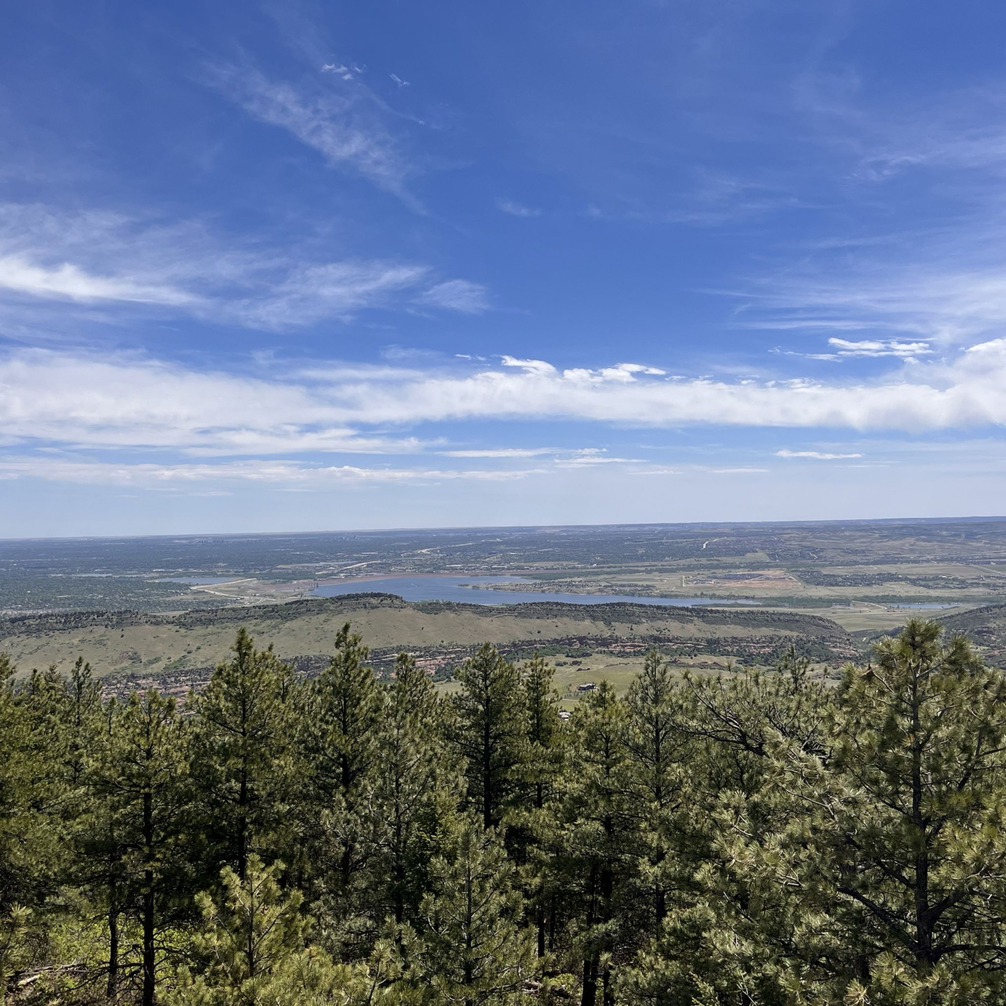
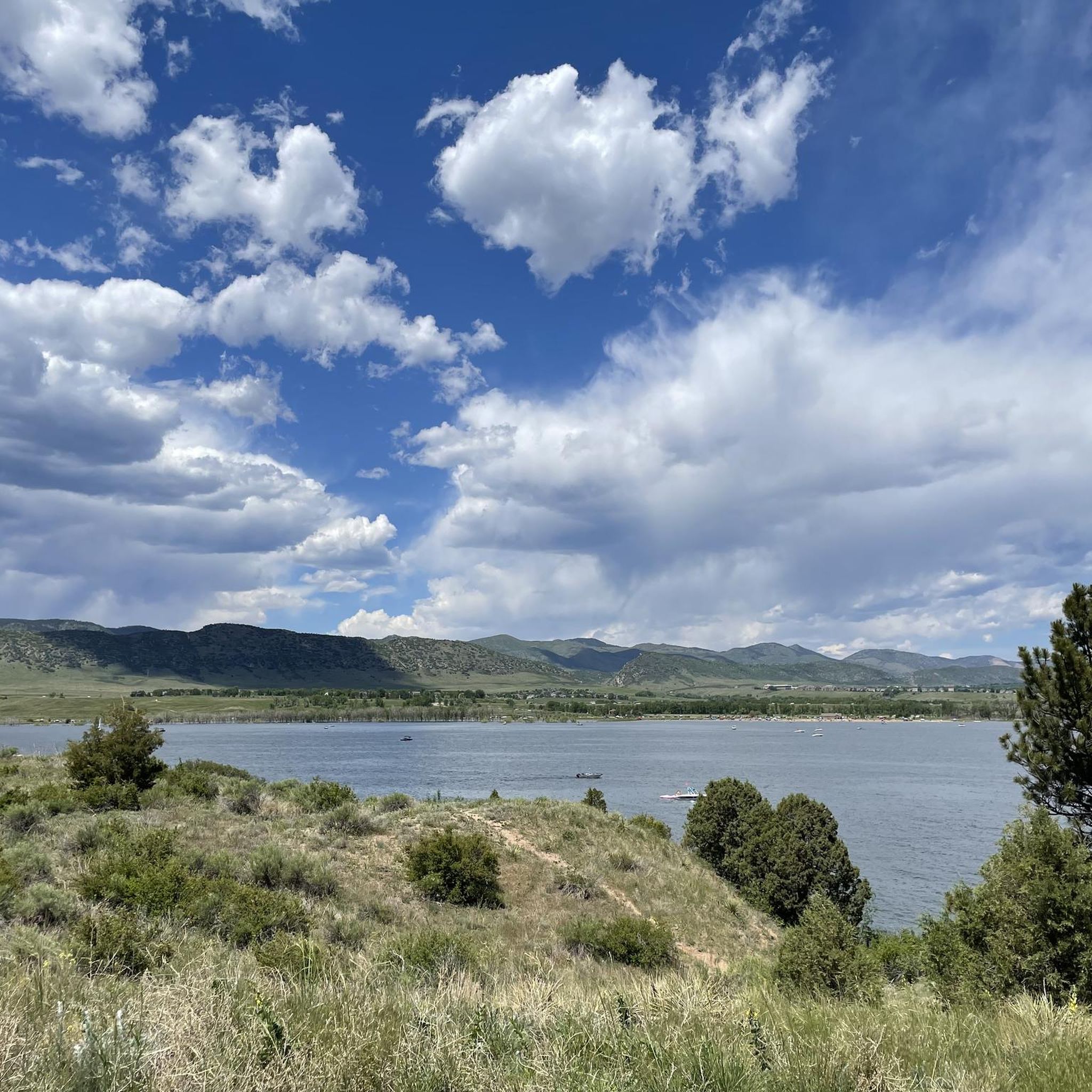
Chatfield State Park is a beautiful park in the lower foothills of the Front Range. The park has a large lake and many miles of trails. It is popular with hikers, boaters, cyclists, and fishermen.
0
0
The Chatfield Reservoir is a 1,423-acre lake in Chatfield State Park. There is a hiking path that runs alongside the water.
0
0

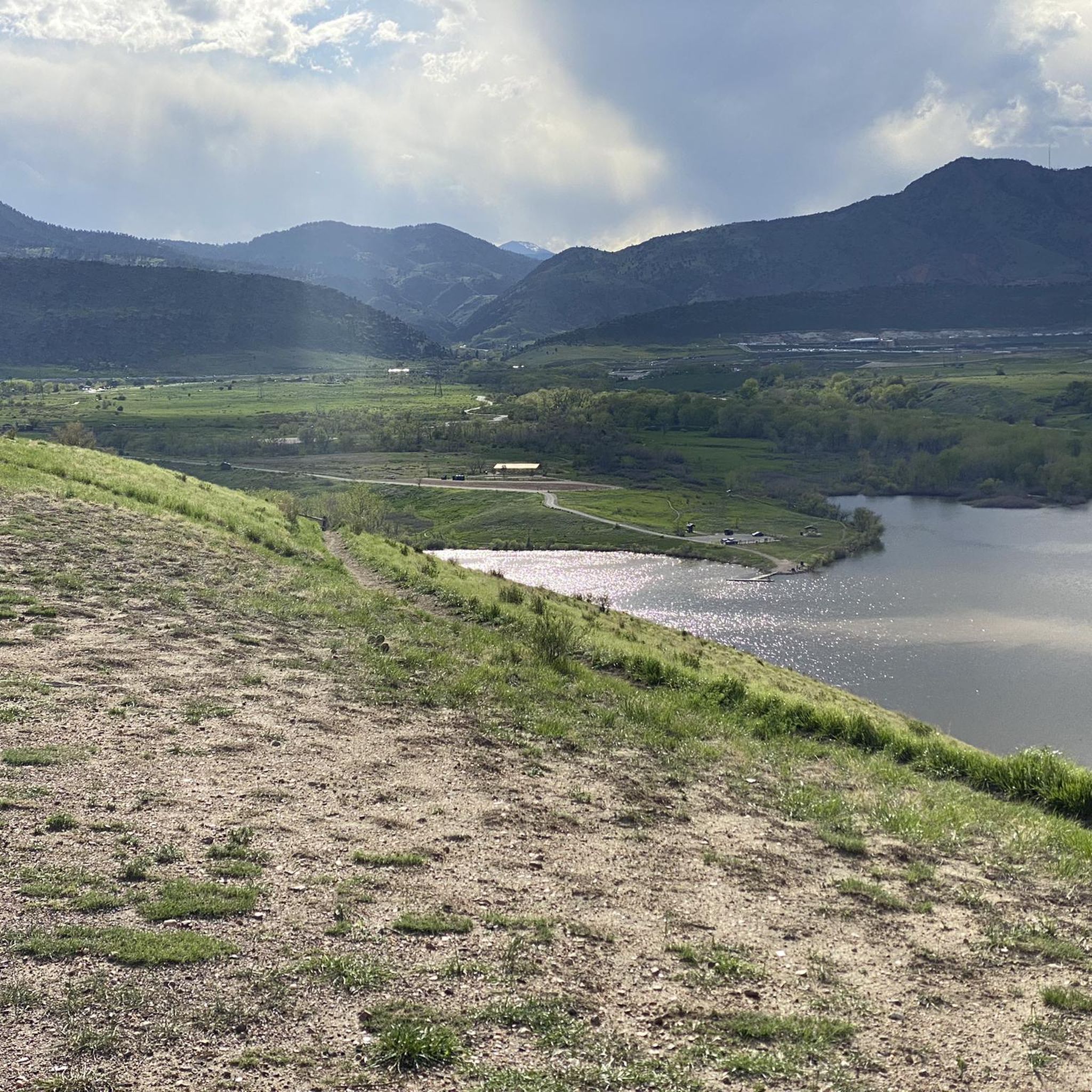
View from the gravel section of the Dam Trail. Nice views of the foothills and the suburbs from the Dam Trail.
0
0

This point marks the intersection and trailhead for the Lee Gulch Trail and the Mary Carter Trail. This major trail junction is along the shores of the South Platte River and is a great resting spot or a spot to visit with the family.
0
0

This is a pretty dirt singletrack that takes you through the meadows and up the stunning cliff formations of South Valley Park. This is a great fast trail with lovely views and full sun.
0
0

The climb from South Valley Park up to Deer Creek Canyon Park is tough, but you get some of the best views of the skyline of Denver – and a great downhill is waiting for you as well.
0
0
This is a visually stunning trail that runs through the middle of waves of red rock that rise out of the earth like diagonal shark fins. The red bedrock is a part of the Fountain Formation, which runs along the Front Range and is responsible for Red Rocks and Garden of the Gods.
0
0

This park contains fairly easy trails and some great singletrack. Keep in mind that one of the most popular trails (and one of the most difficult, thanks to all the elevation gain) — the Black Bear Trail — is closed from Feb. 1 to July 31 to protect nesting raptors.
0
0
Frequently Asked Questions
How many mountain bike trails are available around Littleton?
Based on komoot data, there are over 80 mountain bike trails around Littleton, offering a wide range of experiences for all skill levels. This includes 33 easy, 39 moderate, and 17 difficult routes.
Are there easy mountain bike trails suitable for beginners in Littleton?
Yes, Littleton offers many easy trails perfect for beginners. For example, the Chatfield Reservoir loop is an easy 14.8-mile path with scenic views of Chatfield State Park. Another great option is the Littleton Community and Lee Gulch Trail, a 5.2-mile ride through diverse scenery along Lee Gulch.
Where can I find more challenging mountain bike trails near Littleton?
For more advanced riders, Littleton and its surroundings offer several difficult routes. The Highlands Point Viewpoint – East/West Regional Trail loop is a challenging 42-mile ride with significant elevation gain. Another difficult option is the Denver Skyline loop from Hildebrand Ranch Park, which covers 12.5 miles with over 400 meters of elevation gain.
What natural features or landmarks can I see along the mountain bike trails?
Littleton's trails offer access to diverse natural features. You can ride along the South Platte River, enjoy views of Chatfield Reservoir, or explore the South Platte Canyon Road. The Coyote Song Trail is also a notable highlight for its natural beauty.
Are there any family-friendly mountain bike trails in Littleton?
Yes, many trails in Littleton are suitable for families. The extensive network includes paved and natural surface options, with many gulches and waterways featuring bicycle paths. The Littleton Community and Lee Gulch Trail is an easy, scenic option that families often enjoy.
What do other mountain bikers enjoy most about mountain biking in Littleton?
The mountain bike trails around Littleton are highly rated by the komoot community, with an average score of 4.9 stars. Riders often praise the extensive trail networks, the diverse scenery ranging from riparian habitats to Front Range views, and the accessibility to natural features like the South Platte River and Chatfield State Park.
Are there mountain bike trails that offer scenic viewpoints or vistas?
Absolutely. Littleton is situated with excellent views of the Front Range mountains. Trails within Chatfield State Park, such as the Chatfield Reservoir loop, provide scenic views of the reservoir and distant mountains. The Denver Orbital Trail: Deer Creek and South Valley Parks Loop also offers varied terrain through Deer Creek Canyon, known for its natural beauty.
What is the best time of year to go mountain biking in Littleton?
Littleton offers year-round outdoor adventures. While specific trail conditions can vary, spring and fall generally provide pleasant temperatures for mountain biking. Summer can be warm, so early morning or late afternoon rides are often preferred. Winter riding is possible, but some trails may have snow or ice, requiring appropriate gear and caution.
Are there any loop mountain bike trails in the Littleton area?
Yes, many trails in the Littleton area are designed as loops, offering varied scenery without retracing your path. The Chatfield Reservoir loop is a popular easy option, and for a more challenging ride, consider the Highlands Point Viewpoint – East/West Regional Trail loop.
Is parking available at the trailheads around Littleton?
Many mountain bike trails in and around Littleton, especially those within parks like Chatfield State Park and South Platte Park, offer designated parking areas. The city's commitment to open space means trail access often includes convenient parking facilities.
Can I access mountain bike trails in Littleton using public transport?
Littleton's extensive trail system, including paved and natural surface options, often connects directly to urban areas. While specific public transport access points vary by trail, the city's integrated planning aims to make outdoor activities accessible, and regional trail connections like the Mary Carter Greenway Trail can be reached via various points within the city.
Most popular routes around Littleton
Most popular attractions around Littleton

Get inspired with the komoot mobile app


Explore more
Browse the best MTB trails in other regions.
