The best road cycling routes around Idaho Springs
5.0
(4)
974
riders
10
rides
Road cycling routes around Idaho Springs are set within the Rocky Mountains of Colorado, characterized by a dramatic alpine landscape with significant elevation changes. The region features towering peaks, dense forests, and high-alpine tundra, shaped by geological activity. Cyclists navigate paved mountain roads that ascend to high altitudes, offering expansive views of the surrounding ranges and valleys. Clear Creek runs through the area, providing scenic waterways alongside some routes.
Best road cycling routes around Idaho Springs
- The most popular road…
Last updated: July 21, 2026
5.0
(1)
255
riders
93.9km
05:57
2,460m
2,460m
The Mount Blue Sky (Evans) to Juniper and Mestaa'Ėhehe Passes loop is a high-octane gravel cycling route that plunges you into Colorado's alpine heart. You'll traverse diverse terrain, from open…
5.0
(1)
238
riders
88.5km
05:04
2,090m
2,090m
The Idaho Springs to Mount Blue Sky (Evans) Summit cycling route is an iconic climb, taking you from the historic town through diverse ecosystems to the highest paved road in…

Sign up for free
45
riders
52.4km
02:59
1,210m
1,210m
The Idaho Springs to Juniper Pass via Echo Lake road cycling route is a challenging ascent through the heart of the Rocky Mountains, offering a continuous climb that rewards with…
42
riders
44.5km
02:03
510m
510m
The Clear Creek Greenway offers a delightful road cycling experience, tracing the Clear Creek through a landscape that shifts from natural riverine beauty to the quaint, historic streets of Colorado's…
42
riders
76.4km
04:01
1,400m
1,400m
The Idaho Springs to Guanella Pass Summit road cycling route is a true Colorado classic, offering a journey from a historic mining town through dense forests to exposed alpine tundra.…
Get access to more routes and recommendations from other explorers.
Sign up for free
Already have an account?
Our route recommendations are based on thousands of hikes, rides, and runs completed by other people on komoot.
Start today with a free account
Your next adventure awaits.
Login or Signup
Tips from the Community

Has been a good ride through some of the winter weeks but cold in places.
0
0


This high alpine lake is quite the view and a destination for many. **If you plan on parking here to hike Mt. Evans, a reservation is required to park at Summit Lake and must be purchased through recreation.gov PRIOR to the day of your hike. It's $7. All specific and important info can be found at: recreation.gov/timed-entry/10087438
0
0

Embarking on the ascent of Mount Blue Sky (formerly Mount Evans) is must-do for any cyclist looking for a high altitude challenge. The road up to the summit, which is at 14,130 feet above sea level, is the highest paved road in North America, so as you ride up this epic switchbacking road, keep an eye on how you feel because many experience altitude sickness at these elevations. The summit parking lot is a great place to rest, take photos, and enjoy the views before heading back down the road, which demands vigilance. There are no guardrails, little to no shoulder, and steep drops along the road so please be aware as you begin your descent.
0
0
This section of Little Bear Creek Road from the summit of Mestaa'Ėhehe pass to just before series of tight switchbacks is a fun, smooth gravel road that is doable on a road bike. If descending and not feeling the switchbacks, you can take a sharp right, then a left on to Old Little Bear Creek Road (a slightly less well-graded gravel road) that is more straight for some fun, fast descending.
0
0
Idaho Springs, Colorado, is a small former mining town just off of I-70. This is a great place for hikers, cyclists, and trail runners to start or end an outdoor adventure; with its blend of history, local shops and restaurants, and natural beauty this is a must-stop for anyone visiting Colorado.
0
0

Georgetown was founded in 1859 during the Colorado Gold Rush by George and David Griffith, two prospectors from Kentucky. After 1864, gold and silver ore was mined in countless mines around Georgetown. The town was not a mining camp, but a center for the ore miners and prospectors. Today, the town has a really nice atmosphere and you can still take a ride with the old steam train. There is also a very nice brewery at the north end of the town
0
0
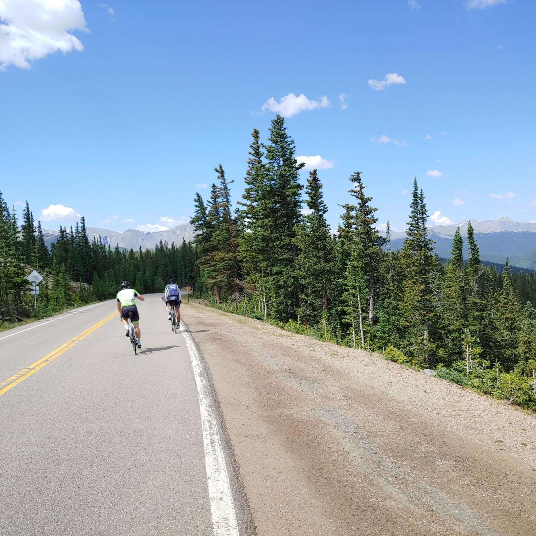
Mestaa'Ėhehe Pass (formerally Squ*w Pass) Summit is located at just over 9,800 feet. This is a popular area for cyclists in the summer time as the temperatures are significantly cooler than in Denver. This also marks the spot where most typically finish the bulk of their climbing. If you are heading back to Idaho Springs or Denver, it's mostly downhill with some great descending.
0
0
Frequently Asked Questions
How challenging are the road cycling routes around Idaho Springs?
Road cycling routes around Idaho Springs are generally challenging due to significant elevation gains and high altitudes. While there are some moderate options, the majority of the 16 available routes are classified as difficult. For instance, the route Idaho Springs to Mount Blue Sky (Evans) Summit involves over 2,000 meters of elevation gain, ascending North America's highest paved road.
What kind of scenery can I expect while road cycling in Idaho Springs?
You can expect dramatic alpine scenery, towering peaks, and dense forests. Routes often pass through high-alpine tundra, offering expansive views of the Rocky Mountains. The Idaho Springs to Guanella Pass Summit route, for example, climbs through Arapaho National Forest, showcasing diverse landscapes and panoramic views of peaks like Mount Bierstadt and Mount Blue Sky. Wildflowers are abundant in spring and summer, and aspens turn golden in autumn.
Are there any family-friendly road cycling options in the area?
While many routes are challenging, the Clear Creek Greenway offers a more moderate 44.5 km ride with around 500 meters of elevation gain. This route provides scenic views of Clear Creek and the Georgetown Loop Railroad, making it a more accessible option for families or those seeking a less strenuous experience.
What are the best times of year for road cycling in Idaho Springs?
The best time for road cycling in Idaho Springs is typically from late spring through early autumn. During these months, the weather is generally more favorable, and the alpine scenery is at its peak with wildflowers in summer and golden aspens in autumn. However, due to the high altitude, be prepared for thinner air and sudden weather changes, even in summer.
Where can I find parking for road cycling routes in Idaho Springs?
Parking is available in and around Idaho Springs. Many routes start directly from the town, which has various parking options. For specific starting points, you might find designated parking areas like the Parking lot highlight, or trailheads such as Chief Mountain Trailhead, which can serve as starting points for rides.
Are there any loop routes for road cycling near Idaho Springs?
Yes, there are loop options available. For instance, the Mount Blue Sky (Evans) to Juniper and Mestaa'Ėhehe Passes loop is a challenging 93.8 km route that offers a comprehensive tour of the alpine landscape. Another option is the Echo Lake, Squaw Pass & the Scott Lancaster cycle trail loop from Idaho Springs, which is a difficult 46.4-mile ride.
What attractions or landmarks can I see along the road cycling routes?
Many routes offer views of significant natural and historical landmarks. You might pass by Echo Lake, a shimmering alpine lake, or catch glimpses of the Mestaa’ėhehe Lookout Tower. The region also has a rich gold rush history, with attractions like the Argo Gold Mill and Tunnel in Idaho Springs itself. The Clear Creek Greenway runs alongside the historic Georgetown Loop Railroad.
How many road cycling routes are available in Idaho Springs?
There are 16 road cycling routes available around Idaho Springs, ranging in difficulty from moderate to difficult. These routes cater to various preferences, from scenic greenways to challenging alpine climbs.
What do other cyclists say about road cycling in Idaho Springs?
The road cycling routes in Idaho Springs are highly rated by the komoot community, with an average score of 5.0 stars from over 4 reviews. Cyclists often praise the stunning alpine scenery, the challenge of the climbs, and the rewarding views from high altitudes. Over 900 road cyclists have used komoot to explore the varied terrain.
Are there any less crowded road cycling routes in Idaho Springs?
While popular routes like those leading to Mount Blue Sky can see more traffic, exploring routes like Idaho Springs to Juniper Pass via Echo Lake, especially during off-peak hours or weekdays, might offer a more serene experience. The vastness of the Arapaho National Forest also provides opportunities for quieter stretches.
What should I know about the road surfaces?
Road surfaces are generally paved throughout the Idaho Springs area. However, some segments on more challenging routes, particularly at higher elevations or less frequented paths, might be unpaved or present more difficult conditions. Always be prepared for varying road quality, especially on mountain passes.
Is public transport an option to reach cycling routes?
Public transport options directly to specific cycling route trailheads are limited in this mountainous region. Most cyclists typically drive to Idaho Springs and start their rides from there. For detailed information on local transport, it's advisable to check local resources or the Clear Creek County website.
Are there any specific permits needed for cycling certain areas?
Generally, no specific permits are required for road cycling on public roads in the Idaho Springs area. However, if your route takes you through state parks like Golden Gate Canyon State Park, or if you plan to access certain recreational areas, there might be day-use fees or specific regulations. Always check the local park or forest service websites for the most current information.
Most popular routes around Idaho Springs
Most popular attractions around Idaho Springs

Get inspired with the komoot mobile app


Explore more
Browse the best Road cycling routes in other regions.
