The best running trails around Lucas Valley-Marinwood
3.3
(3)
542
runners
82
runs
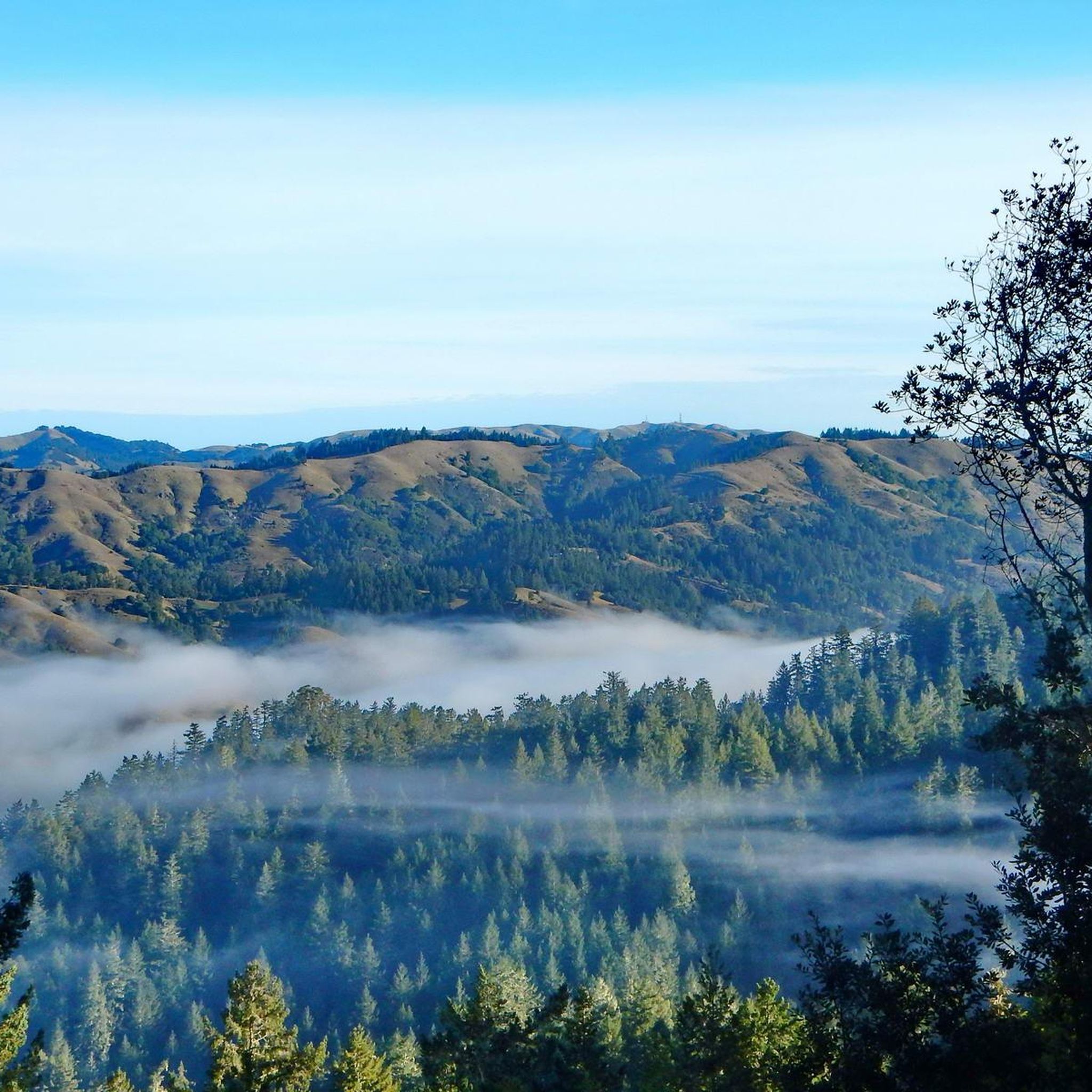
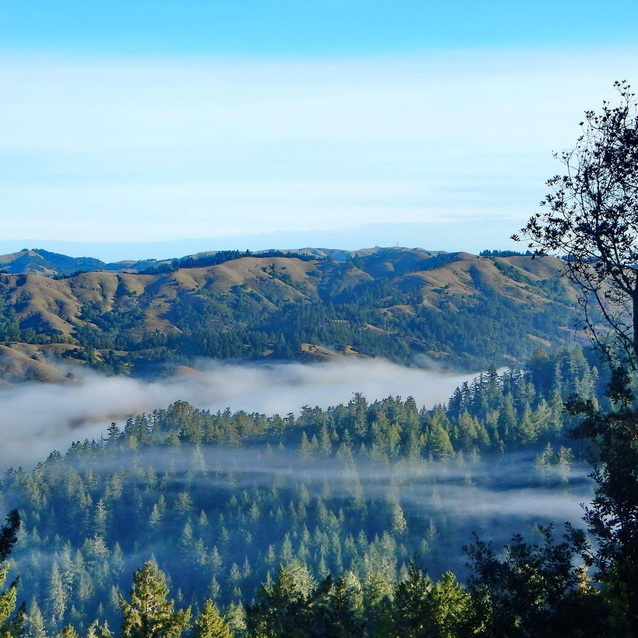
Jogging around Lucas Valley-Marinwood offers diverse natural landscapes, characterized by rolling hills, open valleys, and extensive trail systems. The region features wooded areas and expansive grasslands, providing varied terrain for runners. Natural features like Big Rock Ridge and the Lucas Valley Preserve contribute to the scenic beauty and offer numerous routes for outdoor activity. Miller Creek also flows through the community, adding to its ecological diversity.
Best jogging routes around Lucas Valley-Marinwood
- The most popular jogging route is San Francisco Bay Trail: Hamilton Wetlands, a 6.8 miles (11.0 km) trail that takes 1 hour 15 minutes to complete. This route leads through wetlands and along the bay, offering a distinct natural setting.
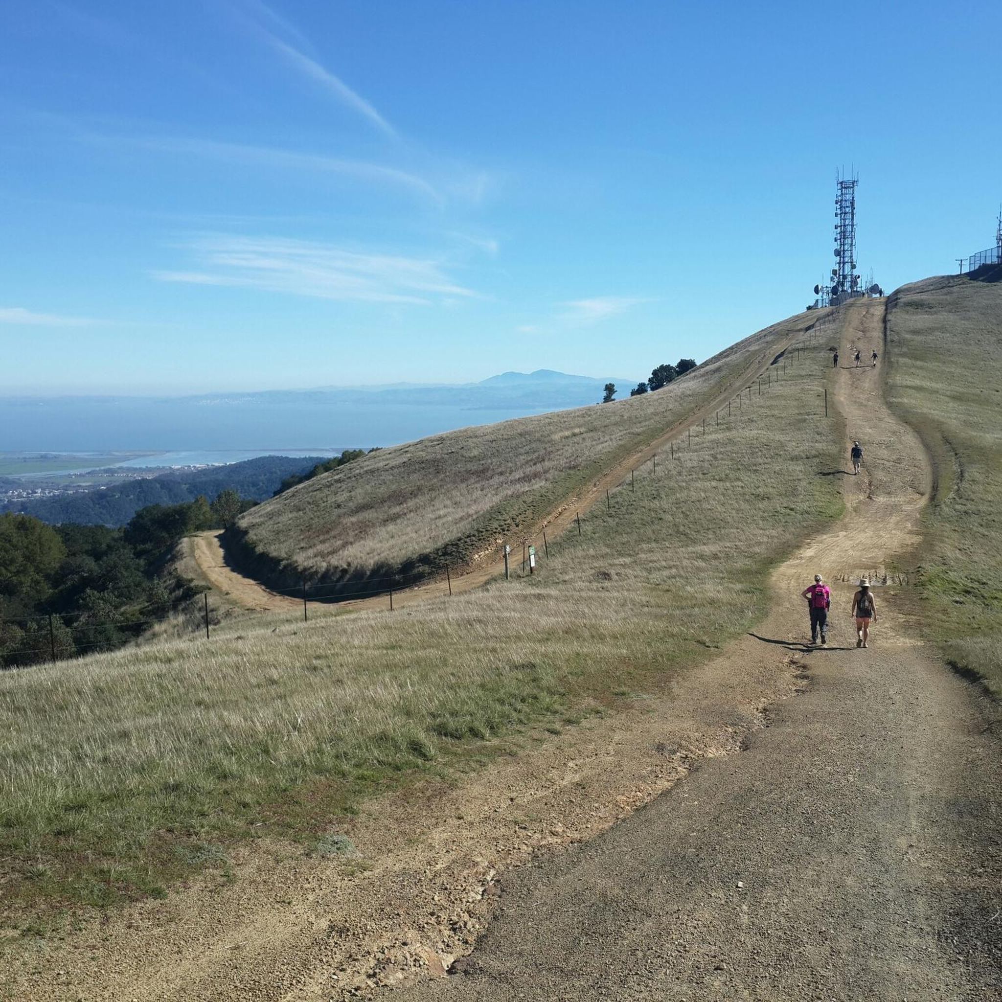
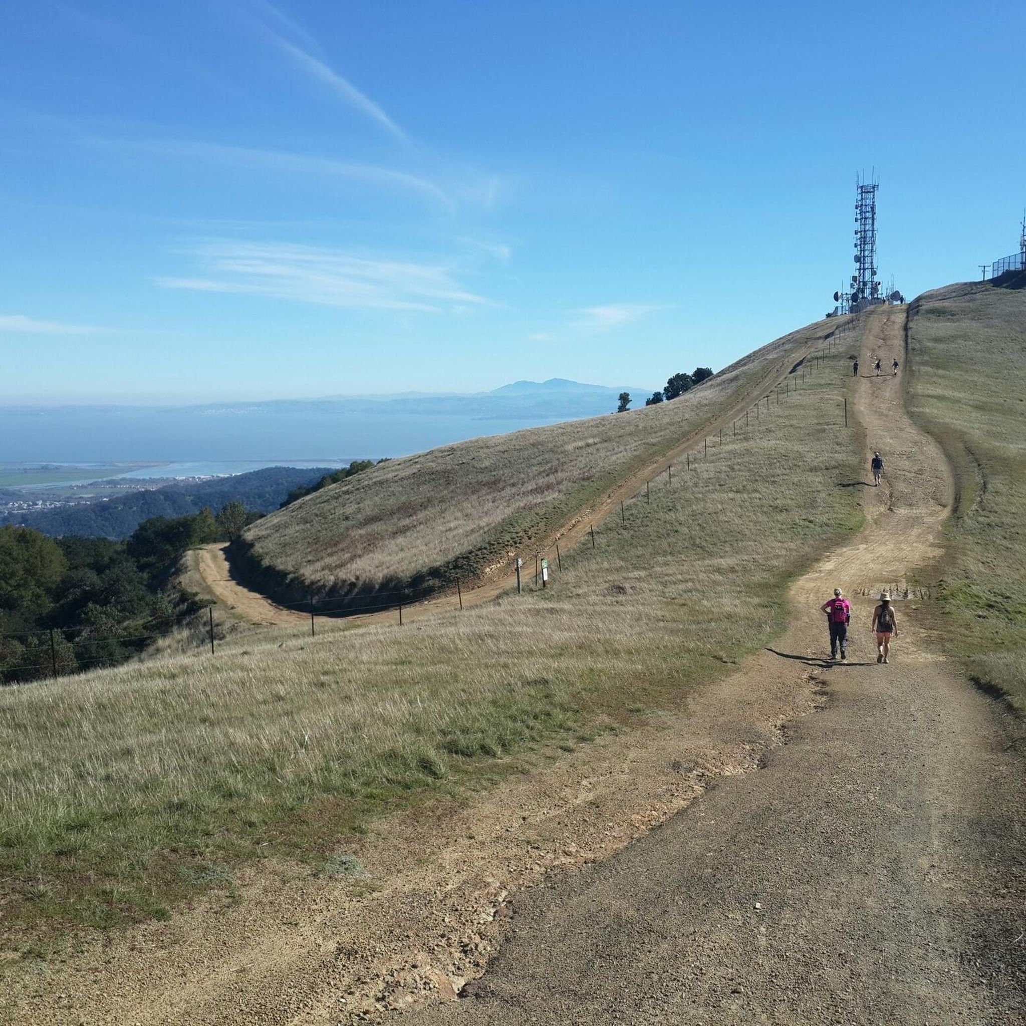
- Another top favourite among local runners is Big Rock Ridge Trail, a difficult 7.4 miles (11.9 km) path. This trail ascends to Big Rock Ridge, providing panoramic views from the second-highest point in Marin County.
- Local runners also love the Goat & Big Cat Trails loop — San Rafael, a 6.8 miles (11.0 km) trail leading through the Lucas Valley Preserve, often completed in about 1 hour 46 minutes.
- Jogging around Lucas Valley-Marinwood is defined by rolling hills, open valleys, and chaparral and oak woodlands. The network offers options for easy, moderate, and difficult routes, catering to various ability levels.
- The routes in Lucas Valley-Marinwood are highly rated by the komoot community with an average score of 4.2 stars from over 5 reviews. More than 500 runners have used komoot to explore Lucas Valley-Marinwood's varied terrain.
Last updated: August 3, 2026
14
runners
11.0km
01:15
20m
20m
Jog along the San Francisco Bay Trail: Hamilton Wetlands for a moderate 6.8-mile (11.0 km) route that takes about 1 hour and 15 minutes. You will experience the open expanse of the San Pablo Bay and the restored wetlands, gaining only 63 feet (19 metres) in elevation. The flat terrain makes for an easy jogging experience, offering wide-open views. Keep an eye out for the Hamilton Wetlands viewpoint, a great spot to observe various bird species. On clear days, you can even see Mount Tamalpais and Mount Diablo in the distance.
When planning your visit to the Hamilton Wetlands trail, remember there is no shade along the route. It is best to jog during the cooler morning or evening hours to avoid direct sun exposure. The trail is welcoming for dogs, but they must be kept on a leash at all times. This route is also very accommodating for cyclists and those with strollers, making it a versatile option for various outdoor activities.
This trail offers a unique perspective on a thriving ecosystem, transformed from its past as an army airfield. Informative placards are placed along the route, providing details about the wetlands' restoration and wildlife. Stationary binoculars at various lookout points enhance your chances of spotting diverse bird species. The Hamilton Wetlands trail provides a valuable opportunity to connect with nature and observe a successful ecological transformation.
11
runners
11.9km
01:38
400m
400m
If you're ready for a challenging jogging experience, the Big Rock Ridge Trail delivers a difficult 7.4-mile (11.9 km) route. You'll gain 1312 feet (400 metres) in elevation, typically completing the journey in about 1 hour and 37 minutes. The path winds through scenic oak-studded hillsides, offering a chance to see spring wildflowers. As you climb, you'll be treated to spectacular 360-degree views of the Bay Area, including Lucas Valley, the Richmond-San Rafael Bridge, and San Francisco; on clear days, you can even spot the Pacific Ocean and Mount Diablo.
When you plan your visit, remember that many sections of the trail are exposed to full sun. This can make it scorching hot and dusty during warmer months, so be sure to carry plenty of water and wear sun protection. It is also wise to keep an eye out for local wildlife, such as rattlesnakes and coyotes, which are common in the area.
This challenging route is located within the Lucas Valley Open Space Preserve and forms part of the larger Bay Area Ridge Trail system. It is particularly known for its impressive vistas, which make the effort of the climb truly worthwhile. The trail's unique position offers glimpses of landmarks like Skywalker Ranch, adding to its distinct character in the region.

Sign up for free
11.0km
01:46
680m
670m
A difficult 6.8-mile jogging loop in San Rafael, the Goat & Big Cat Trails offer a challenging workout with 2216 feet of elevation gain.
15.2km
02:08
660m
660m
Jog the difficult 9.4-mile Loma Alta and Bay Area Ridge Trail Loop for strenuous climbs and panoramic views of the Bay Area.
5.0
(1)
23
runners
26.8km
03:39
1,060m
1,060m
Hard run. Very good fitness required. Mostly paved surfaces. Suitable for all skill levels.
Get access to more routes and recommendations from other explorers.
Sign up for free
Already have an account?
Our route recommendations are based on thousands of hikes, rides, and runs completed by other people on komoot.
Start today with a free account
Your next adventure awaits.
Login or Signup

Other adventures around Lucas Valley-Marinwood

Tips from the Community

Loma Alta literally translates to "high hill" and is the highest point in the Loma Alta Open Space Preserve. A few different dirt roads and trails lead to the bald summit that looks over the surrounding hillsides.
0
0

This broad, flat fire road climbs gradually with magnificent views of the San Francisco Bay, Mount Tamalpais and Mount Diablo in the distance. The surrounding ridges of the path and many wildflowers along the way offer multiple photo opportunities along the way. The loop at the top is an excellent place to take a break and enjoy the beautiful views.
0
0

Embark on an adrenaline-fueled mountain biking adventure through Big Rock. The trail reaches its peak at the towering landmark, a colossal rock that adds a unique touch to the experience. Exercise caution on the descent; the pavement can get slippery, adding an exhilarating challenge to this thrilling ride.
0
0
Big Rock Ridge, a striking ridge near Novato, California, standing as Marin County's second-tallest peak. Spanning 5 miles from northwest to east, it creates a natural boundary for central and southern Marin County. Named after the rock at the base of Big Rock Trail, this ridge promises awe-inspiring views and invigorating trails.
0
0
This broad, flat fire road climbs gradually with magnificent views of the San Francisco Bay, Mount Tamalpais and Mount Diablo in the distance. The surrounding ridges of the path and many wildflowers along the way offer multiple photo opportunities along the way. The loop at the top is an excellent place to take a break and enjoy the beautiful views
0
0

Big Rock Trail cuts through Lucas Valley Open Space to reach the 2nd highest point in Marin County. From later winter through early summer the hills are verdant green and often covered in wildflowers. Bring plenty of water and a wide brimmed hat if it's a warm day as there is little shade, but this means the views are wide open and beautiful.
0
0
There is plenty of street parking at this trailhead, with the amazing Big Rock nearby to make it easy to spot. The Bay Area Ridge Trail runs along the ridgelines surrounding the San Francisco Bay area and spans over 500 miles of multi-use trails. This portion offers some of the best views of Marin and the city skyline.
0
0

Highest point on Big Rock Ridge Fire Road with panoramic views of the Bay, Marin county, and even across the East bay to Mt. Diablo and south to San Francisco. A short spur trail here leads to a point with slightly better views down over Skywalker Ranch and the Lucas Valley.
0
0
Frequently Asked Questions
How many running routes are available in Lucas Valley-Marinwood?
Lucas Valley-Marinwood offers a wide selection of running routes, with over 70 trails to explore. These include a mix of easy, moderate, and difficult options, catering to various fitness levels.
What kind of terrain can I expect on the running trails in Lucas Valley-Marinwood?
The terrain in Lucas Valley-Marinwood is quite varied, characterized by rolling hills, open valleys, wooded areas, and expansive grasslands. You'll find everything from gentle paths to challenging inclines, often featuring chaparral and oak woodlands.
Are there any easy or beginner-friendly running routes in the area?
Yes, there are several easier options. For instance, San Francisco Bay Trail: Hamilton Wetlands offers a moderate, relatively flat experience through wetlands. Lucas Valley Park also features an asphalt path suitable for light jogging, surrounded by scenic grasslands.
Can I find challenging running trails with significant elevation in Lucas Valley-Marinwood?
Absolutely. For a challenging run with significant elevation, consider the Big Rock Ridge Trail, which ascends to Big Rock Ridge, the second-highest point in Marin County. Another demanding option is the Loma Alta and Bay Area Ridge Trail Loop, known for its varied terrain.
Are there any running routes that offer panoramic views or notable landmarks?
Yes, many routes provide stunning vistas. The Big Rock Ridge Trail offers panoramic views stretching from Mount Burdell to the Golden Gate. You might also encounter natural monuments like The Big Rock - Skywalker Ranch or explore the Roy's Redwoods Open Space Preserve.
Are the running trails in Lucas Valley-Marinwood suitable for families?
Many trails are suitable for families, especially those looking for gentler paths. Lucas Valley Park offers an easy asphalt path, and the extensive trail network includes various easy to moderate options within the Lucas Valley Preserve, providing a pleasant outdoor experience for all ages.
Are there dog-friendly running trails in Lucas Valley-Marinwood?
Marin County's open space preserves generally welcome dogs on leash, making many of the trails in Lucas Valley-Marinwood dog-friendly. Always check specific trail regulations before heading out to ensure a pleasant experience for you and your canine companion.
What do other runners say about the trails in Lucas Valley-Marinwood?
The running routes in Lucas Valley-Marinwood are highly rated by the komoot community, with an average score of 4.2 stars from over 5 reviews. Runners often praise the diverse natural landscapes, varied terrain, and the scenic beauty of the area's extensive trail systems.
Are there any loop or circular running routes?
Yes, loop routes are popular in the area. A notable option is the Goat & Big Cat Trails loop — San Rafael, which takes you through the Lucas Valley Preserve. The Loma Alta and Bay Area Ridge Trail Loop is another excellent circular option.
What natural features or wildlife might I encounter while running?
You'll encounter diverse natural habitats, including chaparral and oak woodlands, rolling hills, and open valleys. Miller Creek flows through the community, contributing to its ecological diversity. Keep an eye out for local wildlife, especially in the protected areas of Lucas Valley Preserve and Loma Alta Open Space Preserve.
Is there parking available near the trailheads?
Yes, parking is generally available near the trailheads for many of the popular running routes in Lucas Valley-Marinwood and the surrounding open space preserves. Specific parking details can often be found on individual route pages or local park websites.
What is the best time of year to go running in Lucas Valley-Marinwood?
Lucas Valley-Marinwood offers good running conditions year-round, but spring and fall are particularly pleasant with milder temperatures and vibrant natural scenery. Summers can be warm, so early morning or late afternoon runs are recommended, while winters are generally mild, making it suitable for outdoor activity.
Most popular routes around Lucas Valley-Marinwood
Most popular attractions around Lucas Valley-Marinwood

Get inspired with the komoot mobile app


Explore more
Browse the best Running Trails & Routes in other regions.
