The best walks and hikes around Highlands
4.6
(115)
2,504
hikers
108
hikes
Hiking around Highlands offers a diverse landscape characterized by rugged mountains, deep glens, and expansive lochs. The region features ancient Caledonian pine forests and wild coastal paths, providing varied terrain for outdoor exploration. This vast area includes iconic peaks like Ben Nevis and numerous Munros, alongside more gentle loch-side trails. The geology of the Highlands, with its ancient rock formations, adds to the unique character of its hiking trails.
Best hiking trails around Highlands
- The most popular hiking route is…
Last updated: October 2, 2026
3.0
(2)
14
hikers
5.31km
01:26
70m
70m
Easy hike. Great for any fitness level. Easily-accessible paths. Suitable for all skill levels.
4
hikers
9.67km
02:33
120m
40m
Moderate hike. Good fitness required. Easily-accessible paths. Suitable for all skill levels.

18.0km
05:14
480m
450m
Hard hike. Very good fitness required. Easily-accessible paths. Suitable for all skill levels.
1.07km
00:22
90m
0m
Easy hike. Great for any fitness level. Easily-accessible paths. Suitable for all skill levels.
5.0
(1)
12
hikers
3.52km
01:05
130m
130m
Easy hike. Great for any fitness level. Easily-accessible paths. Suitable for all skill levels.
Get access to more routes and recommendations from other explorers.
Already have an account?
Our route recommendations are based on thousands of hikes, rides, and runs completed by other people on komoot.
Start today with a free account
Your next adventure awaits.

Tips from the Community

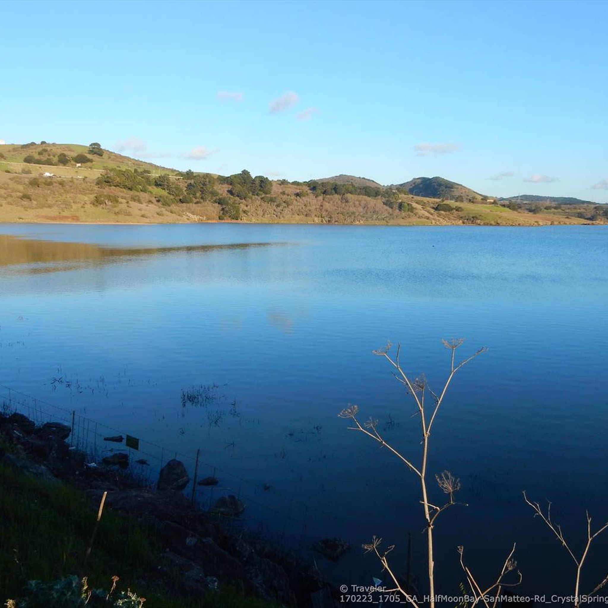
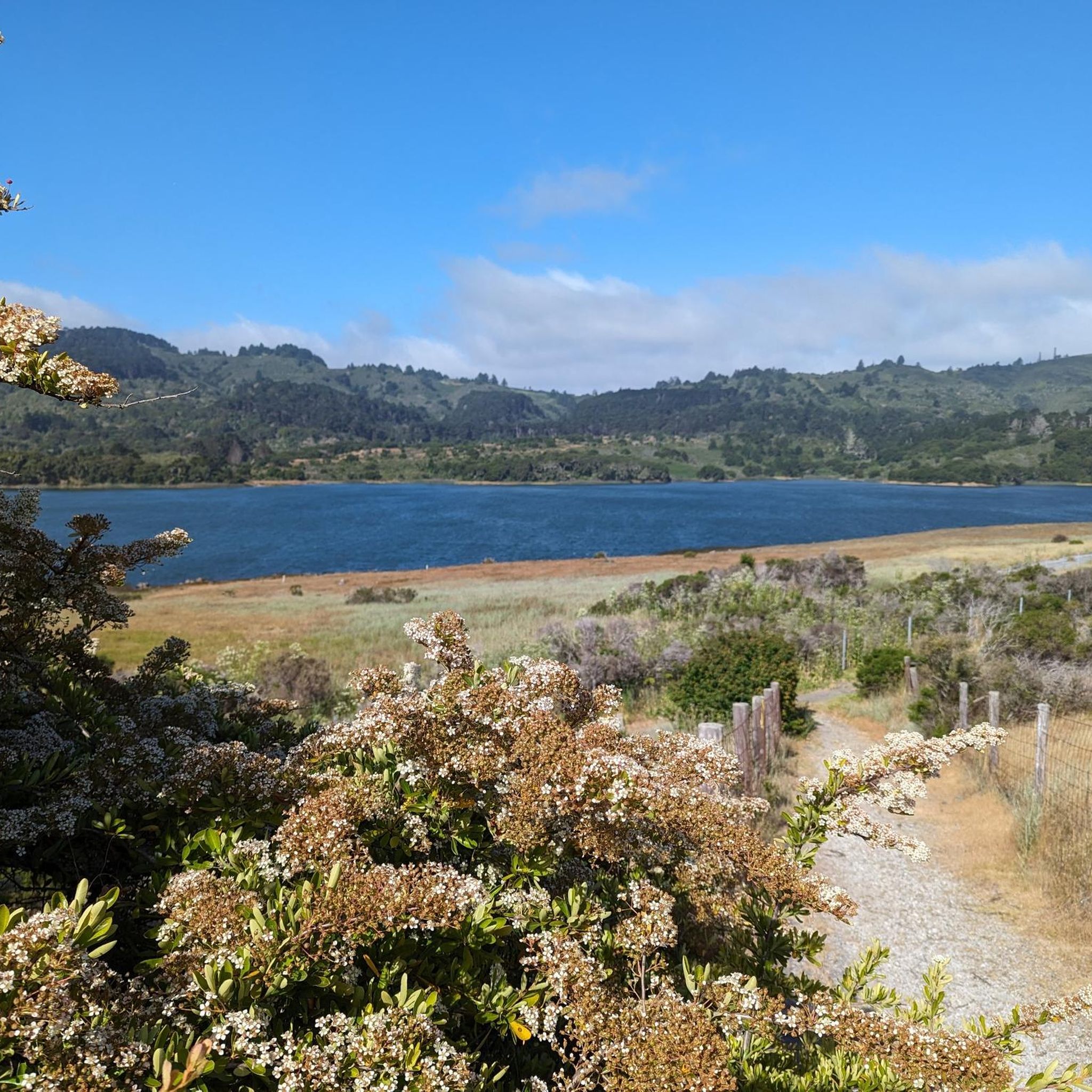
Pretty, near-panoramic views of the surrounding hills.
0
0

San Andreas Lake is a hidden gem tucked into the hills of San Mateo County, just south of San Francisco. Originally a natural sag pond formed by the San Andreas Fault, it was transformed into a reservoir in the late 1800s and now serves as a vital water source for the region. The lake is off-limits for swimming or boating, but you can enjoy its peaceful beauty from the San Andreas Trail or the popular Sawyer Camp Trail, which runs along its eastern edge. It's a serene spot where you can walk or bike with sweeping views of the water and surrounding hills, all while standing right on one of the world’s most famous fault lines. Despite its proximity to urban life, San Andreas Lake offers a quiet, scenic escape steeped in natural and historical significance.
1
0

Sugarloaf Mountain, sometimes more aptly called Sugarloaf Hill, is a simple and quick summit in the San Mateo area, offering some satisfying views of the greater San Francisco Bay Area. It is a great day hike destination if you are in the area.
0
0

Unfortunately Fifield Ridge is only accessible on guided rides organized by the Water district, entering from the South. Reservation is free and online. There is an interesting view to the Andreas fault lakes
0
0

Relatively busy with pedestrians during the weekend but still nice ride. Pavement is pretty good.
0
0
San Andreas Lake is a reservoir adjacent to the San Francisco Peninsula cities of Millbrae and San Bruno in San Mateo County, California. It is situated directly on the San Andreas Fault, which is named after the valley it is in. (https://en.wikipedia.org/wiki/San_Andreas_Lake)
0
0
See https://www.komoot.de/highlight/172571 The 15-mile Crystal Springs Regional Trail is one of the best mostly paved bike trails with few cars in the Bay Area. It spans from San Bruno to Woodside and is routed along three gorgeous lakes and connector links amid riparian woodlands. On Sundays, you can combine the San Andreas and Sawyer Camp segments to south of Highway 92 to Cañada Road, which is closed to cars for Bicycle Sundays (See https://www.komoot.de/tour/11413421 ). Speed limit: 15 mph, difficult for high-end road bikes to stay below; hikers: please don't stand and talk in the center of the trail. San Andreas segment: From Skyline Boulevard south of San Bruno Avenue the trail drops to the head of San Andreas Lake, with pretty views across to the west of the wilderness slope of Montara Mountain. It rides along the lake 2 miles to an access point near Larkspur and 0.6 miles to another (at Hillcrest) where it connects to the Sawyer Camp segment. Sawyer Camp segment: This is a gorgeous, easy bike ride, where you drop 400 feet over the span of 6 miles to Crystal Springs Dam. The route descends into riparian woodlands for 2.5 miles to Jepson Laurel picnic grounds, then runs along Crystal Springs Reservoir for 5.2 miles. You can continue another 1.7 miles to Cañada Road for Bicycle Sunday (no cars). Cañada Road/Crystal Springs segment: South along Upper Crystal Springs Reservoir for 2.1 miles to the Pulgas Water Temple. It continues another 2.1 miles past Filoli Botanical Center and Phleger Estate to Edgewood Road - http://sfgate.com/outdoors/sundaydrive/article/Crystal-Springs-Trail-links-lakes-woodlands-4723374.php - http://parks.smcgov.org/crystal-springs-regional-trail
0
0
Frequently Asked Questions
How many hiking trails are available in the Highlands?
The Highlands region offers a wide variety of hiking opportunities, with over 70 routes currently available on komoot. These range from gentle loch-side strolls to more challenging mountain ascents, catering to all experience levels.
What types of landscapes can I expect to see while hiking in the Highlands?
The Highlands are renowned for their dramatic and diverse landscapes. You'll encounter rugged mountains, sweeping glens, mirror-calm lochs, ancient Caledonian pine forests, and wild coastal paths. Iconic peaks like Ben Nevis and the Cuillin Hills, along with famous glens such as Glen Coe and Glen Affric, define the region's stunning scenery.
Are there any easy, family-friendly walks in the Highlands?
Yes, the Highlands offer many easy and family-friendly routes. Areas like Loch an Eilein in Cairngorms National Park are ideal for gentle strolls. Many loch-side paths provide accessible options with beautiful views. Approximately 58 of the routes listed on komoot for the Highlands are rated as easy.
Where can I find challenging hikes for experienced walkers in the Highlands?
For experienced hikers seeking a challenge, the Highlands are home to numerous demanding mountain routes. You can tackle Munros (mountains over 3,000 feet) in ranges like the Cuillin Hills on the Isle of Skye or the Torridon Hills. Glen Coe also offers a natural playground for more advanced adventurers. There are 21 moderate routes available on komoot, with many more challenging options to explore across the region.
Are there any circular walks available in the Highlands?
Many hiking trails in the Highlands are designed as circular routes, allowing you to start and end at the same point. These are popular for day trips and can be found across various difficulty levels, from short forest loops to longer mountain circuits. Komoot's route planner can help you discover and plan circular walks tailored to your preferences.
What kind of wildlife might I encounter on the trails?
The Highlands are rich in wildlife. Hikers often spot red squirrels, red deer, pine martens, and various bird species, including golden eagles. If you're lucky, you might even catch a glimpse of a wildcat or otter, particularly near lochs and rivers.
Are there any notable natural attractions or landmarks to see along the hiking routes?
Absolutely. The Highlands are dotted with breathtaking natural attractions. You can explore stunning waterfalls like the Falls of Glomach, or visit iconic geological formations such as the Quiraing on the Isle of Skye. The region also features ancient Caledonian pine forests, particularly in areas like Glen Affric and Beinn Eighe National Nature Reserve. For specific points of interest, consider visiting Lower Crystal Springs Reservoir or San Andreas Lake.
Can I bring my dog on hiking trails in the Highlands?
Many trails in the Scottish Highlands are dog-friendly, but it's crucial to keep dogs under close control, especially in areas with livestock or ground-nesting birds. Always check local signage and be mindful of wildlife. Some areas, particularly nature reserves, may have specific restrictions or require dogs to be on a lead.
What is the best time of year to go hiking in the Highlands?
The best time to hike in the Highlands is generally from late spring (May) to early autumn (September). During these months, you'll experience longer daylight hours, milder temperatures, and fewer midges (though they can still be present). Spring offers vibrant wildflowers, while autumn brings stunning foliage. Winter hiking is possible but requires significant experience, proper gear, and awareness of rapidly changing weather conditions.
Are there opportunities for wild swimming near hiking trails?
Yes, the Highlands offer numerous opportunities for wild swimming in its many lochs and rivers. Popular spots include various lochs within the Cairngorms National Park and other secluded locations. Always prioritize safety, check water conditions, and be aware of cold water shock. Many trails lead to or pass by beautiful swimming spots, allowing you to combine hiking with a refreshing dip.
What do other hikers enjoy most about hiking in the Highlands?
The Highlands are highly rated by the komoot community, with an average score of 4.6 stars from over 80 reviews. Reviewers often praise the region's unparalleled natural beauty, the sense of wilderness, and the diverse range of trails that cater to all abilities. The dramatic mountain scenery, tranquil lochs, and opportunities for wildlife spotting are frequently highlighted as favorite aspects.
Are there any long-distance hiking routes in the Highlands?
Yes, the Highlands are home to several iconic long-distance routes. The West Highland Way is a popular 96-mile trail stretching from Milngavie to Fort William, offering a journey through rugged glens and wild moorland. Other notable routes include the Great Glen Way and sections of the Hebridean Way, providing multi-day hiking adventures.
Most popular attractions around Highlands

Get inspired with the komoot mobile app


Explore more
Browse the best Hikes in other regions.
