The best road cycling routes around El Sobrante
4.5
(4)
42
riders
5
rides
Road cycling routes around El Sobrante traverse a semi-rural landscape characterized by varied terrain, including open hillsides and oak woodlands. The region features natural elements such as San Pablo Creek and the San Pablo Reservoir, which contribute to the area's greenbelts. Cyclists can find routes that range from mostly paved surfaces to those with significant elevation changes. This environment provides diverse opportunities for road cycling.
Best road cycling routes around El Sobrante
- The most popular road cycling route is View…
Last updated: May 21, 2026
5.0
(1)
24
riders
60.2km
03:05
540m
540m
Moderate road ride. Good fitness required. Mostly well-paved surfaces and easy to ride.
5.0
(2)
20
riders
Moderate road ride. Good fitness required. Mostly well-paved surfaces and easy to ride.

Sign up for free
5
riders
Easy road ride. Great for any fitness level. Mostly well-paved surfaces and easy to ride.
3
riders
Moderate road ride. Good fitness required. Mostly well-paved surfaces and easy to ride.
3
riders
Easy road ride. Great for any fitness level. Mostly well-paved surfaces and easy to ride.
Our route recommendations are based on thousands of hikes, rides, and runs completed by other people on komoot.
Start today with a free account
Your next adventure awaits.
Login or Signup


Tips from the Community

This smooth, paved, two-lane multi-use path takes you through the heart of Hidden Valley. The views from this part of the park are quite special.
0
0
The park is a "living museum" of citrus history in California, and has many buildings, orchards, and exhibits to explore. If you bike through the park, know there is a 15mph speed limit for cyclists in the park proper.
0
0

Bring plenty of water. There only are water fountains midway in Anaheim.
0
0

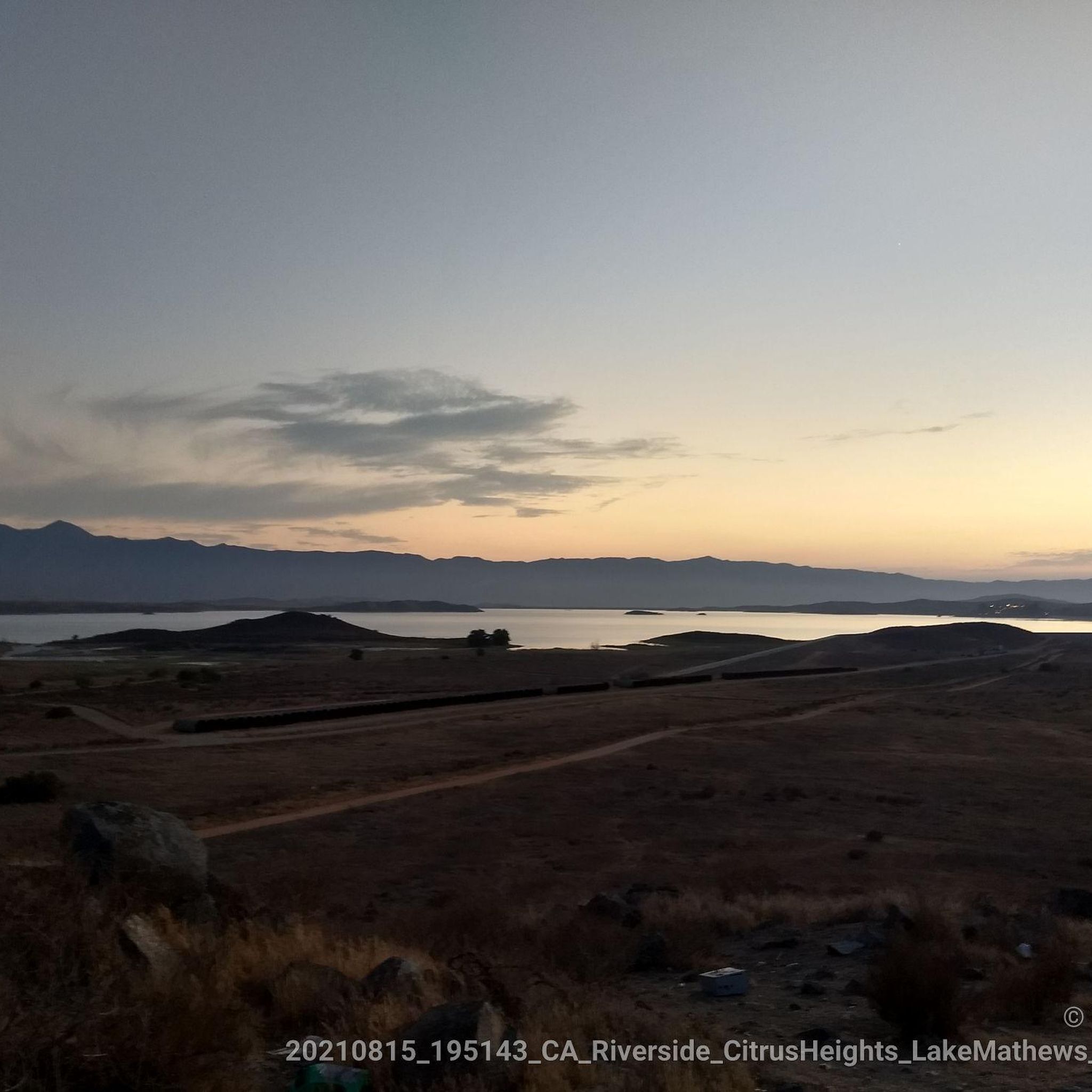
This view of Sierra Peak showcases one of the highest and most easily identifiable peaks in northern Orange County. It stands at 3,045 feet above sea level.
1
0

Nice wooden bridge along the Santa Ana River Trail. It takes you over the river and gives you a good view of the water.
1
0

Set along the edge of the Santa Ana Canyon this park offers visitors a variety of amenities such as sports fields, picnic & BBQ areas, fishing, playgrounds, and more. The Santa Ana Trail runs along the edge of the park and allows you to access other nearby areas as well.
0
0

At Hidden Valley Viewpoint, you'll find a shaded tree, an observation area, and useful maps. The trail to the viewpoint is unpaved, so you might need to hop off your bike and push it. Please proceed with caution. It's a great place to take a break in the shade.
1
0
This is a quiet and scenic stretch of the Santa Ana River Trail. The northern section closely follows the natural channel as it flows from the mountains. The trail runs alongside the river and offers a peaceful atmosphere with nice views of the surrounding area.
1
0
Frequently Asked Questions
How many road cycling routes are available in El Sobrante?
There are 5 road cycling routes around El Sobrante featured in this guide, offering diverse options for cyclists. These include 2 easy routes and 3 moderate routes, catering to various skill levels.
What kind of terrain can I expect on road cycling routes in El Sobrante?
Road cycling routes in El Sobrante traverse a semi-rural landscape with varied terrain. You'll find open hillsides, oak woodlands, and greenbelts along natural features like San Pablo Creek and the San Pablo Reservoir. Routes range from mostly paved surfaces to those with significant elevation changes, providing a mix of challenges and scenic rides.
Are there easy or beginner-friendly road cycling routes in El Sobrante?
Yes, El Sobrante offers easy road cycling routes suitable for beginners or those looking for a more relaxed ride. For example, the Santa Ana River Trail – Hidden Valley Viewpoint loop from Norte Vista High School is an easy 10.4-mile route with minimal elevation gain, often completed in under an hour. Another easy option is the Santa Ana River Trail – Hidden Valley Viewpoint loop from California Baptist University, which covers 38.4 miles.
Are there challenging road cycling routes with significant climbs in the area?
For cyclists seeking a challenge, El Sobrante and its surroundings offer routes with notable elevation gains. The View of Sierra Peak – Santa Ana River loop from Norco, for instance, is a moderate 40.1-mile route with over 1,380 feet of ascent. The region's varied terrain, including the San Pablo Ridge and Sobrante Ridge, provides opportunities for more demanding rides.
What scenic views or landmarks can I expect on road cycling routes in El Sobrante?
Road cycling routes in El Sobrante offer diverse scenic views. You can expect vistas of the San Pablo Reservoir, open hillsides, and oak woodlands. Some routes, like the Hidden Valley Viewpoint – Santa Ana River Bike Path loop from California Baptist University, include scenic sections along the Santa Ana River Bike Path. Nearby attractions include the Hidden Valley Viewpoint and the Pumpkin Rock.
Are there routes that follow water features like rivers or reservoirs?
Yes, several routes incorporate water features. San Pablo Creek is a defining natural feature of El Sobrante, and the San Pablo Reservoir is a prominent landmark. Many routes, such as the View of Sierra Peak – Santa Ana River loop from Norco, offer extensive riding along the Santa Ana River, providing picturesque views of the water.
Are there loop routes for road cycling in El Sobrante?
Most of the featured road cycling routes in El Sobrante are loops, making them convenient for starting and ending at the same point. Examples include the View of Sierra Peak – Santa Ana River loop from Norco and the Hidden Valley Viewpoint – Santa Ana River Trail loop from Harvest Christian Fellowship Church.
When is the best time of year for road cycling in El Sobrante?
El Sobrante generally offers favorable conditions for road cycling throughout much of the year due to California's mild climate. Spring and fall typically provide the most comfortable temperatures, while winters are generally mild. Summers can be warm, so early morning or late afternoon rides are often preferred during hotter months.
What do other road cyclists enjoy the most about road cycling in El Sobrante?
The road cycling routes in El Sobrante are highly rated by the komoot community, with an average score of 4.5 stars from over 4 reviews. Cyclists often praise the region's semi-rural landscapes, varied terrain, and the opportunities to ride along scenic river corridors and past natural features like the San Pablo Reservoir.
Are there any nearby parks or recreational areas worth exploring by bike?
Absolutely. Beyond the specific routes, El Sobrante is close to several notable recreational areas. Kennedy Grove Regional Recreation Area offers trails and mature eucalyptus trees, while Point Isabel Regional Shoreline Park, though multi-use, has segments of the San Francisco Bay Trail that are popular for cycling and offer bay views.
Are there any coffee shops or places to refuel along the routes?
While specific cafes directly on every route are not detailed, El Sobrante is a community with local amenities. You'll find various establishments within or near the community where you can refuel before or after your ride. Local bike shops like The Pedaler Bike Shop and El Sobrante Cyclery also support the cycling community.
What are the typical distances of road cycling routes in El Sobrante?
The road cycling routes in El Sobrante vary in distance to suit different preferences. You can find shorter rides, such as the Santa Ana River Trail – Hidden Valley Viewpoint loop from Norte Vista High School at 10.4 miles (16.8 km), up to longer excursions like the View of Sierra Peak – Santa Ana River loop from Norco, which is 40.1 miles (64.6 km).
Most popular routes around El Sobrante
Most popular attractions around El Sobrante

Get inspired with the komoot mobile app


Explore more
Browse the best Road cycling routes in other regions.
