The best cycling routes around Burlingame
4.3
(117)
1,995
riders
14
rides
Touring cycling routes around Burlingame offer diverse landscapes, from flat, paved paths along the San Francisco Bay shoreline to wooded canyons and rolling hills. The region is characterized by its proximity to the bay, providing scenic water views and marshlands, while inland areas feature eucalyptus groves and access to more elevated terrain. Cyclists can explore multi-use trails and dedicated road cycling routes that traverse varied environments, making for some of the best bike routes Burlingame has to offer.
Best touring cycling routes around Burlingame
- The most popular touring cycling route is Coyote Point Recreation Area – Bay Trail on Foster City Levee loop from Burlingame, a 21.3 miles (34.3 km) trail that takes 1 hour 58 minutes to complete. This route offers flat, paved sections with views of the San Francisco Bay and marshlands.
- Another top favourite among local touring cyclists is Coyote Point Recreation Area – Bay View Point loop from Burlingame, an easy 20.4 miles (32.9 km) path. This route features scenic bay views and passes through waterfront parkland.
- Local touring cyclists also love the Jepson Laurel – San Andreas Lake loop from Broadway, a 16.0 miles (25.8 km) trail leading through wooded areas and past San Andreas Lake, often completed in about 1 hour 40 minutes.
- Touring cycling around Burlingame is defined by San Francisco Bay shoreline paths, wooded canyons, and gentle hills. The network offers options for different ability levels, from leisurely rides to more challenging routes.
- The routes in Burlingame are highly rated by the komoot community with an average score of 4.6 stars from over 60 reviews. More than 900 touring cyclists have used komoot to explore Burlingame's varied terrain.
Last updated: August 5, 2026
5.0
(2)
21
riders
Easy bike ride. Great for any fitness level. Mostly paved surfaces. Suitable for all skill levels.
16
riders
Moderate bike ride. Good fitness required. Mostly paved surfaces. Suitable for all skill levels.

Sign up for free
30
riders
Easy bike ride. Great for any fitness level. Mostly paved surfaces. Suitable for all skill levels.
7
riders
Moderate bike ride. Good fitness required. Mostly paved surfaces. Suitable for all skill levels.
4.6
(8)
95
riders
Moderate bike ride. Good fitness required. Mostly paved surfaces. Suitable for all skill levels.
Get access to more routes and recommendations from other explorers.
Sign up for free
Already have an account?
Our route recommendations are based on thousands of hikes, rides, and runs completed by other people on komoot.
Start today with a free account
Your next adventure awaits.
Login or Signup

Tips from the Community

Caltrain is bike friendly. Read on their website how to do it, then hopon, got to San Jose or San Francisco and ride around there. It makes a great day.
0
0

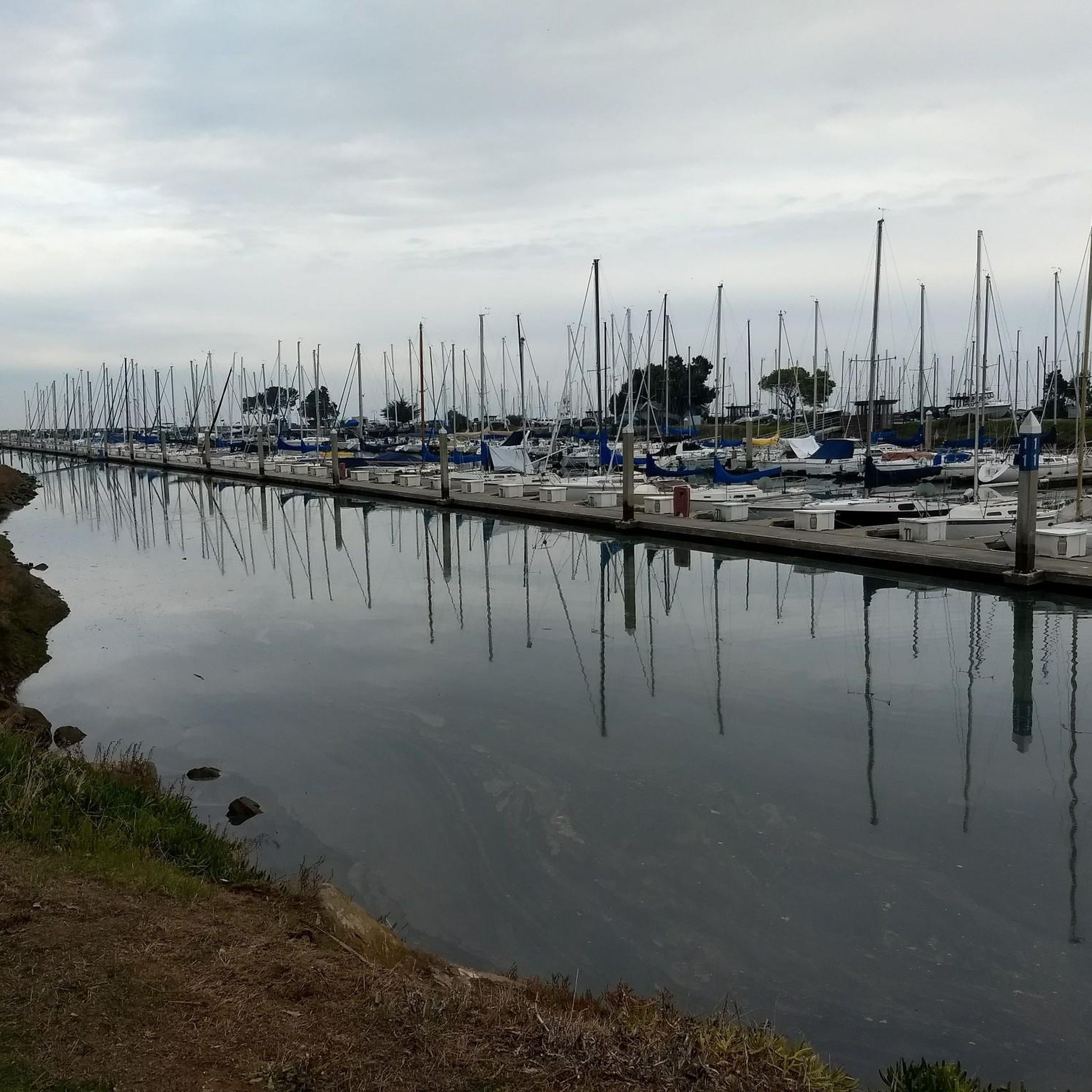
Seal Slough, or Marina Lagoon is a narrow tidal channel through salt‑marsh wetlands. It begins at the San Mateo Bay shoreline and winds east into Foster City. It is home to dense cordgrass, pickleweed, and mudflats, as well as invertebrates, fish, and the endangered California clapper rail. Bikers can enjoy the paved Bay Trail segment that follows the slough’s east bank.
1
0
The Bay Trail wraps around Baywinds Park at Mariners Point. The views are great, and the trail is smooth and paved. Expect a bay breeze, especially windy in the afternoons.
1
0

The station is small, and has a little park by the platform. The Burlingame Hillsborough History Museum is contained within the station, which is historic in its own right. Be sure to check out the exhibits for photographs and stories of the town's past.
0
0

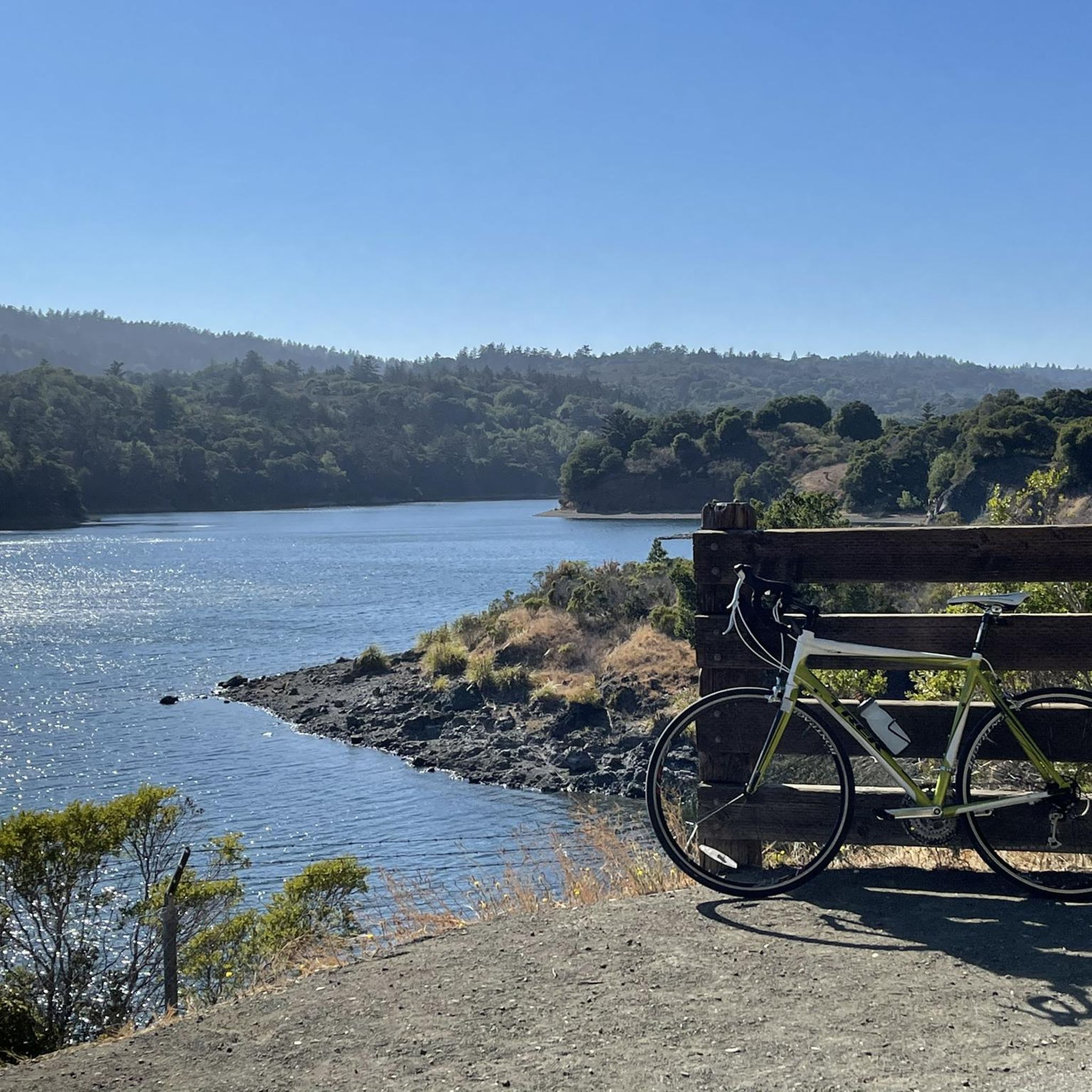
Lower Crystal Springs Reservoir is part of the Crystal Springs Reservoir system, and provides water to the San Francisco Bay Area. The area surrounding the reservoir is rich in biodiversity, home to rare and endangered species like the San Mateo thornmint and the Marin Dwarf Flax. While recreational activities on the water are restricted to protect the watershed, the adjacent Crystal Springs Regional Trail offers scenic views for hikers and cyclists.
0
0

The Crystal Springs Regional Trail is a top spot for cyclists, featuring mostly paved paths with minimal car traffic. The trail runs through scenic areas like Lower Crystal Springs Reservoir, offering beautiful lake views. On Sundays, you can ride the car-free Cañada Road segment for a more relaxed experience. Be mindful of the 15 mph speed limit, especially around hikers. The Sawyer Camp segment provides a gentle descent and stunning views, perfect for an easy ride through woodlands and along the reservoir.
0
1

This small lagoon offers an excellent photo opportunity for visitors and photographers alike. Its calm, crystal-clear waters create a stunning mirror-like reflection of the iconic Oracle Buildings that surround it. The tranquil setting, combined with the striking architecture, makes it an ideal spot to capture breathtaking images, especially during sunrise and sunset.
0
0

Inland from here, the neighborhoods are full of 101 on-ramps and fast multi-lane one-way streets. I don't recommend biking to enter the bay trail here.
0
0
Frequently Asked Questions
How many touring cycling routes are available in Burlingame?
There are 13 touring cycling routes around Burlingame, offering a variety of experiences from easy, flat rides to more moderate excursions. Six of these routes are considered easy, five are moderate, and two are more difficult.
What do other touring cyclists say about the routes in Burlingame?
The touring cycling routes in Burlingame are highly rated by the komoot community, with an average score of 4.6 stars from over 60 reviews. Cyclists often praise the diverse landscapes, from scenic bay views to wooded areas, and the accessibility of the trails.
Are there touring cycling routes suitable for families or beginners in Burlingame?
Yes, Burlingame offers several easy touring cycling routes perfect for families and beginners. The Seal Point Park – Gerry Mon Memorial Path loop from Burlingame is a shorter, easy option, while the Coyote Point Recreation Area – Bay Trail on Foster City Levee loop from Burlingame provides flat, paved sections ideal for a leisurely ride with scenic bay views.
Are there more challenging touring cycling routes in the Burlingame area?
While many routes are easy to moderate, some options incorporate more significant elevation changes, particularly those heading towards areas like Woodside or the nearby coastal mountains. For a moderate challenge with scenic views, consider the San Andreas Lake – Jepson Laurel loop from Highlands-Baywood Park, which features over 400 meters of elevation gain.
Can I find paved touring cycling routes in Burlingame?
Yes, many touring cycling routes in Burlingame feature paved sections, especially those along the San Francisco Bay shoreline. The Burlingame section of the San Francisco Bay Trail is a prime example, offering a flat, paved, multi-use path with stunning bay vistas. Routes like the Coyote Point Recreation Area – Bay View Point loop from Burlingame also include extensive paved segments.
Are there touring cycling routes with scenic views of the Bay?
Absolutely. Burlingame's touring cycling routes are renowned for their bay views. The Bay View Point – Coyote Point Recreation Area loop from Broadway offers continuous picturesque views of the San Francisco Bay, its skyline, and surrounding marshlands. The San Francisco Bay Trail itself is a major highlight for its stunning waterfront vistas.
Are there touring cycling routes that are accessible by public transport?
Yes, Burlingame is well-served by public transport, making several cycling routes accessible. Caltrain, a bike-friendly public transportation option, has a station in Burlingame, allowing cyclists to easily reach various starting points for routes along the Bay Trail and other local paths.
What natural attractions can I see along touring cycling routes in Burlingame?
Cycling routes in Burlingame offer access to several natural attractions. You can enjoy views of Lower Crystal Springs Reservoir and San Andreas Lake, both significant natural features. The Coyote Point Recreation Area – Bay Trail on Foster City Levee loop from Burlingame passes through the expansive Coyote Point Recreation Area, known for birdwatching and diverse wildlife.
Are there any specific landmarks or points of interest to explore while cycling?
Beyond natural beauty, you can encounter points of interest like the Liberty Garden (Quarry Bike Trail). The Shorebird Sanctuary along the bay also features public art installations and excellent opportunities for nature observation.
Are touring cycling routes in Burlingame suitable for dogs?
Many multi-use paths and parks in Burlingame, including sections of the Bay Trail, are dog-friendly, provided dogs are kept on a leash. It's always best to check specific park regulations for the route you plan to take to ensure a pleasant experience for you and your pet.
Where can I find parking for touring cycling routes in Burlingame?
Parking is generally available at various access points along popular routes. For instance, Coyote Point Recreation Area offers parking facilities, and many parks like Washington Park and Bayside Park have designated parking areas that can serve as starting points for your cycling adventure.
Are there any hidden gem touring cycling routes in Burlingame?
For a more rustic and tranquil experience away from the main bayfront paths, Mills Canyon Trail within Burlingame's city limits offers unpaved paths winding through wooded areas and along a creek. It provides a shaded escape with natural sounds, though it's not explicitly listed in the guide's top routes, it's a local favorite for its serene atmosphere.
Most popular routes around Burlingame
Most popular attractions around Burlingame

Get inspired with the komoot mobile app


Explore more
Browse the best Cycling routes in other regions.
