The best road cycling routes around Belmont
4.7
(125)
6,732
riders
167
rides
Road cycling around Belmont, California, offers diverse terrain ranging from flat, scenic bayfront paths to routes with rolling hills and moderate climbs. The region is characterized by open spaces, wooded areas, and extensive paved trails that follow the San Francisco Bay and Crystal Springs Reservoir. Road cyclists can explore routes that provide views of the bay, wetlands, and reservoirs, with options for various fitness levels.
Best road cycling routes around Belmont
- The most popular road cycling route is Stevens Creek…
Last updated: October 12, 2026
5.0
(4)
156
riders
74.7km
03:34
980m
980m
Hard road ride. Very good fitness required. Mostly well-paved surfaces and easy to ride.
63
riders
65.4km
02:34
130m
130m
Moderate road ride. Good fitness required. Mostly well-paved surfaces and easy to ride.

5.0
(2)
32
riders
Moderate road ride. Good fitness required. Some segments of this route may be unpaved and difficult to ride.
5.0
(1)
26
riders
48.2km
02:14
390m
390m
Moderate road ride. Good fitness required. Some segments of this route may be unpaved and difficult to ride.
5.0
(1)
46
riders
29.8km
01:22
350m
350m
Moderate road ride. Good fitness required. Mostly well-paved surfaces and easy to ride.
Get access to more routes and recommendations from other explorers.
Already have an account?
Our route recommendations are based on thousands of hikes, rides, and runs completed by other people on komoot.
Start today with a free account
Your next adventure awaits.

Tips from the Community

A fun, pretty place to stop while riding Cañada road. I has water and an air pump and bathrooms. Take a photo with friends.
0
0

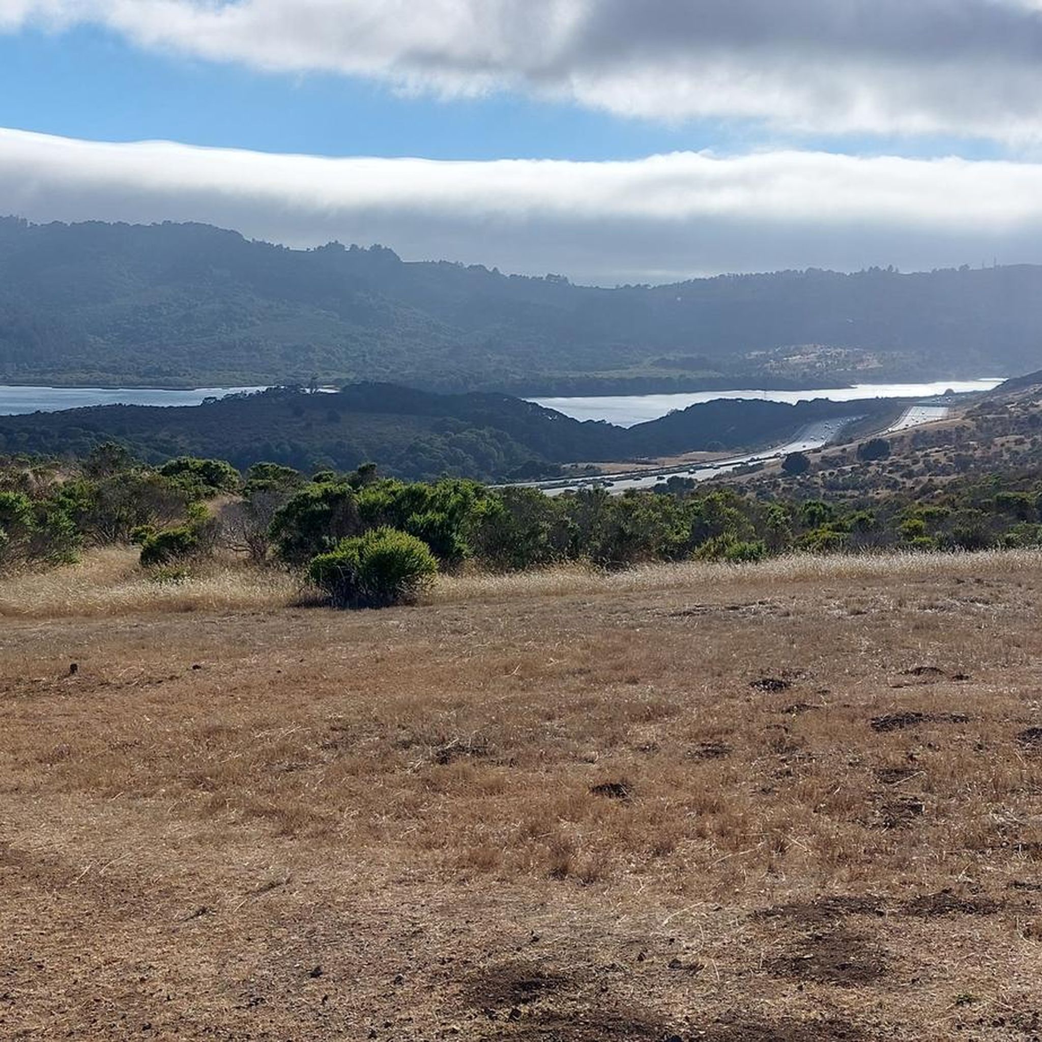
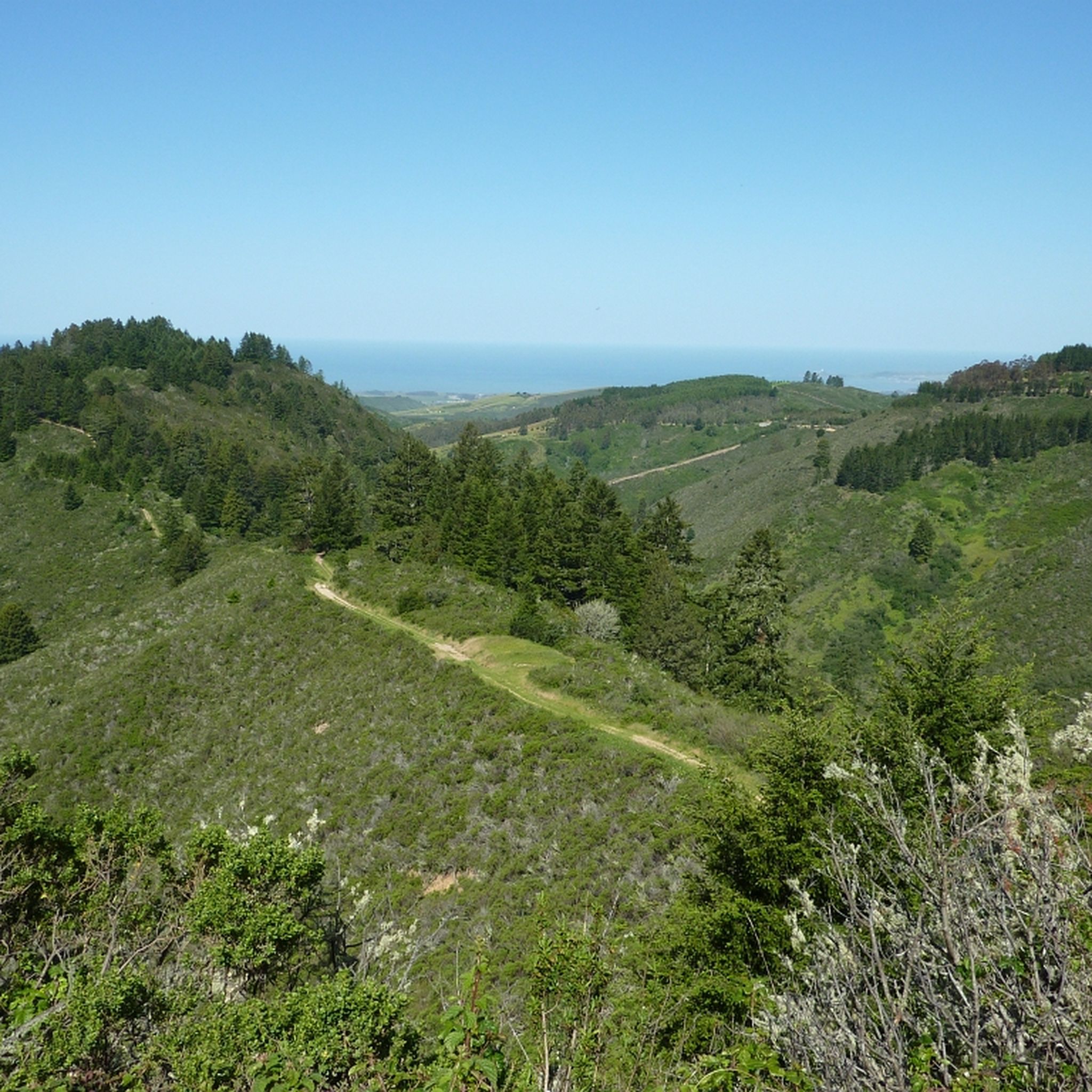
San Andreas Lake is a hidden gem tucked into the hills of San Mateo County, just south of San Francisco. Originally a natural sag pond formed by the San Andreas Fault, it was transformed into a reservoir in the late 1800s and now serves as a vital water source for the region. The lake is off-limits for swimming or boating, but you can enjoy its peaceful beauty from the San Andreas Trail or the popular Sawyer Camp Trail, which runs along its eastern edge. It's a serene spot where you can walk or bike with sweeping views of the water and surrounding hills, all while standing right on one of the world’s most famous fault lines. Despite its proximity to urban life, San Andreas Lake offers a quiet, scenic escape steeped in natural and historical significance.
1
0

You're not hallucinating: This monument was deliberately built in the style of ancient Greek and Roman architecture, to commemorate the Great Depression-era Hetchy Hetchy Project that brought water down from the mountains to the Bay Area. The frieze says, “I give waters in the wilderness and rivers in the desert, to give drink to my people.”
1
0

Woodside Store was built back in the 1850s by two pioneers who came to California for the gold rush. At the time it was the only stagecoach stop between San Francisco and Santa Clara, and it carried all the essential items that travelers riding between cities might need. The store has been restored, inside and out, to look exactly as it did centuries ago. You can call the museum ahead of your trip to book tours.
0
0

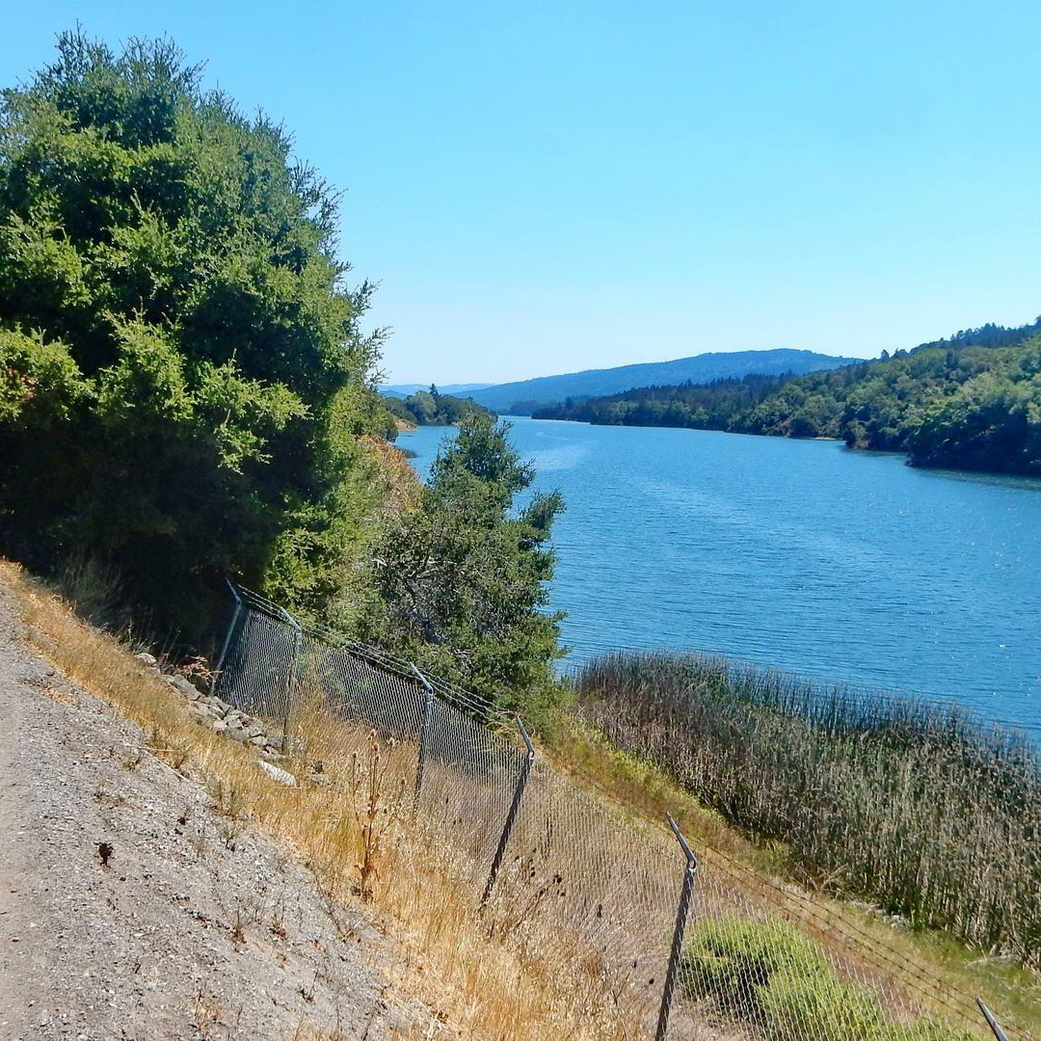
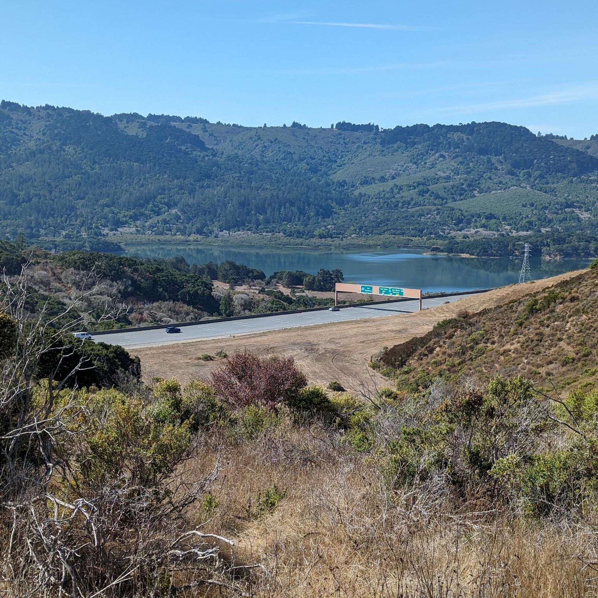
The Crystal Springs Regional Trail is a top spot for cyclists, featuring mostly paved paths with minimal car traffic. The trail runs through scenic areas like Lower Crystal Springs Reservoir, offering beautiful lake views. On Sundays, you can ride the car-free Cañada Road segment for a more relaxed experience. Be mindful of the 15 mph speed limit, especially around hikers. The Sawyer Camp segment provides a gentle descent and stunning views, perfect for an easy ride through woodlands and along the reservoir.
0
1

This small lagoon offers an excellent photo opportunity for visitors and photographers alike. Its calm, crystal-clear waters create a stunning mirror-like reflection of the iconic Oracle Buildings that surround it. The tranquil setting, combined with the striking architecture, makes it an ideal spot to capture breathtaking images, especially during sunrise and sunset.
0
0

Inland from here, the neighborhoods are full of 101 on-ramps and fast multi-lane one-way streets. I don't recommend biking to enter the bay trail here.
0
0

Riding through the Baylands is wonderful especially on a sunny day.
0
0
Frequently Asked Questions
How many road cycling routes are available in Belmont?
Belmont offers a diverse selection of road cycling routes, with over 20 options available on komoot. These routes cater to various skill levels, from easy rides to more challenging excursions.
What kind of terrain can I expect on road cycling routes around Belmont?
Road cycling in Belmont features a varied landscape. You'll find routes with rolling hills and moderate climbs, especially inland, alongside extensive flat, paved trails along the San Francisco Bay and Crystal Springs Reservoir. The region is characterized by open spaces, wooded areas, and scenic bayfront paths.
Are there challenging road cycling routes in Belmont for experienced riders?
Yes, Belmont has several challenging routes for experienced cyclists. For instance, the Stevens Creek Reservoir – Portola Valley loop from Belmont is a difficult 68-mile route featuring significant elevation gain through rolling hills, taking approximately 5 hours to complete.
What are some good options for a more relaxed or family-friendly road cycling experience in Belmont?
For a more relaxed or family-friendly ride, consider the Crystal Springs Regional Trail, particularly the paved Sawyer Camp section, which offers beautiful views along the Crystal Springs Reservoir. The Bay Trail also provides picturesque, paved rides along the water, known for smooth surfaces and bay breezes, such as the segment around Baywinds Park at Mariners Point.
Where can I find scenic views or natural attractions along Belmont's road cycling routes?
Many routes offer scenic views of the San Francisco Bay, wetlands, and reservoirs. For example, the Emily Renzel Wetlands – Baylands Nature Preserve loop from Belmont provides flat terrain and scenic views through wetlands and along the bay. You can also find routes with views of Lower Crystal Springs Reservoir and Upper Crystal Springs Reservoir.
Are there routes that explore the wetlands or baylands areas?
Absolutely. The Emily Renzel Wetlands – Baylands Nature Preserve loop from Belmont is a moderate 34.6-mile path specifically designed to take you through these unique ecosystems, offering flat terrain and beautiful views. Another option is the Seal Slough – Coyote Point Recreation Area loop from Belmont, which also explores bayfront areas.
What do other cyclists say about the road cycling experience in Belmont?
The road cycling routes in Belmont are highly rated by the komoot community, with an average score of 4.7 stars from over 20 reviews. Cyclists often praise the diverse terrain, from flat bayfront paths to routes with rolling hills, and the scenic views of the bay, wetlands, and reservoirs.
How long do road cycling routes in Belmont typically take to complete?
Route durations vary significantly based on distance and difficulty. For example, a moderate route like the San Andreas Lake – Bay Trail - Foster City Levee loop from Belmont, which is 34.4 miles, can be completed in about 2 hours 20 minutes. Longer, more difficult routes, such as the 68-mile Stevens Creek Reservoir – Portola Valley loop from Belmont, may take around 5 hours.
Is it possible to access road cycling routes in Belmont via public transport, or is parking readily available?
While specific public transport access points for all routes are not detailed, Belmont is part of the San Francisco Bay Area, which generally has public transport options. For those driving, many trailheads and parks like Waterdog Lake Park and Twin Pines Park offer parking facilities, making routes accessible by car.
What are the best seasons for road cycling in Belmont?
Belmont, California, generally offers pleasant cycling conditions for much of the year. Spring and fall typically provide mild temperatures and clear skies, making them ideal. Summers are often warm but can be tempered by bay breezes, while winters are usually mild, though occasional rain may occur.
Are there any specific natural monuments or landmarks worth seeing while cycling in Belmont?
Yes, several interesting landmarks and natural features can be found near Belmont's cycling routes. You might encounter the historic Pulgas Water Temple or the unique Tafoni Sandstone Formation. Additionally, there are various viewpoints offering stunning vistas, such as the Amazing Sunset Viewpoint.
Can I find routes that are mostly flat for an easier ride?
Yes, Belmont offers several routes with predominantly flat terrain, perfect for an easier ride. The Emily Renzel Wetlands – Baylands Nature Preserve loop from Belmont is a moderate route known for its flat profile and scenic views along the bay. The Bay Trail and sections of the Crystal Springs Regional Trail are also excellent choices for flat, leisurely cycling.
What are some of the longer road cycling routes available from Belmont?
For longer rides, the Stevens Creek Reservoir – Portola Valley loop from Belmont stands out as a 68-mile route. Other substantial options include the Emily Renzel Wetlands – Baylands Nature Preserve loop from Belmont at 34.6 miles and the San Andreas Lake – Bay Trail - Foster City Levee loop from Belmont, which is 34.4 miles long.
Most popular routes around Belmont
Most popular attractions around Belmont

Get inspired with the komoot mobile app


Explore more
Browse the best Road cycling routes in other regions.
