The best road cycling routes around Rancho Palos Verdes
4.4
(29)
1,698
riders
39
rides
Road cycling around Rancho Palos Verdes offers diverse terrain characterized by dramatic coastal bluffs, ocean vistas, and significant elevation changes. The region features a rugged coastline with cliffs plunging into the Pacific Ocean, providing a scenic backdrop for rides. Cyclists encounter a mix of challenging climbs and exhilarating descents, often with panoramic views of the Pacific and Catalina Island. The landscape includes well-maintained natural preserves and hills, making it an ideal destination for varied road cycling experiences.
Best road cycling routes around Rancho Palos Verdes
- The most popular road cycling route is Manhattan Beach and Pier – El Segundo Beach loop from Palos Verdes, a 55.5 miles (89.3 km) trail that takes 4 hours 2 minutes to complete. This route offers extensive coastal riding with views of the Pacific.
- Another top favourite among local road cyclists is Point Vicente Lighthouse – Bluff Cove loop from Ner Tamid, a moderate 21.3 miles (34.3 km) path. This route showcases stunning ocean views and the Point Vicente Lighthouse.
- Local road cyclists also love the Torrance Beach – Manhattan Beach and Pier loop from Palos Verdes Estates, a 21.4 miles (34.5 km) trail leading through coastal areas, often completed in about 1 hour 39 minutes.
- Road cycling around Rancho Palos Verdes is defined by spectacular coastal bluffs, ocean vistas, and challenging climbs. The network offers options for various ability levels.
- The routes in Rancho Palos Verdes are highly rated by the komoot community with an average score of 4.5 stars from over 10 reviews. More than 900 road cyclists have used komoot to explore Rancho Palos Verdes's varied terrain.
Last updated: November 11, 2026
5.0
(1)
81
riders
40.3km
02:05
670m
670m
Moderate road ride. Good fitness required. Mostly well-paved surfaces and easy to ride.
5.0
(1)
35
riders
24.1km
01:23
470m
470m
Moderate road ride. Good fitness required. Mostly well-paved surfaces and easy to ride.

5.0
(1)
33
riders
Moderate road ride. Good fitness required. Some segments of this route may be unpaved and difficult to ride.
13
riders
20.8km
01:05
340m
340m
Moderate road ride. Good fitness required. Mostly well-paved surfaces and easy to ride.
3.0
(1)
20
riders
39.0km
02:00
550m
550m
Moderate road ride. Good fitness required. Mostly well-paved surfaces and easy to ride.
Get access to more routes and recommendations from other explorers.
Already have an account?
Our route recommendations are based on thousands of hikes, rides, and runs completed by other people on komoot.
Start today with a free account
Your next adventure awaits.
Tips from the Community

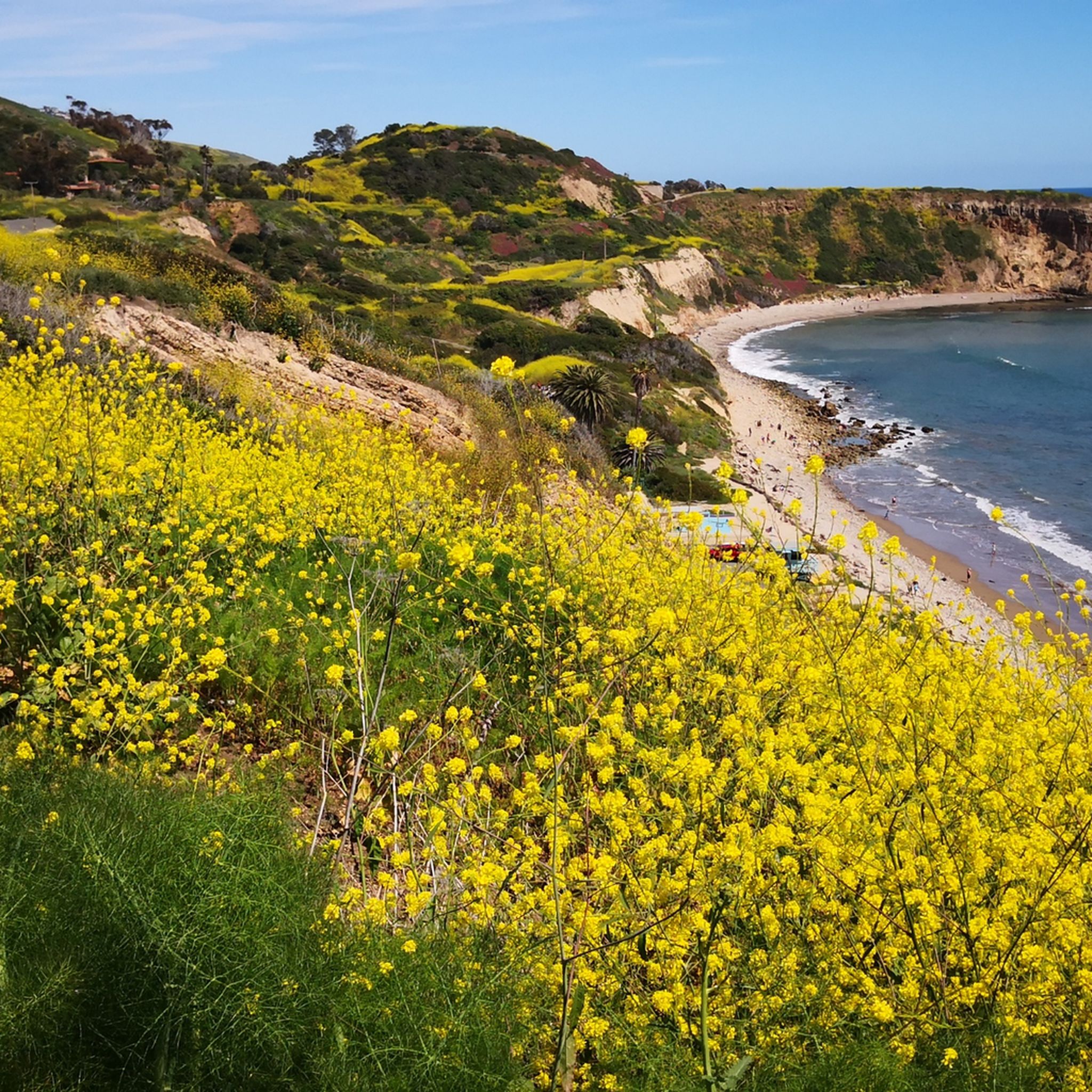
From this spot you get an amazing view out to the Pacific Ocean.
0
0

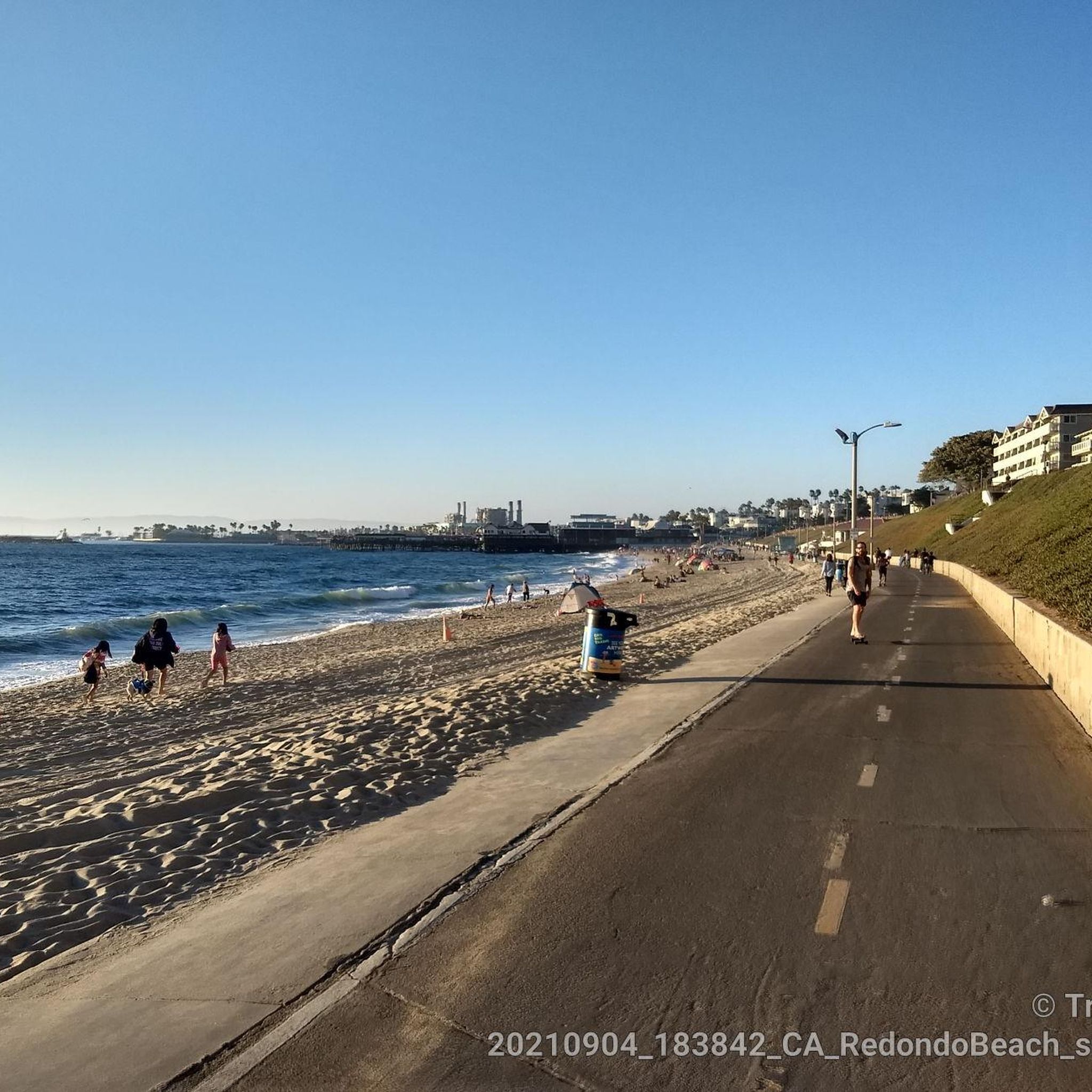
Redondo Beach State Park, located along Pacific Coast Highway 1, offers a vibrant mix of attractions. Once a commercial port, the area now features the Redondo Pier with shops, restaurants, marinas, live music, a skate park, and a sport fishing fleet. The oceanfront esplanade is a walkway known for its stunning sunsets and scenic ocean views. King Harbor has great seafood swimming beaches, surfing, boating, and fishing. More attractions like Veterans Park, Czuleger Park, and the famous “Whaling Wall” by artist Wyland on the old power plant are just as popular as the Redondo beach.
0
0

Torrance Beach lies between Redondo Beach and Malaga Cove. The region shared by Torrance and Redondo Beaches is often called “RAT Beach” (short for “Right After Torrance” Beach or “Redondo and Torrance Beach”). This beautiful, soft sand beach has 40 acres of beach and is at the foot of cliffs which extend to the Palos Verdes Peninsula. There restrooms, a concession stand, showers, bike path, beach wheelchairs, and volleyball nets. Torrance Beach is great for swimming, fishing, scuba and skin diving, and surfing.
1
0
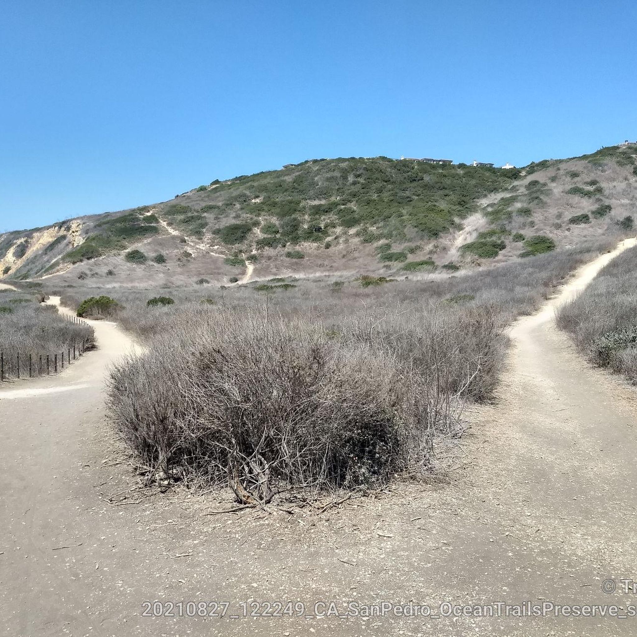
Ocean Trails Preserve Trailhead from Palos Verdes Drive & W 25th St
1
0
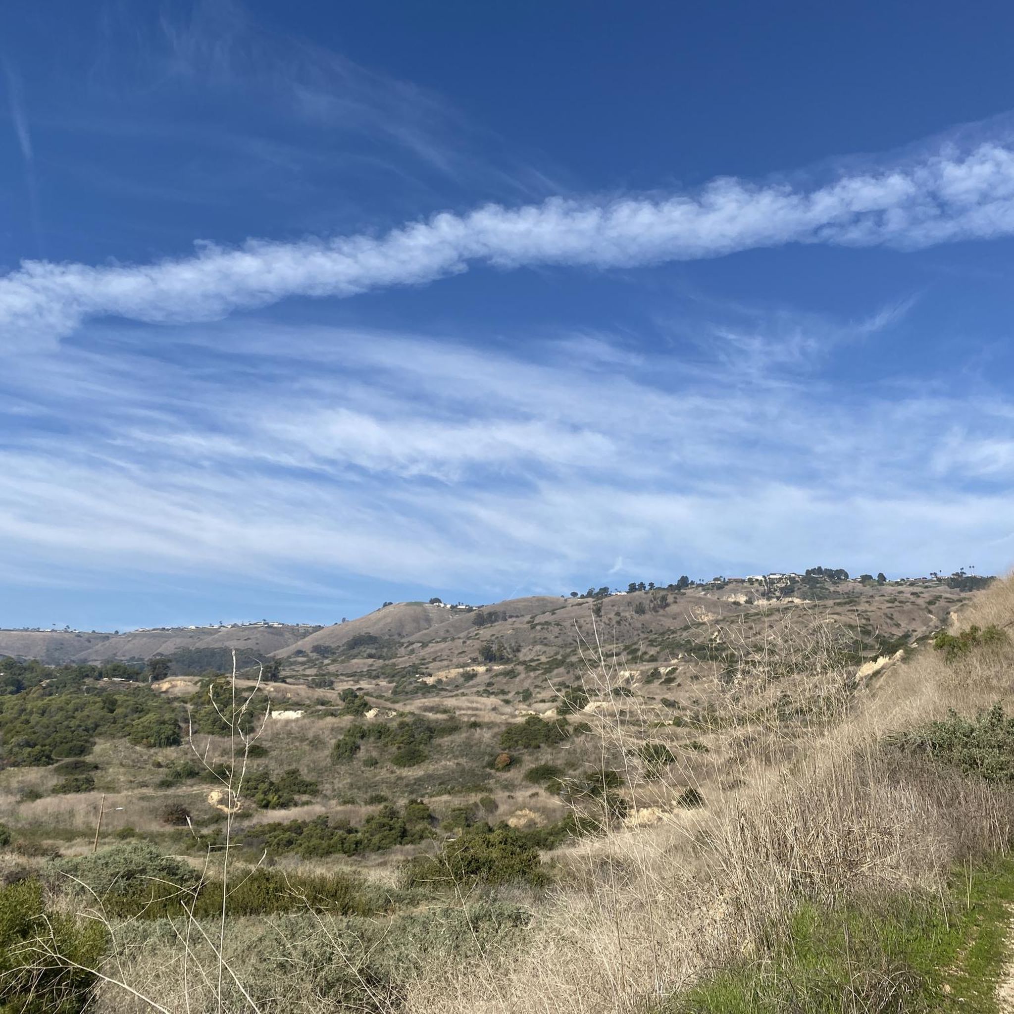
Palos Verdes Drive is a scenic ride with climbs, descents, and turns. The South segment near the Portuguese Bend is prone to landslides and is sometimes closed. The best times to ride are in the mornings on weed days, when there is minimal traffic and cooler temperatures. Public restrooms and water are available at the Point Vicente Interpretive Center, Abalone Cove Park, and Malaga Cove School, located in the parking area.
1
0
Palos Verdes Cove begins at Flat Rock Point and rounds into Rancho Palos Verdes. The cove is a protected marine preserve and a well-known surf spot, with both left and right waves. The views from the tops of the cliffs are amazing.
1
0

At this point in your hike, you'll be treated to sweeping coastal views from the bay.
0
0
As you ride along Palos Verdes Drive West, look down into Bluff Cove, a scenic rocky cove popular with local surfers, scuba divers, and snorkelers braveing the shoreline. A hiking trail descends to Bluff Cove Beach, with a steeper trail leading to Flat Rock Point, where you can explore tide pools at low tide. Walking south beyond the cove takes you into Palos Verdes Estate Shoreline Preserve, continuing to Palos Verdes Point and the rusted remains of a shipwreck along the Shipwreck Hiking Trail.
1
0
Frequently Asked Questions
How many road cycling routes are available in Rancho Palos Verdes?
There are over 50 road cycling routes in Rancho Palos Verdes, offering a diverse range of experiences. These routes are highly rated by the komoot community, with an average score of 4.3 stars.
What is the general difficulty level of road cycling routes in Rancho Palos Verdes?
Rancho Palos Verdes offers a mix of moderate to difficult road cycling routes. While there are 18 easy routes, the majority (37) are moderate, and 3 are considered difficult, often featuring significant elevation changes and challenging climbs. For example, the Miramar Park – Del Cerro Park loop involves over 1,100 meters of ascent.
Are there any road cycling routes with significant climbs and elevation gain?
Yes, Rancho Palos Verdes is known for its challenging climbs. Routes like the Bluff Cove – Via Del Monte Climb loop feature over 550 meters of elevation gain. The Palos Verdes Drive East segment of the 'Donut Loop' is particularly noted for its steep switchbacks and rewarding panoramas.
Which routes offer the best scenic views of the Pacific Ocean and coastline?
Many routes in Rancho Palos Verdes boast spectacular ocean views. The Manhattan Beach and Pier – El Segundo Beach loop provides extensive coastal riding. The Palos Verdes Drive West and South sections of the main loop are also known for continuous incredible coastal vistas, with opportunities to spot whales during certain seasons. You can also enjoy views from Miramar Park.
What are some notable landmarks or attractions I can see along the road cycling routes?
Along your rides, you can encounter several interesting landmarks and natural features. The historic Point Vicente Lighthouse is a prominent sight. You might also pass by beautiful beaches like Torrance Beach and Bluff Cove, or enjoy viewpoints such as Pelican Cove Park - Vincente Bluffs.
Are there any family-friendly road cycling options in Rancho Palos Verdes?
While many routes in Rancho Palos Verdes involve significant elevation, there are options that cater to varying fitness levels. Routes connecting to Torrance Beach and the Redondo Beach Esplanade offer more relaxed rides. For a moderate coastal experience, consider the Redondo Beach – Torrance Beach loop, which is 18.6 miles long with continuous coastal views.
What is the best time of year to go road cycling in Rancho Palos Verdes?
Rancho Palos Verdes offers pleasant cycling conditions for much of the year due to its Southern California climate. Spring and fall generally provide mild temperatures and clear skies, ideal for longer rides. Winter can also be suitable, though it's always wise to check local weather forecasts for any rain or strong winds.
Are there any loop routes available for road cyclists?
Yes, loop routes are a popular feature in Rancho Palos Verdes. The 'Palos Verdes Drive Loop,' often called the 'Donut Loop,' is a well-known roughly 24-mile route with significant elevation changes. Other examples include the Via Del Monte Climb – Palos Verdes Cove loop, which offers a challenging 40 km ride.
Where can I find parking for road cycling routes in Rancho Palos Verdes?
Parking availability varies by trailhead and specific route starting points. Many local parks and beach areas offer parking facilities, though some may require fees or have time limits. It's advisable to research specific starting points for your chosen route to confirm parking options.
What do other road cyclists enjoy most about cycling in Rancho Palos Verdes?
The komoot community highly rates road cycling in Rancho Palos Verdes, with an average score of 4.3 stars from over 40 reviews. Cyclists frequently praise the dramatic coastal bluffs, panoramic ocean vistas, and the unique blend of challenging climbs and exhilarating descents that the region offers.
Are there cafes or places to stop for refreshments along the road cycling routes?
Yes, as you cycle through Rancho Palos Verdes and connect to neighboring areas like Redondo Beach and Torrance, you'll find various cafes and establishments where you can stop for refreshments. The Terranea Resort area also offers dining options, and local towns provide amenities for cyclists.
Most popular routes around Rancho Palos Verdes
Most popular attractions around Rancho Palos Verdes

Get inspired with the komoot mobile app


Explore more
Browse the best Road cycling routes in other regions.
