The best road cycling routes around Azusa
4.4
(36)
2,821
riders
13
rides
Road cycling routes around Azusa, California, are primarily defined by the city's location at the base of the San Gabriel Mountains and its proximity to the San Gabriel River. The terrain offers a mix of challenging mountain climbs, scenic canyon roads, and accessible river greenways. Cyclists can expect significant elevation changes in the higher areas and flatter sections along the river, providing diverse experiences.
Best road cycling routes around Azusa
- The most popular road cycling route is San Gabriel Canyon Road loop from Lario Staging Area, a difficult 37.6 miles (60.5 km) trail that takes 3 hours 40 minutes to complete. This route offers picturesque views of the Morris and San Gabriel Reservoirs as it winds through the historic San Gabriel Canyon.
- Another top favourite among local road cyclists is San Gabriel Canyon Road & Mt Baldy loop from Lario Staging Area, a difficult 65.1 miles (104.8 km) path. This strenuous route includes the iconic Mount Baldy climb, featuring substantial elevation gain and panoramic mountain views.
- Local road cyclists also love the Rubel Castle – Little Dalton Debris Basin loop from APU/Citrus College, a 72.2 miles (116.1 km) trail leading through the foothills of the San Gabriel Mountains, often completed in about 7 hours 4 minutes.
- Road cycling around Azusa is defined by the dramatic San Gabriel Mountains, the winding San Gabriel River, and scenic canyons. The network offers options for different ability levels, from challenging mountain ascents to more accessible paved paths.
- The routes in Azusa are highly rated by the komoot community with an average score of 4.1 stars from over 26 reviews. More than 2000 road cyclists have used komoot to explore Azusa's varied terrain.
Last updated: May 10, 2026
5.0
(1)
247
riders
60.5km
03:40
1,320m
1,320m
Embark on a challenging racebike journey through the San Gabriel Mountains National Monument. This difficult 37.6-mile (60.5 km) loop will test your endurance with a significant 4344 feet (1324 metres) of elevation gain, typically taking around 3 hours and 40 minutes to complete. As you pedal, you'll wind through the historic canyon, passing the tranquil waters of Morris and San Gabriel Reservoirs, with the Angeles National Forest providing a lush backdrop. Keep an eye out for the San Gabriel Canyon Road Scenic View, offering expansive views of the surrounding peaks and valleys.
To begin your ride, head to the Lario Staging Area, which offers convenient parking and direct access to the route. While Southern California generally boasts sunny weather year-round, be aware that higher elevations along the route can occasionally experience snowfall, so check conditions before you go. Weekends tend to be busier, particularly in the section leading up to East Fork, so consider an early start or a weekday ride for a quieter experience.
This route stands out for its blend of demanding climbs and scenic beauty within the historic San Gabriel Canyon. You'll experience the unique environment of the Angeles National Forest, where a running creek often accompanies your ride. The trail offers a chance to immerse yourself in a natural setting that feels far removed from urban life, making it a rewarding challenge for any dedicated road cyclist.
49
riders
105km
06:40
2,680m
2,680m
This difficult 65.1-mile road cycling loop from Lario Staging Area tackles the iconic Mt Baldy climb with 8802 feet of elevation gain.

Sign up for free
5.0
(6)
164
riders
Easy road ride. Great for any fitness level. Mostly well-paved surfaces and easy to ride.
99
riders
57.8km
03:13
1,210m
1,210m
Hard road ride. Very good fitness required. Mostly well-paved surfaces and easy to ride.
5.0
(1)
50
riders
33.9km
01:46
500m
500m
Moderate road ride. Good fitness required. Mostly well-paved surfaces and easy to ride.
Get access to more routes and recommendations from other explorers.
Sign up for free
Already have an account?
Our route recommendations are based on thousands of hikes, rides, and runs completed by other people on komoot.
Start today with a free account
Your next adventure awaits.
Login or Signup



Tips from the Community

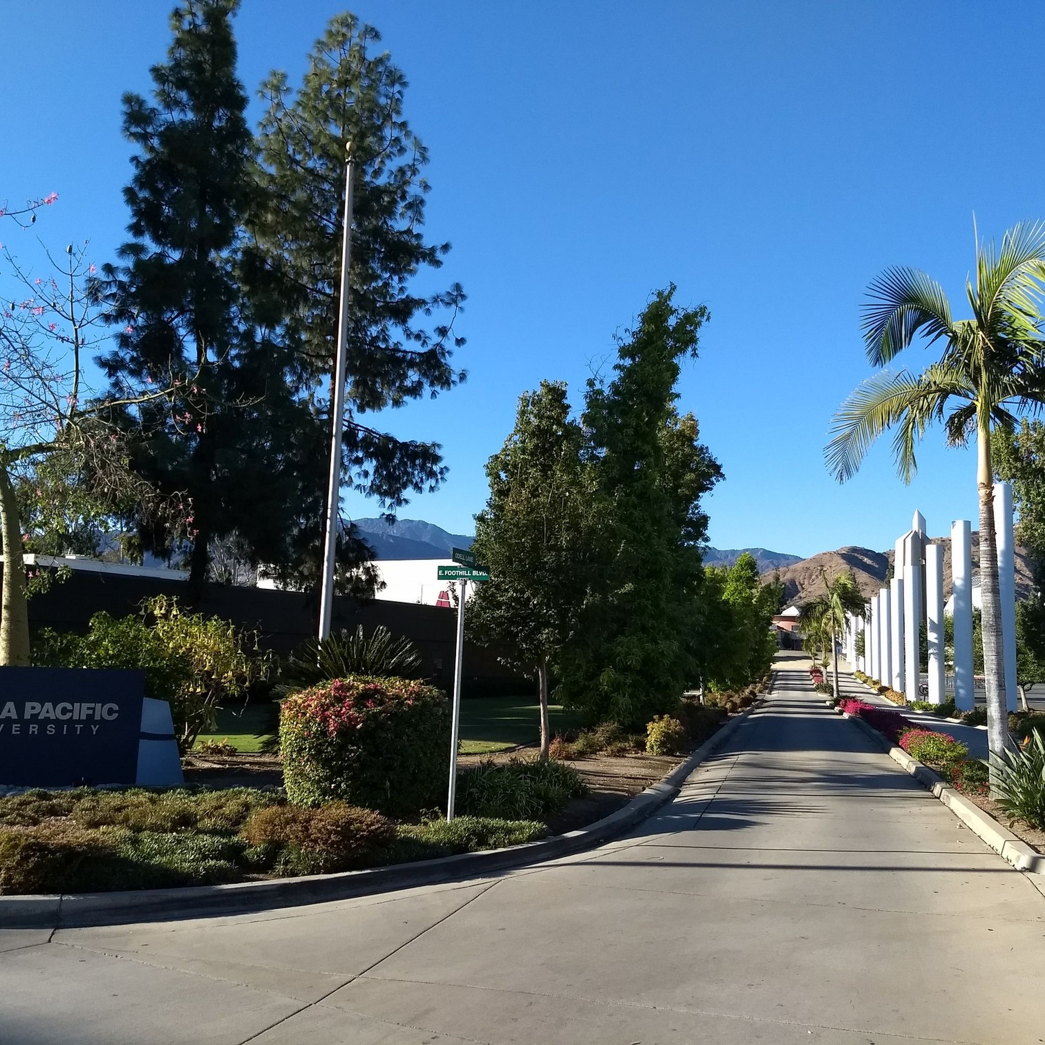
Nice bike path. not much roads to cross. some are hilly but doable for newbies. It's our first time and we had a good time. just some areas are with a lot of homeless people, esp. the tunnels.
0
0

Great view from the cycle path of the San Gabriel Mountains in the distance.
0
0
Halfway up the Highway 39 & Dawson Saddle climb, the Upper Bear Creek Trailhead is a good place to stop for a break if you need to catch your breath. While the trail itself is not suitable for road bikes, the trailhead has picnic tables and restrooms, so it is a good spot for a snack and quick breather.
0
0

One of the best dedicated bike trails in the LA area, leading from the San Gabriel mountains north of Azuza along a car free paved river route all the way to Seal beach
1
0

As you set foot on the trail you are treated to sweeping views of Coldburst Canyon. The trailhead has restrooms, a picnic table, and ample paved parking space. From here you can adventure up to Smith Mountain and Bear Creek.
0
0

The San Gabriel River Greenway is a 35.4-mile paved path that is known as an easy spot to ride. The trail parallels the San Gabriel River.
0
0

Santa Fe Flood Control Basin is a recreation area in the empty reservoir behind the Santa Fe Dam. You can see and access this area from the San Gabriel River Greenway, a 35.4-mile paved, multi-use path that parallels the San Gabriel River.
1
0

Mt. Baldy is the highest peak in the San Gabriel Mountains and gets its nickname from the absence of trees near its summit. It is a grind to get here on your bike but you will be rewarded with gorgeous views of the surrounding mountain tops. A very popular and special place.
0
0
Frequently Asked Questions
What types of road cycling routes can I find around Azusa?
Azusa offers a diverse range of road cycling experiences, from challenging mountain climbs to scenic canyon roads and accessible river greenways. You'll find routes with significant elevation changes in the higher areas and flatter sections along the San Gabriel River, catering to various skill levels.
Are there any easy or family-friendly road cycling routes in Azusa?
Yes, Azusa has options suitable for easier rides. The Duarte Recreational Trail – Monrovia Recreation Park loop from Azusa Downtown is an easy route. Additionally, the San Gabriel River Greenway provides a more accessible, paved route along the San Gabriel River, ideal for a relaxed ride. The West Fork Bikeway, located 14 miles above Azusa on Highway 39, is also a popular, easy, and mostly flat paved trail.
What are some challenging road cycling routes with significant elevation gain?
For experienced cyclists seeking a challenge, the San Gabriel Canyon Road & Mt Baldy loop from Lario Staging Area is a difficult 65.1-mile route featuring the iconic Mount Baldy climb with substantial elevation gain. Another strenuous option is the Rubel Castle – Little Dalton Debris Basin loop from APU/Citrus College, which leads through the foothills of the San Gabriel Mountains.
What scenic landmarks or natural features can I see along Azusa's road cycling routes?
Many routes offer stunning views. You can enjoy picturesque views of the Morris and San Gabriel Reservoirs along the San Gabriel Canyon Road loop. Other notable sights include the View of Puddingstone Reservoir, the dramatic San Gabriel Mountains, and the winding San Gabriel River. The Azusa Wilderness Park also offers spectacular vistas of the San Gabriel River and canyon.
Are there any loop routes available for road cycling in Azusa?
Yes, several routes are designed as loops. Popular options include the San Gabriel Canyon Road loop from Lario Staging Area, the San Gabriel Canyon Road & Mt Baldy loop, and the View of Puddingstone Reservoir – Rubel Castle loop from APU/Citrus College.
What do other road cyclists say about the routes in Azusa?
The road cycling routes in Azusa are highly rated by the komoot community, with an average score of 4.1 stars from over 26 reviews. Cyclists often praise the varied terrain, from challenging mountain ascents to accessible paved paths, and the dramatic scenery of the San Gabriel Mountains and river canyons.
What is the best time of year for road biking in Azusa?
Azusa's mild, year-round climate makes it an ideal location for consistent outdoor activities, including road cycling. While most seasons are suitable, checking local weather forecasts is always recommended, especially for summer conditions or potential winter rain in the mountains.
Is there public transport access to Azusa's cycling trails?
Azusa is served by local public transport options. For specific routes or staging areas, it's advisable to check the local transit authority's schedules and routes to plan your access to the cycling trails.
Where can I find parking for road cycling routes in Azusa?
Many routes start from designated staging areas or public parks that offer parking. For example, the San Gabriel Canyon Road loop begins from Lario Staging Area, which typically provides parking. Routes starting from APU/Citrus College also have parking facilities. Always check specific route details for recommended parking locations.
Are there any permits required for road cycling in Azusa or the surrounding areas?
Generally, no specific permits are required for road cycling on public roads and designated bike paths in Azusa. However, if your route takes you into certain protected areas or private lands, it's always best to verify any specific regulations or permit requirements beforehand. For general information on mountain biking in Azusa Canyon, you can visit azusaca.gov.
Can I find cafes or places to stop for refreshments along the road cycling routes?
While some routes, particularly those closer to Azusa Downtown or other communities, may have cafes or shops nearby, routes venturing deeper into the San Gabriel Canyon or mountains will have fewer amenities. It's recommended to carry sufficient water and snacks, especially for longer or more remote rides.
Most popular attractions around Azusa

Get inspired with the komoot mobile app


Explore more
Browse the best Road cycling routes in other regions.
