The best cycling routes around Temple City
4.5
(58)
907
riders
86
rides
Touring cycling routes around Temple City benefit from its location in the San Gabriel Valley, offering access to diverse terrain. The region is characterized by the majestic San Gabriel Mountains to the north, providing a dramatic backdrop and varied elevation. Extensive river systems, including the San Gabriel River and the Rio Hondo River, feature multi-use paths with minimal elevation gain. This combination of mountain views and riverside trails defines the area's cycling landscape.
Best touring cycling routes around Temple City
…Last updated: October 2, 2026
5.0
(1)
44
riders
55.8km
03:24
230m
230m
Moderate bike ride. Good fitness required. Mostly paved surfaces. Suitable for all skill levels.
4.8
(6)
50
riders
39.0km
02:22
200m
200m
Moderate bike ride. Good fitness required. Mostly paved surfaces. Suitable for all skill levels.

5.0
(3)
40
riders
Moderate bike ride. Good fitness required. Mostly paved surfaces. Suitable for all skill levels.
5.0
(1)
30
riders
Moderate bike ride. Good fitness required. Mostly paved surfaces. Suitable for all skill levels.
4.3
(3)
28
riders
Easy bike ride. Great for any fitness level. Mostly paved surfaces. Suitable for all skill levels.
Get access to more routes and recommendations from other explorers.
Already have an account?
Our route recommendations are based on thousands of hikes, rides, and runs completed by other people on komoot.
Start today with a free account
Your next adventure awaits.



Tips from the Community

The Rio Hondo Greenway is a beautiful bike lane that follows the river that gives the trail its name. It is fully paved and flat, so it is not a challenging trail.
0
0
The San Gabriel Dam is a rock‑fill structure completed in 1939 on the San Gabriel River and is used for flood control.
0
0

Nice bike path. not much roads to cross. some are hilly but doable for newbies. It's our first time and we had a good time. just some areas are with a lot of homeless people, esp. the tunnels.
0
0
Great view from the cycle path of the San Gabriel Mountains in the distance.
0
0

One of the best dedicated bike trails in the LA area, leading from the San Gabriel mountains north of Azuza along a car free paved river route all the way to Seal beach
2
0
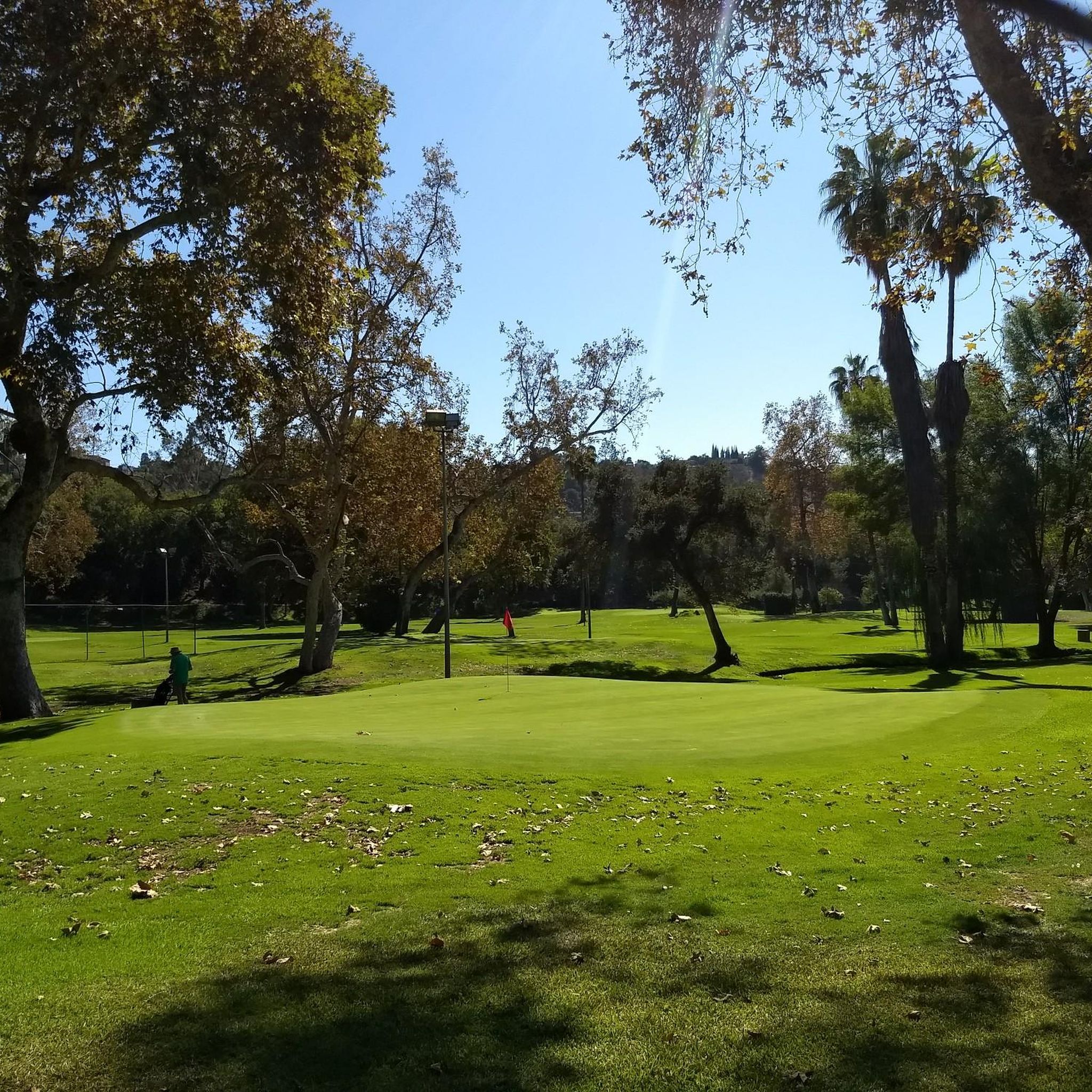
Leafy park with lawns and shaded seating, restrooms, drinking water fountains, and a bike repair station. Great for a break or as trailhead to ride west along the dedicated Duarte Bike Trail, a multi-purpose trail that was founded in 1977. It stretches 1.6 miles from Royal Oaks Park at Vineyard Avenue to Buena Vista Avenue. Next to the paved cycling path runs a dirt jogging and equestrian trail shaded by oak trees. The gently sloped trail follows the historic Pacific Electric Railway route, passing an arched bridge that once carried Red Trolley Cars to Los Angeles.
1
0

Duarte Bike Trail is a multi-purpose trail that was founded in 1977. It stretches 1.6 miles from Buena Vista Avenue to Royal Oaks Park at Vineyard Avenue. There are both a paved cycling path and a dirt jogging and equestrian trail. The path runs under shady oak trees with gentle slopes, and the trail follows the historic Pacific Electric Railway route, where you can spot an arched bridge that once carried Red Trolley Cars to Los Angeles. Great for biking, jogging, dog walking, or leisurely strolls, the trail includes amenities like parking, restrooms at Royal Oaks Park, drinking fountains, and a bike repair station at Vineyard Avenue. It’s open daily from dawn to dusk.
0
0

There is a parking lot and restroom here at the trailhead, which provides access to a large network of paved and packed dirt trails along the beautiful Rio Hondo. The trailhead closes at sunset.
0
0
Frequently Asked Questions
How many touring cycling routes are available around Temple City?
There are over 90 touring cycling routes available around Temple City, offering a wide variety of options for different skill levels and preferences. The komoot community has explored these routes over 900 times.
What kind of terrain can I expect on touring cycling routes near Temple City?
Touring cycling routes near Temple City offer diverse terrain. You'll find extensive multi-use paths along the San Gabriel River and Rio Hondo River with minimal elevation gain, ideal for relaxed rides. For more challenging experiences, the majestic San Gabriel Mountains provide routes with significant ascents and varied landscapes, from high alpine to desert climates.
Are there any easy, family-friendly touring cycling routes in the Temple City area?
Yes, many routes are suitable for families. For instance, the Bosque del Rio Hondo – Rio Hondo Greenway loop from North El Monte is an easy 14.5-mile path along the Rio Hondo River. The West Fork National Scenic Bikeway in the San Gabriel Mountains National Monument is also largely flat and picturesque, perfect for families seeking solitude amidst nature.
Can I find circular touring cycling routes around Temple City?
Yes, many of the touring cycling routes around Temple City are loops, providing convenient starting and ending points. Examples include the San Gabriel River Greenway – View of San Gabriel Mountains loop from El Monte and the Rio Hondo River Trail – Bosque del Rio Hondo loop from North El Monte.
What are some notable natural features or landmarks I might see while cycling?
While cycling, you can enjoy stunning views of the San Gabriel Mountains. Along the Rio Hondo River, you might pass through areas like Bosque del Rio Hondo. The region also offers access to attractions like the Historic Colorado Street Bridge and the Eaton Canyon Waterfall, which can be incorporated into your touring plans.
Is Temple City a good destination for cycling year-round?
Yes, Temple City benefits from Southern California's climate, offering suitable year-round cycling weather. This makes it an excellent destination for touring cyclists looking to explore at any time of the year.
Where can I park my car when accessing touring cycling routes near Temple City?
Access points for major river trails like the San Gabriel River Trail and Rio Hondo River Trail often have designated parking areas. While specific parking locations aren't detailed, the region is known for providing trailhead access, and local parks like Temple City Park and Live Oak Park can serve as starting points with parking.
Are there options for more challenging touring cycling routes?
Absolutely. For experienced touring cyclists seeking a challenge, the San Gabriel Mountains offer over 30 climbs, including renowned routes like Glendora Mountain Road and the ascent of Mt. Baldy. An example of a more difficult route is the Brookside Park – Arroyo Seco Bike Trail loop from Arcadia, which features significant elevation gain.
What do other cyclists say about the touring cycling experience in Temple City?
The touring cycling routes in Temple City are highly rated by the komoot community, with an average score of 4.7 stars from over 70 reviews. Cyclists often praise the diverse terrain, from flat river paths with mountain views to challenging mountain ascents, and the well-maintained multi-use trails.
Are there any waterfalls accessible by touring bike near Temple City?
Yes, the region offers natural attractions like the Eaton Canyon Waterfall, which can be reached as part of a touring cycling adventure. Additionally, the West Fork National Scenic Bikeway in the San Gabriel Mountains parallels the West Fork San Gabriel River, offering views of wild trout streams and smaller waterfalls.
Can I find places to eat or drink near the cycling paths in Temple City?
Temple City and its neighboring communities offer various amenities. While specific cafes or pubs directly on the trails are not detailed, the city's commitment to cycling infrastructure means you'll find local establishments within easy reach of many routes. Temple City also has a dedicated bike shop, The Cub House, which serves as a community hub.
What are the options for accommodation for touring cyclists in the Temple City area?
While specific bike-friendly accommodations in Temple City are not explicitly listed, the broader Los Angeles County area features hotels that cater to cyclists with amenities like secure bike storage and repair stations. Several hotels are also conveniently located near the San Gabriel River Bike Trail, making them suitable stops for multi-day tours.
How can I access the touring cycling routes using public transport?
Temple City's location within the San Gabriel Valley, northeast of downtown Los Angeles, means it has access to regional public transportation networks. While direct public transport to every trailhead might vary, its proximity to cities like Pasadena and Arcadia suggests that major transit lines could provide access points to the wider cycling network.
Most popular attractions around Temple City

Get inspired with the komoot mobile app


Explore more
Browse the best Cycling routes in other regions.
