The best running trails around La Cañada Flintridge
4.4
(39)
3,262
runners
127
runs
Jogging routes around La Cañada Flintridge offer diverse terrain set against the scenic San Gabriel Mountains. The region features picturesque foothills, abundant green spaces, and an extensive network of trails. Runners can explore a variety of landscapes, from wide fire roads to single tracks traversing canyons and watershed parks. This area provides numerous opportunities for outdoor activity, catering to different fitness levels.
Best jogging routes around La Cañada Flintridge
- The most popular jogging route is Wella's Peak – Angeles National Forest, a 7.8 miles (12.5 km) trail that takes 1 hour 43 minutes to complete. This difficult route offers significant elevation gain within the Angeles National Forest.
- Another top favourite among local runners is Running loop from Rose Bowl Stadium, a moderate 4.0 miles (6.5 km) path. This route provides a relatively flat and accessible running experience around a well-known landmark.
- Local runners also love the Gabrielino Trail (NRT) – Picnic area & Arroyo Seco loop from John Muir High School, an 8.2 miles (13.3 km) trail leading through the Arroyo Seco area, often completed in about 1 hour 34 minutes.
- Jogging around La Cañada Flintridge is defined by the foothills of the San Gabriel Mountains, extensive trail systems, and watershed parks. The network offers options for different ability levels.
- The routes in La Cañada Flintridge are highly rated by the komoot community with an average score of 4.5 stars from 35 reviews. More than 2800 runners have used komoot to explore La Cañada Flintridge's varied terrain.
Last updated: August 20, 2026

1
runners
12.5km
01:43
590m
590m
Hard run. Very good fitness required. Mostly paved surfaces. Suitable for all skill levels.
4.8
(4)
293
runners
4.95km
00:31
30m
30m
Easy run. Great for any fitness level. Mostly paved surfaces. Suitable for all skill levels.

Sign up for free
35
runners
7.23km
00:46
70m
70m
Moderate run. Good fitness required. Mostly paved surfaces. Suitable for all skill levels.
5.0
(3)
207
runners
16.9km
01:47
170m
170m
Hard run. Very good fitness required. Mostly paved surfaces. Suitable for all skill levels.
20
runners
11.0km
01:15
140m
140m
Moderate run. Good fitness required. Mostly paved surfaces. Suitable for all skill levels.
Get access to more routes and recommendations from other explorers.
Sign up for free
Already have an account?
Our route recommendations are based on thousands of hikes, rides, and runs completed by other people on komoot.
Start today with a free account
Your next adventure awaits.
Login or Signup

Tips from the Community

The Gabrielino Trail spans 28.8 miles in the heart of Angeles National Forest, featuring a mix of well-known and secluded areas. This scenic route is perfect for running and boasts historical importance as well. In 1970, it became the first National Recreation Trail (NRT) in the country, honored for its regional representation, support of a diverse community, and recognition as one of America's finest trails.
0
0

Brookside Park is Pasadena's largest fully maintained park at 61.1 acres. It sits south of Rose Bowl Stadium with tons of parking off Arroyo Boulevard. The park features a lighted baseball diamond, two softball diamonds, and a large, lighted, multi-purpose field for soccer and flag football. There is also a speaker's platform with permanent seating, numerous picnic tables, barbecue pits, a play area, restrooms, and drinking fountains.
0
0
Built in 1920, Devil's Gate Dam is the oldest dam constructed by the Los Angeles County Flood Control District, designed to protect Pasadena, South Pasadena, and Los Angeles from floods. The dam was named after a rock formation resembling a devil’s face and gained popularity in the 1940s when occultists performed rituals there. Today, Devil's Gate Dam attracts hikers, paranormal investigators, and TV crews checking out its haunted reputation.
0
0

Devil's Gate Dam is an abandoned dam, close to Hahamongna Watershed Park. From the bridge you get an amazing view of the valley and the surrounding area. Below the bridge there are a couple of tunnels that might be the reason why this place is considered a portal to hell, giving the dam its name.
0
0

My first time doing this peak. It was a great workout with good views.
0
0


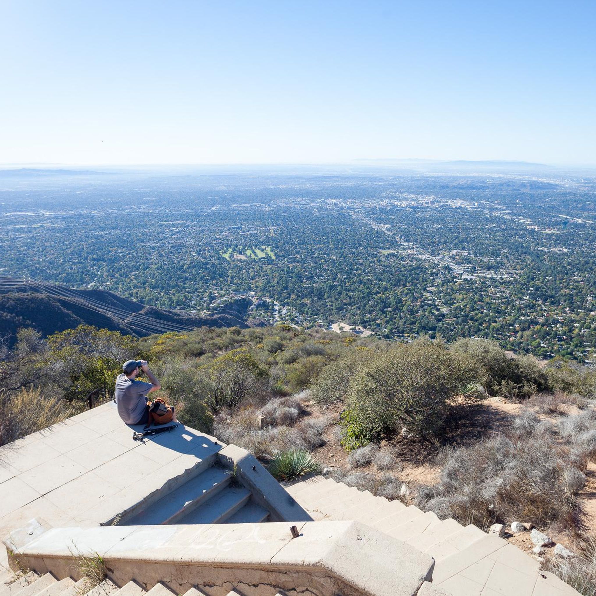
A moderately challenging trail leads up to Wella's Peak at an elevation of 2,995 feet with scenic views over the mountains and the Los Angeles Basin. The easiest approach is via Ken Burton Trail starting at Angeles Crest Station.
1
0
Take a break at this nice picnic area nestled in a canyon close to the bubbling Arroyo Seco. The impressive Brown Mountain Dam is just a short stroll away.
1
0
Frequently Asked Questions
How many running routes are available in La Cañada Flintridge?
La Cañada Flintridge boasts over 110 running routes, providing a wide array of options for joggers of all skill levels. These routes are highly rated by the komoot community, with an average score of 4.5 stars from 35 reviews.
Are there easy running routes suitable for beginners or a relaxed jog?
Yes, La Cañada Flintridge offers several easy running routes. You can find around 7 routes specifically categorized as easy, perfect for beginners or those looking for a more relaxed pace. The region's diverse terrain ensures there are options for every fitness level.
What are some family-friendly running paths in the area?
For families, areas like Cherry Canyon Park and Hahamongna Watershed Park offer extensive trail networks with varied terrain, some of which are suitable for a family jog. While Descanso Gardens is primarily for walking, its serene paths provide a beautiful setting for a leisurely stroll with older children.
Are there any dog-friendly running trails in La Cañada Flintridge?
Many trails within Cherry Canyon Park and Hahamongna Watershed Park are popular among dog owners. These parks offer diverse terrain, from wide fire roads to single tracks, providing ample space for you and your canine companion to enjoy a run. Always check local park regulations for specific leash requirements.
Where can I find running routes with scenic views or interesting landmarks?
Many routes in La Cañada Flintridge offer breathtaking views of the San Gabriel Mountains and surrounding valleys. For instance, trails in Cherry Canyon Park provide panoramic city views. You can also explore routes that pass by landmarks such as the Historic Colorado Street Bridge or offer views from Mount Lukens.
Are there any running routes that are circular loops?
Yes, many running routes in La Cañada Flintridge are designed as loops, offering a convenient way to start and finish at the same point. A popular moderate option is the Running loop from Rose Bowl Stadium, which provides a relatively flat experience around a well-known landmark.
What is the best time of year to go jogging in La Cañada Flintridge?
La Cañada Flintridge enjoys a mild climate, making it suitable for jogging year-round. However, the cooler months from fall to spring are often preferred, especially for trails with limited shade. Summer mornings and evenings are also pleasant, allowing you to enjoy the natural beauty without the midday heat.
Are there any long-distance running trails for more challenging workouts?
Absolutely. For those seeking a challenge, the region offers several difficult and long-distance routes. An example is the Brookside Park loop from Saint Francis High School, which spans over 15 miles (24 km) and includes significant elevation gain.
Are there any permits required for running on trails in the Angeles National Forest?
Some areas within the Angeles National Forest may require an Adventure Pass for parking. It's advisable to check the specific requirements for your chosen trailhead, especially if you plan to access routes deep within the forest, such as those leading to Strawberry Peak or Verdugo Peak.
Can I access running trails using public transport in La Cañada Flintridge?
While many trailheads are best accessed by car, some parks like Hahamongna Watershed Park and areas near the Rose Bowl Stadium may have public transport options nearby. It's recommended to check local bus routes and schedules to plan your journey to specific trail access points.
Are there running routes that pass by waterfalls or other natural water features?
Yes, the region offers opportunities to encounter natural water features. For example, some trails in the wider area can lead you to sights like Eaton Canyon Waterfall, providing a refreshing natural landmark during your run.
What kind of terrain can I expect on the running routes?
The running routes in La Cañada Flintridge offer a diverse range of terrain. You'll find everything from wide fire roads and relatively flat paths suitable for speed work to more technical single tracks, rocky river beds, and challenging uphills, particularly in areas like Cherry Canyon Park and Hahamongna Watershed Park.
Are there any moderate running routes that offer a good balance of distance and challenge?
Yes, the majority of routes in La Cañada Flintridge are categorized as moderate, offering a good balance for intermediate runners. A great option is the Gabrielino Trail (NRT) loop from Saint Francis High School, which covers about 5 miles (8 km) with a manageable elevation gain.
Most popular routes around La Cañada Flintridge
Most popular attractions around La Cañada Flintridge

Get inspired with the komoot mobile app


Explore more
Browse the best Running Trails & Routes in other regions.
