The best walks and hikes around Tehachapi
4.5
(2)
33
hikers
4
hikes
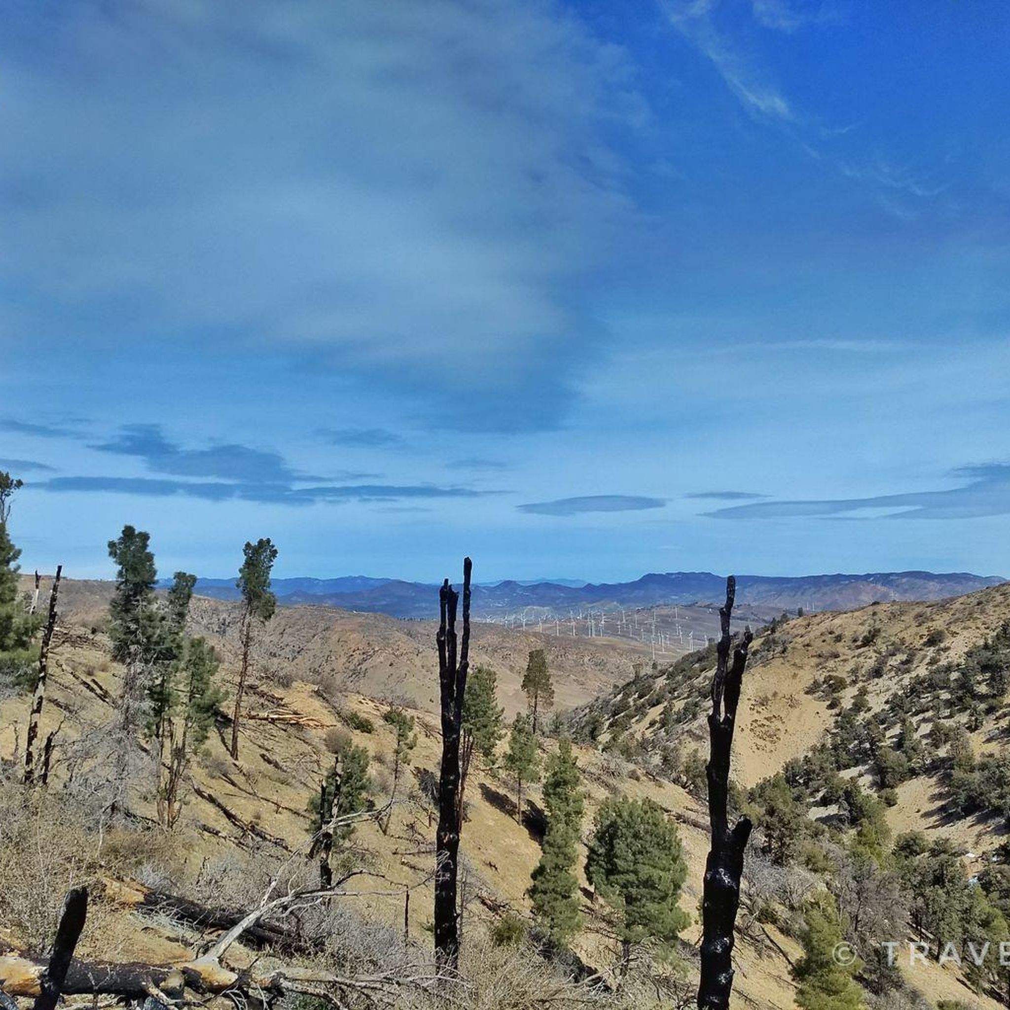
Hiking around Tehachapi offers diverse landscapes within the Tehachapi Mountains, which serve as a crucial wildlife corridor. The region features varied ecosystems, from lower elevation chaparral and grasslands to higher elevation pine forests and alpine meadows. Its geology is primarily composed of granite, contributing to unique formations and scenic vistas. Wind-swept hills and sprawling meadows characterize much of the terrain, providing a range of hiking experiences.
Best hiking trails around Tehachapi
- The most popular hiking route is Pacific Crest Trail South via Tehachapi Willow Springs Road, a 4.0 miles (6.5 km) trail that takes 2 hours to complete. This moderate section of the PCT offers views of the surrounding mountain landscape.
- Another top favourite among local hikers is Tehachapi Mountain Trail, a moderate 4.0 miles (6.5 km) path. This trail ascends through varied terrain, providing elevation gain and panoramic viewpoints.
- Local hikers also love the Meadowood Path, a 0.9 miles (1.5 km) trail leading through open meadows, often completed in about 23 minutes.
- Hiking around Tehachapi is defined by its granite mountains, diverse ecosystems including pine forests and chaparral, and wind-swept hills. The network offers options for various ability levels, from easy strolls to more challenging climbs.
- The routes in Tehachapi are highly rated by the komoot community with an average score of 4.5 stars from 2 reviews. More than 30 hikers have used komoot to explore Tehachapi's varied terrain.
Last updated: July 27, 2026
3
hikers
6.54km
02:02
390m
30m
Hike the Pacific Crest Trail South via Tehachapi Willow Springs Road, a moderate 4.1-mile route with windmills and mountain views.
1.50km
00:24
10m
10m
Explore the easy 0.9-mile Meadowood Path in Meadowbrook Park, a short hike taking about 23 minutes.

Sign up for free
7.72km
02:13
250m
70m
Hike a moderate 4.8-mile section of the Pacific Crest National Scenic Trail, gaining 833 feet with diverse scenery.
1.34km
00:21
0m
10m
This easy 0.8-mile loop around Tom Sawyer Lake in Golden Hills Nature Park is perfect for a quick stroll or family outing.
5.0
(1)
10
hikers
6.49km
02:31
470m
470m
Hike the moderate Tehachapi Mountain Trail, a 4.0-mile route with 1536 feet of elevation gain, offering forest views and wildlife.
Our route recommendations are based on thousands of hikes, rides, and runs completed by other people on komoot.
Start today with a free account
Your next adventure awaits.
Login or Signup
Popular around Tehachapi

Tips from the Community

The Tehachapi Mountain Trail is a popular hiking trail close to the lovely town of Tehachapi. It leads into the Tehachapi Mountain Park with great views and tree cover that is a refresh during the hot summer months. The final section up to the summit, unfortunately, is not accessible since it is on private property.
2
0
On your way along the LA Aqueduct you already passed some windmills. Now you are entering a massive wind park stretching all the way to Highway 58. And yes, the amount of windmills gives you a good idea of how windy it can get in this area.
4
0

Good highway with a wide shoulder runs along the mostly flat edge of the Mohave. Passing miles of electricity wind mills, here also crossing some streams that might have water in winter..
1
0
Frequently Asked Questions
How many hiking trails are available around Tehachapi?
Komoot features several hiking routes around Tehachapi, with 4 distinct trails currently detailed in this guide. These range from easy strolls to moderate challenges, offering diverse experiences in the region.
What kind of terrain can I expect on Tehachapi's hiking trails?
The Tehachapi region offers a varied landscape. You'll find trails winding through chaparral and grasslands at lower elevations, transitioning to pine forests and alpine meadows at higher altitudes. The geology is primarily granite, contributing to unique formations and scenic vistas. Expect some wind-swept hills, especially near the impressive wind farms.
Are there any easy, family-friendly hikes in Tehachapi?
Yes, Tehachapi has several easy trails perfect for families. The Meadowood Path is a gentle 1.5 km route, and the Tom Sawyer Lake Loop is an easy 1.3 km walk, both suitable for a leisurely outing with children.
What are some moderate hiking options for more experienced hikers?
For those seeking a bit more challenge, the Pacific Crest Trail South via Tehachapi Willow Springs Road offers a moderate 6.5 km hike with significant elevation gain. Another great option is the Tehachapi Mountain Trail, a 6.4 km route known for its sweeping landscapes within Tehachapi Mountain Park.
Can I bring my dog on the hiking trails in Tehachapi?
Many trails in Tehachapi are dog-friendly, but it's always best to check specific trail regulations before you go. Generally, dogs are welcome on leash in most outdoor areas. The diverse ecosystems provide plenty of scents and sights for your canine companion to enjoy.
What kind of views or natural features can I expect to see while hiking?
Tehachapi offers stunning views of the surrounding mountains, valleys, and wind-swept hills. You'll encounter diverse plant life, including various oaks and pines, and might spot local wildlife like deer or bobcats. The region is also known for its impressive wind farms, which are a unique sight against the natural backdrop.
Are there any circular routes available for hiking?
Yes, the Tom Sawyer Lake Loop is a short, easy circular route perfect for a quick walk around the picturesque lake.
What is the best time of year to hike in Tehachapi?
Tehachapi experiences hot, dry summers and cool, wet winters. Spring and fall generally offer the most pleasant hiking conditions with milder temperatures and often vibrant wildflowers in spring. However, the varied ecosystem allows for outdoor activities year-round, with higher elevations providing cooler escapes in summer and unique winter scenery.
What interesting landmarks or attractions can I find near the hiking trails?
Beyond the trails themselves, you can explore several points of interest. The Tehachapi Willow Springs Rd PCT trailhead - Oak Creek is a notable starting point for the Pacific Crest Trail. For a glimpse into local history, visit the Errea House Museum or the Historic Tehachapi Depot. If you're looking for a treat, the Kohnen German Bakery is also nearby.
What do other hikers enjoy most about hiking in Tehachapi?
The komoot community highly rates the hiking experiences in Tehachapi, with an average score of 4.5 stars. Reviewers often praise the serene natural beauty, the diverse landscapes ranging from chaparral to pine forests, and the opportunities for both leisurely strolls and more challenging climbs.
Are there any sections of the Pacific Crest Trail accessible from Tehachapi?
Yes, sections of the renowned Pacific Crest Trail pass through the Tehachapi Mountains. You can access a part of it via the Pacific Crest Trail South via Tehachapi Willow Springs Road, offering opportunities for long-distance hiking and breathtaking views.
Most popular routes around Tehachapi
Most popular attractions around Tehachapi

Get inspired with the komoot mobile app


Explore more
Browse the best Hikes in other regions.
