The best cycling routes around Brettmühlenteich
4.6
(1027)
3,696
riders
381
rides
Touring cycling around Brettmühlenteich offers routes through tranquil forest ponds, expansive forests, and meadows within the Zschornaer Teichgebiet nature reserve. The landscape is characterized by gentle terrain, making it suitable for various cycling abilities. The region's natural features include the Brettmühlenteich lake itself, fed by the Grundbach and Springbach streams, providing a serene backdrop for rides. Cyclists can explore a network of paths that wind through this idyllic scenery, often with minimal elevation changes.
Best touring cycling routes around Brettmühlenteich
…Last updated: November 9, 2026
4.2
(5)
32
riders
Easy bike ride. Mostly paved surfaces.
4.6
(7)
49
riders
Easy bike ride. Mostly paved surfaces.

4.4
(32)
122
riders
Easy bike ride. Mostly paved surfaces.
4.7
(3)
24
riders
Easy bike ride. Mostly paved surfaces.
4.4
(5)
19
riders
62.0km
04:00
250m
250m
Moderate bike ride. Good fitness required. Mostly paved surfaces.
Get access to more routes and recommendations from other explorers.
Already have an account?
Our route recommendations are based on thousands of hikes, rides, and runs completed by other people on komoot.
Start today with a free account
Your next adventure awaits.
Tips from the Community

excellent surface, very good alternative to the road
0
0
quiet road, nice to ride
0
0

When the sun shines on it, it radiates over the whole village and is also (without sunshine) a pretty little church.
0
0

This is the former officers' mess of the "Neues Lager" military training area and it is one of the last buildings that were not demolished.
0
0

So, recently after a long day, I felt like I needed something new. A friend suggested I try https://rolldorados.co.at. I started with small bets, initially losing, but then I hit big, and that moment was truly liberating. There are bonus promotions for players from Austria that make the experience especially worthwhile. Since then, it's been my little break, and it's truly worth it.
0
1

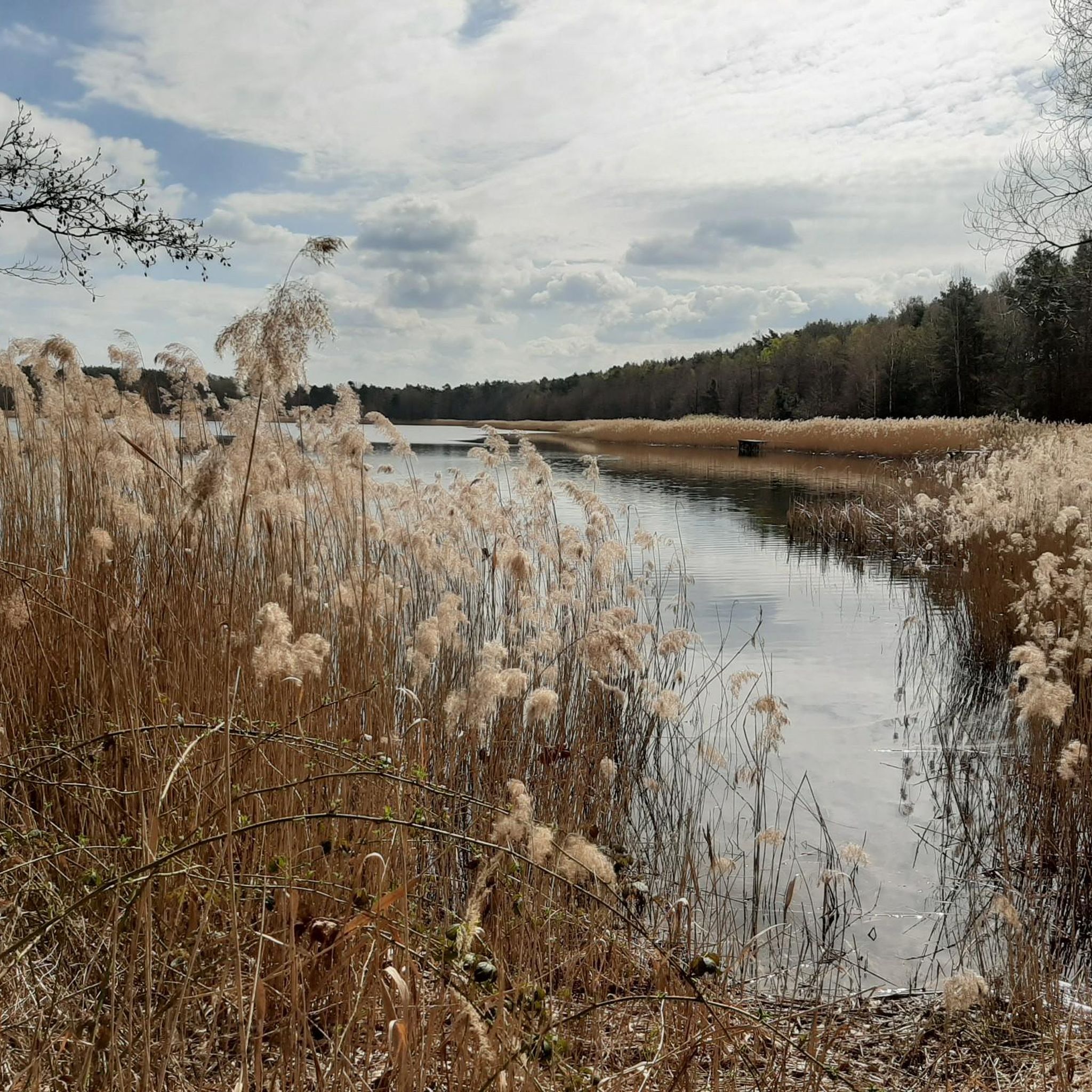
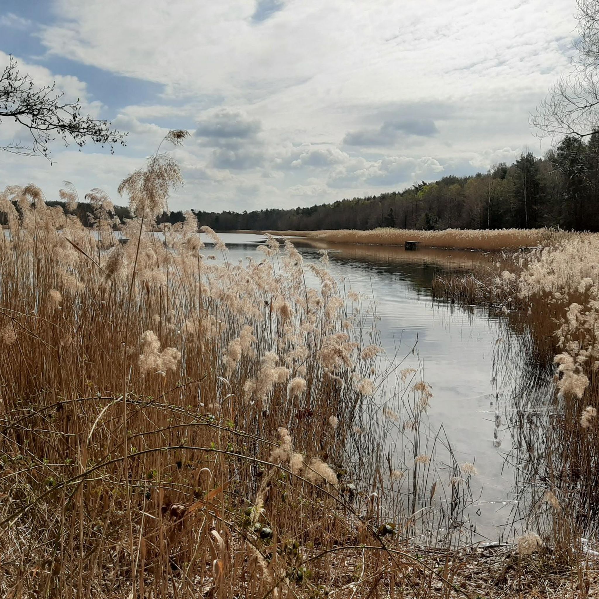
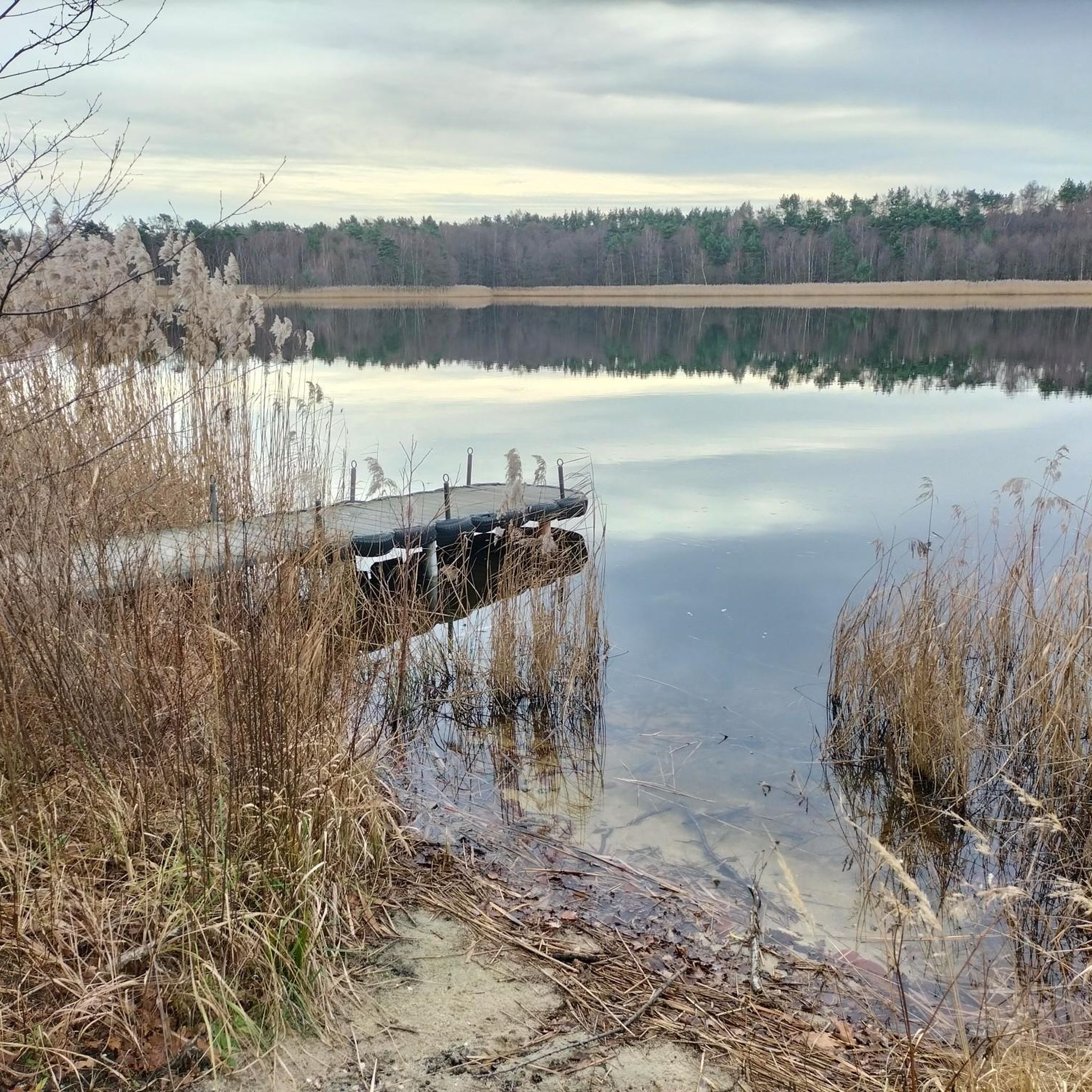
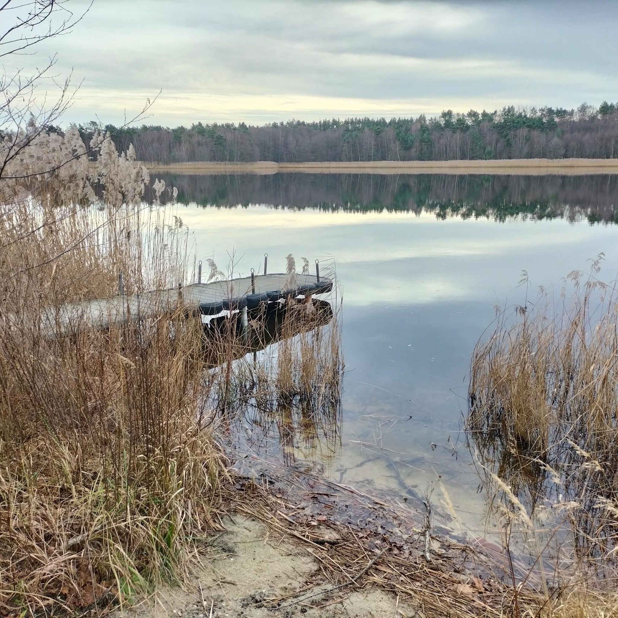
Beautiful lake with plenty of benches and a rest hut. Unfortunately, not suitable for swimming—it's a fishing spot.
0
0

If you're lucky, it's wonderfully quiet in the evenings and mornings. A perfect destination or stopover on a tour.
0
0

A colorful spot along the roadside in spring - it's so beautiful at home!
0
0
Frequently Asked Questions
How many touring cycling routes are available around Brettmühlenteich?
There are over 380 touring cycling routes available around Brettmühlenteich. The area offers a diverse network of paths, with a significant number of easy routes suitable for various skill levels.
What kind of landscapes can I expect to see while touring cycling in this region?
The region around Brettmühlenteich is characterized by tranquil forest ponds, expansive forests, and meadows, all nestled within the Zschornaer Teichgebiet nature reserve. You'll find serene backdrops for your rides, often with gentle terrain. The Brettmühle Pond itself is a central natural feature, and routes often wind through this idyllic scenery, offering views of diverse flora, especially wildflowers and wood anemones in spring.
Are there easy routes suitable for beginners or families?
Yes, Brettmühlenteich is well-suited for beginners and families, with over 220 easy touring cycling routes. Many paths feature gentle terrain and minimal elevation changes, making them perfect for leisurely rides. An excellent option is the Zschorna Pond Area – View of the Zschornaer Pond Area loop from Zschornaer Teichgebiet, which is 5.0 miles (8.1 km) long and leads through the beautiful Zschornaer Pond Area.
What do other cyclists enjoy most about touring cycling in Brettmühlenteich?
The routes in Brettmühlenteich are highly rated by the komoot community, with an average score of 4.6 stars from over 890 reviews. Cyclists often praise the tranquil forest ponds, the expansive forests, and the serene atmosphere of the Zschornaer Teichgebiet nature reserve. The variety of routes, from easy to more challenging, also receives positive feedback.
Are there any circular touring cycling routes in the area?
Yes, many of the touring cycling routes around Brettmühlenteich are circular, allowing you to start and end at the same point. For example, the Zschorna Castle – Beautiful cycle path loop from Zschornaer Teichgebiet is an 8.7-mile (14.1 km) easy loop that takes you past the historic Zschorna Castle.
What interesting landmarks or attractions can I see along the touring cycling routes?
Beyond the natural beauty, you can explore several interesting landmarks. The Zschorna Castle – Beautiful cycle path loop from Zschornaer Teichgebiet takes you past Zschorna Castle. You might also encounter natural highlights like the Beaver Habitat or enjoy views from the View of the bathing area at Brettmühlenteich. The View of the Zschornaer Pond Area – Entrance to the Nature Reserve loop from Zschornaer Teichgebiet offers scenic views and enters the nature reserve.
Can I bring my dog on the cycling routes around Brettmühlenteich?
While the Zschornaer Teichgebiet nature reserve is a beautiful area, specific rules regarding dogs on cycling paths can vary. It's generally advisable to keep dogs on a leash in nature reserves to protect wildlife. We recommend checking local regulations or signage at trailheads for the most current information on dog-friendly policies.
What is the best time of year to go touring cycling in Brettmühlenteich?
The spring and summer months are particularly beautiful for touring cycling around Brettmühlenteich. In spring, you can witness vibrant wildflowers and wood anemones. The mild weather during these seasons makes for pleasant riding conditions. While cycling is possible year-round, some unpaved sections might be muddy in wetter seasons.
Are there any routes that offer views of the Zschornaer Pond Area or enter the nature reserve?
Absolutely. The View of the Zschornaer Pond Area – Entrance to the Nature Reserve loop from Zschornaer Teichgebiet is an 8.0-mile (13.0 km) easy path specifically designed to offer views of the Zschornaer Pond Area and lead into the nature reserve. Another route, Entrance to the Nature Reserve – Wood Anemones and Wildflowers loop from Zschornaer Teichgebiet, also takes you into the reserve, highlighting seasonal flora.
Where can I find accommodation or places to eat near the cycling routes?
Nature Camping Brettmühlenteich is an ideal base for cyclists, offering amenities and direct access to trails. It also provides bicycle rentals. For dining, you'll find cafes and pubs in nearby towns. The region's proximity to Dresden (20-30 minutes away) also means a wider range of cultural attractions and dining options are within easy reach.
Are there any more challenging touring cycling routes for experienced riders?
While many routes are easy, Brettmühlenteich also offers options for more experienced riders. There are 98 moderate and 61 difficult routes available. For a more challenging ride, consider the Upper Pond and Middle Pond – Naturcamping Brettmühlenteich loop from Zschornaer Teichgebiet, which is a difficult 11.9-mile (19.2 km) route with more significant elevation changes.
Is there public transport access to the Brettmühlenteich area for cyclists?
The region around Brettmühlenteich is generally accessible, but specific public transport options for cyclists (e.g., trains with bike carriage) would depend on your starting point. For detailed information on public transport routes and bike-carrying policies, it's best to consult local transport providers' websites or schedules for the Saxony region.
Most popular routes around Brettmühlenteich
Most popular attractions around Brettmühlenteich

Get inspired with the komoot mobile app


Explore more
Browse the best Cycling routes in other regions.
