The best walks and hikes around Tusayan
4.8
(2021)
23,227
hikers
109
hikes
Hikes around Tusayan Arizona provide direct access to the Grand Canyon's South Rim and the surrounding Kaibab National Forest. The region is characterized by high-elevation plateaus, vast ponderosa pine forests, and the dramatic canyon landscape. Trails range from paved rim paths with expansive views to more rugged routes descending from the canyon edge.
Best hiking trails around Tusayan
- The most popular hiking route is Bright Angel Trailhead – 1.5-Mile Resthouse loop from Grand Canyon Village, a 5.6 mile (9.0…
Last updated: November 7, 2026
5.0
(1)
11
hikers
5.78km
01:32
20m
90m
Explore the Grand Canyon Greenway Trail, a moderate hiking route that offers a unique perspective of the South Rim. You will walk through areas dotted with ponderosa pines, pinyon, and…
5
hikers
1.72km
00:28
20m
30m

4.9
(21)
342
hikers
3.34km
00:54
40m
40m
93.9km
24:49
570m
1,430m
4.9
(162)
1,482
hikers
Hard hike. Very good fitness required. Mostly walkable paths. Sure-footedness required.
Get access to more routes and recommendations from other explorers.
Already have an account?
Our route recommendations are based on thousands of hikes, rides, and runs completed by other people on komoot.
Start today with a free account
Your next adventure awaits.



Tips from the Community

Once you've descended past the tunnel, look up to your left to see some amazing petroglyphs, including very-detailed deer done in red, with beautiful antlers!
0
0
Unlike at the 3-mile resthouse, this resthouse does not have benches inside the shelter
0
0

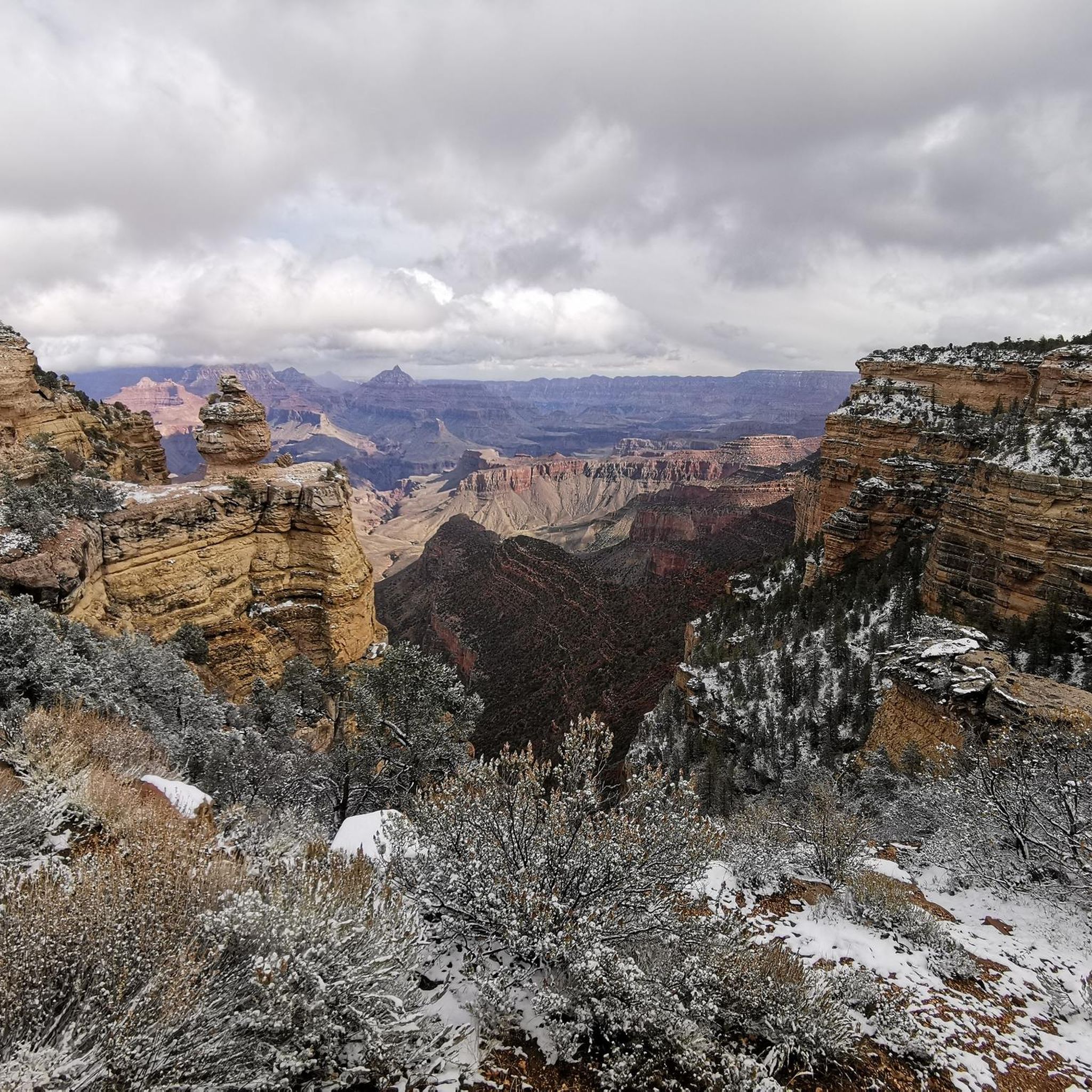
From this viewpoint, you can admire breathtaking views of the Grand Canyon and the unique rock formation known as Duck Rock, named for its striking resemblance to a duck. Take your time soaking in the views and snapping as many pictures as you like.
0
0

Highway 89 runs North-South through here between Page and Flagstaff. Arizona 64 runs westward into Grand Canyon National Park. If you can find what you need here, just a short distance northwards is the Cameron Trading Post which should get you sorted out.
0
0

The further down you go, the more deserted it becomes, but you also have to remember to come back up again!! We were here in December and the way up was strenuous even with the low temperatures. Make sure you take enough water with you, the drinking water fountains are turned off in winter.
1
0
The Grand Canyon National Park features the stunning geologic formation, its vegetation, rivers, and many species of wild animals. The Bighorn Sheeper, the Elk, Mule Deers, Squirells, Ringtails, Mountian Lions, and California Condors are some of the species that live whithin the Park area, some of these you might encounter while hiking the National Park. If that happens just enjoy the opportunitie of seeing than in their natural habitat, making sure to respect their space.
1
0
A perfect spot to enjoy lunch while admiring the breathtaking beauty of the canyon. Covered picnic tables and restrooms are available nearby Shoshone Viewpoint.
0
0
This is where the Bright Angel Trail's switchbacks begin—a strategic spot offering stunning views of the canyon and its towering walls surrounding the trail. From here, you can choose between a short, easy hike or a more challenging adventure that descends deeper into the canyon.
0
0
Frequently Asked Questions
Are there any easy, family-friendly hikes near Tusayan?
Yes, the area offers several accessible trails perfect for families. A great option is the Shoshone Point — Grand Canyon National Park trail, which is a relatively flat 2.1-mile (3.3 km) walk through woodland to a stunning, less-crowded viewpoint. The main Rim Trail within the park is also largely paved and offers spectacular canyon views without significant elevation changes.
Can I hike from Tusayan directly to the Grand Canyon South Rim?
Yes, you can. The Tusayan Greenway Trail is a multi-use path that connects the town of Tusayan with the Grand Canyon National Park's South Rim. It's approximately 6.6 miles (10.6 km) one way and provides a scenic route through the Kaibab National Forest, allowing you to hike or bike directly to the park entrance.
What are some good hikes within the Kaibab National Forest near Tusayan?
The Kaibab National Forest has excellent trails that showcase the region's beautiful ponderosa pine landscape. A highly-regarded route is the Arizona Scenic Trail to Grandview Lookout Tower. This moderate 9.2-mile (14.7 km) hike follows a section of the long-distance Arizona Trail and rewards you with panoramic views from a historic fire tower.
Are dogs allowed on the hiking trails around Tusayan?
Dogs are permitted on the Tusayan Greenway Trail and on trails within the Kaibab National Forest, but they must be leashed. Inside Grand Canyon National Park, pets are only allowed on the paved Rim Trail. They are not permitted on any trails that go below the canyon rim.
What should I pack for a day hike in the Tusayan area?
For any hike, especially those descending into the canyon, it's crucial to be prepared. Essentials include plenty of water (more than you think you'll need), salty snacks, sun protection (hat, sunscreen), and sturdy footwear. The weather can change quickly, so layered clothing is recommended. Always check the forecast before you go.
Are there any long-distance hiking opportunities starting near Tusayan?
Yes, Tusayan is an official Arizona Trail Gateway Community. You can access Passage 37 of the 800-mile Arizona National Scenic Trail from here. For a challenging multi-day trek within the park, the Mather Point Viewpoint – Bright Angel Trailhead loop offers an extensive 15-mile (24 km) experience, but it is extremely strenuous and requires significant planning.
What is hiking like in the winter around Tusayan?
Winter hiking can be beautiful but requires caution. The South Rim is at a high elevation (around 7,000 feet), so snow and ice are common on the trails. Upper sections of trails descending into the canyon, like the Bright Angel Trail, can be very icy. It's essential to have microspikes or crampons for your boots and to check trail conditions before heading out.
How many hiking trails are available around Tusayan?
There are over 80 designated hiking routes in and around Tusayan. These range from easy, paved paths along the canyon rim to extremely difficult trails that descend to the Colorado River, offering options for all skill levels.
What do other hikers say about the trails in Tusayan?
The trails around Tusayan are very highly rated by the komoot community, with an average score of 4.8 stars. Hikers frequently praise the breathtaking, expansive views of the Grand Canyon and the peaceful atmosphere of the Kaibab National Forest trails.
What are some of the best viewpoints accessible by hiking?
Many trails lead to incredible vistas. Hopi Point is a popular favorite, known for its wide, dramatic canyon views, especially at sunrise and sunset. For a quieter spot, the trail to Shoshone Point offers a more secluded but equally stunning perspective of the canyon.
What is the terrain like on the trails descending into the canyon?
Trails that go below the rim, such as the Bright Angel Trailhead – 1.5-Mile Resthouse loop, are steep, rugged, and unpaved. The terrain consists of dirt paths with switchbacks and significant elevation changes. Remember that the hike back up is much more strenuous than the descent.
Where can I find current trail conditions?
For the most up-to-date information on trail conditions, closures, and safety alerts within Grand Canyon National Park, it is essential to check the official park service website. You can find day hiking information at the NPS Day Hiking page.
Most popular routes around Tusayan
Most popular attractions around Tusayan

Get inspired with the komoot mobile app


Explore more
Browse the best Hikes in other regions.
