The best MTB trails around Damscheid
4.6
(1115)
2,941
riders
333
rides
Mountain biking around Damscheid offers diverse terrain within Germany's Rhein-Hunsrück-Kreis. The region is characterized by rolling hills and dense forests, providing natural elevation changes and wooded paths suitable for mountain biking. Many routes offer panoramic views of the UNESCO World Heritage Upper Middle Rhine Valley, including castles and vineyards. The area features a mix of forest paths, natural trails, and gravel roads, contributing to varied mountain biking experiences.
Best mountain bike trails around Damscheid
- The most popular mountain bike trail…
Last updated: October 31, 2026
4.9
(9)
25
riders
58.1km
04:11
860m
870m
Moderate mountain bike ride. Good fitness required. Advanced riding skills necessary.
4.9
(12)
13
riders
Moderate mountain bike ride. Good fitness required. Advanced riding skills necessary.

5.0
(3)
15
riders
31.6km
02:23
420m
420m
Moderate mountain bike ride. Good fitness required.
4.4
(7)
17
riders
Moderate mountain bike ride. Good fitness required. Advanced riding skills necessary.
5.0
(6)
7
riders
20.9km
01:51
540m
540m
Moderate mountain bike ride. Good fitness required.
Get access to more routes and recommendations from other explorers.
Already have an account?
Our route recommendations are based on thousands of hikes, rides, and runs completed by other people on komoot.
Start today with a free account
Your next adventure awaits.



Tips from the Community

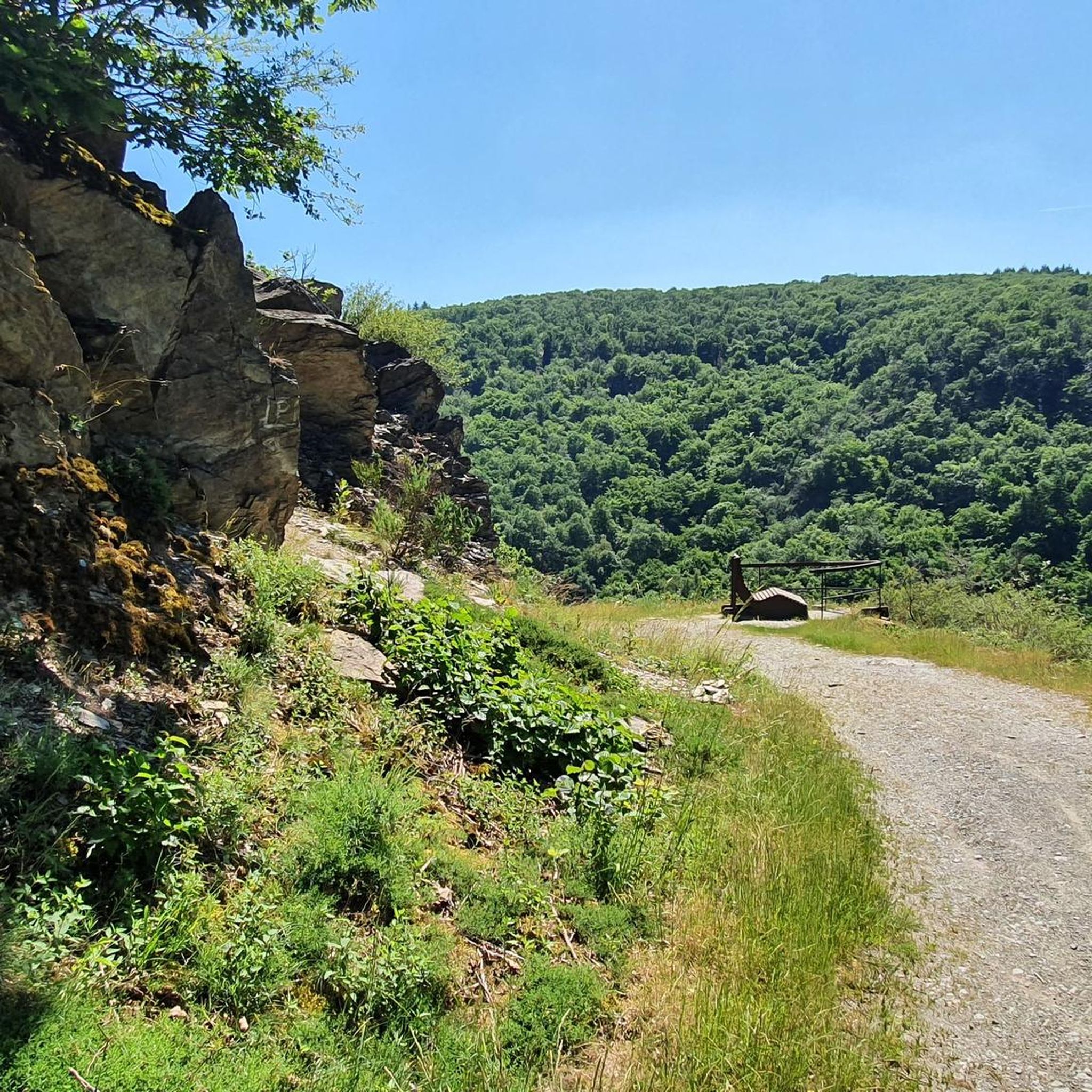
Very beautiful overview of the Middle Rhine Valley from up here
0
0

HISTORY OF THE PILGRIMAGE CHURCH Around the year 1400, a knight named Johannes Brömser von Rüdesheim lived. He had inherited the Sterrenberg Castle above Bornhofen. By now he had built two churches: the parish church of Rüdesheim and the pilgrimage church “Noth Gottes” near Rüdesheim. Now he also began in Bornhofen, at the foot of his newly acquired castle, to build a church by extending the already existing church. He died in 1416. The construction of the church was continued after his death until its completion (1435). Thus the present-day pilgrimage church came into being.
2
0
The name Loreley-Felsen originated from the myths and legends of, among others, Clemens Brentano, who wrote a romantic ballad named Loreley. In a 19th-century legend, it is told that the blonde beauty Loreley enchanted the skippers on the Rhine with her singing from the rock, and therefore, despite the dangerous current, they no longer paid attention to their course and the ships crashed against the rock reefs.
2
0
The Loreley is a slate rock formation and is located in the UNESCO World Heritage site Upper Middle Rhine Valley south of Sankt Goarshausen on the eastern right bank of the Rhine at river kilometer 555. With its height of 132 meters (193.14 m above sea level), it towers high on the inside of the Rhine bend, but also has shallows up to 100 meters in the middle of the river. This makes this section of the river one of the most dangerous on the Rhine.
2
0
The BUGA 2029 will offer its visitors the opportunity to experience the beauties of this unique landscape in a new way. For this purpose, garden landscapes and parks are to be created, each with its own character and its own story to present. The program will be complemented by guided tours of historical castles or wine tastings, where guests will be introduced to the history of wine cultivation in the region.
0
0
Located in the beautiful Middle Rhine Valley, very close to the famous Loreley rock, the Rheinfels Castle ruins today attract guests from near and far with their picturesque setting. Previously, the fortress was considered one of the safest and most impregnable castles in Germany.
1
0

Bacharach became Protestant in 1545 because its Palatinate authorities converted to the Reformation. This ended 150 years of profitable pilgrimages to the invented "Saint" Werner. In 1997, the memorial plaque at the ruin of the Bacharach Werner Chapel provided exemplary enlightenment. https://www.komoot.com/de-de/highlight/1018567 Oberwesel was under the authority of the Archbishopric of Trier and remained Catholic to this day. It took over the pilgrimage business with its own Werner Chapel. When in 1963 the Archbishopric finally struck the false saint from the list of feast days, Oberwesel stubbornly resisted. Only reluctantly was the chapel rededicated to the Franciscan Mother Rosa.
1
0

The Mutter-Rosa-Kapelle in Oberwesel (formerly Wernerkapelle) is the rebuilt choir of the former church of the Holy Spirit Hospital, which was destroyed in 1689. The structure, built on the city wall, is characterized by a baroque roof hood. It is now located in the area of the Loreley Clinics and the retirement home.
0
0
Frequently Asked Questions
How many mountain bike trails are there around Damscheid?
There are over 340 mountain bike trails around Damscheid, offering a wide range of options for different skill levels. You'll find 40 easy routes, 257 moderate routes, and 43 difficult routes to explore.
What kind of terrain can I expect on mountain bike trails in Damscheid?
Mountain biking in Damscheid is characterized by its hilly terrain and dense forests, providing natural elevation changes and wooded paths. You'll encounter a mix of forest paths, natural trails, and gravel roads. The region's topography offers both challenging climbs and exhilarating descents, often with stunning views of the Rhine Valley.
Are there any family-friendly mountain bike trails in Damscheid?
While many trails in Damscheid offer varied terrain, some of the easier forest paths can be suitable for families. For a moderate option that offers scenic views without extreme difficulty, consider the Summit Cross Aufm Nack – St. Peter's Church Wiebelsheim loop from Laudert, which is shorter at 11.6 miles (18.6 km) and has less elevation gain compared to longer routes.
What are some notable landmarks or viewpoints I can see while mountain biking in Damscheid?
Many routes in and around Damscheid offer spectacular panoramic views of the UNESCO World Heritage "Upper Middle Rhine Valley." You can pass by or visit highlights such as the View of the Loreley Rock, the Spitzenstein Observation Tower, and the Felsenkanzel Viewpoint Overlooking the Rhine and the Loreley. Some trails also feature interesting rock formations, like those found near the Großmördersnack Rock Formation.
Are there any circular mountain bike routes in Damscheid?
Yes, many of the mountain bike trails around Damscheid are designed as loops, allowing you to start and end at the same point. A popular example is the Spitzenstein Observation Tower – View of the Loreley Rock loop from Damscheid, which is a 22.4-mile (36.0 km) moderate route offering panoramic views.
What do other mountain bikers enjoy most about the trails in Damscheid?
The mountain bike trails in Damscheid are highly rated by the komoot community, with an average score of 4.7 stars from over 900 reviews. Riders often praise the diverse terrain, the stunning panoramic views of the Rhine Valley and its historic landmarks, and the mix of forest paths and natural trails that make for an engaging ride.
Is Damscheid a good destination for advanced mountain bikers?
Yes, Damscheid offers 43 difficult mountain bike routes for experienced riders seeking a challenge. These trails often feature more significant elevation changes and technical sections through the hilly and forested landscape. The varied terrain ensures that advanced riders will find routes to test their skills.
Can I bring my dog on the mountain bike trails in Damscheid?
Many of the forest paths and natural trails in the Damscheid region are multi-use and generally dog-friendly. However, it's always recommended to keep your dog on a leash, especially in areas shared with hikers or near wildlife. Please be mindful of local regulations and other trail users.
What is the best time of year for mountain biking in Damscheid?
The spring, summer, and autumn months generally offer the best conditions for mountain biking in Damscheid. Spring brings lush greenery, while autumn provides beautiful foliage. During these seasons, the weather is typically mild, and the trails are less likely to be muddy or icy, ensuring a more enjoyable and safer ride. Winter riding is possible but may involve colder temperatures and potentially slippery conditions.
Are there places to eat or stay near the mountain bike trails in Damscheid?
Damscheid and the surrounding villages in the Upper Middle Rhine Valley offer various options for cafes, restaurants, and accommodation. You'll find local eateries to refuel after your ride and guesthouses or hotels if you plan an extended stay. The region's proximity to the Rhine also means access to charming towns with more amenities.
How long are the mountain bike trails around Damscheid?
The length of mountain bike trails around Damscheid varies significantly. You can find shorter routes, such as the Summit Cross Aufm Nack – St. Peter's Church Wiebelsheim loop from Laudert at 11.6 miles (18.6 km), to longer, more challenging rides like the Spitzenstein Observation Tower – View of the Loreley Rock loop from Damscheid, which is 22.4 miles (36.0 km) long.
Most popular routes around Damscheid
Most popular attractions around Damscheid

Get inspired with the komoot mobile app


Explore more
Browse the best MTB trails in other regions.
