The best walks and hikes in Shoshone National Forest
4.7
(27)
341
hikers
23
hikes
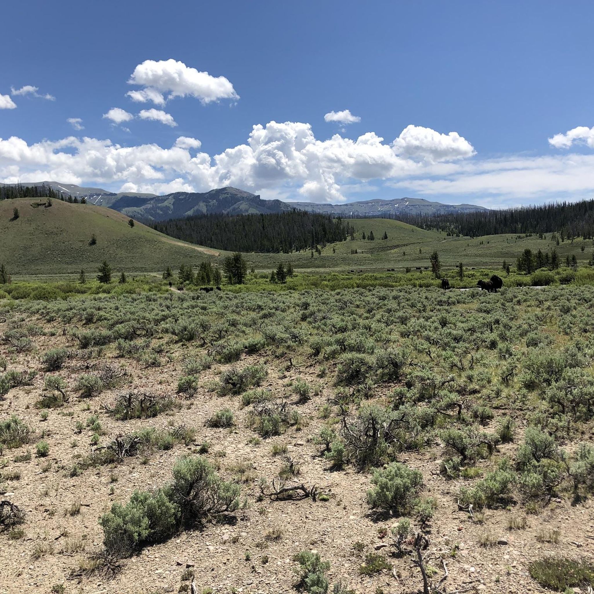
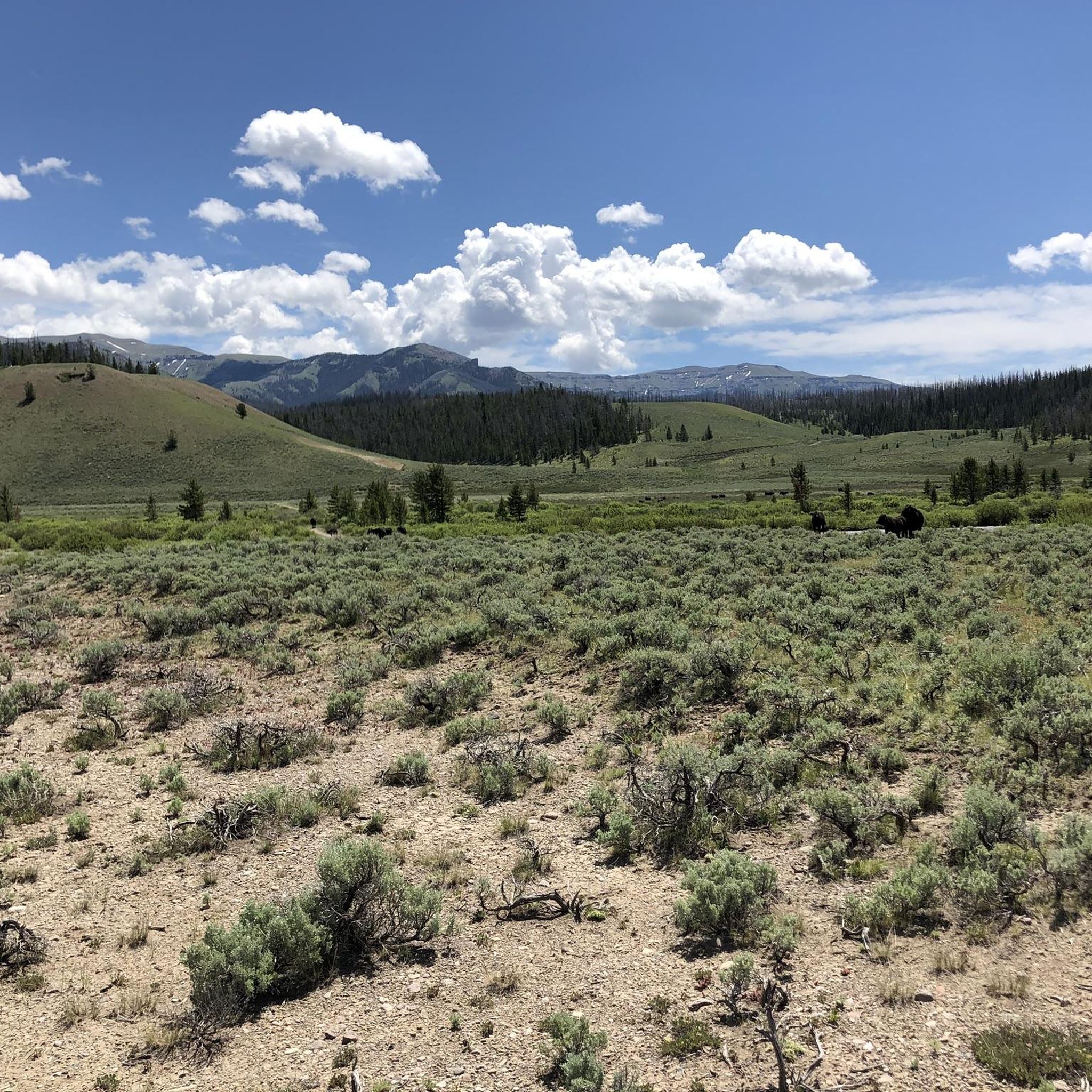
Hiking in Shoshone National Forest offers access to nearly 2.5 million acres of diverse landscapes in northwestern Wyoming, bordering Yellowstone National Park. The terrain ranges from brush plains and rocky canyons to snow-capped peaks and dense spruce forests, with elevations from 4,600 to 13,804 feet. Over 1.4 million acres are designated wilderness, providing extensive trail systems through varied ecosystems. The forest is characterized by significant portions of the Absaroka, Beartooth, and Wind River Mountains, along with numerous lakes and rivers.
Best hiking trails in Shoshone National Forest
- The most popular hiking route is Lake Louise Trail – Wind River Range, a 4.8 miles (7.7 km) trail that takes 2 hours 20 minutes to complete. This moderate route leads to the serene Lake Louise within the Wind River Range.
- Another top favourite among local hikers is Silas Lakes Trail – Wind River Range, a moderate 7.3 miles (11.7 km) path. This trail navigates through the wilderness to the Silas Lakes, offering views of the alpine environment.
- Local hikers also love the Bears Ears Trail – Wind River Range, a 19.9 miles (32.1 km) trail leading through the rugged Wind River Range, often completed in about 9 hours 52 minutes.
- Hiking in Shoshone National Forest is defined by diverse mountain ranges, extensive wilderness areas, and numerous lakes and rivers. The network offers options for various ability levels, from moderate day hikes to challenging multi-day routes.
- The routes in Shoshone National Forest are highly rated by the komoot community with an average score of 4.7 stars from more than 20 reviews. More than 200 hikers have used komoot to explore Shoshone National Forest's varied terrain.
Last updated: September 27, 2026
15
hikers
2.96km
00:58
220m
0m
The Popo Agie Falls Trail offers a delightful and accessible hiking experience, leading you through a scenic path to the beautiful Popo Agie Falls. This easy 1.8-mile (3.0 km) route involves a manageable 712 feet (217 metres) of elevation gain, making it a perfect choice for a quick adventure that takes around 57 minutes to complete. You'll enjoy the journey to the falls, which are a highlight of the Sinks Canyon area.
Planning your visit to the Popo Agie Falls Trail is straightforward. The trailhead is typically easy to access, but as a popular destination, arriving earlier in the day is recommended to ensure you find parking. While the trail is generally open, it's always a good idea to check current conditions, especially during shoulder seasons, to ensure a smooth trip. Don't forget to pack water for your hike.
Located within the stunning Sinks Canyon State Park, the Popo Agie Falls Trail is one of the most popular routes in the area, known for its family-friendly nature and rewarding waterfall views. Its relatively short length and easy difficulty make it an ideal option for beginners or those looking for a high-reward, low-effort outing. The falls themselves are a natural wonder, offering a picturesque spot to relax before heading back.
5.0
(1)
5
hikers
12.2km
03:36
340m
340m
Start your hike on the Beauty Lake and Beartooth High Lakes Loop, a moderate route covering 7.6 miles (12.2 km) with an elevation gain of 1124 feet (343 metres). You can expect to complete this journey in about 3 hours and 35 minutes. The trail winds through varied terrain, from rolling granite to marshy meadows and open subalpine areas. You will encounter many clear alpine lakes, with Beauty Lake being a highlight, often described as a mirror for the surrounding landscape. Look out for panoramic views of Beartooth Butte and Lonesome Mountain, especially when wildflowers are blooming in mid to late summer.
Planning your visit is key for this hike. The best time to go is typically from mid to late summer, after the snow has melted and wildflowers are in full bloom. If you plan an early season trip, be prepared for potential snow, challenging stream crossings, and marshy sections. Parking is available right at the trailhead, which you can reach via the scenic Beartooth Highway.
This loop offers a fantastic journey through the Shoshone National Forest, showcasing the high alpine beauty of the Beartooth Mountains. The diverse landscape features not only granite and meadows but also open subalpine areas, providing a rich natural experience. It is a popular choice for those wanting to immerse themselves in the unique environment of this mountain range.

3
hikers
3.82km
01:30
60m
380m
Embark on the Glacier Lake Trail, a moderate hike that leads you through dramatic mountain scenery to a stunning alpine lake. This route covers 2.4 miles (3.8 km) with an elevation gain of 188 feet (57 metres), offering a rewarding journey to Glacier Lake itself. You will find the striking turquoise blue water of the lake nestled at 9,700 feet, a truly memorable sight after your ascent. The trail provides a wonderful sense of accomplishment as you reach this high-altitude gem.
While the Glacier Lake Trail is relatively short, its significant uphill climb makes it a good workout, taking about 1 hour and 30 minutes to complete. It is a popular destination, so be ready to share the path with other hikers, especially during peak times. The higher elevations can be quite windy, so it is wise to bring appropriate layers to stay comfortable throughout your hike. Plan your visit to enjoy the best conditions and avoid any unexpected weather changes.
This trail is located within Wyoming's Custer Gallatin National Forest, leading you into the vast Absaroka-Beartooth Wilderness. The area is renowned for its rugged beauty and offers expansive views that stretch across the landscape. You can even catch glimpses of Glacier Lake from the Beartooth Pass summit, highlighting its prominent position in this wild region. The journey to the lake provides a true taste of the high country.
2
hikers
40.1km
12:05
1,700m
670m
The Glacier Trail offers a deep dive into the rugged wilderness of Wyoming, presenting a challenging yet rewarding experience for those prepared. You'll traverse diverse terrain, from dense forests to open alpine landscapes, with the beautiful Double Lake serving as a notable landmark along the way. Expect a true backcountry feel, where the path can be rough and the solitude profound, making it ideal for hikers seeking an immersive natural escape.
Planning your visit to the Glacier Trail requires careful consideration due to its length and difficulty. Parking at the trailhead can be limited, so an early start is always recommended, particularly if you're aiming to complete the entire 24.9 miles (40.1 km) in a single push. Always pack sufficient water and provisions for the 12 hours and 4 minutes estimated hiking time, as services are not available on the route. The best time to hike is generally during the warmer, drier months to avoid snow and ice.
This difficult route, with its 5576 feet (1700 metres) of elevation gain, stands out as one of the more demanding options in the region, appealing to experienced hikers looking for a significant physical and mental test. It's a prime example of the kind of challenging multi-day hikes Glacier National Park Montana is known for, offering a chance to truly disconnect and explore the natural features of this remote area.
2
hikers
7.22km
01:59
130m
70m
The Becker Lake via Beartooth High Lakes Trail offers an easy hiking experience through an alpine environment. You will cover 4.5 miles (7.2 km) with a gentle elevation gain of 417 feet (127 metres), making it a rewarding route for nearly two hours of hiking. The path leads you past several clear alpine lakes, eventually reaching Becker Lake itself, providing panoramic views of surrounding mountains often reflected in the calm waters. This easy trail takes approximately 1 hour and 58 minutes to complete, providing a pleasant outing.
When planning your hike on the Becker Lake via Beartooth High Lakes Trail, be aware of potential early season conditions. You might encounter marshy sections and lingering snowfields, so choose your footwear accordingly. Mosquitoes can also be quite active, especially during warmer months, so bringing repellent is a good idea. The trail is generally well-traveled, but prepare for varied terrain including soft dirt, boulder fields, and some mucky spots. Consider starting your hike earlier in the day to enjoy the serene morning atmosphere and avoid potential afternoon weather changes.
The Becker Lake via Beartooth High Lakes Trail is part of the larger Beartooth High Lakes system, known for its numerous pristine water bodies. This area is characterized by its high-altitude setting, where abundant wildflowers add vibrant color to the landscape. The trail offers a fantastic reward-to-effort ratio, allowing you to experience the beauty of the Shoshone National Forest without extreme exertion. You will pass by several notable lakes, including Island Lake, Night Lake, Mutt Lake, and Jeff Lake, before reaching your destination.
Get access to more routes and recommendations from other explorers.
Already have an account?
Our route recommendations are based on thousands of hikes, rides, and runs completed by other people on komoot.
Start today with a free account
Your next adventure awaits.
Popular around Shoshone National Forest
Tips from the Community

A beautiful lake with many inlet streams to cross
0
0
Trail can be very flooded early in the season, streams can be passed on rocks
0
0

The crystal-clear lake is beautifully dotted with tiny rock islands. It is fed by Double Lake Creek and is accessible from Glacier Trail.
3
0
Frequently Asked Questions
How many hiking trails are available in Shoshone National Forest?
Shoshone National Forest offers a vast network of trails. Our guide features 14 curated hiking routes, but the forest boasts over 1,500 miles of trails in total, catering to a wide range of abilities and experiences.
What kind of terrain and difficulty can I expect on hikes in Shoshone National Forest?
The terrain in Shoshone National Forest is incredibly diverse, ranging from brush plains and rocky canyons to snow-capped peaks and dense spruce forests. Elevations vary significantly, from 4,600 to 13,804 feet. You'll find everything from easily accessible paths to challenging routes requiring good fitness and alpine experience. Our guide includes 2 easy, 6 moderate, and 6 difficult routes.
Are there any hikes in Shoshone National Forest that feature waterfalls?
Yes, the Shoshone National Forest is home to several beautiful waterfalls. You can discover natural rock slides and falls like Middle Fork Falls and Lake Creek Falls, which are popular natural attractions within the forest.
Can I find hikes that lead to scenic lakes in Shoshone National Forest?
Absolutely. The forest is dotted with numerous crystal-clear lakes. You can hike to the serene Lake Louise in the Wind River Range, or explore the wilderness leading to the Silas Lakes. Another option is the route from Dickinson Park to Middle Lake.
Are there family-friendly hiking options in Shoshone National Forest?
Yes, Shoshone National Forest offers easily accessible paths suitable for all skill levels, including families. While specific family-friendly routes are not detailed in this guide, the forest's extensive trail system ensures there are options for shorter, less strenuous walks. Always check the route's difficulty and length to ensure it's appropriate for your family.
Are dogs allowed on trails in Shoshone National Forest?
Generally, dogs are permitted on trails within the Shoshone National Forest, but they must be kept on a leash. However, specific regulations can vary, especially in designated wilderness areas or near wildlife habitats. It's always best to check with the local Forest Service office for the most current rules and any area-specific restrictions before heading out with your dog.
What are some notable landmarks or viewpoints to look for while hiking?
Shoshone National Forest is rich in natural landmarks. Hikers can experience the high-alpine environment of the Beartooth Plateau, accessible via Beartooth Pass. The Wind River Range features Wyoming's tallest mountain, Gannett Peak, and the dramatic Cirque of the Towers. The forest also offers breathtaking views of rugged mountain peaks and expansive wildflower-strewn plateaus.
What is the best time of year to hike in Shoshone National Forest?
The best time to hike in Shoshone National Forest is typically from late spring through early fall (June to September). During these months, trails are generally free of snow, and the weather is more favorable. High-alpine areas, like the Beartooth Plateau, may remain snow-covered into July. Always check current conditions and weather forecasts before your trip, as conditions can change rapidly at higher elevations.
Are there any loop trails available for hiking in Shoshone National Forest?
Yes, the Shoshone National Forest offers various loop trails. A notable example is the Beartooth Loop National Recreation Trail, which guides hikers along alpine ridges, through deep valley meadows, and past lakes, providing a comprehensive experience of the high-alpine environment.
What do other hikers enjoy most about hiking in Shoshone National Forest?
The area is highly rated by the komoot community, with an average score of 4.7 stars from more than 20 reviews. Reviewers often praise the diverse landscapes, from brush plains to snow-capped peaks, the extensive wilderness areas, and the opportunity to encounter abundant wildlife like bighorn sheep and elk. The pristine lakes and rivers are also frequently highlighted.
Are there opportunities for wildlife viewing while hiking?
Yes, the diverse ecosystems of Shoshone National Forest support a rich array of wildlife. Hikers often spot bighorn sheep grazing on rocky slopes or elk roaming freely across meadows, particularly during dawn and dusk. The Big Game Campground, situated next to the North Fork of the Shoshone River, is known for its wonderful wildlife viewing opportunities.
Are permits required for hiking or camping in Shoshone National Forest?
While most day hiking in Shoshone National Forest does not require a permit, permits are often necessary for overnight backpacking in designated wilderness areas. It's crucial to check with the Shoshone National Forest Service for specific regulations regarding permits, especially if you plan an extended trip or intend to visit specific wilderness areas like the North Absaroka, Washakie, Fitzpatrick, or Popo Agie Wildernesses.
What are some of the more challenging multi-day hikes in the area?
For experienced hikers seeking a challenge, the Shoshone National Forest offers several difficult multi-day routes. Examples include the Bears Ears Trail, a 19.9-mile route through the rugged Wind River Range, or the Bomber Basin & Bomber Falls trail, which covers over 20 miles with significant elevation gain. These routes require good fitness and preparation for alpine conditions.
Most popular attractions in Shoshone National Forest

Get inspired with the komoot mobile app


Explore more
Browse the best Hikes in other regions.
