The best road cycling routes around Tohloppi
4.1
(126)
3,388
riders
101
rides
Road cycling around Tohloppi, a district of Tampere, Finland, offers varied natural landscapes connected to a broader urban cycling network. The area features Lake Tohloppi and the Epilänharju ridge, which includes rocky areas and hills, providing diverse terrain for road cyclists. While specific paved routes within Tohloppi are not extensively detailed, its integration into Tampere's extensive cycling infrastructure allows access to scenic routes through nature and lake landscapes. The topography includes gentle gradients around the lake and more varied elevation…
Last updated: May 15, 2026
41
riders
Hard road ride. Very good fitness required. Some segments of this route may be unpaved and difficult to ride.
4.0
(1)
22
riders
95.2km
04:08
700m
700m
Moderate road ride. Good fitness required. Some segments of this route may be unpaved and difficult to ride.

Sign up for free
22
riders
78.9km
03:25
550m
550m
Moderate road ride. Good fitness required. Some segments of this route may be unpaved and difficult to ride.
16
riders
72.3km
03:14
580m
580m
Moderate road ride. Good fitness required. Some segments of this route may be unpaved and difficult to ride.
17
riders
99.2km
04:08
510m
510m
Moderate road ride. Good fitness required. Some segments of this route may be unpaved and difficult to ride.
Get access to more routes and recommendations from other explorers.
Sign up for free
Already have an account?
Our route recommendations are based on thousands of hikes, rides, and runs completed by other people on komoot.
Start today with a free account
Your next adventure awaits.
Login or Signup


Tips from the Community

Hämeenkyrö is a Finnish municipality of about 10,300 inhabitants, located in the Pirkanmaa region. It is strategically located just 36 kilometers west of Tampere (about 30 minutes by car) along the national road 3. The municipality is known for its strong cultural identity, its natural landscapes, and its commitment to environmental sustainability.
0
0

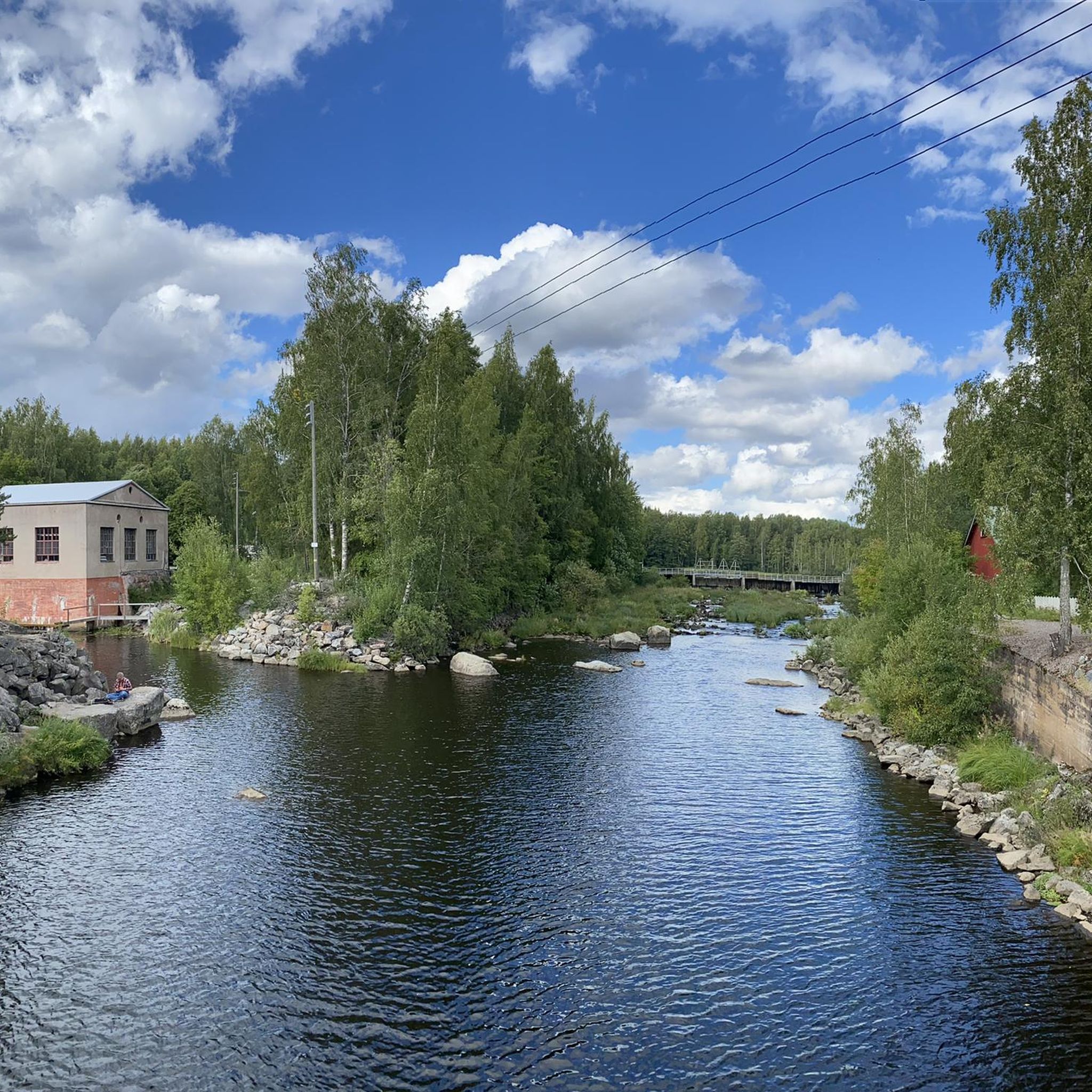
Around Lake Tohloppi, you will find beautiful lakeside paths, a small beach, and a nature trail that is perfect for walking or jogging.
0
0

Skip the line if you only want tickets to go up; most people queue for drinks. A beautiful view from the tower for only €2.
0
0

new high-quality (ish, a bit narrow) bike path running alongside a recently opened light rail extension, no crossing car traffic, straight and (false) flat, also nice lakeside views for now (until blocked by houses), should extend at both ends eventually
0
0


Hämeenkyrö is a peaceful municipality in the Pirkanmaa region, about 36 km from Tampere. Known for its scenic landscapes of lakes, forests, and rolling countryside, it’s a great spot for outdoor activities. The area is also famous as the birthplace of Nobel Prize-winning author Frans Eemil Sillanpää. Though small, Hämeenkyrö offers a blend of natural beauty and cultural heritage.
0
0
A gravel wide road through the park. The trail is in excellent condition, and there aren't many pedestrians, even on weekends. It's a smooth, uninterrupted ride, perfect for getting into a good rhythm.
0
0

Hämeenkyrö is a rural municipality located near the urban area, only 30 minutes west of Tampere.
1
0
Frequently Asked Questions
What kind of terrain can I expect on road cycling routes around Tohloppi?
Tohloppi's road cycling routes offer varied terrain. You'll find gentle gradients around Lake Tohloppi, while the Epilänharju ridge provides more varied elevation profiles with rocky areas and hills. This allows for a diverse riding experience, from flatter sections to more challenging climbs.
Are there many road cycling routes available in the Tohloppi area?
Yes, the Tohloppi area, as part of Tampere's broader cycling network, offers a wide selection of routes. There are over 100 road cycling routes available, catering to various skill levels. You can find 21 easy routes, 74 moderate routes, and 13 difficult routes to explore.
What are some notable landmarks or viewpoints I can see while road cycling in Tohloppi?
While road cycling around Tohloppi, you'll encounter scenic lake views, especially around Lake Tohloppi itself. The area is also characterized by its natural landscapes, including the Epilänharju ridge. For a specific route that highlights lake views, consider the Bench With Lake View loop from Tesoma.
What is the best time of year for road cycling in Tohloppi?
The best time for road cycling in Tohloppi is typically during the warmer months, from late spring to early autumn (May to September), when the weather is mild and the routes are clear of snow and ice. During winter, Lake Tohloppi is known for its tour skating track, indicating that cycling conditions would be challenging due to snow and ice.
Are there family-friendly road cycling options in Tohloppi?
Tohloppi's connection to Tampere's extensive cycling network means there are options for various abilities. While specific 'family-friendly' road cycling routes are not explicitly highlighted, the presence of 21 easy routes suggests that less challenging, shorter rides suitable for families can be found within the broader network accessible from Tohloppi.
Can I bring my dog on road cycling routes in Tohloppi?
While the Tohloppi Nature Trail is suitable for walking with a dog, specific regulations for dogs on paved road cycling routes can vary. Generally, dogs on a leash are permitted in public areas. It's always advisable to check local signage or specific route details for any restrictions regarding pets on cycling paths.
Are there any cafes or amenities along the road cycling routes in Tohloppi?
Tohloppi is a district of Tampere, so you can expect to find amenities such as cafes and shops within the broader urban area. While specific cafes directly on rural cycling paths might be limited, routes often connect to areas where refreshments are available. For example, the Eliander Kiosk and SUP Rental – Lakeside Pathway loop from Tesoma suggests proximity to such facilities.
What do other road cyclists enjoy most about road cycling in Tohloppi?
The road cycling experience in Tohloppi is highly rated by the komoot community, with an average score of 4.1 stars from over 100 reviews. Cyclists often praise the diverse natural landscapes, the scenic lake views, and the seamless connection to Tampere's wider cycling network, which offers routes for all ability levels.
Are there paved cycling paths around Lake Tohloppi?
While the Tohloppi Nature Trail is a 5-kilometer path around the lake, it's primarily a nature trail and not fully paved for road cycling. However, Tohloppi's integration into Tampere's broader cycling network means you can access paved routes that connect to and around the lake area, offering scenic rides with lake views.
How can I access Tohloppi's road cycling routes using public transport?
Tohloppi is approximately seven kilometers from Tampere's city center, making it accessible via Tampere's public transport network. You can use local buses to reach the Tohloppi district, from where you can easily connect to the various road cycling routes that extend into and around the area.
Are there any specific regulations for cycling in nature reserves or protected areas near Tohloppi?
The Tohloppi Nature Trail, which includes parts of the Epilänharju ridge, is a protected natural area. While road cycling typically occurs on designated roads and paths, if your route takes you near or through such areas, it's important to respect local regulations, which usually involve staying on marked paths and protecting the natural environment. Always look for local signage.
What is the difficulty level of road cycling routes in Tohloppi?
Road cycling routes in Tohloppi cater to a range of difficulty levels. You can find easy routes for a relaxed ride, moderate paths that offer a good challenge, and more difficult routes, such as the Pyynikki Observation Tower – Kaarina Maununtyttären Road loop from Tesoma, which is 127.8 km long and features significant elevation changes.
Most popular routes around Tohloppi

Get inspired with the komoot mobile app


Explore more
Browse the best Road cycling routes in other regions.
