The best walks and hikes around Steirersee
4.6
(2592)
15,014
hikers
174
hikes
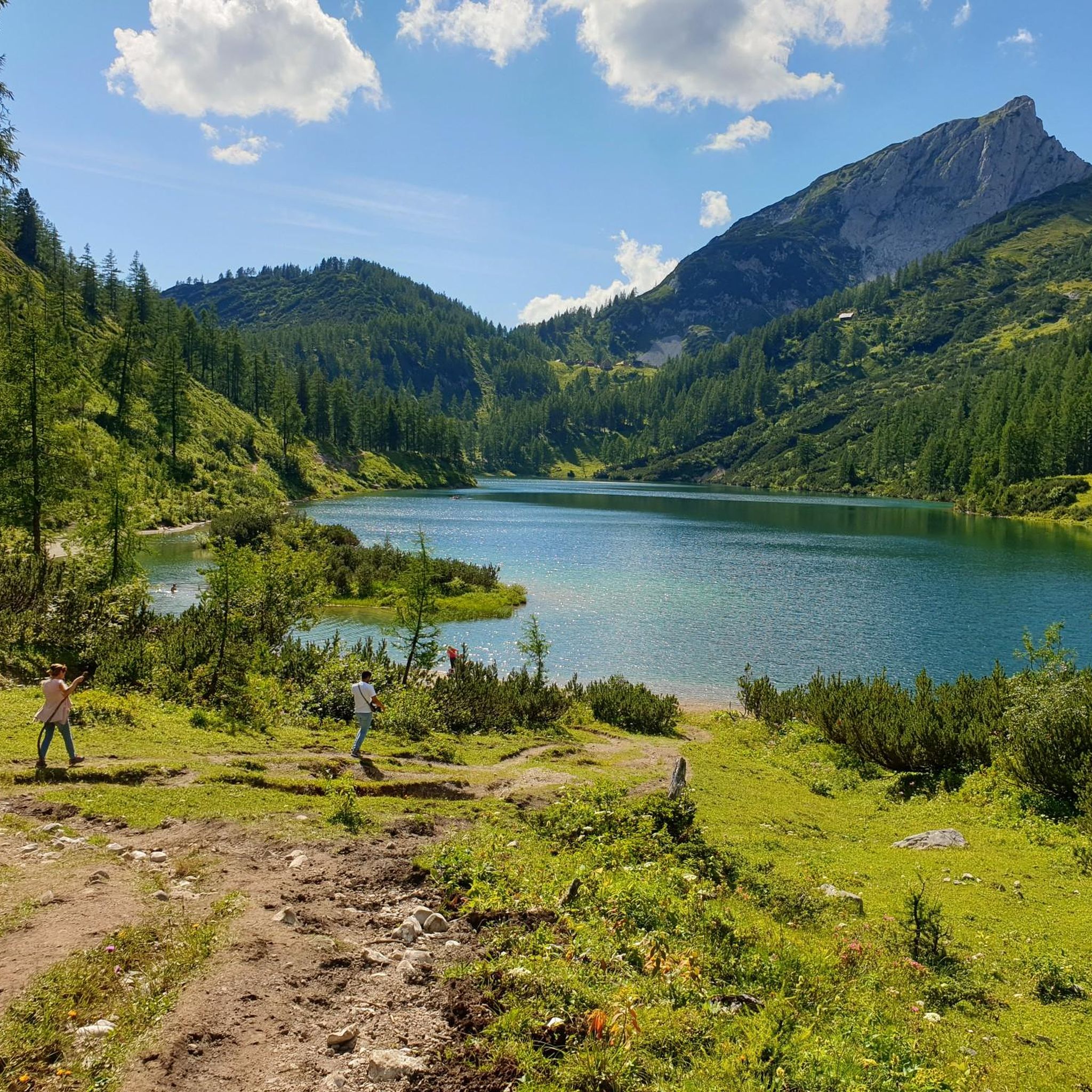
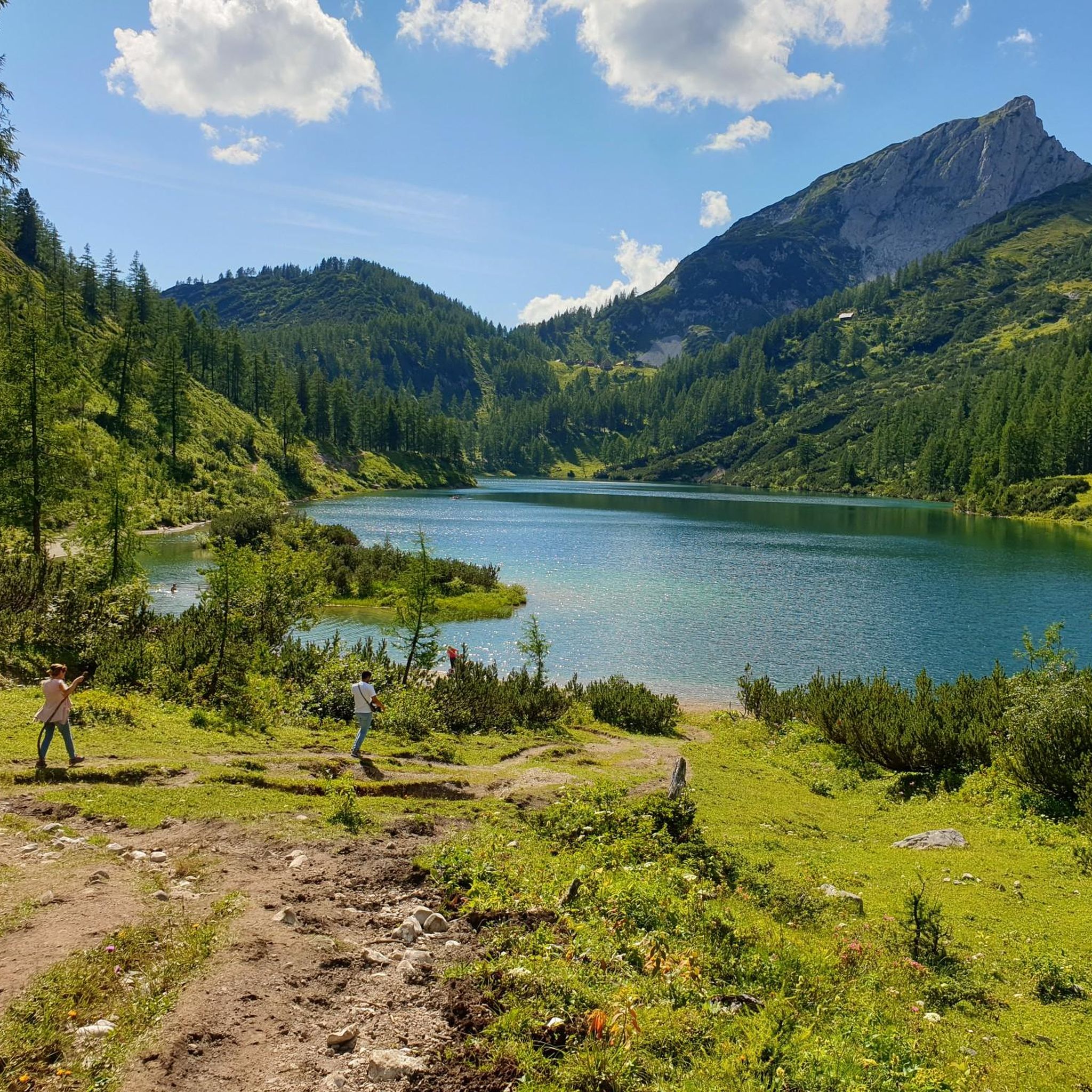
Hiking around Steirersee is situated in the Liezen district, characterized by an alpine landscape surrounding the lake. The region features a mix of forested areas, open meadows, and rocky terrain, typical of the Tauplitzalm plateau within the Totes Gebirge mountains. The area is known for its clear mountain lakes, including Steirersee itself, and panoramic views of peaks like Sturzhahn and the distant Dachstein. Elevations vary, offering both gentle paths and more challenging ascents.
Best hiking trails around Steirersee
- The most popular hiking route is Wiadahoam Hut – Leistalm loop from Schwarzensee, a difficult 7.0 miles (11.2 km) trail that takes 5 hours 13 minutes to complete, exploring alpine huts and lake views.
- Another top favourite among local hikers is Großsee Lakeside Trail – View of Großsee loop from Tauplitzsee, a moderate 4.5 miles (7.3 km) path that offers lakeside paths and views of Großsee.
- Local hikers also love the Krallersee – Lawinenstein Summit loop from Tauplitzsee, a 7.5 miles (12.1 km) trail leading through mountain lakes and offering panoramic views, often completed in about 3 hours 55 minutes.
- Hiking around Steirersee is defined by clear mountain lakes, alpine meadows, and forested paths. The network offers options for different ability levels, from easy strolls to more demanding mountain hikes.
- The routes in Steirersee are highly rated by the komoot community with an average score of 4.5 stars from over 2,200 reviews. More than 13,000 hikers have used komoot to explore Steirersee's varied terrain.
Last updated: October 8, 2026
4.7
(109)
626
hikers
7.16km
02:03
160m
160m
Moderate hike. Good fitness required. Easily-accessible paths. Suitable for all skill levels.
4.2
(33)
135
hikers
12.2km
03:56
530m
530m
Moderate hike. Good fitness required. Easily-accessible paths. Suitable for all skill levels.

3.8
(12)
107
hikers
11.8km
04:15
720m
730m
Moderate hike. Good fitness required. Easily-accessible paths. Suitable for all skill levels.
5.0
(13)
105
hikers
19.6km
07:36
900m
900m
Hard hike. Very good fitness required. Sure-footedness, sturdy shoes and alpine experience required.
4.0
(4)
15
hikers
Easy hike. Great for any fitness level. Easily-accessible paths. Suitable for all skill levels.
Get access to more routes and recommendations from other explorers.
Already have an account?
Our route recommendations are based on thousands of hikes, rides, and runs completed by other people on komoot.
Start today with a free account
Your next adventure awaits.

Tips from the Community

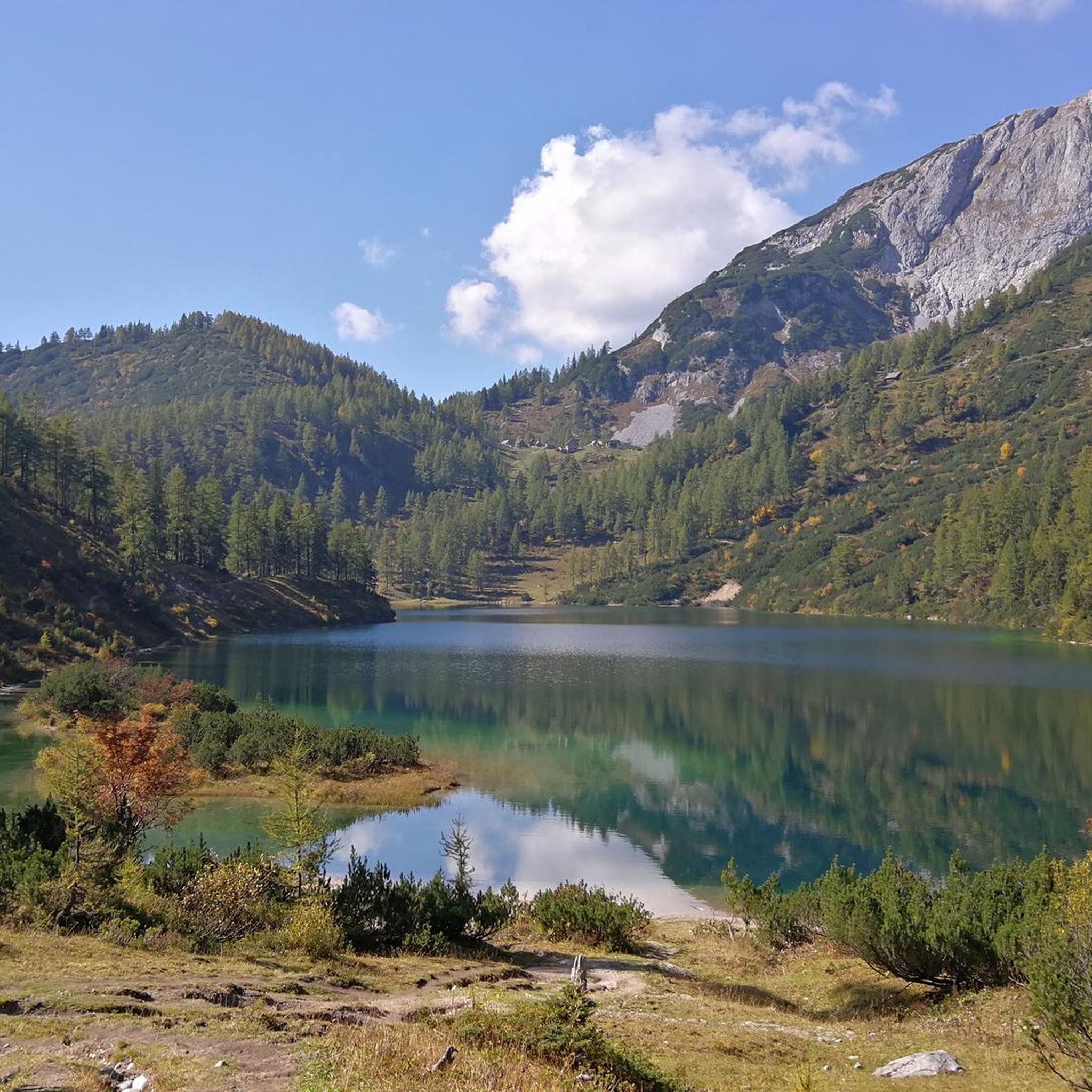
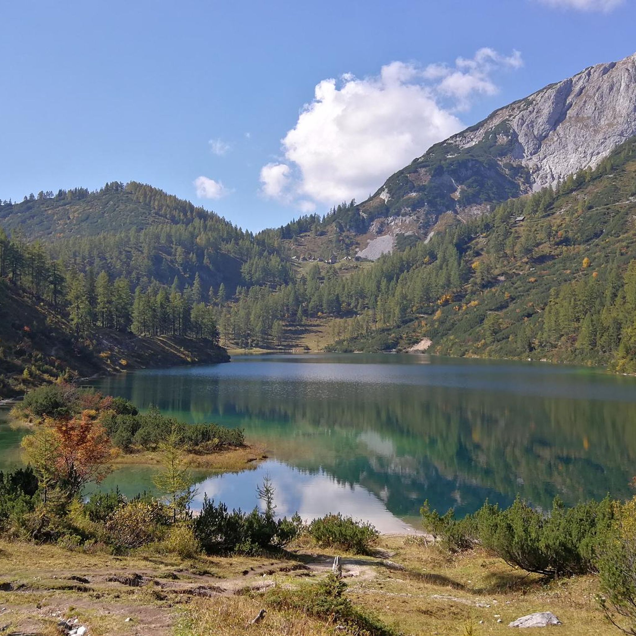
Beautiful and easily accessible. There is a bench in the shade under a tree with a beautiful view of the picturesque lake.
0
0

The route is also perfectly doable with a dog. The dog should, of course, be fit, healthy, and not too old or too young. We were there in October. There were few cows. The route was absolutely gorgeous.
2
0

Beautiful tiny mountain lake, somewhat hidden.
0
0

Thanks to the chairlift, you can get up the mountain comfortably. Information on lift times and prices: https://www.dietauplitz.com/de/sommer/.
2
0

There are always beautiful views of the lake
0
0

technically somewhat more demanding, good footwear and stamina are recommended for the circuit
1
0


Krallersee is always worth it despite the mast. You have to see all the lakes here.
0
0
Frequently Asked Questions
What is the typical difficulty level of hiking trails around Steirersee?
The trails around Steirersee offer a range of difficulties. Approximately 65 routes are considered easy, 70 are moderate, and 44 are more difficult, providing options for various fitness levels and experience. The terrain varies from gentle lakeside paths to more challenging alpine sections on the Tauplitzalm plateau.
Are there family-friendly hiking options near Steirersee?
Yes, Steirersee offers several family-friendly hiking options. Many of the easy and moderate trails are suitable for families, often featuring relatively flat sections around the lake or through meadows. These routes allow for enjoyable walks with children, focusing on the natural beauty of the alpine landscape.
Can I bring my dog on the hiking trails around Steirersee?
Dogs are generally welcome on hiking trails around Steirersee and in the Tauplitzalm region. However, it's important to keep them on a leash, especially in areas with grazing livestock or near wildlife. Always carry water for your dog and be prepared to clean up after them.
What is the best time of year to go hiking around Steirersee?
The best time for hiking around Steirersee is typically from late spring (May/June) through early autumn (September/October). During these months, the weather is generally pleasant, the trails are clear of snow, and the alpine flora is vibrant. Autumn offers particularly stunning views with changing foliage.
Are there any circular hiking routes available near Steirersee?
Yes, the region around Steirersee and the broader Tauplitzalm plateau features numerous circular hiking routes. These trails are popular as they allow hikers to experience diverse landscapes without retracing their steps, often connecting multiple lakes or mountain huts.
Where can I find parking for hikes around Steirersee?
Parking is available at various access points to the Tauplitzalm plateau, which serves as the gateway to hikes around Steirersee. Specific parking areas are usually well-marked and may require a fee, especially during peak season. It's advisable to arrive early, particularly on weekends, to secure a spot.
What kind of views can I expect on hikes around Steirersee?
Hikes around Steirersee offer stunning panoramic views typical of the alpine landscape. You can expect vistas of clear mountain lakes, expansive alpine meadows, and the surrounding peaks of the Liezen district. Many trails provide excellent photo opportunities of the Steirersee itself and the picturesque Tauplitzalm.
Are there opportunities for wild swimming near the hiking trails?
Given the presence of clear mountain lakes in the region, including Steirersee itself and other lakes on the Tauplitzalm, opportunities for wild swimming exist. However, be aware that mountain lake waters are often very cold, even in summer. Always check local regulations and safety guidelines before entering the water.
What should I wear for hiking in Steirersee during autumn?
For autumn hiking around Steirersee, it's crucial to dress in layers. Temperatures can vary significantly throughout the day. We recommend waterproof and windproof outer layers, warm mid-layers (fleece or wool), and moisture-wicking base layers. Sturdy hiking boots, a hat, and gloves are also advisable, as weather conditions can change rapidly in the mountains.
Are there mountain huts or cafes along the hiking trails?
Yes, the Tauplitzalm plateau, where Steirersee is located, is known for its traditional mountain huts (Hütten) and cafes. Many hiking routes pass by or lead to these establishments, offering opportunities for refreshments, meals, and a rest stop. These huts often serve local specialties and provide a welcoming atmosphere for hikers.
What do other hikers enjoy most about the Steirersee region?
The Steirersee region is highly rated by the komoot community, with an average score of 4.5 stars from over 2,200 reviews. Hikers frequently praise the stunning natural beauty, particularly the clear mountain lakes and panoramic views. The diverse terrain and well-maintained paths also receive positive feedback, making it a popular destination for various hiking abilities.
How many hiking trails are available in the Steirersee area?
There are over 170 hiking trails available for exploration in the Steirersee area and the surrounding Tauplitzalm plateau. This extensive network provides a wide variety of options, from short, easy strolls to more demanding full-day mountain hikes.
Most popular routes around Steirersee

Get inspired with the komoot mobile app


Explore more
Browse the best Hikes in other regions.
