The best MTB trails around Hauptspeicher Kölnbrein
4.6
(43)
154
riders
5
rides
Mountain biking around Hauptspeicher Kölnbrein offers diverse routes set within the Hohe Tauern National Park in Austria. The region features dramatic alpine landscapes, including the impressive Kölnbrein Dam and its reservoir, surrounded by hilly, rocky terrain. Mountain bike trails often follow unpaved, wide paths, winding through areas with low vegetation and past steep cliffs and small rivers. The area is characterized by its significant elevation changes and the scenic Malta High Alpine Road.
Best mountain bike trails around Hauptspeicher Kölnbrein
…Last updated: November 9, 2026
10
riders
10.9km
01:08
260m
260m
Easy mountain bike ride.
4.0
(1)
16
riders
7.55km
01:45
450m
450m
Moderate mountain bike ride. Good fitness required.

4.4
(7)
15
riders
18.4km
02:05
720m
720m
Hard mountain bike ride. Good fitness required. Advanced riding skills necessary. Some portions of the route may require you to push your bike.
4.5
(2)
10
riders
14.7km
01:31
440m
440m
Moderate mountain bike ride. Good fitness required.
5.0
(2)
17
riders
27.8km
02:35
1,010m
1,010m
Hard mountain bike ride. Very good fitness required.
Our route recommendations are based on thousands of hikes, rides, and runs completed by other people on komoot.
Start today with a free account
Your next adventure awaits.
Popular around Hauptspeicher Kölnbrein

Tips from the Community

Always worth a detour, and also open at the beginning of October.
0
0
Always worth it, still open even in early autumn.
0
0

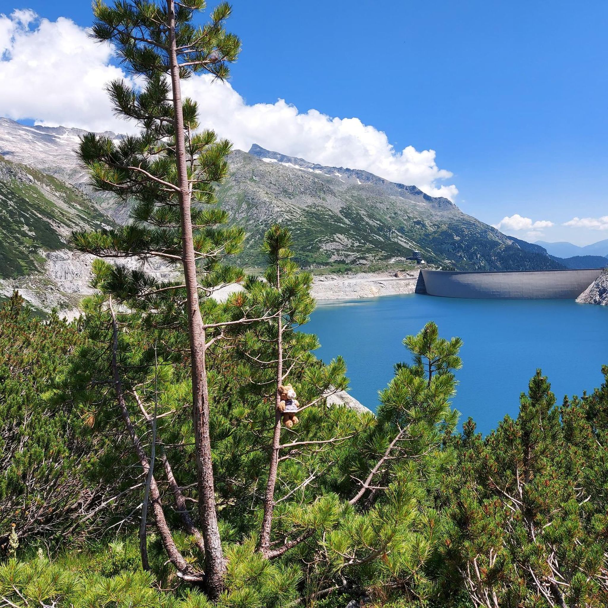
Coming from the valley, a first beautiful sight of Austria's highest dam (625 m long, 200 m high), which is located at 1900m above sea level.
0
0
Austria's highest dam (625 m long, 200 m high) is located at an altitude of 1900m.
0
0
A mountain hut that fits perfectly into the landscape, worth seeing!
0
0
A very imposing and massive waterfall, which practically plunges into the valley over several rock steps.
0
0
A very impressive and massive waterfall, which practically tumbles over several rock steps into the valley.
0
0

If there's a waterfall nearby, it attracts us, and this time it was a highlight too, absolutely beautiful.
2
0
Frequently Asked Questions
What types of mountain bike trails can I find around Hauptspeicher Kölnbrein?
The region offers a diverse network of mountain bike trails, ranging from easy loops to more challenging routes with significant elevation gain. You'll find routes suitable for various skill levels, set amidst stunning alpine landscapes. The terrain is typically hilly, rocky, and features unpaved, wide paths.
Are there any easy mountain bike trails suitable for beginners or families?
Yes, there are options for easier rides. For instance, the Kölnbrein Reservoir loop from Gensbichl is an easy 6.7-mile (10.8 km) path, providing accessible riding around the reservoir with continuous exposure to the alpine scenery. This route is a good choice for those looking for a less strenuous experience.
What are some challenging mountain bike routes with significant elevation gain?
For those seeking more challenging rides, the area offers routes with notable elevation changes. The Hubalm – Hirschgrubenalm loop from Parkplatz Oberneureit is an 11.4-mile (18.4 km) trail that leads through varied mountain terrain and involves a substantial climb of over 660 meters. Another option is the Wolfau Chapel – Reitalm loop from Aschlreit, which features over 710 meters of elevation gain.
How long do mountain bike trails around Hauptspeicher Kölnbrein typically take to complete?
Trail durations vary depending on the route's length and difficulty. For example, the moderate Kölnbrein Reservoir – Osnabrücker Hut loop from Kölnbrein Dam typically takes around 1 hour and 44 minutes. Longer, more challenging routes, such as the Hubalm – Hirschgrubenalm loop from Parkplatz Oberneureit, can take over 2 hours.
Are there any circular mountain bike routes in the area?
Yes, many of the mountain bike trails around Hauptspeicher Kölnbrein are designed as loops, allowing you to start and end at the same point. Examples include the Kölnbrein Reservoir – Osnabrücker Hut loop from Kölnbrein Dam and the Kölnbrein Reservoir loop from Gensbichl.
What interesting sights or landmarks can I see along the mountain bike trails?
The trails offer continuous exposure to the breathtaking alpine environment. You can encounter impressive sights such as the Kölnbreinsperre Dam, Austria's tallest dam, and its unique Airwalk at the Kölnbrein Dam viewing platform. The region is also known as the 'Valley of Rushing Water,' so you might spot various waterfalls, including the Waterfall at Kölnbreinspeicher, and rushing glacier streams.
What is the best time of year for mountain biking around Hauptspeicher Kölnbrein?
The best time for mountain biking in this alpine region is typically during the warmer months, from late spring to early autumn, when the trails are free of snow and the weather is more stable. Always check local weather conditions before heading out, as alpine weather can change rapidly.
Are there any viewpoints along the mountain bike routes?
Absolutely. The entire area is renowned for its panoramic views. The Airwalk at the Kölnbrein Dam offers unparalleled views into the depths below. Many routes provide continuous exposure to the stunning alpine environment, allowing for numerous scenic stops and views of the surrounding Hohe Tauern National Park and the Ankogel Group.
What do other mountain bikers enjoy most about the trails in Hauptspeicher Kölnbrein?
The mountain bike trails around Hauptspeicher Kölnbrein are highly rated by the komoot community, with an average score of 4.6 stars from over 20 reviews. Riders often praise the stunning alpine landscapes, the dramatic backdrop of the Kölnbrein Dam, and the diverse trail offerings that cater to various skill levels.
Is there parking available for mountain bikers at Hauptspeicher Kölnbrein?
Yes, parking is available, particularly at key starting points for routes. For example, the Hubalm – Hirschgrubenalm loop starts from Parkplatz Oberneureit, indicating designated parking areas are present to access the trails.
Can I reach the mountain bike trails using public transport?
While the Malta High Alpine Road leads directly to the Kölnbrein Dam, public transport options directly to all trailheads might be limited due to the remote alpine location. It's advisable to check local bus schedules or consider driving to access the starting points of the mountain bike routes.
Most popular routes around Hauptspeicher Kölnbrein
Most popular attractions around Hauptspeicher Kölnbrein

Get inspired with the komoot mobile app


Explore more
Browse the best MTB trails in other regions.
