The best walks and hikes around Amaranth
4.8
(128)
936
hikers
27
hikes
Hiking around Amaranth offers a tranquil rural escape with diverse natural landscapes. The region is characterized by extensive trail networks, including sections of the Upper Grand Trailway and Dufferin Rail Trail, which traverse wetlands, rivers, and an active agricultural community. Protected natural areas contribute to varied terrains and scenic beauty, providing opportunities for outdoor exploration.
Best hiking trails around Amaranth
- The most popular hiking route is Split Rock Trail loop — Splitrock Narrows Nature Reserve, an easy 2.3 miles…
Last updated: October 29, 2026
5.0
(2)
21
hikers
3.64km
00:58
40m
40m
Easy hike. Easily walkable paths.
8
hikers
3.48km
00:54
10m
10m
Easy hike. Easily walkable paths.

5.0
(1)
3
hikers
3.99km
01:04
40m
40m
Easy hike. Easily walkable paths.
2
hikers
8.41km
02:18
130m
130m
Moderate hike. Good fitness required. Easily walkable paths.
2
hikers
8.90km
02:18
50m
50m
Moderate hike. Good fitness required. Easily walkable paths.
Get access to more routes and recommendations from other explorers.
Already have an account?
Our route recommendations are based on thousands of hikes, rides, and runs completed by other people on komoot.
Start today with a free account
Your next adventure awaits.
Popular around Amaranth
Tips from the Community

Mono Tract Forest Trail runs through a mixed forest of conifers and hardwoods, following old forest roads and narrower trails throughout the tract. It’s ideal for hiking, running, and mountain biking, and its natural setting makes it easy to leave the busier routes behind for a while and spend a few hours enjoying a lovely walk, run or bike ride through the trees.
0
0
The Mono Tract is one of 14 tracts in the Dufferin County Forest, a patchwork of woodland replanted from 1931 onward after early land clearing left thin, sandy soils too eroded to farm. Today it’s a healthy mix of pine, spruce and mixed hardwood forest, with Hurontario Street along its western edge and Mono Cliffs Provincial Park next door to the east. Ruffed grouse and white-tailed deer call the woods home, and as you explore, you’ll be sharing the trails with mountain bikers, so keep an eye out for others while you’re here. Dogs are welcome, but be sure to keep your pup on a leash or under control.
0
0
Middle Loop winds through the heart of the Mono Tract, connecting with the North and South loops on either side, as well as several others throughout the tract. It twists and turns more than the wider logging roads around it, making for a slower, more sheltered walk through the trees. You can take it as a short route or fold it into a longer loop to explore deeper into the tract, where planted conifers gradually give way to a mix of hardwood trees.
0
0

A little bridge takes you over the river, where the trail splits and follows the water's edge for a short distance on either side of the junction. Here, the Credit River is near its headwaters in Orangeville Reservoir, as it flows south into Lake Ontario.
0
0
The north loop is a grassy doubletrack trail that leads you along the edge of a patch of forest along the farms and meadows of Melville. You follow the Credit River for the first side of the loop on a shadier section of trail that cuts through the woods.
0
0
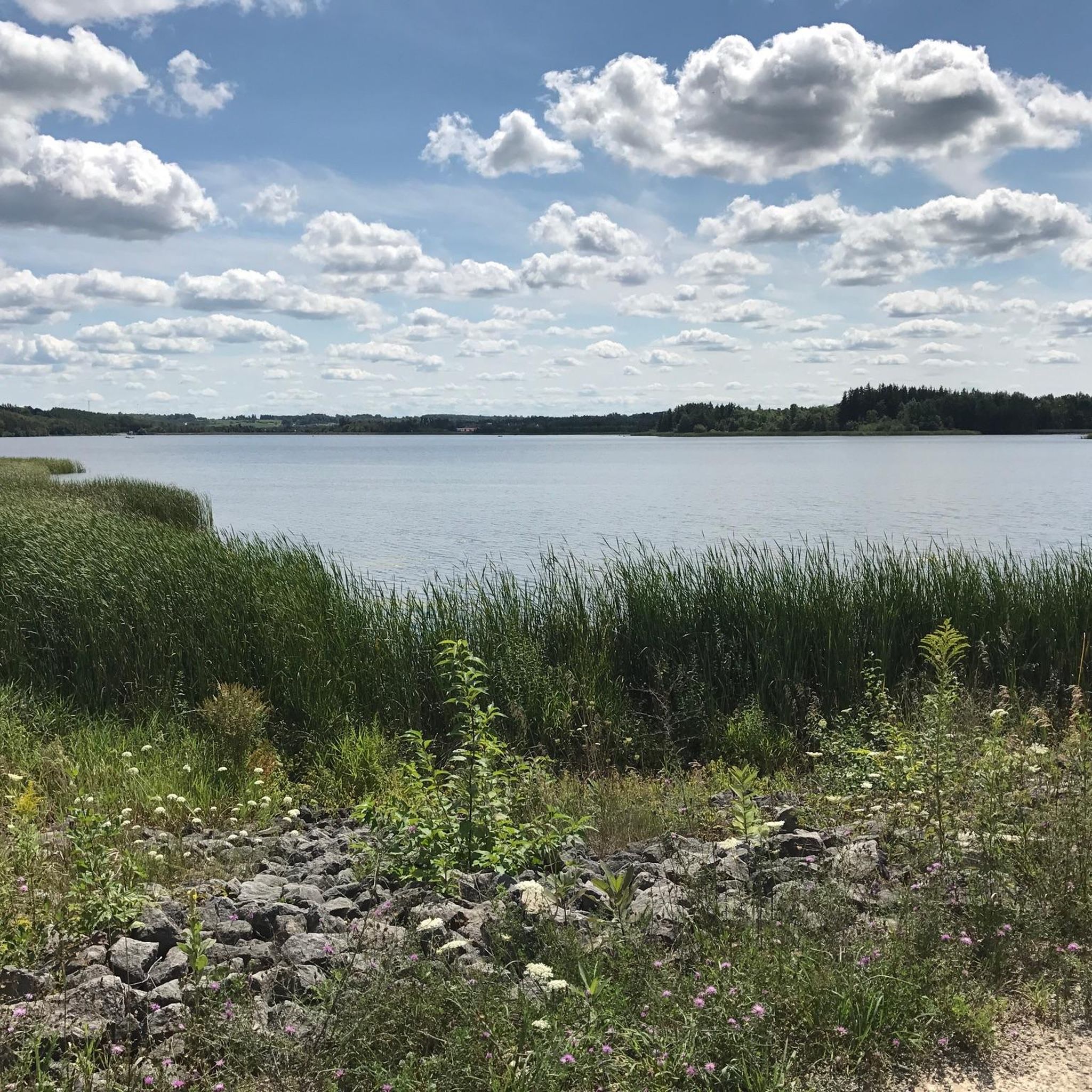
Here you can walk through wetlands, forest, and meadowland along the Credit River. This is one of the end points of the proposed 100-kilometre Credit Valley Trail system. In the winter, the hiking trails are perfect for snowshoeing and cross country skiing.
0
0
This lookout sits high on a hill in Boyne Valley Provincial Park, where you’ll be treated to stunning, unobstructed views of the rolling farmland, wooded valleys, and moraine ridges in the distance. From this elevated spot, you can see the landscape drop away into a patchwork of fields and trees stretching all the way to the horizon, making it one of the most breathtaking places in the park.
0
0
Primrose Loop is a lovely path that meanders through the rolling forested hills of Boyne Valley Provincial Park. The route passes through a mix of mature woodland and reforested areas, with gentle elevation changes and occasional views across the beautiful surrounding countryside. It’s a peaceful setting, and along the way, you’re likely to spot white-tailed deer, plenty of birds, and other wildlife that thrive in this valley.
0
0
Frequently Asked Questions
How many hiking trails are available around Amaranth?
Amaranth offers a good selection of hiking opportunities, with over 25 routes available for exploration. These trails cater to various skill levels, including 13 easy routes and 14 moderate options.
What types of landscapes can I expect to see while hiking in Amaranth?
The region of Amaranth is characterized by diverse rural landscapes, including wetlands, rivers, and active agricultural areas. You'll also find trails winding through protected natural areas, offering varied terrains and scenic beauty. Some trails, like the Split Rock Trail loop, feature unique geological formations.
Are there any easy hiking trails suitable for beginners or families in Amaranth?
Yes, Amaranth has 13 easy hiking routes perfect for beginners or families. A great option is the Split Rock Trail loop — Splitrock Narrows Nature Reserve, which is an easy 2.3-mile (3.6 km) trail known for its unique geological features and takes about an hour to complete.
Can I bring my dog on the hiking trails in Amaranth?
Many trails in Amaranth, including sections of the Upper Grand Trailway and Dufferin Rail Trail, are suitable for dog walking. However, it's always best to check specific trail regulations for leash requirements and any restrictions, especially within provincial parks or conservation areas.
Are there any circular hiking routes in the Amaranth area?
Yes, there are several circular routes available. For example, the Bike Trail – Island Lake Conservation Area loop from Mono is a popular 5.8-mile (9.4 km) moderate loop. Another option is the Island Lake Conservation Area loop from Maple Sugar Shack, which is an 8.2 km moderate loop.
What are some notable natural features or attractions to look out for on the trails?
Along the trails, you can discover several interesting features. The Island Lake Conservation Area offers scenic lake views. At Mono Cliffs Provincial Park, you can explore the Canyon Boardwalk and enjoy views from the Mono Cliffs Lookout. The Hockley Valley Lookout also provides expansive vistas. Additionally, the Upper Grand Trailway features heritage apple trees that offer seasonal treats in late summer and fall.
What is the best time of year to go hiking in Amaranth?
Amaranth offers enjoyable hiking experiences throughout the year. Spring brings fresh greenery, while summer is ideal for longer days. Fall is particularly scenic with vibrant autumn colors, and winter provides opportunities for snowshoeing or cross-country skiing on suitable trails. The heritage apple trees along the Upper Grand Trailway are a unique feature in late summer and fall.
Are there any longer or more challenging hikes for experienced hikers?
While there are no routes classified as 'difficult' in Amaranth, there are 14 moderate trails that offer longer distances and more elevation gain. For example, the Mono Cliffs Lookout – Big Tree loop from Mono Cliffs Provincial Park is a moderate 8.9-mile (14.3 km) path with significant elevation changes, and the Hockley Valley Lookout loop from Hockley Valley Provincial Park is a moderate 13.9 km route.
Is public transport available to reach hiking trailheads in Amaranth?
Public transport options directly to many trailheads in the rural Amaranth area can be limited. It is generally recommended to travel by car to access most hiking starting points, especially for trails within provincial parks or conservation areas. Always check local transit schedules for specific routes if relying on public transport.
Are there any fees or permits required to hike in the Amaranth area?
While many trails in Amaranth are free to access, some areas, particularly provincial parks like Mono Cliffs Provincial Park or conservation areas like Island Lake Conservation Area, may require day-use fees or permits. It's advisable to check the official websites of these specific locations before your visit for current fee structures.
What do other hikers say about the trails in Amaranth?
The hiking routes in Amaranth are highly rated by the komoot community, with an impressive average score of 4.9 stars from over 120 reviews. Hikers often praise the diverse rural landscapes, the tranquility of the trails, and the well-maintained networks that offer options for various ability levels.
Are there opportunities for bird watching while hiking in Amaranth?
Yes, the scenic rural settings, diverse landscapes, and wetlands throughout Amaranth provide excellent opportunities for bird watching. Many trails pass through natural habitats that attract a variety of bird species, making it a rewarding activity for nature enthusiasts.
Can I find trails that are suitable for mountain biking as well as hiking?
Absolutely. Extensive trail networks like the Upper Grand Trailway and the Dufferin Rail Trail are multi-use paths that are suitable for both hiking and mountain biking. These trails offer a great way to explore the region's diverse landscapes on two wheels or on foot.
Most popular routes around Amaranth
Most popular attractions around Amaranth

Get inspired with the komoot mobile app


Explore more
Browse the best Hikes in other regions.
