The best walks and hikes around Labelle
4.6
(453)
6,275
hikers
89
hikes
Hiking around Labelle, Quebec, is characterized by its diverse terrain within the Laurentian Mountains, featuring forested paths, lake views, and varied elevation changes. The region offers a network of trails that traverse woodlands and provide access to scenic overlooks. These routes often include climbs to viewpoints overlooking lakes and valleys, typical of the Canadian Shield landscape.
Best hiking trails around Labelle
- The most popular hiking route is Nez-de-l'indien, a 4.8 miles (7.7 km) trail that takes 2 hours 16 minutes to complete. This moderate route features significant elevation gain and panoramic views.
- Another top favourite among local hikers is View of Lac Monroe loop from Lac-Tremblant-Nord, a moderate 4.5 miles (7.3 km) path. This trail offers views of Lac Monroe and winds through forested areas.
- Local hikers also love the Hiking loop from Lac Baptiste, a 2.1 miles (3.3 km) trail leading through varied forest terrain, often completed in about 1 hour 23 minutes.
- Hiking around Labelle is defined by forested trails, lake views, and moderate climbs, offering a range of experiences from shorter loops to longer, more challenging ascents. The network offers options for different ability levels, from easy walks to more difficult hikes.
- The routes in Labelle are highly rated by the komoot community with an average score of 4.6 stars from over 400 reviews. More than 6000 hikers have used komoot to explore Labelle's varied terrain.
Last updated: May 15, 2026
4.9
(15)
196
hikers
7.73km
02:16
220m
220m
Moderate hike. Good fitness required. Easily-accessible paths. Suitable for all skill levels.
4.9
(14)
202
hikers
3.32km
01:23
160m
160m
Moderate hike. Great for any fitness level. Mostly accessible paths. Sure-footedness required.

Sign up for free
4.8
(6)
180
hikers
10.4km
04:17
490m
490m
Moderate hike. Good fitness required. Mostly accessible paths. Sure-footedness required.
4.7
(3)
100
hikers
17.2km
06:16
690m
690m
Hard hike. Very good fitness required. Mostly accessible paths. Sure-footedness required.
5.0
(1)
60
hikers
5.41km
01:39
190m
190m
Easy hike. Great for any fitness level. Easily-accessible paths. Suitable for all skill levels.
Get access to more routes and recommendations from other explorers.
Sign up for free
Already have an account?
Our route recommendations are based on thousands of hikes, rides, and runs completed by other people on komoot.
Start today with a free account
Your next adventure awaits.
Login or Signup

Tips from the Community

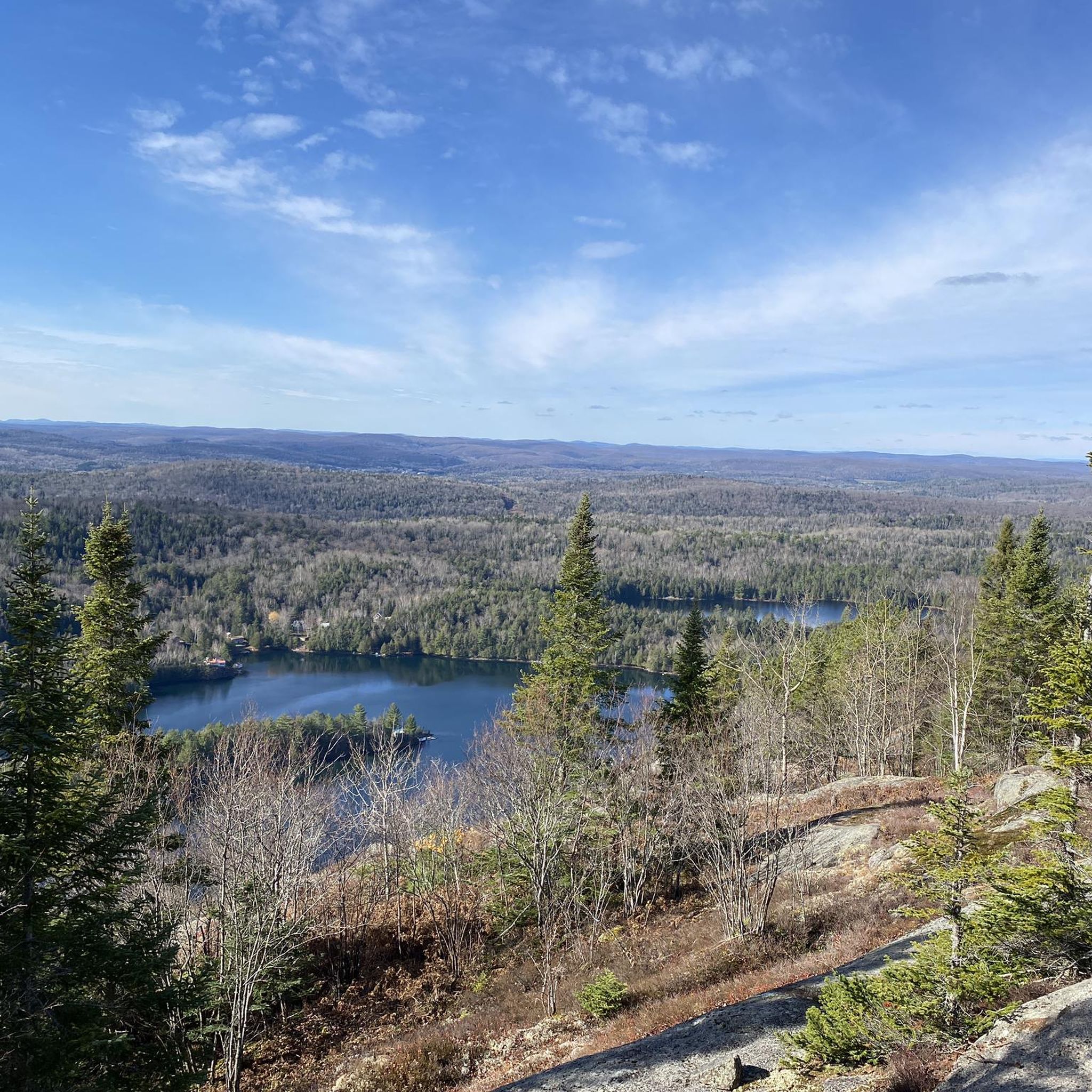
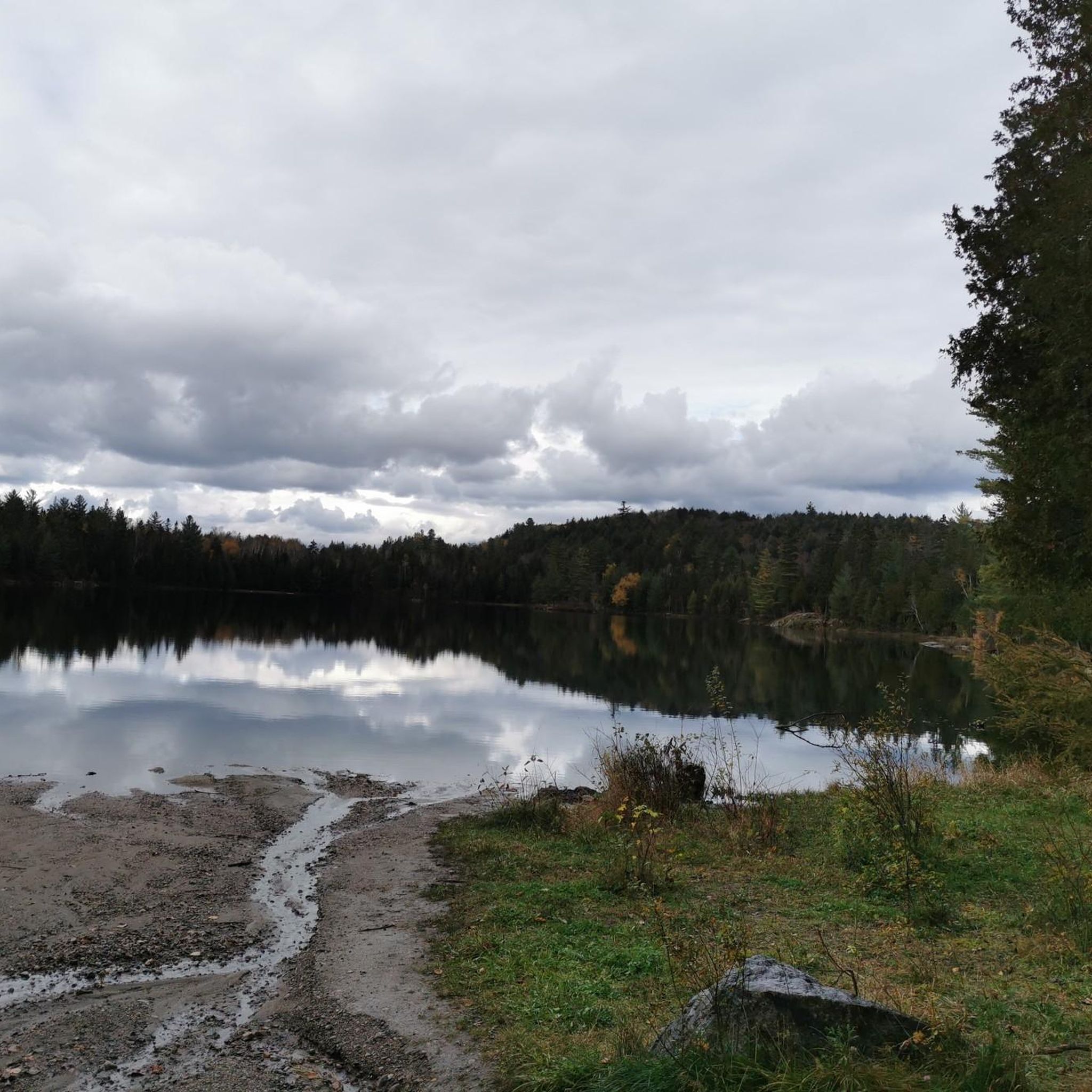
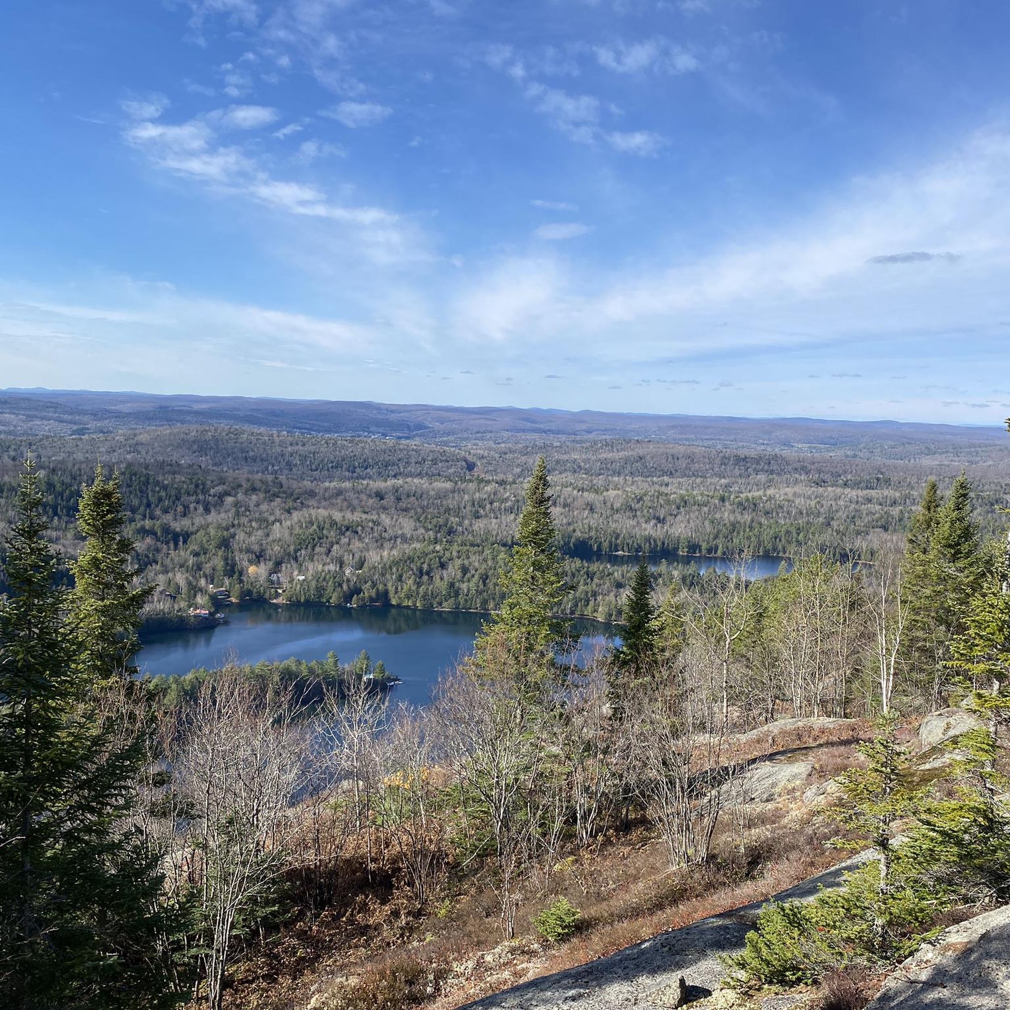
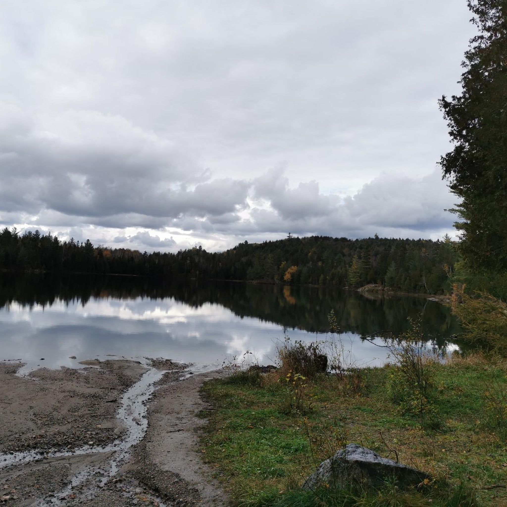
From this section of the trail, you can look out over Bibite Lake, a small lake in the Laurentides region. Recreation in the area centers around the trails that circle the lake and opportunities for fishing. A private marina is located on the lake’s south end.
0
0
From the summit of Nez-de-l’Indien, you’re rewarded with beautiful views of Lake Tremblant. The lake is long and narrow, with seven islands and five bays nestled at the base of Mont Tremblant.
0
0
The Nez-de-l'Indien Trail runs just over 8 kilometers and offers a rewarding mix of scenic views and moderate challenge, with approximately 350 meters of elevation gain. As you wind through the woods, keep an eye out for the white diamond markers that guide the trail.
0
0

Good place to sit down and have a pause while enjoying the view.
0
0

Nice moderate hike with several viewing points so you get a good overview of all surrounding lakes and mountains.
0
0
Frequently Asked Questions
How many hiking trails are available around Labelle?
There are over 90 hiking routes around Labelle, offering a wide range of experiences from easy walks to more challenging ascents. The komoot community has explored these trails over 6,000 times.
What kind of terrain can I expect on hikes in Labelle?
Hiking around Labelle is characterized by diverse terrain within the Laurentian Mountains. You'll find forested paths, scenic lake views, and varied elevation changes typical of the Canadian Shield landscape. Trails often include climbs to viewpoints overlooking lakes and valleys.
Are there any easy hiking trails suitable for beginners in Labelle?
Yes, Labelle offers a good selection of easier trails. Out of the over 90 routes, 26 are classified as easy, making them suitable for beginners or those looking for a more relaxed walk. These trails often lead through varied forest terrain.
Are there any circular hiking routes in Labelle?
Many trails in Labelle are designed as loops, allowing you to start and end at the same point. For example, the Hiking loop from Lac Baptiste is a popular option, offering a pleasant walk through varied forest terrain.
What are some notable natural features or landmarks to see while hiking in Labelle?
The region is known for its beautiful lakes and scenic viewpoints. You can enjoy views of Lac Monroe on routes like View of Lac Monroe loop from Lac-Tremblant-Nord. Other highlights include Lake Mercier and the View from La Corniche Lookout, which offers expansive vistas.
What do other hikers enjoy most about hiking in Labelle?
The area is highly rated by the komoot community, with an average score of 4.6 stars from over 400 reviews. Hikers often praise the scenic lake views, the well-maintained forested paths, and the rewarding climbs to panoramic viewpoints.
Are there any longer or more challenging hikes for experienced hikers?
Yes, for more experienced hikers, Labelle offers several challenging routes. There are 11 difficult trails available, including longer loops with significant elevation gain. An example is the View of Bibite Lake – View of Lac Tremblant loop from Lac-Tremblant-Nord, which is over 17 km long with substantial ascent.
Are there any historical sites or points of interest near the hiking trails?
Yes, Labelle has some interesting historical points. You can visit the Labelle Train Station and Museum, which offers a glimpse into the region's past. The Mont-Tremblant Train Station is also a nearby historical facility.
What is the typical duration for hikes in Labelle?
Hike durations vary widely depending on the trail's length and difficulty. Shorter, easy loops might take around an hour, while moderate trails like Nez-de-l'indien typically take over two hours. Longer, difficult routes can extend to several hours, even a full day.
Can I find hikes that offer views of Lac Tremblant?
Absolutely. Several trails provide stunning views of Lac Tremblant. A notable option is the View of Lac Tremblant loop from Lac Baptiste, which is a moderate 10.3 km route offering beautiful vistas of the lake.
Are there any specific trails that are particularly popular for their scenic beauty?
Many trails in Labelle are highly regarded for their scenic beauty. The Nez-de-l'indien trail is particularly popular for its panoramic views after a significant elevation gain. Routes around Lac Monroe and Lac Tremblant also offer picturesque landscapes.
Most popular attractions around Labelle

Get inspired with the komoot mobile app


Explore more
Browse the best Hikes in other regions.
