Attractions and Places To See around Area H (Canim Lake/Forest Grove) - Top 14
Attractions and places to see around Area H (Canim Lake/Forest Grove) offer a diverse range of natural features and outdoor activities in British Columbia's Cariboo region. Known as the "Land of Hidden Waters," the area features large lakes like Canim Lake, numerous waterfalls, and extensive backcountry trails. Visitors can explore geological formations, engage in water sports, or discover the region's Secwepemc First Nation heritage. This area provides opportunities for hiking, mountain biking, and winter sports.
Best attractions and places to…
Last updated: May 9, 2026
Helmcken Falls
Highlight • Waterfall
Translated by Google •
Tip by

Helmcken Falls
Highlight • Waterfall
Tip by

Sign up now to discover places like this
Get recommendations on the best single tracks, peaks, & plenty of other exciting outdoor places.
Sign up for free
Dawson Falls
Highlight • Waterfall
Tip by
The Mushbowl
Highlight • Waterfall
Tip by
Baileys Chute
Highlight • Waterfall
Translated by Google •
Tip by

Sign up for free to discover even more attractions around Area H (Canim Lake/Forest Grove).
Sign up for free
Already have an account?
Start today with a free account
Your next adventure awaits.
Login or Signup
Popular around Area H (Canim Lake/Forest Grove)
Tips from the Community

The road to the parking lot from Helmcken Falls is quite bumpy, with lots of potholes, etc. It's no problem with a pickup truck or SUV, and doable with a regular car, but you do have to be a bit careful. The "flying" fish are worth it, though.
0
0


From the Dawson Falls parking lot, a trail along the Murtle River takes you to the Falls in about 10 minutes. About two-thirds of the way, there is an excellent viewing point for the Falls. The water of the Murtle River plunges about 18 meters down a step at Dawson Falls. If you're lucky, you can see a rainbow below the Dawson Falls. Opposite is another observation point; it can be reached from the Pyramid Campground. In addition to Dawson Falls, there are six other waterfalls along the Murtle River in Wells Gray Park. (Visit June 3, 2018) https://www.worldwaterfalldatabase.com/waterfall/Dawson-Falls-2305 https://en.wikipedia.org/wiki/Dawson_Falls
2
0
“Helmcken Falls is the centerpiece to Wells Gray Provincial Park, one of the most powerful waterfalls on earth and one of BC’s prime tourist draws. The Murtle River, which is just a few kilometers upstream, drops over 300 foot (91 m) wide Dawson Falls, narrows to about 75 feet (23 m) wide and surges over the lip of Helmcken Canyon, hurtling 462 feet (141 m) into one of the largest river-sculpted amphitheaters in North America. The bowl behind the falls recedes over 150 feet (46 m) into the cliff and stretches over 500 feet (152 m) wide. Just downstream lies a 50 foot (15 m) lower tier which isn’t usually counted in the total height of the falls but legitimately boosts this to a 500 foot (152 m) tall waterfall. Pictures really do not do this waterfall justice, as there is no way to convey the true power and volume of water spilling off the cliff.” (Visit June 3, 2018) https://www.worldwaterfalldatabase.com/waterfall/Helmcken-Falls-2303
2
0
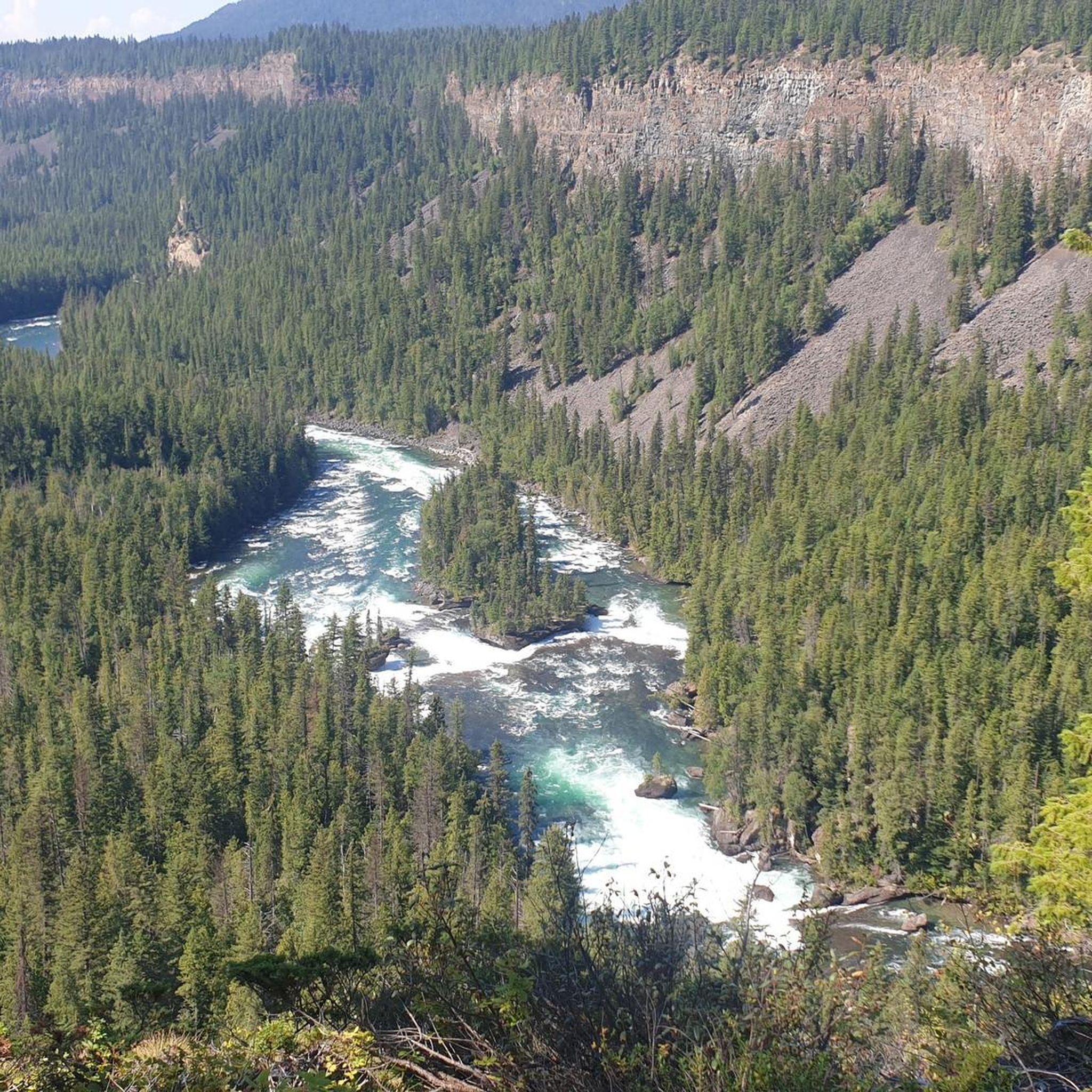
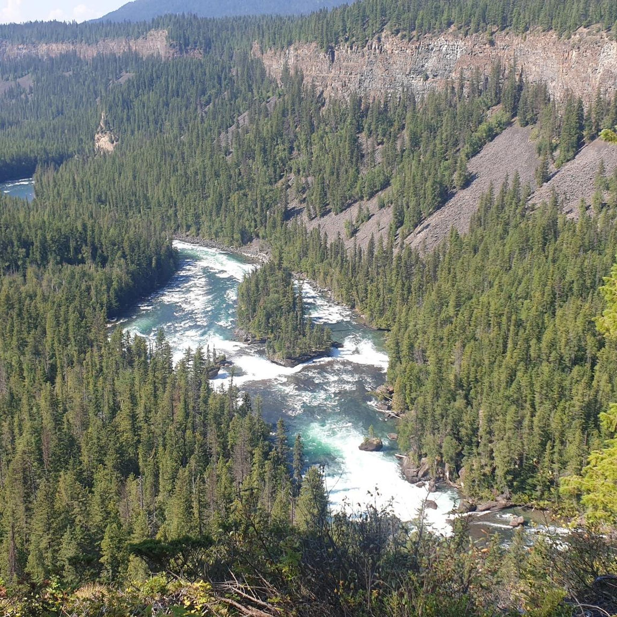
The Mushbowl is a waterfall on the Murtle River and is located between the Dawson Falls and the Helmcken Falls. At the Mushbowl, the riverbed is narrowed by rocks in the middle and on the side. When the river is low, you can get a good view of the waterfall from a cave that is then accessible. (Visit June 3, 2018) https://www.worldwaterfalldatabase.com/waterfall/Mushbowl-The-2304
2
0

Dawson Falls waterfall is only about 10 minutes from the parking lot. It's not very tall, but quite wide. It is ranked 5th in Wells Gray Provincial Park's waterfall rankings.
1
0
The Helmcken Falls falls 141 meters, making it the fourth highest waterfall in Canada. It also ranks first in the ranking of Wells Gray Park's waterfalls. The viewpoint can be easily reached on foot within a few minutes from the parking lot. From there you have an excellent view of the waterfall.
1
0

Frequently Asked Questions
What natural features can I explore around Area H (Canim Lake/Forest Grove)?
The region, known as the "Land of Hidden Waters," is rich in natural beauty. You can explore large bodies of water like Canim Lake, which is ideal for water sports and fishing, and Ruth Lake, popular for swimming and fishing. The area is also famous for its numerous waterfalls, including Helmcken Falls, Dawson Falls, and Baileys Chute, many of which are located within or accessible from Wells Gray Provincial Park. Volcanic cones near Spanish Creek add to the geological interest.
Are there family-friendly attractions in Area H (Canim Lake/Forest Grove)?
Yes, several attractions are suitable for families. Dawson Falls is a family-friendly waterfall and viewpoint, easily accessible from a parking lot. Ruth Lake offers a recreational day-use area with a grassy space and a small sandy beach, perfect for swimming and fishing. Many of the easy hiking trails, such as the Canim Falls Trail, are also great for families.
What kind of hiking trails can I find near Area H (Canim Lake/Forest Grove)?
You'll find a variety of hiking trails, from easy walks to more challenging routes. Popular options include the Canim Falls Trail, an easy route, and the Baileys Chute – Waterfall loop from Marcus Falls, also considered easy. For those seeking a moderate challenge, consider the Helmcken Falls loop from Rim Trail. You can find more details and routes in the Hiking around Area H (Canim Lake/Forest Grove) guide.
What are the best times to visit Area H (Canim Lake/Forest Grove) for outdoor activities?
The area offers activities year-round. Summer and fall are ideal for hiking, mountain biking, and water sports on Canim Lake and Ruth Lake. Winter transforms the region into a haven for snow activities, including backcountry skiing, snowmobiling, skating, snowshoeing, and even dogsledding. Mt. Timothy Ski Area also offers downhill skiing and snowboarding.
Are there opportunities for water sports or fishing in the area?
Absolutely. Canim Lake is a central hub for water sports like canoeing and boating. Anglers can find rainbow trout, lake trout, kokanee, and burbot in Canim Lake, with ice fishing being popular in winter. Ruth Lake is also stocked annually with Rainbow Trout and is a popular spot for fishing and swimming.
Where can I see waterfalls in Area H (Canim Lake/Forest Grove)?
The region is renowned for its waterfalls. Key waterfalls include Helmcken Falls, a spectacular 141-meter drop, and Dawson Falls, both located within Wells Gray Provincial Park. Other notable falls are Baileys Chute, known for its salmon run, Canim Falls, Mahood Falls, Deception Falls, and Hendrix Falls.
What historical or cultural sites are there to visit?
Area H is the traditional territory of the Secwepemc (Shuswap) First Nation. You can find ancient native pictographs and pit houses at Deception Creek, and pictographs are also visible on the rock faces of Mahood Lake, offering a glimpse into the region's rich heritage. The broader Cariboo region also has a history tied to the fur trade, ranching, and the Gold Rush.
Can I go mountain biking or horseback riding in Area H?
Yes, the backcountry offers hundreds of kilometers of logging roads suitable for mountain biking. The surrounding mountains and ranch country also provide excellent terrain for horseback riding, with local lodges offering guided rides and overnight pack trips.
What do visitors enjoy most about the attractions in Area H (Canim Lake/Forest Grove)?
Visitors particularly appreciate the powerful and beautiful waterfalls, such as Helmcken Falls and Dawson Falls, often noting their accessibility and the sheer volume of water. The opportunity to witness the salmon run at Baileys Chute is also a highlight for many.
Are there any easy walking trails suitable for all abilities?
Yes, there are several easy walking trails. The trail to Dawson Falls is an easy 10-minute walk from the parking lot. The Canim Falls Trail is also an easy option. For more easy routes, check out the Easy hikes around Area H (Canim Lake/Forest Grove) guide.
What winter activities are available around Forest Grove and Canim Lake?
During winter, the area is perfect for backcountry skiing, snowmobiling, skating, snowshoeing, dogsledding, and sleigh rides. Mt. Timothy Ski Area is also nearby for downhill skiing and snowboarding enthusiasts.
Is Wells Gray Provincial Park accessible from Area H (Canim Lake/Forest Grove)?
Yes, parts of Wells Gray Provincial Park, known for its stunning lakes, rivers, and numerous waterfalls, are accessible from the Canim Lake area. Many of the prominent waterfalls like Helmcken Falls and Dawson Falls are located within the park.
Most popular routes around Area H (Canim Lake/Forest Grove)
Most popular attractions around Area H (Canim Lake/Forest Grove)

Get inspired with the komoot mobile app


Explore more
Still not found the Highlight you’re looking for? See guides of the top attractions in other regions:
