Attractions and Places To See around Area E (Balfour/Cottonwood Lake) - Top 11
Best attractions and places to see around Area E (Balfour/Cottonwood Lake) are found in the West Kootenay region of British Columbia. This area is characterized by its diverse natural landscapes, including Kootenay Lake, Cottonwood Lake, and the surrounding Selkirk and Purcell Mountains. Visitors can explore a variety of outdoor activities, from lake-based recreation to extensive hiking and biking trails. The region also offers cultural points of interest and unique local experiences.
Best attractions and places to see around Area E (Balfour/Cottonwood Lake)
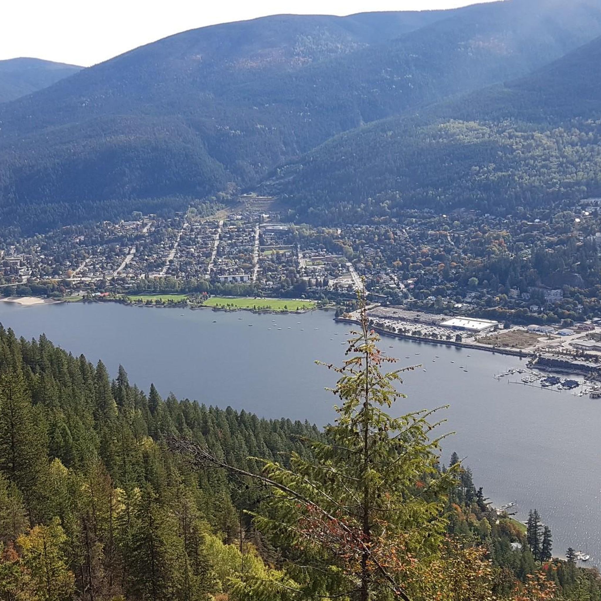
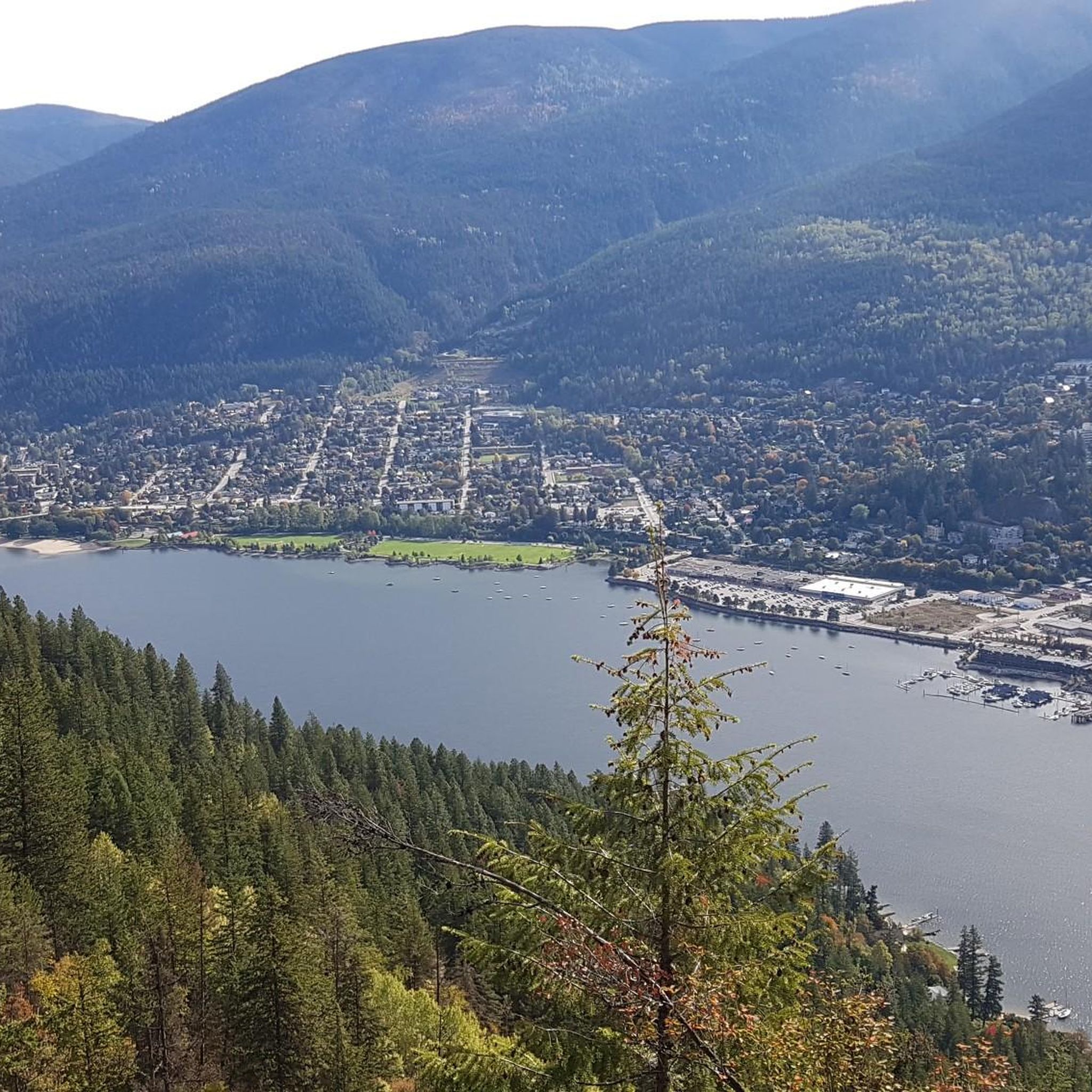
- The most popular attractions is View of Nelson from Pulpit Rock, a viewpoint that offers expansive views of the town of Nelson. This spot is noted for its scenic vistas.
- Another must-see spot is Nelson, a settlement known for its historical significance and numerous mountain biking trails. Visitors can explore the town's heritage and access various outdoor recreation opportunities.
- Visitors also love Gray Creek Pass, a mountain pass and trail. This challenging route is part of the Great Trail and offers rugged terrain through a forest service road, providing a rewarding experience for cyclists.
- Area E (Balfour/Cottonwood Lake) is known for its natural features, extensive trail networks, and charming settlements. The region offers a variety of attractions to see and explore, from lake activities to mountain vistas.
- The attractions around Area E (Balfour/Cottonwood Lake) are appreciated by the komoot community, with 11 photos and 12 upvotes contributing to their popularity.
Last updated: August 4, 2026
View of Nelson from Pulpit Rock
Highlight • Viewpoint
Translated by Google •
Tip by

Gray Creek Pass
Highlight (Segment) • Mountain Pass
* Heading East: Average of 11.1% grade for 12+km from the start of this highlight, to the Pass. In the last 4km or so, you will find grades in the high teens and low 20's.
* Heading West: Average of 3.1% grade for 30+km from the start of this highlight, to the Pass. Note: Although lower grade, the road can be very rugged and technically difficult, especially with a loaded bike. The last 3km or so, you will find grades in the low to mid teens.
Complete this ride fully equipped. There are no supplies, limited water and expect no cell service. Bring a GPS tracker in case of emergency.
The route follows active FSR's with limited visibility, USE CAUTION along the way. Watch for all vehicles, especially heavily laden logging trucks, give them much extra room to pass.
The Gray Creek Pass road is normally closed to vehicles through the winter, opening as late as mid July. Late snow and the occasional washout can delay the annual opening. Cyclists can often pass through these obstacles but do so at their own risk. Visit the Gray Creek Store’s website for the latest road conditions: graycreekstore.com/general-store/news
Tip by

Sign up now to discover places like this
Get recommendations on the best single tracks, peaks, & plenty of other exciting outdoor places.
Sign up for free
Columbia and Western Rail Trail
Highlight (Segment) • Trail
Translated by Google •
Tip by

Kootenay River and Kootenay Lake Route
Highlight (Segment) • Trail
Translated by Google •
Tip by
Waldie Island Trail
Highlight (Segment) • Trail
Tip by

Sign up for free to discover even more attractions around Area E (Balfour/Cottonwood Lake).
Sign up for free
Already have an account?
Start today with a free account
Your next adventure awaits.
Login or Signup
Tips from the Community

The Waldie Island Trail is a scenic 1.5-kilometer path along the Columbia River in Castlegar, blending local history with a vital riparian ecosystem. As a non-motorized, multi-use route, it’s a favorite for hikers, dog walkers, and cyclists, though pups must remain on a leash to protect the sensitive environment. The trail’s standout feature is its proximity to the Waldie Island Heron Reserve, a crucial sanctuary for Great Blue Heron. By sticking to the marked paths and keeping noise down, visitors can enjoy a rare, up-close look at these majestic birds in their natural habitat.
0
0


Gray Creek Pass is part of the Great Trail and also part of the BC Trail & BC Epic 1000. It is tough and rugged, following a forest service road. This price of admission (effort) for this ride is high, but so is the reward. * Heading East: Average of 11.1% grade for 12+km from the start of this highlight, to the Pass. In the last 4km or so, you will find grades in the high teens and low 20's. * Heading West: Average of 3.1% grade for 30+km from the start of this highlight, to the Pass. Note: Although lower grade, the road can be very rugged and technically difficult, especially with a loaded bike. The last 3km or so, you will find grades in the low to mid teens. Complete this ride fully equipped. There are no supplies, limited water and expect no cell service. Bring a GPS tracker in case of emergency. The route follows active FSR's with limited visibility, USE CAUTION along the way. Watch for all vehicles, especially heavily laden logging trucks, give them much extra room to pass. The Gray Creek Pass road is normally closed to vehicles through the winter, opening as late as mid July. Late snow and the occasional washout can delay the annual opening. Cyclists can often pass through these obstacles but do so at their own risk. Visit the Gray Creek Store’s website for the latest road conditions: https://graycreekstore.com/general-store/news
2
0

Nelson gave me the impression of a stoner-hippie town ☺️
2
0

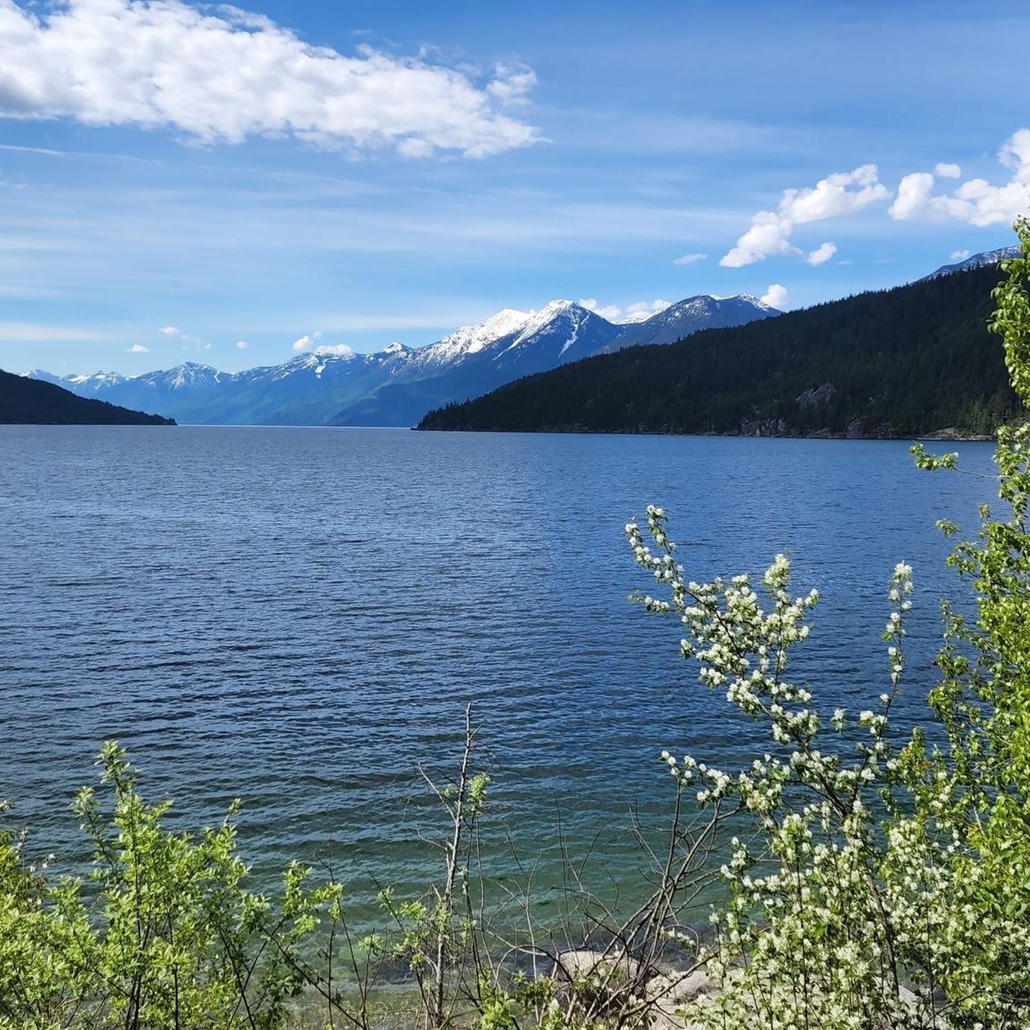
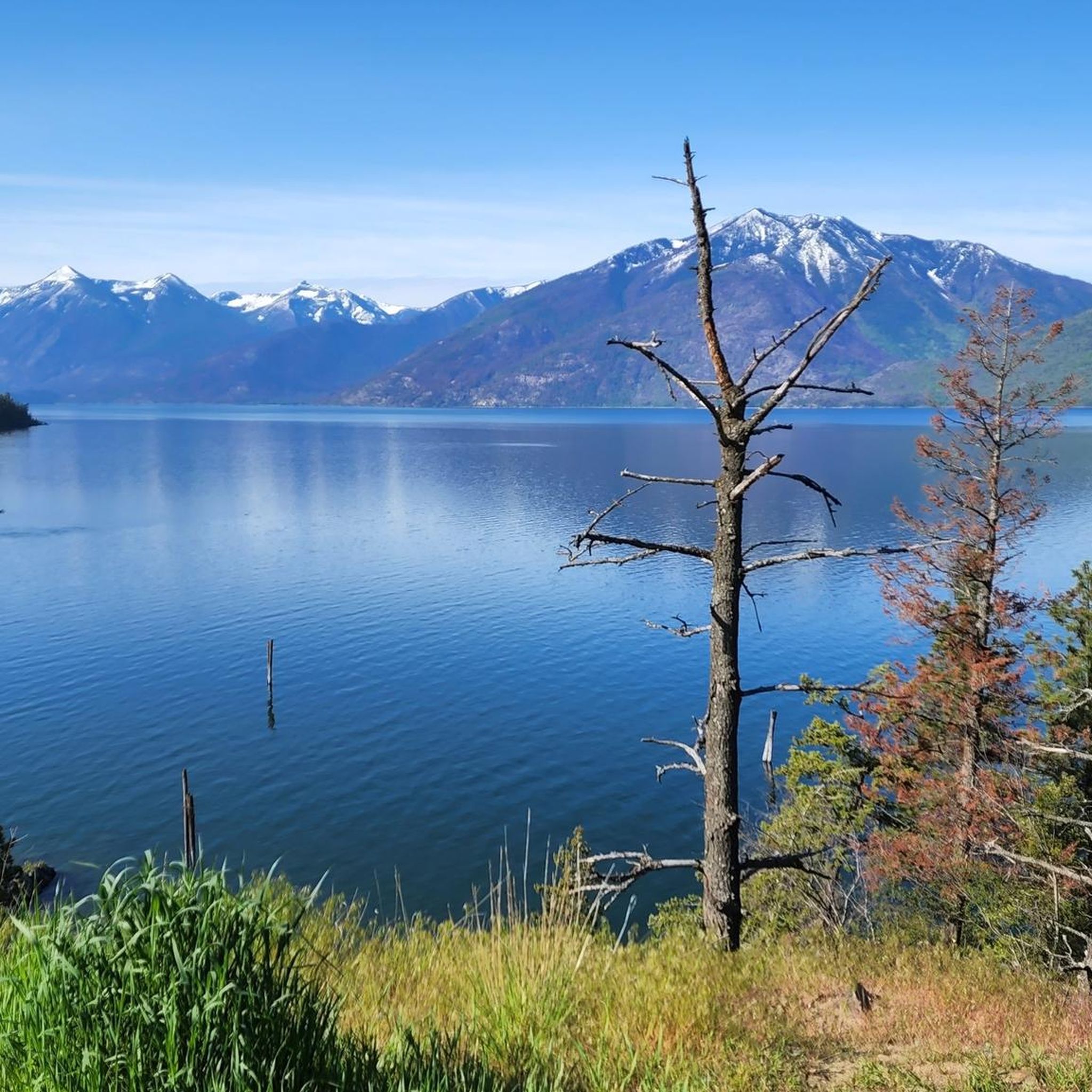
The trail runs mostly parallel to the shore to the nice town of Nelson, which invites you to a delicious lunch. From here to the lake you have to cycle on the country road. On the banks of the lake-like river you can always find stretches of beach that invite you to take a break with a refreshing swim. Some beaches have showers and drinking water. Kootenay Lake can be reached at Balfour, where a free ferry crosses the lake. There is a snack right at the ferry terminal that also offers delicious ice cream. If you arrive in Balfour in the afternoon or even in the evening, you should spend the night at Cedar`s Lake Campground a few hundred meters in front of the ferry. On the other side of the lake, there are few places to stay, the next campsite is only at Gray Creek.
0
0
Frequently Asked Questions
What kind of natural features can I explore in Area E (Balfour/Cottonwood Lake)?
The region is rich in natural beauty. You can visit Cottonwood Lake Regional Park, which features a 6-hectare lake ideal for fishing, canoeing, and birdwatching, with a scenic hiking trail circling it. Kootenay Lake, where Balfour is situated, offers beautiful beaches and is known for fishing, boating, and various water sports. Pulpit Rock near Nelson provides fantastic views of the town and surrounding landscape. You can also find Fletcher Falls, particularly impressive in May or June, and the stunning backdrop of the Selkirk and Purcell Mountains.
Are there family-friendly activities or attractions in the Balfour/Cottonwood Lake area?
Yes, there are several family-friendly options. Cottonwood Lake Regional Park is great for picnicking, swimming, and easy walks. Kokanee Creek Provincial Park features a sand spit beach, an adventure playground, and interpretive signage about kokanee salmon spawning channels, which are active in August. The Nelson area also offers various activities suitable for families.
What outdoor activities, besides hiking, are popular near these attractions?
Beyond hiking, the area offers a wide range of outdoor activities. Kootenay Lake is excellent for fishing, boating, sailing, kayaking, windsurfing, and stand-up paddleboarding. You can also find technical mountain biking trails at Kokanee Creek Provincial Park. For more adventurous options, consider the Kokanee Mountain Zipline, Cody Caves for spelunking tours, or Nelson Whitewater Rafting for diverse rafting trips. For cycling routes, explore options like the Cycling around Area E (Balfour/Cottonwood Lake) guide.
Where can I find easy hiking trails in Area E (Balfour/Cottonwood Lake)?
For easy hikes, Cottonwood Lake Regional Park offers a pleasant trail that circles the lake. Kokanee Creek Provincial Park also has accessible trails. You can find more options in the Easy hikes around Area E (Balfour/Cottonwood Lake) guide, which includes routes like the Lyon's Bluff loop and the Kokanee Creek – Canyon Lookout loop.
Are there any historical or cultural sites to visit in the region?
Balfour has some historical significance, founded in 1889. You can see the charming St. Michael and All Angels' Anglican Church, built in 1892. The town of Nelson itself is known for its historical heritage. Additionally, the communities along Kootenay Lake, including Balfour, are home to vibrant artist communities, with studios featuring potters, blacksmiths, and woodworkers.
What is the Kootenay Lake Ferry and where does it go?
The Kootenay Lake Ferry is North America's longest free ferry service. Balfour serves as its western terminal. The scenic 35-minute ride connects Balfour to Kootenay Bay on the eastern side of Kootenay Lake, offering beautiful views during the crossing.
Can I bring my dog to trails and attractions in the area?
Many outdoor areas in the region are dog-friendly, especially trails. Cottonwood Lake Regional Park is generally welcoming to dogs on its trails. Always ensure your dog is on a leash and that you clean up after them. It's advisable to check specific park regulations before visiting, as some areas, particularly sensitive wildlife habitats or designated swimming beaches, might have restrictions.
What are some notable viewpoints in Area E (Balfour/Cottonwood Lake)?
One of the most popular viewpoints is View of Nelson from Pulpit Rock, which offers expansive views of the town of Nelson. Buchanan Lookout, near Balfour, also provides spectacular vistas from an elevation of 6,263 feet (1,909 meters), with a 2 km loop trail.
What do visitors enjoy most about Area E (Balfour/Cottonwood Lake)?
Visitors frequently appreciate the stunning natural scenery, particularly the views from spots like Pulpit Rock. The diverse outdoor activities, from tranquil lake experiences to challenging mountain trails, are also highly valued. The charming atmosphere of towns like Nelson and the unique local culture, including artisan communities, contribute to a memorable experience.
Are there any challenging cycling routes in the area?
Yes, for experienced cyclists, Gray Creek Pass offers a tough and rugged route, part of the Great Trail, with steep grades and challenging terrain on a forest service road. The Columbia and Western Rail Trail also provides a long-distance cycling experience through natural landscapes. For more options, check the Road Cycling Routes around Area E (Balfour/Cottonwood Lake) guide.
What is the best time of year to visit Area E (Balfour/Cottonwood Lake)?
The best time to visit largely depends on your preferred activities. Summer (June to August) is ideal for lake activities, hiking, and enjoying the warm weather. Spring (May-June) offers impressive views of Fletcher Falls and lush landscapes. Fall (September-October) brings beautiful autumn colors. In winter, Cottonwood Lake Regional Park provides access to cross-country ski trails, offering a different kind of outdoor experience.
Are there opportunities for wildlife viewing in the Balfour/Cottonwood Lake area?
Yes, the natural areas around Balfour and Cottonwood Lake offer opportunities for wildlife viewing. Cottonwood Lake Regional Park is known for birdwatching. Kokanee Creek Provincial Park is famous for its kokanee salmon spawning channels, which are a significant natural spectacle in August. The surrounding forests and Kootenay Lake are home to various bird species and other wildlife.
Most popular routes around Area E (Balfour/Cottonwood Lake)
Most popular attractions around Area E (Balfour/Cottonwood Lake)

Get inspired with the komoot mobile app


Explore more
Still not found the Highlight you’re looking for? See guides of the top attractions in other regions:
